I've done similar things in the past, but I've seen such awesome work done by people on this forum that I thought I would ask to see what people offered.You could pick a real-life similar sized town from OTL then check maps.google to figure out the scale you want then adapt it.
You are using an out of date browser. It may not display this or other websites correctly.
You should upgrade or use an alternative browser.
You should upgrade or use an alternative browser.
Request Maps/Flags/Coats of Arms/Heraldry here, II
- Thread starter Pragmatic Progressive
- Start date
New Britain Mapping
Banned
Could you put it into the UK flag but change the blue to the 4 colors like 2 on the top left or something like that?I like the simplicity of the The Professor's offering. Very much in keeping with English aesthetic. However, I wanted to preserve the Stonehenge and the dragon. So I offer you this:
Also I want the henges kept along with the dragon please.
Could you put it into the UK flag
Okay. I get that.
but change the blue to the 4 colors
I'm guessing you mean the 4 panels of blue in the Union Jack should instead be panels in the 4 chosen colors from my flag. Okay.
like 2 on the top left or something like that?
I'm sorry, you lost me here. 2 what on the top left of what?
Also I want the henges kept along with the dragon please.
Sensible.
It's mine. Yes, you can use it.I found this map stored on my computer, and I wanted to use a little section of it for an ISOT project I'm planning,
But I've been unable to find the original creator (i feel i should ask them for permission before starting my project)
Are any of you the creator, or at least know who they are?

Can someone edit out the "star" from this "crescent and star" symbol below:

And please color the crescent yellow, whose shade is like in an earlier post.
Thanks!
And please color the crescent yellow, whose shade is like in an earlier post.
Thanks!

My best guess. The Union Drax.Could you put it into the UK flag but change the blue to the 4 colors like 2 on the top left or something like that?
Also I want the henges kept along with the dragon please.
are there any good resources on north eastern america in the 1400s / 15th century? the stuff ive found on wikipedia regarding the placement of states/tribes/societies is sparse and inconsistent. id also be happier with later periods but with the caveat that there is supplementary information about how indirect european contact had shifted the geopolitical landscape. so far ive roughed out the Haudenosaunee, Innu, Nunavimmiut, st Laurence Iroquois, Atikamekw and what would later become the Wabanki confederacy. (no its not in q-bam so dont ask). i want it because im pretending to myself im going to write a timeline set during the period and i want native american plants and cultural ideas to make their way to europe via an earlier (vaccinated) contact. the rough ideas would technically be sufficient but a map is always nice. Also some of these entities should really be represented on the historical q-bams anyway as they are just as real as the haudenosaunee/ Iroquois league. a list of native port settlements would also be good.
Starforce
Banned
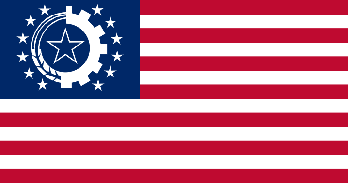
Can someone make a flag of a Syndicalist United States that became syndicalist after the great depression, where the Russian Revolution never happened, and a surviving Russian Empire flag, that modernized and liberalized? Reverse cold war.
United States - Union of Syndicalist American States
USSR - Russian Empire
United States - Union of Syndicalist American States
USSR - Russian Empire
Russia would probably just use the modern Russian flag.Can someone make a flag of a Syndicalist United States that became syndicalist after the great depression, where the Russian Revolution never happened, and a surviving Russian Empire flag, that modernized and liberalized? Reverse cold war.
United States - Union of Syndicalist American States
USSR - Russian Empire
For a Syndicalist USA perhaps:
Starforce
Banned
Russia would probably just use the modern Russian flag.
For a Syndicalist USA perhaps:
View attachment 567622
Would be possible, but to me it doesn't have the certain Syndicalist flare, any ideas?
Starforce
Banned
There is this:
Oooh thats actually quite amazing! What do you think Russia's would be?
Like @The Professor said the current Russia would probably work best, turns out it's older than I thought (from the 17th century or older I think).
One website that might help you is warpaths2peacepipesare there any good resources on north eastern america in the 1400s / 15th century? the stuff ive found on wikipedia regarding the placement of states/tribes/societies is sparse and inconsistent. id also be happier with later periods but with the caveat that there is supplementary information about how indirect european contact had shifted the geopolitical landscape. so far ive roughed out the Haudenosaunee, Innu, Nunavimmiut, st Laurence Iroquois, Atikamekw and what would later become the Wabanki confederacy. (no its not in q-bam so dont ask). i want it because im pretending to myself im going to write a timeline set during the period and i want native american plants and cultural ideas to make their way to europe via an earlier (vaccinated) contact. the rough ideas would technically be sufficient but a map is always nice. Also some of these entities should really be represented on the historical q-bams anyway as they are just as real as the haudenosaunee/ Iroquois league. a list of native port settlements would also be good.
How about a challenge for all the map makers out there...
The map of Earth post 1883 Shaping Event..
Earthside
On the Earth itself the Angels lead the reformation of the Earth with the massive mana infusion and direction from a higher power.
In Asia the Horde lands of Central Asia reshape so that two thirds of the water that had drained into the Arctic Ocean now drains along a massive shallow vale that stretches from Inner Mongolia’s new string of low hills and mountains separating the North China Plain from the Horde Lands west into the Caspian and Aral seas. Joining both at a new depression connecting the northern half of both in massive area of swamps and open lakes and channels. The Caspian Sea is connected to the Black Sea via a channel between Taganrog Bay to Volgograd to Astrakhan.
Finland and Russia are separated by a thirty-mile-wide channel. And a new series of hills tilts the Northern half of European Russia to drain its rivers south into the Black Sea at Astrakhan and the curve of low hills and mountains cleaves the north European plain and Baltic states off from Russia from the north east of the Pripet marshes rising north along the Baltic states borders with Russia too a few short River valleys and fjords along the Arctic coast.
Africa is spun on its centrum so that Cape Town is now opposite Gibraltar where Tangiers had been, increasing the width of the straits by more than an order of magnitude, and that the Sahara now faces the Antarctic/Indian Oceans with Dakar half-way between the Seychelles and Yemen with the horn of Africa pointed at Argentina and cutting the south Atlantic into two lobes. Most of the Sahara Deserts goes from equatorial to temperate zone climates greening out over the next century and become a major breadbasket two centuries on. The Middle East and Central Asia have to deal with greatly increased rainfall from evaporation because of fifty-fold increase in the size of the South Mediterranean or Red Sea. It’s enough of a change that the Fertile Crescents surrounding deserts are pushed back twenty to fifty miles by rain drenched grasslands and discrete water portals over the next quarter century. Added to this several water portals in the mountains of Yemen filling the ancient dried lake bed depression of the Empty Quarter with a massive inland lake a hundred meters deep or more further changing the climate not only of South Arabia but also of south Persia via evaporation with the portals at Al Qassim reviving the ancient river cutting Arabia in two and feeding into the reborn swamps of southern Iraq and northern Kuwait. Rice becomes a major crop in these areas over the next century.
Madagascar is moved to a point half-way between Malta and Gaza and oriented on its long axis East and West, now marking the line between the Mediterranean and Red Seas.
Australia gets a series of high ridges across the outback with two active volcanoes in the new range. And a series of large and small islands dotting the shallow sea bed in a jumble for five hundred miles to the east, from New Zealand north to the Solomon Islands. The southern outback greens with the aid of water portals and a doubling in annual rains.
Japan becomes fewer and larger islands; Hokkaido-Sakhalin, Honshu-Kyushu with a new hundred and fifty mile wide plain extending to the east of the old mountain chain of north Honshu, cut by a series of ridges leading westward breaking the new island plains into discrete river valleys. And a series of fifteen medium and large islands extending from a fifty times larger Ko-jima south to within twenty miles of a Guam that is now the size of Madagascar. The Japanese quickly expand their population south as soon as the initial surveys are in two years later and then swarm the islands with peasants from Honshu-Kyushu and Okinawa right up but not onto Guam. This effectively triples the arable land and quintuples the total land area of Japan.
The Aleutian Islands fuse into a score of larger islands along its length and a hundred mile wide band of forested plain and rolling hills extends south to connect Kodiak to the Alaska peninsulas new south plain between Turnagain Sound and Dutch Harbor. A new series of low rocky shield islands extends from Kodiak south and east toward Sitka creating an upper extension to the inland passage and shielding the Alaska coast from the worst of the Pacific storms. Turnagain arm raises up to low marshy ground of the Knik River Delta just north of Homer and gently slopes up from there to the very fertile river valley behind it.
The Northwest Canadian Pacific coast is cut with a few river valleys between the coast and the northern interior. An interior that now has a line of low mountains, splitting off from the Northern Rockies with three active volcanoes between the Arctic and the continent that cuts across the southern half of the upper third of Canadian shield. South of this the middle third of the Canadian shield is broken by a new series of hills and plateaus rising between the new mountains and petering out into the northern plains. The mountains tend to be snow covered well into the summer months and feed the new western rivers and a new river feeding into Hudson Bay out of the new mountains. While runoff from the southern hills and several water portals drain into the northern plains or goes west to the Pacific.
At Vancouver a new deep inlet goes nearly a hundred miles inland and north east to just touch the inland plains at the lower Canadian shield via a narrow river valley. A similar inlet appears near Portland Oregon and extends into the foot hills of the Rockies and the sea shore is extended between five and fifty miles further out to sea with a shielding series of low rocky islands at the seaward side from the Gordo Escarpment to Conception Point. A new massive Farallon Island twenty miles offshore, fifty miles long north from the Cordell Bank south toward Half-Moon Bay and seven miles wide, shielding but not blocking the opening to San Francisco Bay, creating the outer bay. For southern California a double score of large islands appears twenty to a hundred miles distance from the shore and extends south from Point Conception to Isla Guadalupe shielding the California Coast from the worst of the pacific storms and creating a widening of the coastal plain of between five and thirty miles.
In Mexico the entire gulf of California is raised up and becomes a vast flat river valley with feeds from a score of Water Portal Fountains feeding the Gila, the Colorado, the Whitewater filling the Salton Sea in the north and draining out south from America as the California River. Being joined by a score of others from Baha and northern Mexico turning the Great Valley or Gran Valle California green after a century of hard labor by the land owners financing irrigation projects, canal locks, mills, and their peons tilling the soil, raising goats, pigs, sheep and oxen and orchards, the middle Gran Valle from the Salton Sea too within seventy miles of the end of the Baha Range is the most heavily cultivated land on earth. With the last sixty miles being intense wet rice paddies, Mango groves and aquaculture farms.
The last seventy miles of the Gran Valle California is a massive low swamp with a few dredged and marked canals filled with wild life and kept as a game reserve, bird sanctuary and natural fish hatchery. A third of the small villages and all the fishing fleets in the Gulf of California are relocated to the western side of Baha near small rivers formed by water portals.
The high deserts of the American west green out as the nineteen water fountains dump huge amounts of water in them over the next three years. By 1990 Death Valley floods six hundred feet deep and the Great Salt Lake Flats are the largest migratory bird rest stop in the world as the water turns the Great Salt desert into a feed and cattail covered swamp. Evaporating from the high desert lakes and rivers keeps the high plains of the Mississippi river basin green in short grass from lake effect rains. It also fills the western rivers of the basin with moderate levels of water year-round, especially for those with feeds from the seven water fountains just east of the Rockies.
South America moved twenty-two hundred miles due west of its pre-Shaping position. This allows unlimited travel between the Caribbean and the Pacific through a thirty too eighty mile wide, eight hundred mile long island and sand bar filled channel between Nicaragua in Central America and Columbia/Venezuela/Giana in South America.
The Windward Islands of the Caribbean are enlarged and raised up several hundred feet into a dozen massive islands curving from a ten times large Anguilla south to Port of Spain. Guadalupe and Dominica are merged as a long island, so are Martinique and St Lucia, and Barbados to Trinidad and Tobago and a three hundred mile long, forty mile wide island rises between Aruba and Isle La Orchila. Another Island stretching a hundred and sixty miles long and thirty wide stretches from St. Vincent to Grenade is also raised. All of these new islands have one or more active volcanoes and several have long lines of plate up thrust cliffs several hundred feet high along their south and east shores. Jamaica extends two hundred and fifty miles south and west across rocky up thrusts and mangrove and sea reed swamp ground all the way to the Rosalind Cut and is a hundred and fifty miles wide at the cut.
Cuba has everything between Isla de la Juventud to Cuba raised up into a great shallow plain thirty miles wide. While everything between a line running south east between Playa Ancono and Niquero and Cuba itself becoming low river valley and mangrove swamps. This is shielded to the South by a twenty mile wide low mango and sand spit area similar to the Bahamas Bank.
Off the Atlantic coast of North America the entire Little Bahamas Bank is also raised up into a low mangrove swamp but several score smaller islands now define an area a hundred miles across extending two hundred and thirty miles to the north and nearly a hundred and seventy miles wide as the Northern Bahamas bank and is a vast shallow sand bar riven area ideal for sea fish and bird hatcheries. It also greatly warms the North Atlantic current going North.
The new ‘Shield Islands’ will be instrumental in reducing the increased power of Hurricanes on the Coast of North America and to some extant the islands to their north. But their lee shores, the northern and western facing shores sloping down to the sea will become some of the most sought after vacation and plantation locations on earth for Americans, with Madagascar and the shallow seas stretching a hundred miles to its south just edging it out for Europeans.
Last edited:
Share: