I have a bit of an odd one, but can I get a flag of the ill-fated Henry Ford-sponsored American Colony in the Amazon by the name of Fordlandia? In broad terms, this nation in my scenario is essentially a South American Rhodesia: https://en.m.wikipedia.org/wiki/Fordlândia
You are using an out of date browser. It may not display this or other websites correctly.
You should upgrade or use an alternative browser.
You should upgrade or use an alternative browser.
Request Maps/Flags/Coats of Arms/Heraldry here, II
- Thread starter Pragmatic Progressive
- Start date
What about the colours of the Ford logo as well as the initial "F" coupled with the brazilian COA' southern cross ?I have a bit of an odd one, but can I get a flag of the ill-fated Henry Ford-sponsored American Colony in the Amazon by the name of Fordlandia? In broad terms, this nation in my scenario is essentially a South American Rhodesia: https://en.m.wikipedia.org/wiki/Fordlândia
Wow! This work’s perfectly. The incorporation of the Southern Cross is amazing! Thank you good sir!What about the colours of the Ford logo as well as the initial "F" coupled with the brazilian COA' southern cross ?
View attachment 820087
I'm open-minded about how to do it and what colors to use.
What would a Portuguese tricolor flag look like?
Why yellow/gold as the third color?
the armillary sphere behind the shield in the OTL flagWhy yellow/gold as the third color?
A request for anyone who can: could someone please convert this map from QBAM to MBAM format?

Does anyone have a decent basemap of the Americas in QBAM?
It’d be nice if it had rivers and was blank.
It’d be nice if it had rivers and was blank.
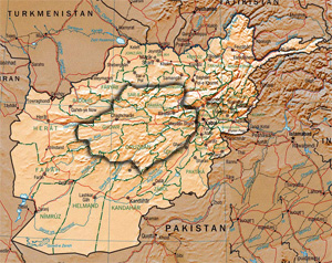
Has anyone managed to make a Q-BAM or M-BAM showing Hazarajat?
 en.wikipedia.org
Hazarajat - Wikipedia
Flag idea for the one and only Raccoon City.
1: A bend flag with the upper part rustic green ( Arklay Mountains), the line in the middle blue ( Circular.) and the lower half golden. (The wealth and prosperity of Raccoon City.) Complete with a raccoon
1a: Same idea but as a Fess.
2: The Colors instead are Red, Green, Blue. (The Original Herbs.)
@BloodAndIron I don't suppose you could make a divided Germany like from image 3 of this post from one of @Crazy Boris maps?Bit late, but hope this is good")
The only thing different from the proposal would be to still have the same Polish-German border and Hungary not being part of South Germany.Different plans to split up Germany after WW2
Can someone take this flag and make it dark red and more sinister looking. I need it for the people's revolution.
what do you mean by " sinister looking" ?View attachment 823569
Can someone take this flag and make it dark red and more sinister looking. I need it for the people's revolution.
I'm thinking occult symbolism.what do you mean by " sinister looking" ?
Sorry for not specifying
so like upside down pentagram ?I'm thinking occult symbolism.
Sorry for not specifying
You might find one you like on this page: https://www.nuketown.com/random-planet-generators/Is there a good map generator for maps of alternative earths?
Share: