For the sake of completeness, could someone here try and fill in Antarctica's topograhy into this elevation map? Specifically with the ice on it intact, like with greenland on this map.
I mean, this is a very old map. What bugs me is that for all these years, the topographical worlda map that is in the map resources of the wiki is unfinished with sections that hadn't been filled in.
This version is mostly "Complete" as in I had to stitch it together with other versions of this map at various stages of completion, save for one landmass.

They all consistently left antarctica blank and unfilled.I did an extensive search and haven't found any verson of this map with a filled in antarctica.
I know that the excuses coming are going to be "But it has ice covering it" or "it's not inhabited", but how come greenland's toograhy has been filled in despite showing the ice on it.
Is there anyone in this forum that is open and and has the time to fill in this last part of this map? If so, here's the legend, taken when it was being made:
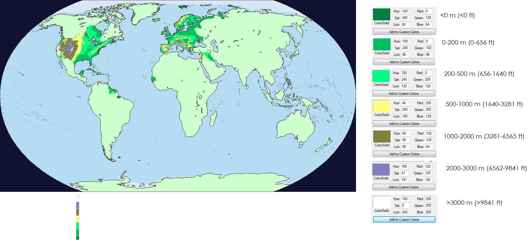
If there's any reason why I'm asking, it's because I'm doing a modified version of this 800 meter sea level rise by Metalist-99 to visualize the setting of a post apocalytic fantasy AU.
Same with the others, one part of the map is not accounted for, except in this case Antarctica has been completely cropped out.
I mean, this is a very old map. What bugs me is that for all these years, the topographical worlda map that is in the map resources of the wiki is unfinished with sections that hadn't been filled in.
This version is mostly "Complete" as in I had to stitch it together with other versions of this map at various stages of completion, save for one landmass.
They all consistently left antarctica blank and unfilled.I did an extensive search and haven't found any verson of this map with a filled in antarctica.
I know that the excuses coming are going to be "But it has ice covering it" or "it's not inhabited", but how come greenland's toograhy has been filled in despite showing the ice on it.
Is there anyone in this forum that is open and and has the time to fill in this last part of this map? If so, here's the legend, taken when it was being made:
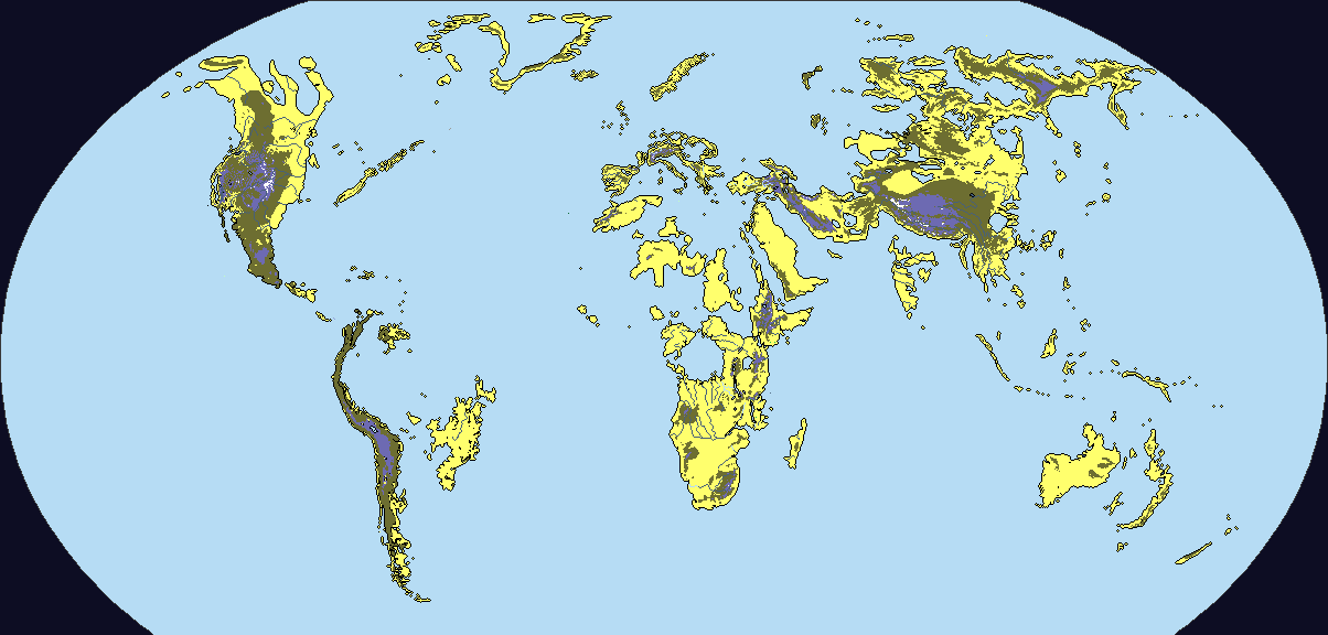
If there's any reason why I'm asking, it's because I'm doing a modified version of this 800 meter sea level rise by Metalist-99 to visualize the setting of a post apocalytic fantasy AU.
Same with the others, one part of the map is not accounted for, except in this case Antarctica has been completely cropped out.
Last edited: