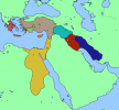
I think the Russian/Ottoman border is wrong @Crazy Boris Also, what is that state abutting Sierra Leone (that isn't Liberia)?
You are using an out of date browser. It may not display this or other websites correctly.
You should upgrade or use an alternative browser.
You should upgrade or use an alternative browser.
Q-Bam Historical Map Thread
- Thread starter The Alternative
- Start date
-
- Tags
- historical maps q-bam
Crazy Boris
Banned
Kaabu EmpireI think the Russian/Ottoman border is wrong @Crazy Boris Also, what is that state abutting Sierra Leone (that isn't Liberia)?
any chance we could get a legend? it's a little confusing to navigate if you don't know the state names alreadyoops, used the wrong reference, should be good now

I thought the Kaabu Empire was the state abutting Portuguese Guinea?Kaabu Empire
Crazy Boris
Banned
That’s what I thought you meant, if you mean the one directly south of it Making up the bulk of modern SL, that’s the Koya-Temne Kingdom.I thought the Kaabu Empire was the state abutting Portuguese Guinea?
I never realized Koya was that large at one time.That’s what I thought you meant, if you mean the one directly south of it Making up the bulk of modern SL, that’s the Koya-Temne Kingdom.
Crazy Boris
Banned
I will be making labelled versions of these maps eventually, but not at the moment.any chance we could get a legend? it's a little confusing to navigate if you don't know the state names already

Here's a new one, January 272, Start of Aurelian's campaign against Zenobia (might not actually be January but I think it is, specific dates during the crisis are not exactly easy to find)
Crazy Boris
Banned

...okay here's that last one with labels since it's easy to do with so few countries
Nice map but there are some mistakes in the Russo-Ottoman border.oops, used the wrong reference, should be good now
updated historical map compilation doc to fit new updates in here since like january 11
https://docs.google.com/document/d/14LEJv7zYhiuviBklCwkqw7f8ugOy3eH-PXZ-7rN0jRo/edit
https://docs.google.com/document/d/14LEJv7zYhiuviBklCwkqw7f8ugOy3eH-PXZ-7rN0jRo/edit
Ottoman Vilayet, Sanjak and Kaza's.
Some stuff to note:
-It was mostly done by overlaying, except for in The Balkans.
-Some areas are missing Kaza's, but I don't have anything on them.
-Everything that is de jure Ottoman is added for maximum coverage
-It's syntax is probably inaccurate, but the borders are %95 correct.
-In Southeastern Anatolia, Ankara and Sivas, there's some alignment issues.
-Some borders may not fit the common borders but they were off in the Q-BAM, I'm like %90 sure.
-Libya's desert borders are a bit arbitrary, but it shouldn't be an issue.
I plan on adding egypt next.
Source: Here
Hope you guys enjoy!
November 14, 565, at the death of chad Justinian I. Wanted to finish this in time for the Dovahhatty episode on this but I procrastinated
Some more stuff:

A small patch for A-L and Bavaria in 1914wred is 1st level, blue is 2nd level.

Khedivate of Egypt in 1899.
A small patch for A-L and Bavaria in 1914wred is 1st level, blue is 2nd level.
Khedivate of Egypt in 1899.
Amazing map! But I have some stupid questions to ask. Stupid questions such as:View attachment 642399
November 14, 565, at the death of chad Justinian I. Wanted to finish this in time for the Dovahhatty episode on this but I procrastinated
Is that the Thuringii?
The Angles are still in the Angeln peninsula?


If you mean the Green, those are Saxons. If you mean the blue, those are Bavarians. The Thuringii have been absorbed into the Frankish state by now.Amazing map! But I have some stupid questions to ask. Stupid questions such as:
Is that the Thuringii?
The Angles are still in the Angeln peninsula?
And yeah they are, the Angles, Saxons, and Jutes migrated in waves but never fully left, at least until the Jutes and Angles disappeared as a distinct ethnic group in Jutland
Not quite perfect, but a rough map of the political situation in the Near East circa 1250-1200 B.C. based on Ian Mladjov's resources.
- Terracotta red-brown are the Ahhiyawa, or Mycenaean Greeks. Borders between wanax realms are not shown here - the situation among the Greeks in this period is varyingly interpreted as a group of closely-related independent palatial states, or a decentralized single realm under a high king.
- Tan is the Kingdom of Hattusa/Hittite Empire. Vassal realms in southern Syria and western Anatolia are not distinguished here.
- Lime-green is Lycia, home to the Lukka tribes and independent of long-term Hittite control.
- Orange (in Cyprus) is the Kingdom of Alashiya, an independent state controlling Cyprus before its brief conquest by the Hittites. The exact territorial span and degree of centralization of Alashiya is currently unknown, though while this territorial extent is somewhat speculative, outside texts use the name to refer to the entirety of Cyprus.
- Gold is Egypt in the New Kingdom period, ruled by the 19th Dynasty.
- Teal is Assyria, currently in a state of ascension at the expense of the neighboring Hittites and Babylonians. The title "King of Kings" was first employed in this period by Tukulti-Ninurta I (r. 1243-1207 B.C.).
- Vermillion red is Babylon/Karduniash in the late stages of its rule by the Kassite Dynasty.
- Deep blue is Elam, currently in a state of conflict with Kassite Babylon (which it will eventually go on to annex).
Attachments

Ermenleri stronk... come on guys, you can hold those borders against Kemal 🇦🇲🇦🇲🇦🇲🇦🇲🇦🇲🇦🇲🇦🇲🇦🇲🇦🇲🇦🇲
August 10, 1920: Treaty of Sevres comes into effect
Share: