Comes down how one decides which land goes with who. Odd with the Kazakhs and Kirghiz on the map, though I did one read they called the Kazakhs Kirghiz so as to not mix them up with the Cossacks when saying the group names out loud. Doesn’t explain why the Kazakhs are in place of the Karakalpaks. Well, the three are from the same Kipchak linguistic family, so many that is why. Come to think of it, most of these groups were somewhat nomadic. Perhaps it is the same withthe Cossack areas here, or they are just claiming the lands they had special rights in from when settling the territory. Don’t suppose anyone knows some good reading on the Cossacks?I think this should be accurate?

You are using an out of date browser. It may not display this or other websites correctly.
You should upgrade or use an alternative browser.
You should upgrade or use an alternative browser.
Proposals and War Aims That Didn't Happen Map Thread
- Thread starter Beedok
- Start date
Were there any Japanese plans at the time to expand the territory of Manchukuo and their right-wing Mongolian puppet state?Found this on Wikipedia. Apparently these were plans by the Japanese for an invasion of the Soviet Union
I'm not sure about that.Were there any Japanese plans at the time to expand the territory of Manchukuo and their right-wing Mongolian puppet state?
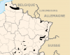
What if the Nazis had gone through with their proposed plan to expel the Sorb population of Lusatia to mining districts of Alsace-Lorraine?
Edit: Here's northeastern France on a map of French coal basins. This includes Nord-Pas-de-Calais and not just Alsace-Lorraine, since maybe the Nazis would expel some of the Sorbs there, too.
Edit: Here's northeastern France on a map of French coal basins. This includes Nord-Pas-de-Calais and not just Alsace-Lorraine, since maybe the Nazis would expel some of the Sorbs there, too.
Attachments
Last edited:
This was apparently a thing:

Site: http://bigthink.com/strange-maps/248-friends-polypotamians-countrymen
Thought y'all would be interested, I made a Q-Bam of this proposal. It's not the most up to date Q-Bam but it works, also I recently found this and its related to this, it's basically a highly detailed map of Jefferson's Metropotamia: https://somethingaboutmaps.wordpress.com/2016/10/10/metropotamia/
Last edited:
Ah, so beautifully chaotic, isn't it?Thought y'all would be interested, I made a Q-Bam of this proposal. It's not the most up to date Q-Bam but it works, also I recently found this and its related to this, it's basically a highly detailed map of Jefferson's Metropotamia: https://somethingaboutmaps.wordpress.com/2016/10/10/metropotamia/
View attachment 578996
"You know what we need more of? Squares."Ah, so beautifully chaotic, isn't it?
Except Pelisipia which has that weird tiny panhandle for some reason"You know what we need more of? Squares."
"What state do you live in?"Thought y'all would be interested, I made a Q-Bam of this proposal. It's not the most up to date Q-Bam but it works, also I recently found this and its related to this, it's basically a highly detailed map of Jefferson's Metropotamia: https://somethingaboutmaps.wordpress.com/2016/10/10/metropotamia/
View attachment 578996
"The square one"
"You're going to have to be a bit more specific"
"The, uh, second one from the top"
"Is that the one west of Virginia or west of North Carolina"
"To be honest I kind of forgot"
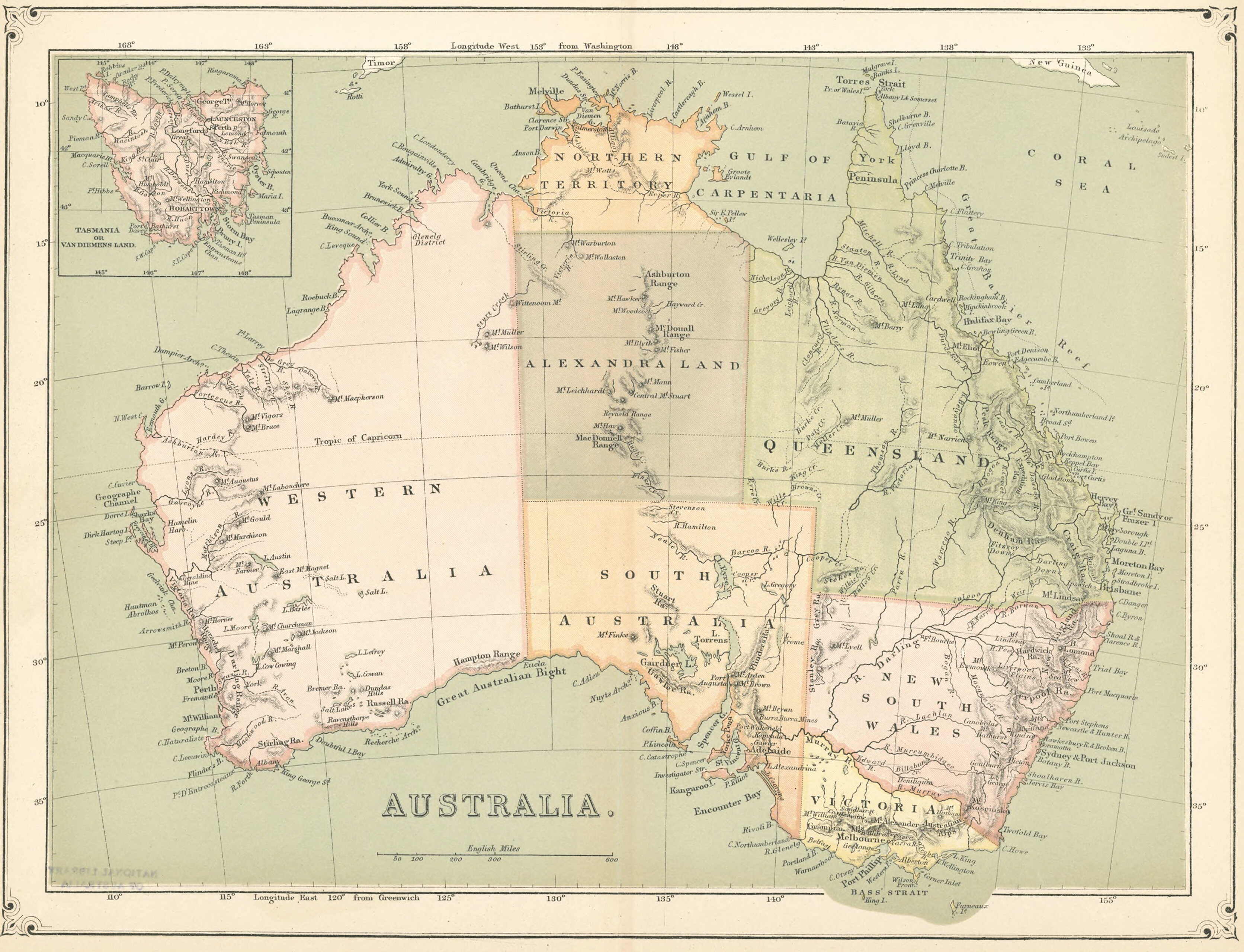
The name "Alexandra Land" was given to part of the Northern Territory after it was transferred from New South Wales to South Australia in 1863.
The land was named after Alexandra of Denmark, the new wife of the then-future King Edward VII, who had married that same year.
Apparently they hoped that it would be as economically prosperous as Queensland for sugar, tobacco, cotton, and coffee.
It wasn't.
I've seen this image a couple times around the internet, and I decided to make it into a worlda map:


Note that Spanish Guinea is coloured as a colonial possession (even if it doesn't have a thick border), and I included the Cabinda Exclave with Angola, since it didn't appear in the map.

Note that Spanish Guinea is coloured as a colonial possession (even if it doesn't have a thick border), and I included the Cabinda Exclave with Angola, since it didn't appear in the map.
I've seen this image a couple times around the internet, and I decided to make it into a worlda map:
View attachment 580135
Note that Spanish Guinea is coloured as a colonial possession (even if it doesn't have a thick border), and I included the Cabinda Exclave with Angola, since it didn't appear in the map.
Interestingly enough if all of the members of ECOWAS were to join OHADA then that would roughly correspond to the United States of Africa featured on that map. Now if the non-CFA Franc members of ECOWAS adopted the West African CFA Franc/Eco and the Eco kept the same exchange rate as the Central African CFA Franc and the currencies were made fully convertible, this would cement the similarity as it would for the entirety of that area there would in essence be one business law, one currency and two (imperfect) free movement zones.
now i totally want to see something about a United States of Africa and a unified Commonwealth of Africa (maybe expanding the latter a bit more) in some kind of conflict, maybe a cold war, with the rest of the continent caught in the middleI've seen this image a couple times around the internet, and I decided to make it into a worlda map:
View attachment 580135
Note that Spanish Guinea is coloured as a colonial possession (even if it doesn't have a thick border), and I included the Cabinda Exclave with Angola, since it didn't appear in the map.
Crazy Boris
Banned
Apparently they hoped that it would be as economically prosperous as Queensland for sugar, tobacco, cotton, and coffee.
I’m assuming they never actually saw what the landscape of Alexandra Land was like.
I suspect their thinking went like "it's the same latitude as Queensland, so it must be the same".I’m assuming they never actually saw what the landscape of Alexandra Land was like.
The territory had only been lightly explored by Europeans at that point in history, with the first full crossing from Adelaide, South Australia to Van Diemen Gulf on the coast of the Northern Territory only being completed in 1862. Which is probably why all of the features in Alexandra Land form a wiggly sort-of line.
During the construction of Interstate 40 in California, the Santa Fe Railway Company wanted to find a way to cut through the Bristol Mountains, as this would prevent the highway from having to swerve around them like the Santa Fe Railway and Route 66 did. That would, however, involve cutting through 4,000 feet of rock, which would've necessitated either a huge tunnel or 500-foot-deep cuts in the mountains, costing around $22 million . Far too expensive for the company.
This attracted the attention of the Atomic Energy Commission, who offered their own plan, called Project Carryall. This would've involved the use of 23 nuclear weapons, 22 to hollow out the path and the 1 for the runoff water, excavating a total of 68,000,000 cubic yards of land. All of this would cost only $13.8 million.
Of course, as with all of Operation Plowshare's proposals, none of them panned out. Carryall was scrapped in 1968 and Interstate 40 was instead carved out using conventional means.
I suspect that the true cost would have been much higher as history proves that humanity consistently underestimates the level of danger regarding fallout, so it could turn into an EPA superfund site for the levels of decontamination that would be required.This attracted the attention of the Atomic Energy Commission, who offered their own plan, called Project Carryall. This would've involved the use of 23 nuclear weapons, 22 to hollow out the path and the 1 for the runoff water, excavating a total of 68,000,000 cubic yards of land. All of this would cost only $13.8 million.
As seen on reddit:

To quote the redditor fatyoshi48 who posted the map over there:
Okay, it was a satire show and as such the proposal is not meant serious, but nevertheless it still is a proposal...
To quote the redditor fatyoshi48 who posted the map over there:
So, this map was brought up in the satirical Dutch show ‘Zondag met Lubach’ (Sunday with Lubach, the presentor) while discussing the current problems with regarding the Belgian government. As Flanders doesn’t want to belong to another nation, and Wallonia wanted to belong to someone, he satirically proposed this.
Okay, it was a satire show and as such the proposal is not meant serious, but nevertheless it still is a proposal...
Oh yeah, definitely. And especially because they planned to use 50 kiloton bombs, which have more overall fallout. 23 of them in the Mojave Desert? Nobody's using that road anytime soon.I suspect that the true cost would have been much higher as history proves that humanity consistently underestimates the level of danger regarding fallout, so it could turn into an EPA superfund site for the levels of decontamination that would be required.
Share: