OTL Map Thread Mk IV., 2014-

fashbasher

Banned
For my timeline, I wanted to try to get an idea of a lower and upper bound of the Asian populations in the regions that were my main bastions of civilization. I came up with this range of 1.5-5.5% for the core Caribbean (depending on how much Colombia you include), 1.5-4% including all of Colombia, and up to 9% including Mexico and the Andes (which have mountain ranges that could shield them from any land invasion in a collapse scenario). The POD is mainly in the future so the wildly aggressive right numbers are likely with a grain of salt, but I also allocated zero Asians to some countries. The point was to get an idea of how many Asian descendants (even if only of 1/4 or 1/8 ancestry) would be left to rebuild Asia in such a scenario.
soZ0Xbe.png
 

fashbasher

Banned
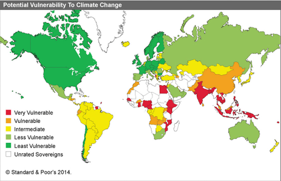
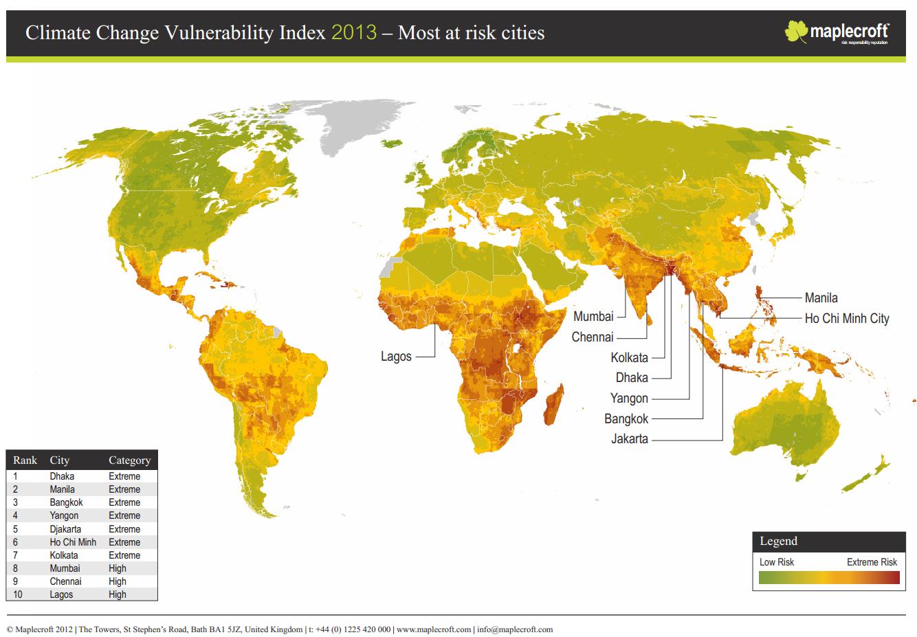
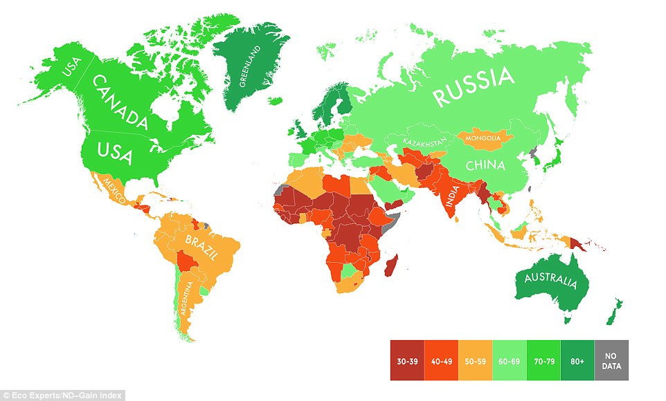
A bunch of maps of the impact of climate change from various sources. Looks like I want to go to Russia, Canada, or Scandinavia, with (depending on model) a winter place in either Australia or Colombia (Africa is fVcked):

climate_impacts_map_0.png

Pope-Climate-Change-Seattle-2.jpg

maplecraft-climate-change-vulnerability-index-2013-map.jpg


151123-economic-effects-of-climate-change-world-map.png


b2-hi-temp-aggregate-impacts-2100.jpg

24AAE2D600000578-2908213-image-a-37_1421157721470.jpg
These need to be posted in the climate change thread
 
At first, I thought this was a sci-fi map of galactic hyperlanes and interstellar colonies.

Well, sometimes a foreign language sounds rather alien, don't they? ;)

Unrelated, have here a linguistic map.

A bit odd for often showing prominent borders between dialects, but meh.

cig3g9ux761z.jpg
 
That's less a linguistic map than an ethno-linguistic map (combining elements of both) as can be see in the British Isles where Welsh certainly does not cover all of Wales unless one is referring to the Welsh people and not just the Welsh language.
 
Surprised by how little pork Denmark seems to consume, although I guess since they do export a shitload of it, there must not be much left.
 
Surprised by how little pork Denmark seems to consume, although I guess since they do export a shitload of it, there must not be much left.

And given how they lead the chart in cattle meat consumption I hereby suggest that they shall re-name their capital into Cowpenhagen

(sorry couldn't resist) :oops:
 
Surprised by how little pork Denmark seems to consume, although I guess since they do export a shitload of it, there must not be much left.
Their hot dogs/pölser are bright red. Been years since I was there, outside of a two day stop, but I would say their cuisine is a bit different than one might expect.
 
Their hot dogs/pölser are bright red. Been years since I was there, outside of a two day stop, but I would say their cuisine is a bit different than one might expect.

Yes, I am familiar. And it's just the casing that's bright red, the inside of the sausage is basically the same as a normal one.
 
Yes, I am familiar. And it's just the casing that's bright red, the inside of the sausage is basically the same as a normal one.
Yes, they use dyes. I just found a lot of the food there in my youth to be a bit different than in Norway, the U.S.., or other places. Soft kransekake... What a thing.
 
Yes, they use dyes. I just found a lot of the food there in my youth to be a bit different than in Norway, the U.S.., or other places. Soft kransekake... What a thing.

I have a feeling that if we turn to the topic of "weird Danish foods" we could be here all night.
 
Top