Upvoteanthology
Donor
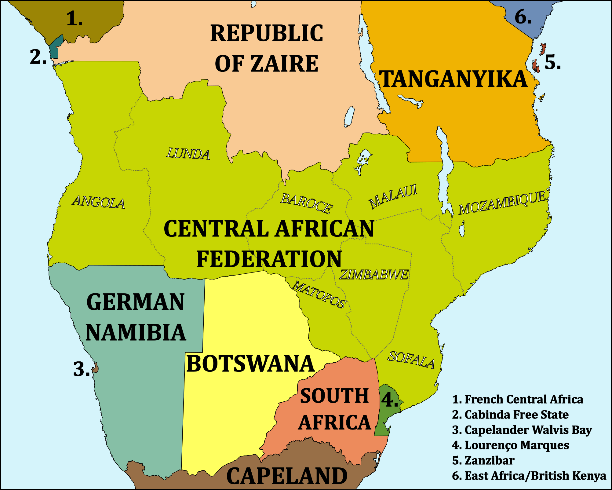
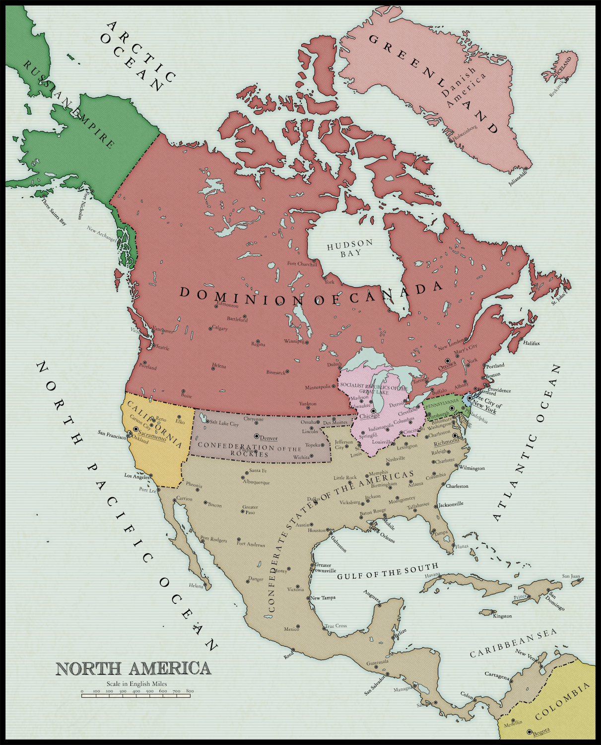
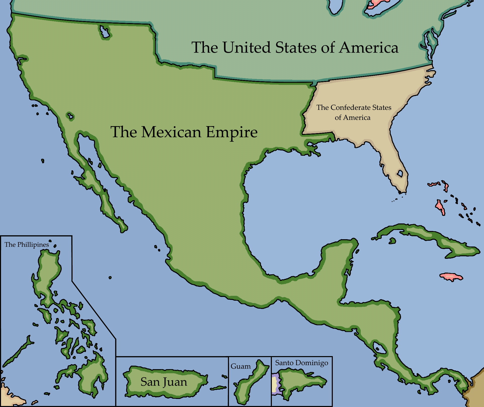
MotF 170: To Shining Sea
The Challenge
Make a map of a country or region that extends from one major body of water to another. (IRL examples: Russia, Canada, the USA, Australia)
The Restrictions
There are no restrictions on when the PoD of your map should be. Fantasy, sci-fi, and future maps are allowed.
If you're not sure whether your idea meets the criteria of this challenge, please feel free to PM me or comment in the main thread. Sometimes it isn't as clear as I intend it to be.
---
Entries will end for this round when the voting thread is posted on Monday, Christmas 2017.
---
ALL DISCUSSION ON THE CONTEST OR ITS ENTRIES MUST TAKE PLACE IN THE MAIN THREAD. PLEASE.
Any discussion must take place in the main thread. If you post anything other than a map entry (or a description accompanying a map entry) in this thread then you will be asked to delete the post.
Remember to vote on the previous MotF round!