One quick comment on salt. The east would not be as salt deprived as you may think. The Atlantic coast would provide a rival source. Also, there are a few inland cities that sit on huge salt deposits stemmed from the beds in the western Appalachians. The mine under Detroit is huge, and Cleveland and Hutchinson, Kansas had extensive salt deposits. The Finger Lakes region in New York is a salt producing region.
The areas that I think will be hardest up will be the southern Appalachians, and the interior of the Pacific Northwest. The PNW especially will be hard hit because the is no natural iodine in the soil. This would result in increased birth defects over generations for a population without access to salt or the sea (central India is a parallel example).
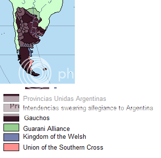
A couple of idea stemming from this. There may be a small city/large town in Kansas, the heart of Cowboy territory. The town will be built around a minable salt bed. It would be a trading center, as well as a powerful political force on the plains. The only reason a tribe of Cowboys doesn't raze the place and claim the salt for themselves is that the other tribes would never stand for one tribe having so much power of the others. Second, people from the eastern PWN might be looked at strangely, or there may by folklore of 'cursed' areas where children are born dead or deformed.
The areas that I think will be hardest up will be the southern Appalachians, and the interior of the Pacific Northwest. The PNW especially will be hard hit because the is no natural iodine in the soil. This would result in increased birth defects over generations for a population without access to salt or the sea (central India is a parallel example).
A couple of idea stemming from this. There may be a small city/large town in Kansas, the heart of Cowboy territory. The town will be built around a minable salt bed. It would be a trading center, as well as a powerful political force on the plains. The only reason a tribe of Cowboys doesn't raze the place and claim the salt for themselves is that the other tribes would never stand for one tribe having so much power of the others. Second, people from the eastern PWN might be looked at strangely, or there may by folklore of 'cursed' areas where children are born dead or deformed.
Last edited: