Another telephone map game post! Woo!
I hope you all enjoy!
I really like it! And the scenario is also fun!
Another telephone map game post! Woo!
I hope you all enjoy!
Reminds me of Mystara. Is there a qbam version of it?View attachment 501256
Some terrible map I made of past earth.
No, just exists.Reminds me of Mystara. Is there a qbam version of it?
snip


A quick map inspired by my most recent CK2 run as the Saka Satrap of Kashgar, its fairly simple and is literally what it says on the map itself but I may yet use it for something else if my new interest in Central Asian history keeps up.
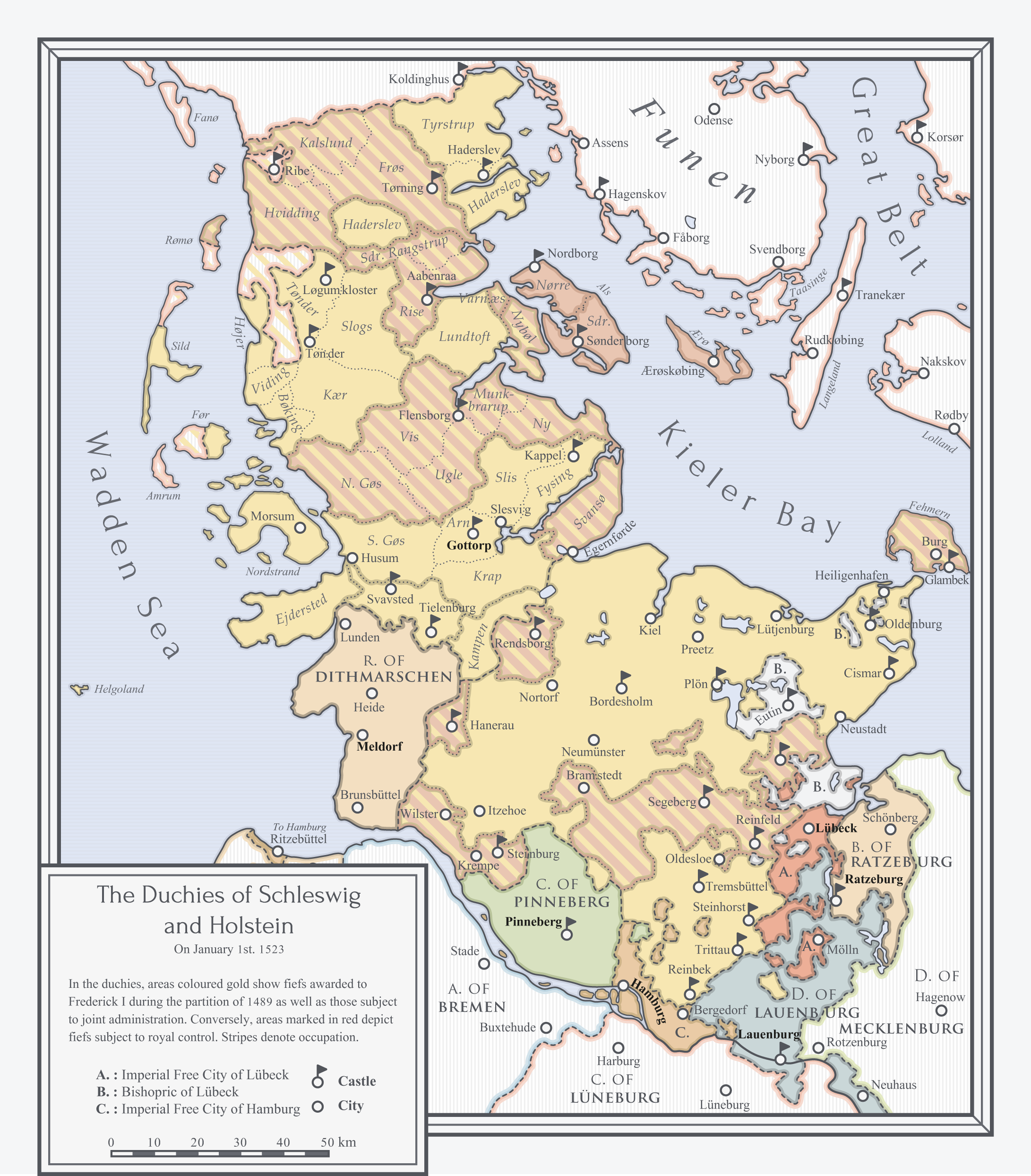
(Sydjylland)

Map of Africa in my Années Douces TL
Every state with no specific mention under it means independence, the colors signifie an alignment with a European power (may it be an alliance or a colonial status)
Well..I was more trying to say that it shouldn't be assumed syndicalism will fail like state command economics.
-snip-
I think they’re all really well done, although I personally can’t comment on their accuracy.I'm sorry if this is against the rules but please see my signature as I love what I've created and would love to see some feedback
Because humanity is otherwise unremarkable in a universe with other self-aware, intelligent beings that can feel emotion.
This was the only sea level rise basemap that I could find; given another one I would gladly have used that (ideally one that would represent a sea level rise that might be feasible in the next several decades). I used this one because it's all I could find, and I'm not all that skilled with physical cartography so I couldn't really make one on my own.Your map seems to show a variant of the 100 meter sea level rise concept; that is problematic as it's literally impossible, even if all the ice caps on the planet melted the maximal sea level rise possible is 66 meters.