Zimmerwald1915
Banned
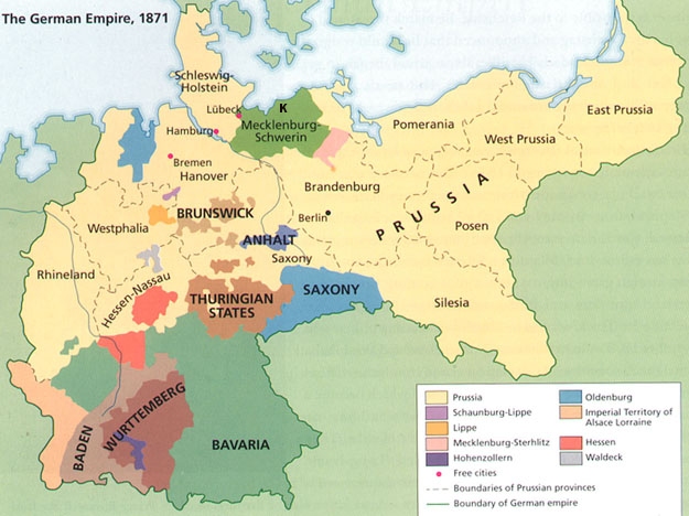
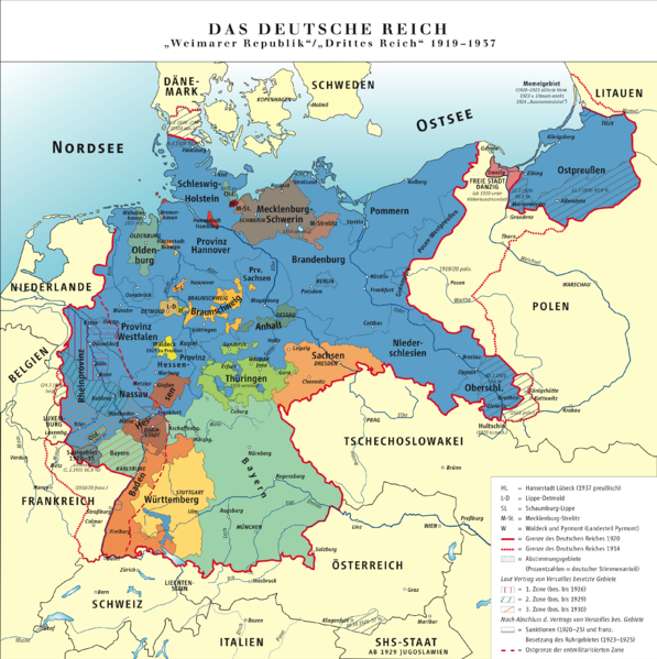
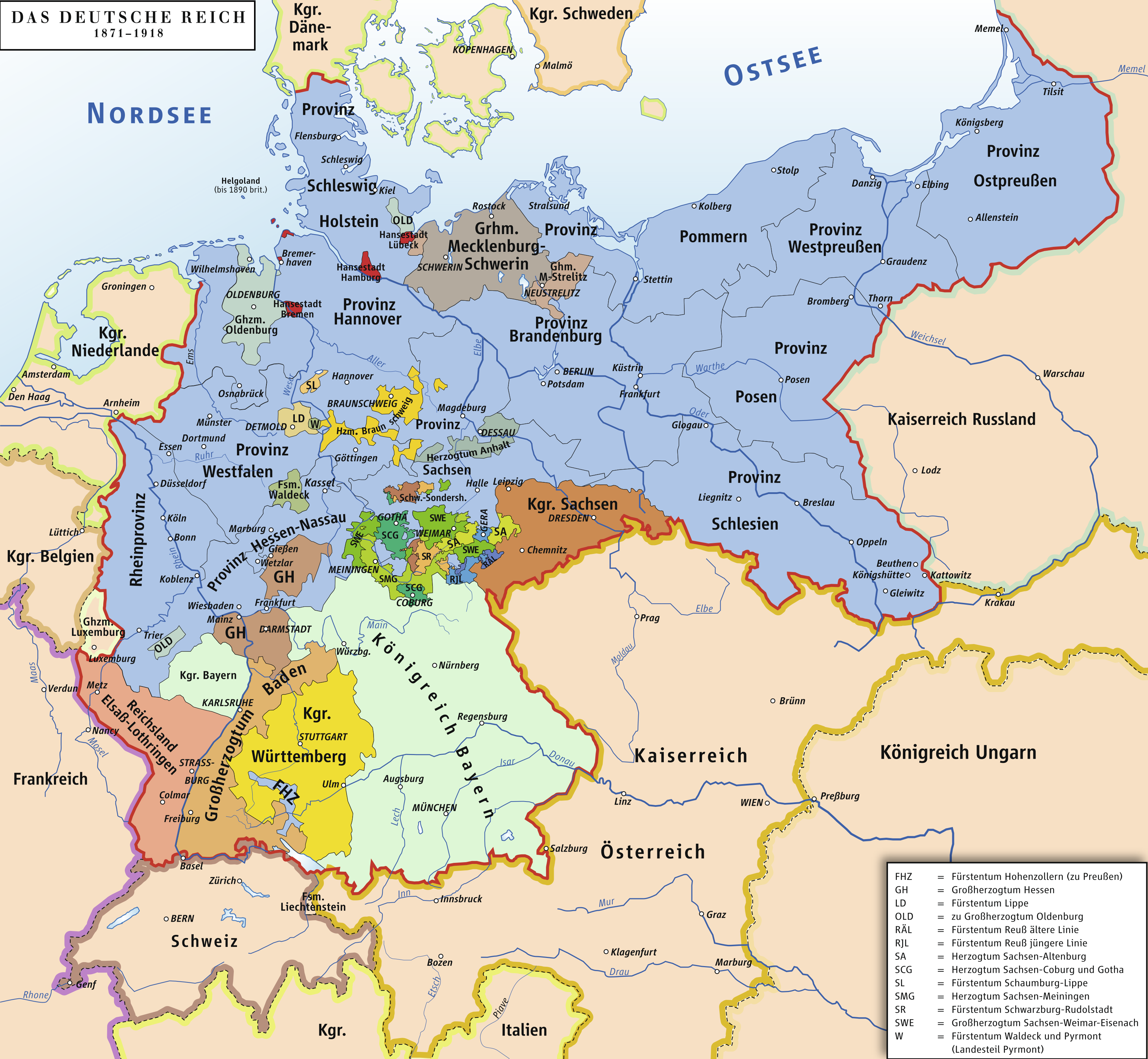
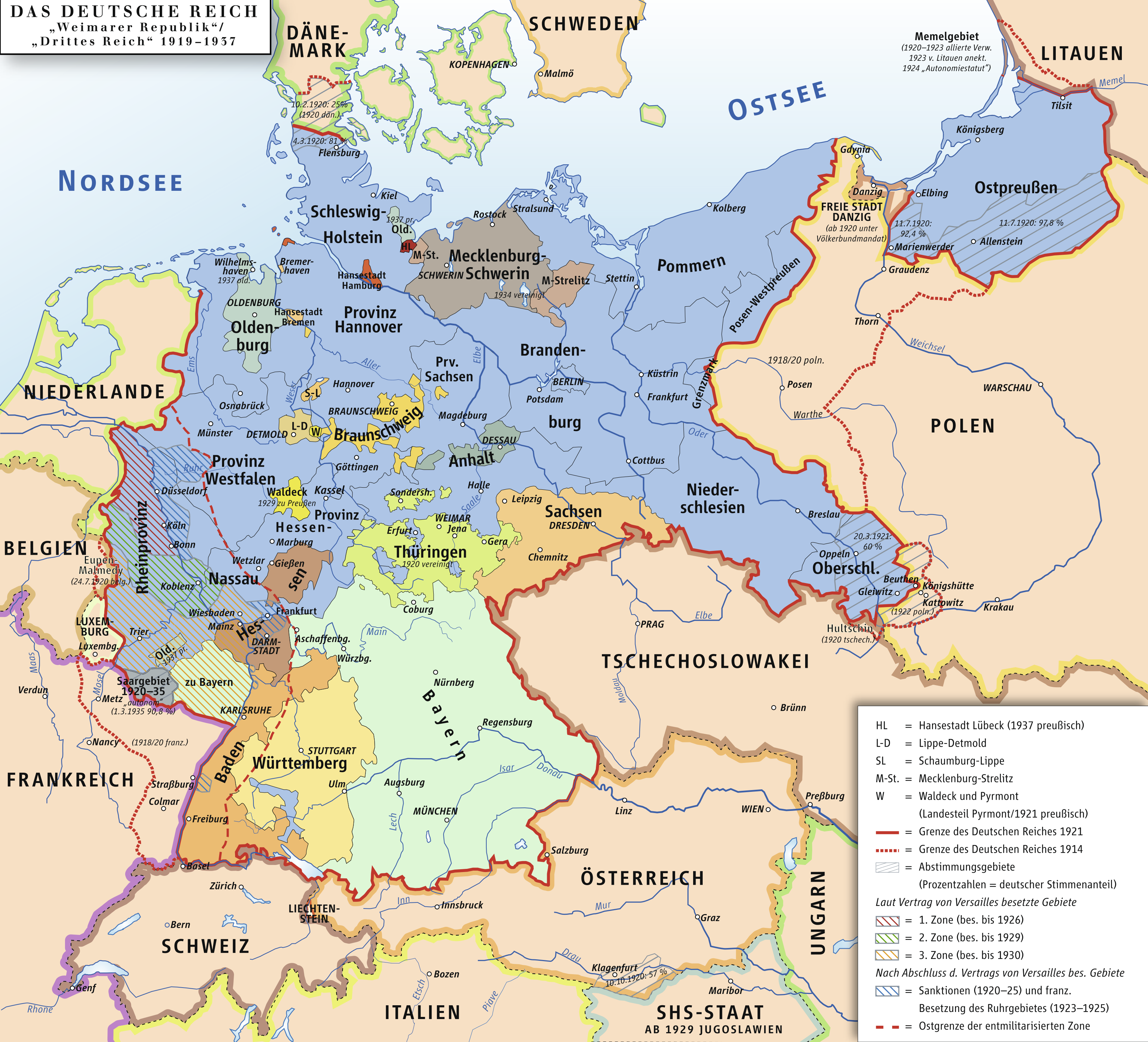
Does anyone happen to have a large map of the German Empire, and a large map of the Weimar Republic, showing internal subdivisions (individual states as well as subdivisions of Prussia)? Quite a few exist on the Web, but I haven't managed to find any that are the same size, which has somewhat hampered my efforts to fabricate an "alt-Versailles" settlement map.
Maps lacking anti-aliasing are preferred.
Maps lacking anti-aliasing are preferred.