B-29_Bomber
Banned
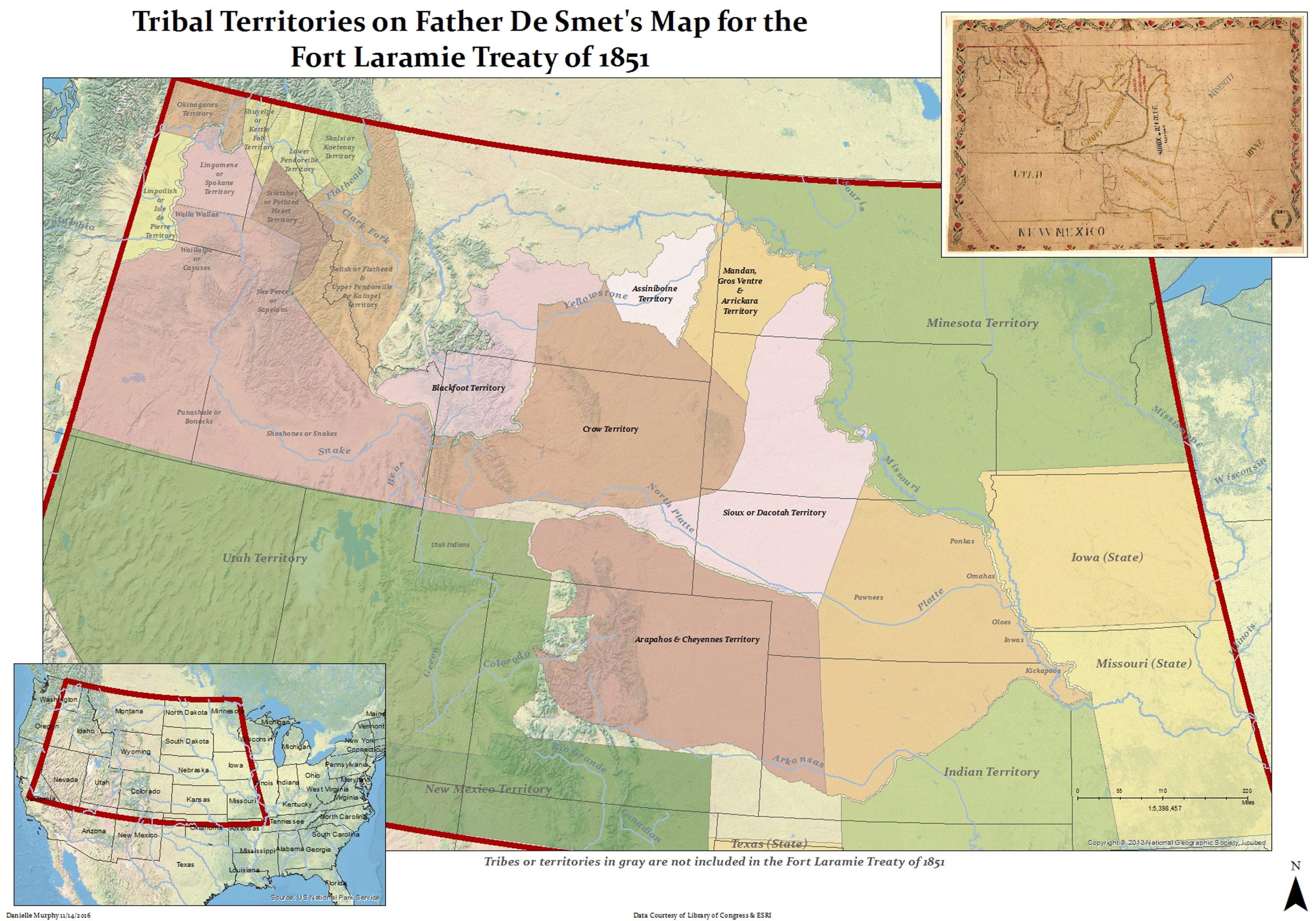
Anyone know of any good maps depicting Native American tribal lands as of the year 1860?
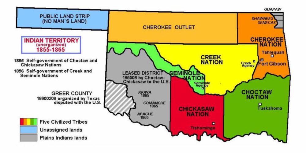
In 1860 most of the West was still unceded, wasn't it? Searching around, I didn't find any really good maps, but there were several blobby textbook style maps, and they all show everything from eastern California to western Kansas as a contiguous block of unceded land.
There must still be maps depicting the traditional lands of Native tribes such as the Sioux or Lakota.