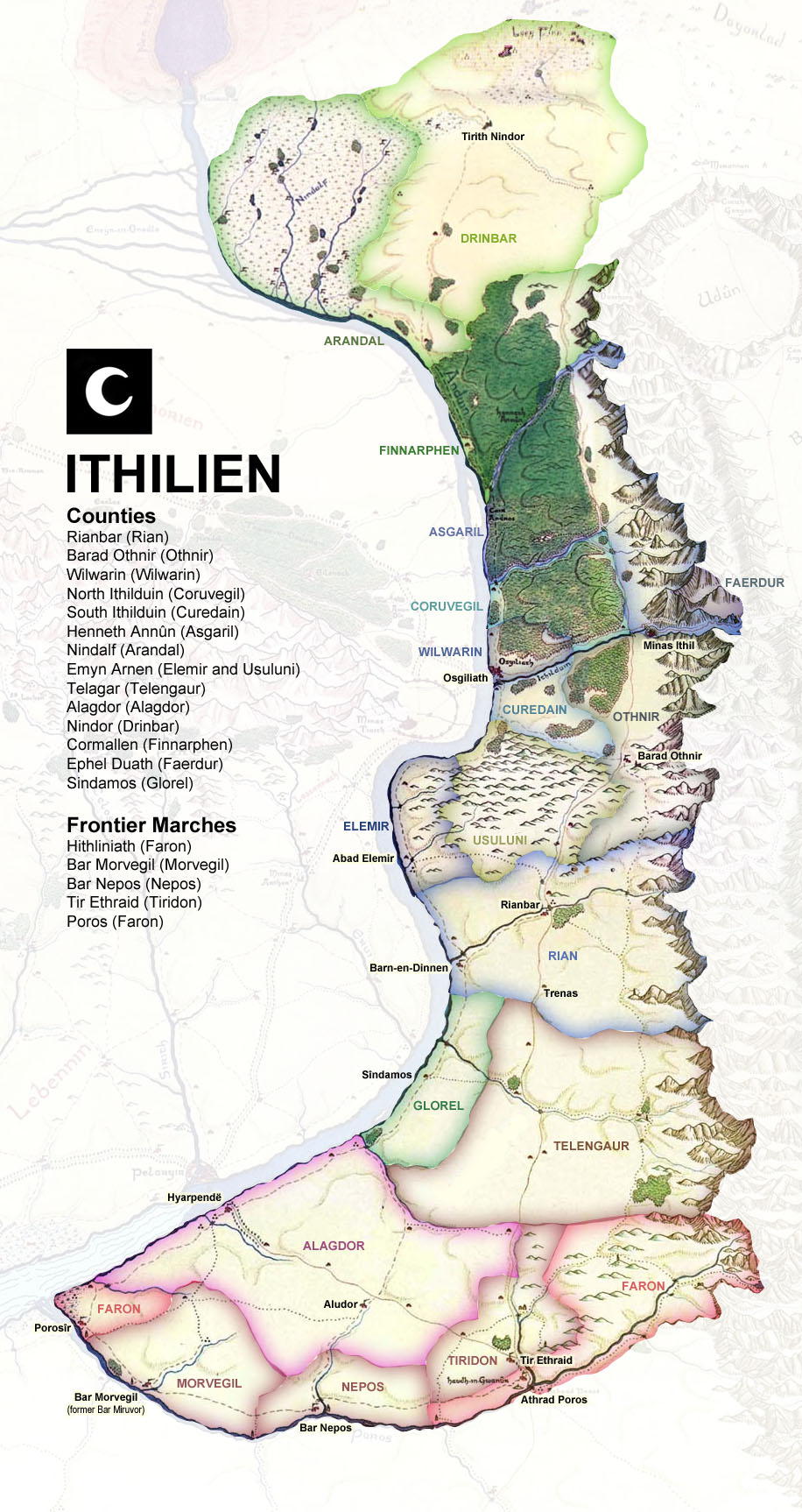
I made some changes to Rohan
View attachment 366026
I pulled back the border near the Adorn to match the most commonly accepted border.
I drew more defined shapes for Fangorn and Lorien and added the Parth Celebrant.
I also drew all the coasts and rivers In this section and cleaned up a few incorrectly colored pixels around the map.
The basemap oddly seems to be some kind of hybrid between the MERP map and the lower detail Tolkien maps, which messes up the shape of the Parth Celebrant, It uses the MERP Anduin and the MERP coast south of the Gwathlo, The rest of the rivers are taken from one or the other or are missing entirely (Limlaith) the Celebrant is drawn from the Tolkien maps for example which is the main reason that the Parth Celebrant is squashed, I think the mountains are also drawn from the Tolkien maps.