Looking For a Good Eastern Europe Interwar Map

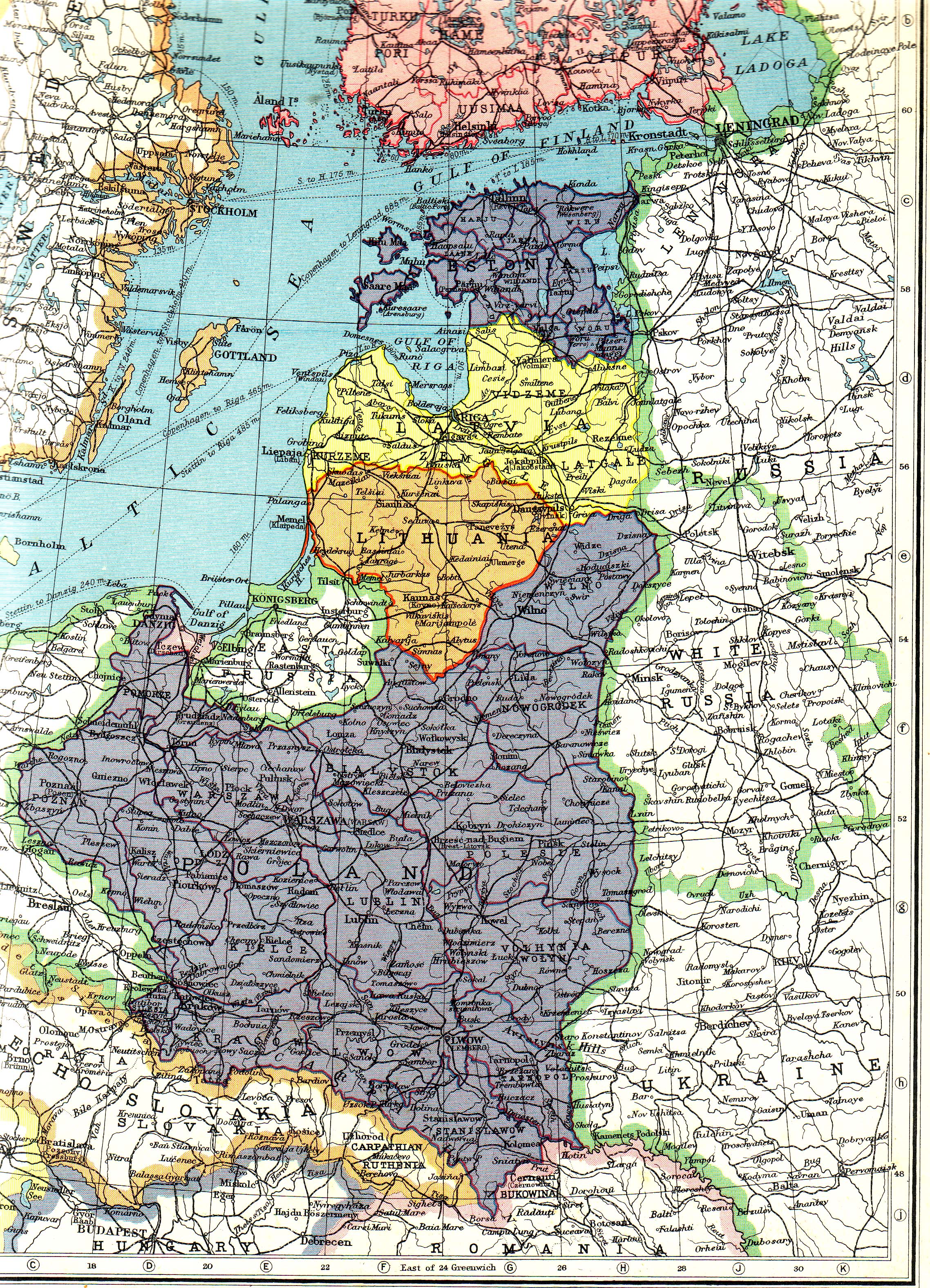
Specifically, one that includes Hungary, Czechoslovakia, White Russia/Belarus, Lithuania, and Poland for a map I'm doing. It's a map that will serve as the base for the map I plan to make, so the bigger the better. Preferably something like the image below, but including Hungary. I've looked all over for a good one and couldn't find any, so now I turn to all of you here.

osteuropa22_38.jpg
 
These two might be useful. Note that the second seems to come from the immediate aftermath of WWI before all the borders were properly settled. The borders of Lithuania are subtly different, and Ukraine is shown as a separate state, but otherwise all the borders seem to be what they eventually became in OTL.
 
These two might be useful. Note that the second seems to come from the immediate aftermath of WWI before all the borders were properly settled. The borders of Lithuania are subtly different, and Ukraine is shown as a separate state, but otherwise all the borders seem to be what they eventually became in OTL.
Thank you! Got any more, by any chance? And yeah, I noticed the differences and can account for them in making the map.
 
Top