Full(est) House - Constitutional Apportionment Amendment

What data should be used to determine party share?

  • 2020 Presidential

    Votes: 3 25.0%
  • 2016 & 2020 Presidential

    Votes: 5 41.7%
  • Whatever automatic composite DRA gives me for each state

    Votes: 4 33.3%

  • Total voters
    12
  • Poll closed .
Introduction

  • As a geek with equal amounts of love for mathematics and American history, it was only a matter of time before I stumbled upon the Congressional Apportionment Amendment. To briefly summarize the CAA such that those with more of a life than I can have some understanding, it was an amendment proposed by James Madison that would define the number of seats in the House of Representatives by a certain formula.

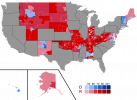
    Following this formula using 2020 Census data yields 1,723 seats in the House.

    The purpose of this thread is not to ruminate on how the passage of this amendment would turn the nation on her head, how the Senate's power would balloon, and the utter havoc this massive paradigm shift would wreak on American history.

    Rather, this is my interpretation on a "wow it's the House but big" scenario, but using an objective, historically plausible (only one state away from ratification!) method to determine the size of the House. I've already crunched all the numbers, so this thread will be solely devoted towards Dave's Redistricting maps made with these parameters

    This is technically collaborative - while I plan to make plenty of these maps myself, I heartily welcome the prospect of outside contributions.
    If you wish to map out a state, simply let me know and I'll provide you with whatever resources and assistance you may require.

    Also, if this is the wrong place for such a thread, please do correct me.
     
    State List
  • State - # of Districts
    (Completed areas will be bolded and hyperlinked to the Dave's redistricting map.)
    USA Total - 1,723
    California - 206
    Texas - 152
    Florida - 112
    New York - 105
    Pennsylvania - 68
    Illinois - 67
    Ohio - 61
    Georgia - 56
    North Carolina - 54
    Michigan - 53
    New Jersey - 48
    Virginia - 45
    Washington - 40
    Arizona - 37
    Massachusetts - 37

    Tennessee - 36
    Indiana - 35
    Maryland - 32
    Missouri - 32
    Wisconsin - 31
    Colorado - 30
    Minnesota - 30
    South Carolina - 27
    Alabama - 26
    Louisiana - 24
    Kentucky - 23
    Oregon - 22
    Oklahoma - 21
    Connecticut - 19
    Utah - 17
    Iowa - 17
    Nevada - 16
    Arkansas - 16
    Mississippi - 15

    Kansas - 15
    New Mexico - 11

    Nebraska - 10
    Idaho - 10
    West Virginia - 9
    Hawaii - 8
    New Hampshire - 7
    Maine - 7
    Rhode Island - 6
    Montana - 6
    Delaware - 5
    South Dakota - 5
    North Dakota - 4
    Alaska - 4
    Vermont - 3
    Wyoming - 3
     
    Last edited:
    Composite Map - credit to Gust
  • iD5VZ1d.png
     

    Attachments

    • 1723.png
      1723.png
      302.8 KB · Views: 263
    • 1723.png
      1723.png
      318.2 KB · Views: 262
    • 1723.png
      1723.png
      422.9 KB · Views: 97
    • 1723.png
      1723.png
      466.8 KB · Views: 130
    Last edited:
    Top