Also I'll need to go back and edits my maps to accomplish this too, but IMO the data used should be the DRA default composition unless anyone else has another suggestion
You are using an out of date browser. It may not display this or other websites correctly.
You should upgrade or use an alternative browser.
You should upgrade or use an alternative browser.
Full(est) House - Constitutional Apportionment Amendment
- Thread starter HillbillyJake
- Start date

Montana: 4R-2D
Not much to say here, Montana's one of those red states with a notable blue streak as seen in MT-5 and 6.
Last edited:

Last edited:

Maine: 3R-4D
One of the most proportional maps yet, and in my opinion one of the nicer-looking.


Hawaii: 0R-8D
Literal hell map. I'm just glad it's over with.
Some of the numbers seem to be missing.
Yep. They are.Some of the numbers seem to be missing.
Also I'm COVID-positive so I may have to put my own contributions to this on hold for a while
If you zoom into the linked map, it'll show all 8, but I try to only include 1 screenshot per postSome of the numbers seem to be missing.
Composite Map - credit to Gust

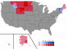
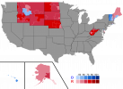
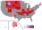
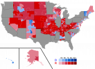
Holy crap, this is incredible, how'd you make it?Here's a map of the districts so far.
View attachment 710489
By downloading the districts and the Census Bureau's shape boundaries as .geojson, then I cut the states into districts in Inkscape.Holy crap, this is incredible, how'd you make it?
What I'm gonna do from here is just start posting maps, then once all the maps are on the "board" and all the needed revisions have been made, only then will I start expounding upon official district data and stuff. With that said, I'll be removing most of the current threadmarks and making newer more "polished" state maps after the grunt work is all finished.
@Gust
Here's a link to the map as a whole, let me know if it doesn't work for you and I'll keep sending the individual map links: https://davesredistricting.org/join/06e5eae8-a07d-4833-b90d-843fe32aa17f
Here's a link to the map as a whole, let me know if it doesn't work for you and I'll keep sending the individual map links: https://davesredistricting.org/join/06e5eae8-a07d-4833-b90d-843fe32aa17f
I need the individual links. Otherwise you can't download geojson or view the precise partisan percentages.@Gust
Here's a link to the map as a whole, let me know if it doesn't work for you and I'll keep sending the individual map links: https://davesredistricting.org/join/06e5eae8-a07d-4833-b90d-843fe32aa17f
WV - https://davesredistricting.org/join/d12a9ef1-448e-4f83-81b7-8095930068b5I need the individual links. Otherwise you can't download geojson or view the precise partisan percentages.
ID - https://davesredistricting.org/join/9e630aa3-5d7e-4808-97c1-fe3e3e5bdff0
NE - https://davesredistricting.org/join/595b9fba-4367-46bb-970a-e2bfcfc37935
Sweet. I’ll threadmark that post and revamp the states list here after while.
Share: