@ Rekjavik
Upon seeing your utterly badass inverted Europe fantasy map, i had to do my own take of it.
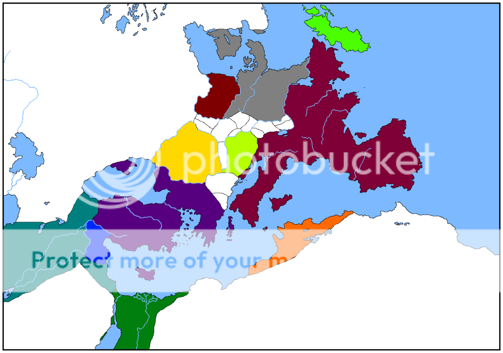
Upon seeing your utterly badass inverted Europe fantasy map, i had to do my own take of it.
The only thing I can think of is to make them straight lines.
I made them straight, so any straight river you see on the finished product are canals.One way I've seen it done are dashed blue and white lines.
Duly noted and added.Here are my suggestions;
1) A small, connecting sea in the Anatolia-like region.
2) in the Egypt-like area, shift the river more towards the right. This way the region with canal(?) connecting the two seas is a very large desert. This desert is very hot and inhospitable, the only reason anyone wants the territory is because of the canal.
It's nice to know that my, what I originally though of as a rather minimalistic, map is inspiring enough for a spin-off@ Rekjavik
Upon seeing your utterly badass inverted Europe fantasy map, i had to do my own take of it.
") .
.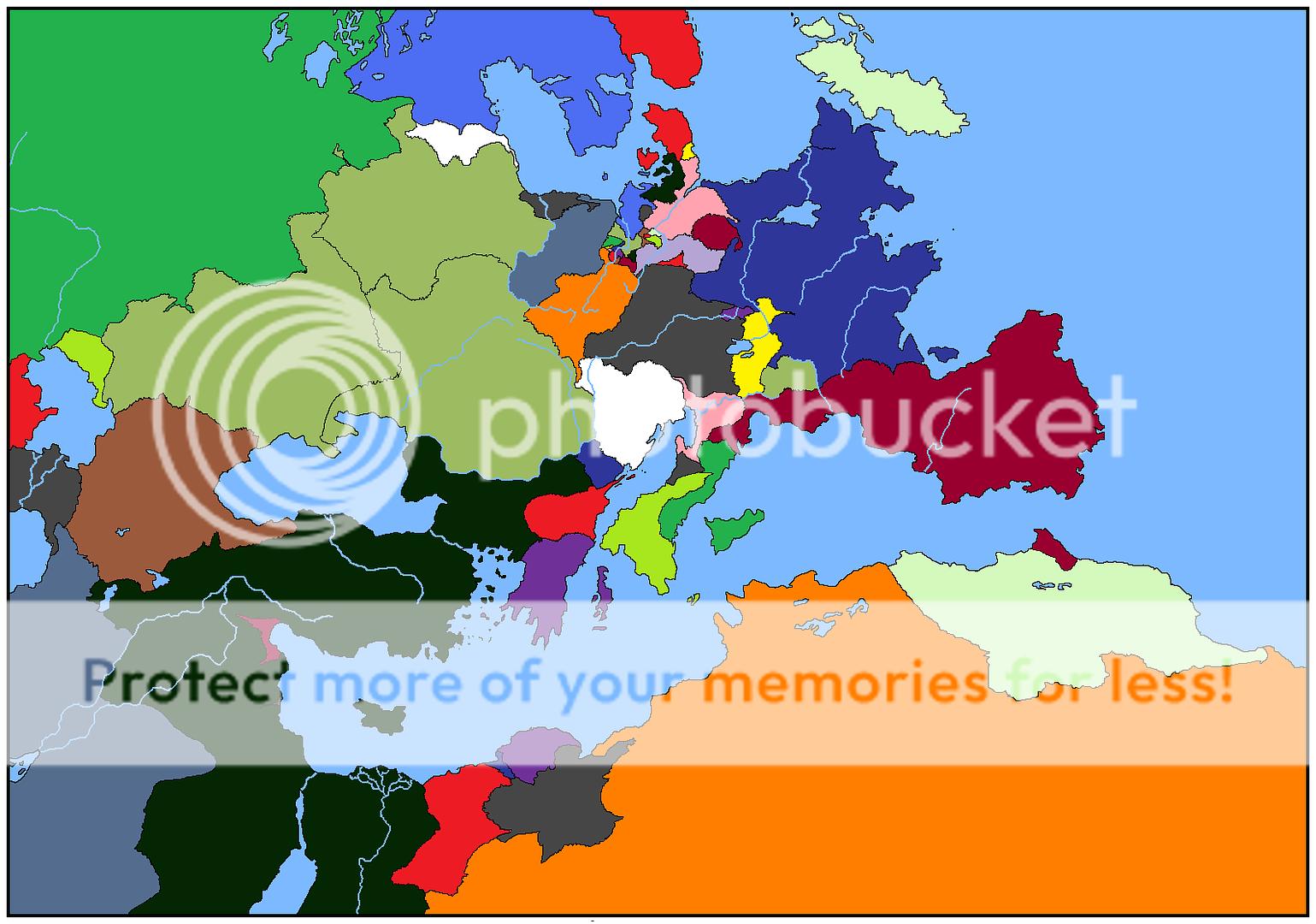

Your map style really is much more awesome than anyone else's.I'll join my entry to the pile of people using this map - I noted its similarity to Turtledove's Videssos, so voila.
Your map style really is much more awesome than anyone else's.
Well, the Turks had the Jannisaries.Not sure about the Arabs, but I did learn that the Sassanids used women as auxiluries for a short time, so maybe you could spin that into something.By the way, I'm a bit stuck on the unique classes for the Anatols and the Mesosyrians. What kind of soldier or profession was relatively unique to the Turks and Arabs?
I'm sure I can squeeze the women auxiliaries in, one of the pillars of my design is to take advantage of other peoples historical ignorance, especially in the case of the Anatol BeyliksWell, the Turks had the Jannisaries.Not sure about the Arabs, but I did learn that the Sassanids used women as auxiluries for a short time, so maybe you could spin that into something.
.Nonhumans do not play a major role in Latminis, I'm afraid. Sure there are strange ceartures in the world, but none of them have human-level intelligence. And most of these creatures are present in Mashriq. The Holy Empire, the big grey country, had previously launched a large scale exterminatin campaign against creatures that could pose a threat to its citizens. And, unfortunantly for you I'm assuming, that also means the majority of the fantastical creatures. Giants and Latmian Dragons still exist, but they are endangered species and are rarely sighted.BTW, where are you putting the nonhumans?
.Here's a thought (also a few stylistic suggestions that work well with this labeling method).By the by, now my main trouble is finding an aesthetically pleasing way to label the map. Can anyone give me a nice example of a professional way of labelling so many countries?
May I ask you how you drew on those lines of longitude and latitude (or whatever they are)?Here's a thought (also a few stylistic suggestions that work well with this labeling method).
If you do outline countries for colour, I'd suggest blurring 'em a little bit.
I just drew a whole bunch o' random lines across the map.May I ask you how you drew on those lines of longitude and latitude (or whatever they are)?
I guess I could have guessed that. Anyway, the font you used seems to fit the style very well. Which font did you use?I just drew a whole bunch o' random lines across the map.
Garamond. It's perfect for just about any map from the 16th Century to the 18th.I guess I could have guessed that. Anyway, the font you used seems to fit the style very well. Which font did you use?
Thank you, and I'll keep that tip in mind.Garamond. It's perfect for just about any map from the 16th Century to the 18th.
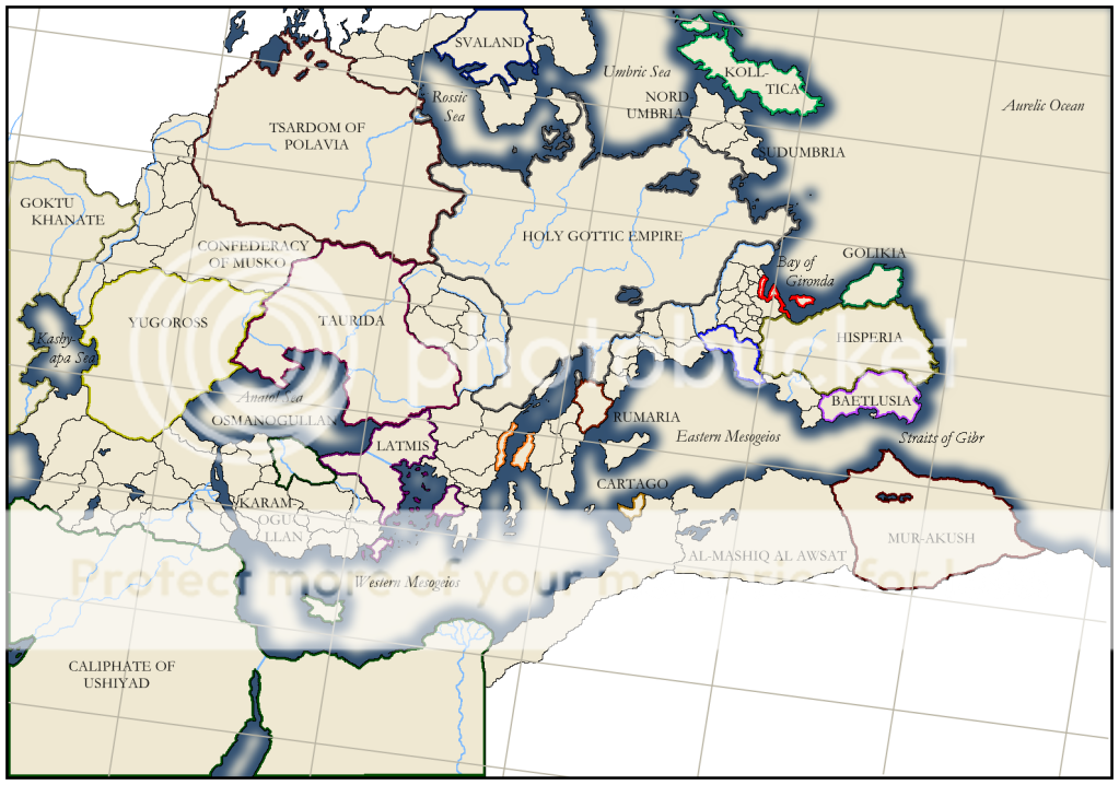
Thank you, and I'll keep that tip in mind.
Anyway, here is the map, redone with euio's recomendations and added names and lines. I think it looks pretty good now, almost ready for release onto the Map Thread. I might alter the font size for the small states on the Anatol and Umbric peninsulas if it causes problems. Any other final suggestions?

