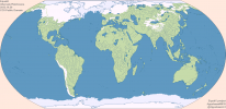
Anywhere to get the EqualD map that isn't blurry?here's the map i'm using
You are using an out of date browser. It may not display this or other websites correctly.
You should upgrade or use an alternative browser.
You should upgrade or use an alternative browser.
If you DL /save as from Imgur it is full sizeAnywhere to get the EqualD map that isn't blurry?
this was meant for tracing out subdivisions for than anything.Anywhere to get the EqualD map that isn't blurry?

more like EqualAAAAAAHH MY EYESCosmic Microwave Background EqualAA
Looks pretty nice!made a cool altgeo thing, might be useful to some for some rivers too.
I discovered this series of maps a week ago and was pleasantly surprised. Accuracy of projection always played an important role for me. And although I noticed that the borders in EqualA are not quite perfect, it is still better than WorldA thanks to a single projection. So I made a map of Europe in 1942 using QGIS.
Note: this was made on standart borders, so it can be incorrect in different places like Ticino in Switzerland etc.

Note: this was made on standart borders, so it can be incorrect in different places like Ticino in Switzerland etc.
Last edited:
Woah, this exists.
I've been wanting to make a new basemap recently (or more accurately, start the work on it)
Equal Earth seems like a good projection, so may I ask, is there a map size you want?
I barely know anything about this project anyway so I don't know what map sizes already exist.
I've been wanting to make a new basemap recently (or more accurately, start the work on it)
Equal Earth seems like a good projection, so may I ask, is there a map size you want?
I barely know anything about this project anyway so I don't know what map sizes already exist.
I believe that we don't need more basemaps, we need to have more historic data on maps like EqualX with a single existing projection.Woah, this exists.
I've been wanting to make a new basemap recently (or more accurately, start the work on it)
Equal Earth seems like a good projection, so may I ask, is there a map size you want?
I barely know anything about this project anyway so I don't know what map sizes already exist.
Existing projection allows you to do a bunch of things using GIS tools, and they will be much more accurate than anything we have on qbam and worlda with their cursed projections.
The problem is that once upon a time people created qbam probably without access to GIS tools, and amateurs, for lack of an alternative, made many content on it. That's why we can't switch to new maps right now.
Sorry if I've worded it wrong, but I meant that I was planning to start an EqualX basemap, maybe EqualC since it is practically non existent.I believe that we don't need more basemaps, we need to have more historic data on maps like EqualX with a single existing projection.
Existing projection allows you to do a bunch of things using GIS tools, and they will be much more accurate than anything we have on qbam and worlda with their cursed projections.
The problem is that once upon a time people created qbam probably without access to GIS tools, and amateurs, for lack of an alternative, made many content on it. That's why we can't switch to new maps right now.
if other equalX maps use this, then why notI think I will just work on EqualC, and I am very, very obsessed with accuracy so you can trust me to use actual resources.
One question though, do I have to add land pixels not surrounded by coast pixels in regions such as small islands? Or can I just outline them?
Share: