EqualX Project

  • Thread starter Deleted member 101966
  • Start date
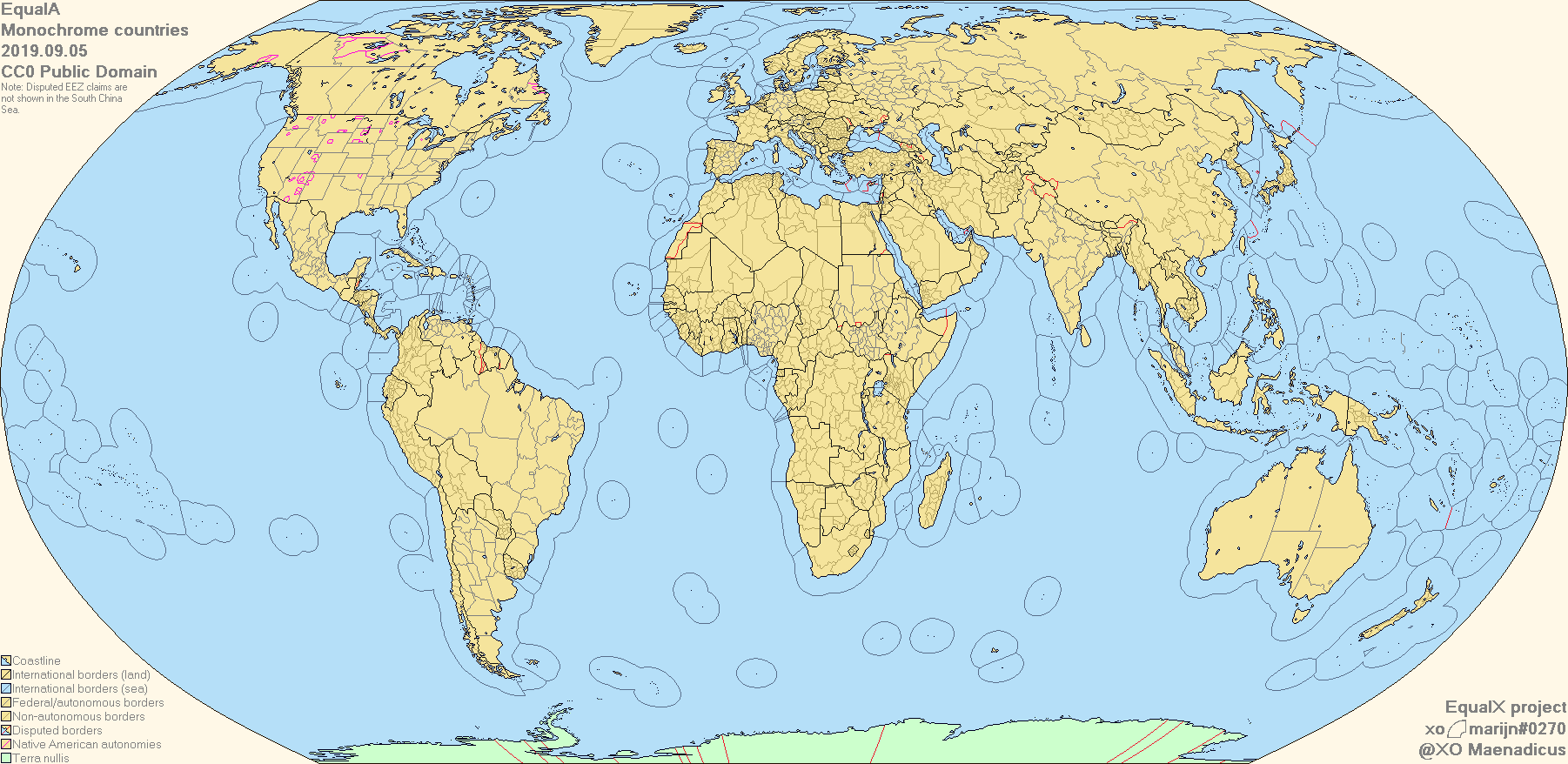
Made some patches for Equal AA 1.20 for North America (the western donut hole in the Gulf of Mexico has been gone for the past 19 years and there is a dispute in the EEZ boundaries between the USA and the Bahamas), Europe (Norway and Russia agreed on a maritime border in 2010, Russia's annexation of Crimea comes with a claim to waters arounds it), Africa (Somaliland claims an EEZ as best as I can remember), Asia (the peanut hole in the Sea of Okhotsk has been gone since 2014):

EqualAA 1.20 north america patch.png


EqualAA 1.20 europe africa patch.png


EqualAA 1.20 asia patch.png


Some of these changes were already made for EqualA but the Norway-Russia maritime EEZ border, US-Mexico maritime EEZ border in the western donut hole in the Gulf of Mexico and the end of the Peanut Hole in the Sea of Okhotsk would still need to be applied.

The Costa Rica-Nicaragua maritime border would also need to be in the EqualA map.
 
Last edited:
I'm proud to announce that the EqualA is done!

Currently it comes in two flavours: Monochrome, and toasted. I'm also planning on releasing a patch for people who prefer the classic islands in boxes rather than EEZs.
upload_2019-8-28_15-54-32.png


upload_2019-8-28_15-54-40.png
 
I'm proud to announce that the EqualA is done!

Currently it comes in two flavours: Monochrome, and toasted. I'm also planning on releasing a patch for people who prefer the classic islands in boxes rather than EEZs.
View attachment 483734

View attachment 483735


Excellent work.

The Norway-Russia EEZ border seems to have been missed though.

And I think a number of the French islands around Madagascar are claimed by Madagascar (so maybe the red border for them?)
 
Right now the project isn't in dire need of more hands to trace boundaries; a few deliberate choices are being made with the pixel styles which take a bit of oversight (for small entities, overall shape is more important than fill-tool-ability, hence the nearly complete absence of one-pixel-surrounded-by-four-more objects on this map).

In the interest of keeping all the resources open and public, though, a particularly ugly 9600px base is linked.

More immediately in the pipeline: ever use a weird, misshapen box to indicate which Pacific islands belong to which sovereign entity? With the EqualAA soon to include EEZs, never do it again.

View attachment 467881
I personally prefer the EEZs far more since it is a little more organic and provides more color to the map (if the user chooses to include the country's color in it). Shame it doesn't catch on so often.
 
I personally prefer the EEZs far more since it is a little more organic and provides more color to the map (if the user chooses to include the country's color in it). Shame it doesn't catch on so often.
The problem wih EEZ is that they only make sense in a contemporary context, any Map set with a POD significantly before 1982 when they were formalised would have no use of these particular EEZ, and even if a similar concept is created in an ATL nothing guarantees they would also be up to 200 nautical miles.

Also there is a fundamental problem that it’s hard to draw alternate eez created by different borders, they are curved, and to draw them someone need to reproject that wih the right scale on the Equal Earth projection, very hard to do without a Gis software.

So it is pretty, but its practical uses are very limited
It would have to fall down to using a lot of circles from multiple points i.e. the American East Coast. Borders with other countries along with international waters would be tricky such as the Norwegian EEZ.
 
The EqualA has been updated to fix some stray issues.
More importantly, a patch for those of us who like islands in boxes has been released!
Perpetually-updated versions can now be found on DeviantArt here.

Monochrome
ddfkyw1-42ab26b5-9d51-400b-a314-7bfd4dd149d8.png


Toasted
ddfkzvn-12a5c688-7855-49b0-84d0-99eab5b2353d.png

Monochrome
ddfl0vk-a09b6041-d36c-4e75-bab4-854d4641dde0.png


Toasted
ddfl0oj-6bf7e9fd-c7c0-492f-93d5-fbb88b5ddb4e.png

Changes on the monochrome version (and hopefully all others):
- Updated the Norway/Russia maritime boundary
- Removed Rockall
- Added the rest of the Kermadec Islands

Changes on the toasted version:
- Fixed part of Nunavut being shown without the territory colour
- Artsakh now shown as claimed by Azerbaijan
- Somaliland now shown as claimed by Somalia
- Taiwan now shown as claimed by China (i'll add the taiwanese claims when a good shapefile or georeferenced map is found)
- Hala'ib Triangle claim now coloured in with the Sudan colour instead of the default red
- Liancourt rocks claim now coloured with the Japanese EEZ colour
- Fixed some stray pixels here and there
 
Using that map and the previous map with the borders, I whipped up May 23, 1990 relief with political borders (some are of course a bit off for the time especially the EEZs):

Equal AA 1.21 relief with 1.20 borders patched may 23 1990.png
 
Well, just doing a little concept exploration, I took a 2K elevation projection from Drex and converted it to Equal Earth using G.Projector, disregarding some missing coastlines, rivers and lakes most projection fit well with EqualA, so I used an Alpha Black scale from 0 to 180 to make a topographic map in EqualA (it is also possible to draw the barimetry). Anyway the result is interesting...

PS: The extra lakes, coastlines and rivers have not been reviewed, they are just there to avoid some holes in the topography.

upload_2019-10-14_11-44-48.png


upload_2019-10-14_11-45-23.png


And here a version with only the alpha and extra coasts

EqualA_with_top_aplha(XO_Maenadicus_&_Drex).png


EDIT: Ah, I almost forgot, the original projection

upload_2019-10-14_12-3-33.png
 
Last edited:
Could anybody apply the "islands in boxes" patch to the basemap(s) and upload these on AH.com? I don't trust my skills unfortunately...

Also, is there an Equal-AA or Equal-A basemap with rivers?
 
IMG_1240.PNG


Don’t know if this goes here, but I’ve started working on a 1930 EqualX map

To do list for this one is fixing the Aral Sea, giving Italy Fiume and the bit of Dalmatian coast I seemed to have forgotten, and then filling in the rest of the world.
 
Last edited:
Top