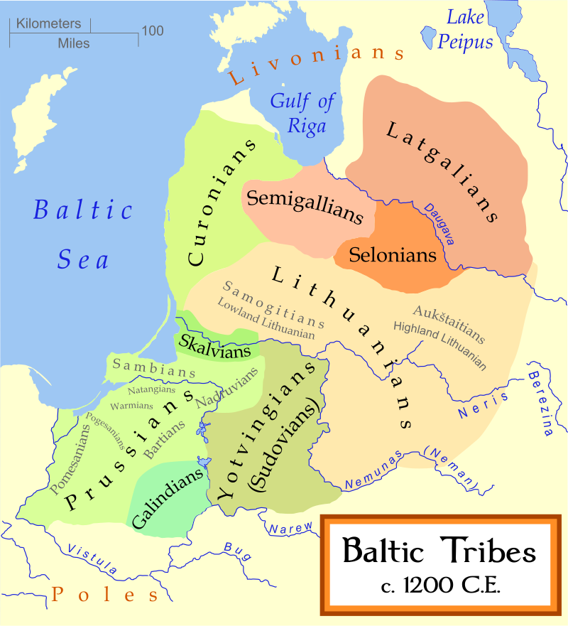
Collaborative timeline: Dunes of the Desert, a Timeline without Islam

Great update, I was wondering what are Constantine VII’s policies towards religious minorities. I would also like an update on the political and religious life in the Levant (with the departure of Egyptian power from the holy land, I would imagine Constantine VII stepping in to protect the religious rights of the Christians).
 
@Mike Louis
While writing this Byzantine update, I see a need to write another one on Byzantium. This will deal more with the Byzantine state administration and court titles, but also Constantines heirs.
Of course, the Levant will be updated soon afterwards (although its northern half is held by Byzantium)
 
Indeed I shall test another scheme for the languages
Okay so I ve looked at Toaster and COVFEFE, but decided to use the colour scheme in the linguistic map thread as the standard one once more.
DoDling.png
 
Chapter 43: A Triumph for the Levant
In this update, I shall cover heirs of Constantine VII, and then I shall speak more of the the functioning of the Rhomaic state during the ninth century.

Conquest of the Levant
Constantine VII was succeeded by his son Romanos II. (945-959). While he himself was a rather hedonistic ruler, marrying an innkeepers daughter called Anastaso; and he left the matters of the state in hands of competent ministers: the military was under the command of his brother Leo and Nicephoros Phocas. Nicephoros originated from Cappadocia.

Nicephoros Phocas sought to stablish full Rhomaic control over the Eastern Mediterranean; so that it would have been a Rhomaic Mare Nostrum. The only opposing force were the Phoenician city-states of Beirout and Tyre and the County of Galilee. In 960, the campaign against Phoenicia began; a brilliant naval victory to the southeast of Cyprus, followed by a land invasion from Tripoli very well ended with the Phoenician republics. The Counts of Galilee, seeing the winning side accepted Rhomaic suzerainty after the fall of Berytos.

After the death of Romanos II., the imperial office passes into the hands of Nicephoros II. Phocas, reigning from 963 to 969. Nicephoras would have liked to “tidy up” the western borders of the Empire. This would have meant the consolidation of imperial holdings in Italy: especially irritating was the existence of the Duchy of Salerno, cutting off Naples, Calabria and Apulia from each other. The second issue in the west was the divided island of Sicily; this should be united as soon as possible under the Rhomaic banner.

The liquidation of the Duchy of Salerno was no big deal: rather it could be well described as large-scale military manoever. Diplomatically, Salerno has gained support from Otto, the German emperor in the north, however it was too far off for the Germans to intervene, before having to acknowledge fait accompli.

From 964 to 965 Nicephoras decided to strike eastwards once more: to conquer Aram and Nabatea, ruled by the Yabroudid dynasty from Damascus. This campaign was rather successful, for the Yabroudid dynasty could only hope for their allies in Hejaz; the Syriac kingdom in Gozarto dared not to provoke the wrath of the Empire unto themselves. Nicephoras promised Palmyra some territorial gains in the desert regions should they join him in the war, as well as more commercial opportunities. To this they agreed, and thus the Rhomaic empire could rely on masters of desert warfare to counter the Yabroudids.

The heir of Nicephoros Phocas was John I. Tzimiskes (969-976), of Armenian descent, from the region of Cappadocia.

Tzimiskes turned the attention of imperial troops northwards, doing away with the independence of Serbia (Rashka) in the Morava valley. In 972, he once more took the army to the Levant, and waging war on the sole independent kingdom on the shores of the eastern Mediterranean: Israel. The Samaritans and Jews and Ebionites would put up a heavy resistance in the mountains and the desert, with skirmishes and guerrilla tactics used frequently by the defenders. The Rhomaic army, on their part, would have won battles in the open and secured major cities.

The newly conquered areas of the Levant were automatically incorporated into the Diocesan structure of the Empire. The whole region was rearranged, esulting in the following structure:

· Diocese of Cilicia (Tarsus)

· Magistrate of Antioch

· Diocese of Syria (Beroea)

· Diocese of Osroene (Edessa)

· Diocese of Phoenicia (Tyre)

· Diocese of Aram (Emesa)

· Diocese of Palestina (Akko)

After Tzimiskes, the Empire would receive again a very capable ruler named Basil II. (1)….To be featured in some other update

(1) Not named Bulgar slayer, because, well the job has been done before already

State Administration
In the Rhomaic Empire, one can view three major institutions, each with their own territorial organization: the State, the Church and the Military. The unity of the empire is however, best manifested in the person of the Emperor.

The Emperor himself would be titled Basileus in all major occasions. Sometimes, the emperors would use the title Porphyrogennetos, to emphasize their legitimacy (meaning born in purple) and Autokrator meaning self-ruler.

The sons of the emperor would bear the title Despotes, meaning Lord. This would not have any territorial connections to it however.

Equivalent to the Frankish majordomus was the Rhomaic kouropalates, literally the one who takes care of the running of the palace. This position was of great prestige, and should the Emperor have other issues he is dealing more urgently with, the responsibility to solve the daily affairs would most likely be upon the kouropalates.

The State administration, or civil administration has been reformed by Constantine VII Porphyrogennetos. The Empire itself was divided into Dioceses, headed by a Vicar , which would further be divided into “nomos” or prefectures. Each Diocese would also have a council of its own, to deal with local affairs, as advisory body to the Vicar.

The Military was also structured territorially. Parallel to the diocesan structure of civil administration, there would exist a theme system: the themes would have been military districts which were tied to specific military units. The districts would be replentishment and recruitment zones; their borders were drawn so, that they do not match the borders of the Dioceses, as to prevent a rebellion.

As for the Church, of course, the State-sanctioned denomination was the Chalcedonian Church. With the reconquests of the Macedonian dynasty, the Empire would once more get a substantial population of non-Chalcedonian denominations.

The core regions of the Empire would be included under the jurisdiction of the Patriarchate of Constantinople, with its southern border being at the ridges of the Taurus Mountains. The subordinate Metropolitans to Constantinople would be, as follows:

a. Kaisareia

b. Ephesus

c. Herakleia

d. Ankyra

e. Kyzikos

f. Sardis

g. Thessalonica

h. Nikomedeia

i. Nikaia

j. Chalkedon

k. Korinthos

l. Side

m. Sebasteia

n. Amasia

o. Athinai

p. Tyana

q. Gangra

r. Klaudiopolis

s. Neokaisareia

t. Pessinous

u. Myra

v. Patras

w. Staroupolis

x. Laodikeia

y. Synnada

z. Ikonion

aa. Antiocheia in Pisidia

bb. Perge

cc. Larissa

dd. Philippopolis

ee. Traianopolis

ff. Rhodos

gg. Adrianoupolis

hh. Hierapolis

ii. Choniai

jj. Kotyaion

kk. Trebizond

ll. Serrai

mm. Philippoi

nn. Neupaktos

oo. Thebes

pp. Gortyn

qq. Philippopolis

rr. Dristra

ss. Naissus

tt. Akrid

uu. Dyrrhacion

vv. Tarentum

ww. Hagia Severina

xx. Rhegium

yy. Catania

zz. Syrakusa

aaa. Rus´

bbb. Servia

Furthermore, the majority of the Levant, as well as Armenia would come under the jurisdiction of the Patriarchate of Antioch.

a. Seleukia in Isauria

b. Anazarbos

c. Tarsus

d. Beroia

e. Laodikeia ad Mare

f. Edessa

g. Hierapolis

h. Apamea

i. Edessa

j. Tyre

k. Berythos

l. Tripoli

m. Mopsuestia

n. Damascus

o. Constantia on Cyprus

p. Bostra

The Greek Patriarchate of Alexandria would be restored to a large degree after the incorporation of Cyrenaica and Alexandria to the Empire. Its structure would be as follows.

a. Alexandria

b. Thebais (Kemet)

c. Cyrenaica

d. Neukratis

e. Pelusium

f. Kabasa

g. Paraetonium

h. Ptolemais

i. Berenike

j. Antipyrgus

Ultimately, the Patriarchate of Jerusalem would have remained mostly unchanged

a. Metropolitanate of Caesarea

b. Metropolitanate of Scythopolis

c. Metropolitanate of Nazareth

d. Metropolitanate of Ptolemais/Acre

e. Metropolitanate of Bostra

f. Metropolitanate of Petra

g. Metropolitanate of Neapolis (Nablus)

h. Metropolitanate of Gaza

Outisde of the Church would remain still some surviving Paulicians in Rhomaic Armenia (although some were resettled to Thrace), a mainly Maronite-populated Phoenicia, the Coptic Church in Cyrenaica and Alexandria to a large degree, and the Syriac Church in Aram. Furthermore, there would have been Jews, Samaritans and Ebionites in Israel, and Miphysites on the Palestinian coast.

As for imperial policy, the attitude differed from case to another. In general, the Macedonian dynasty did not stick their nose into religious affairs, that much. In general, Jews and Samaritans were not „encouraged“ to convert, but rather offered to resettle in Paristrion; and many jews were relocated to that particular region, which needed to be populated by settlers needing Rhomaic protection.

The „competing churches“ : Coptic and Syriac Jacobite, would be allowed to continue to operate even inside of Rhomaic jurisdiction, although they would be „tolerated“ and the chalcedonian chuches „preferred“. Especially in Cyrenaica, there was issued a ban on doing Miaphysite liturgy in Greek – and new Chalcedonian dioceses were created in the region, hoping to convert the Cyreneian Greeks to Chalcedonianism. As for Phoenicia, no action was taken to actively convert the population.

The Ebionites and Marcionists would be however actively persecuted.
 
Chapter 44: The Heirs of Charlemagne: A Divided Francia
The Heirs of Charlemagne: a Divided Francia

The former Frankish realm is by now divided into Western Francia, Eastern Francia, Upper and Lower Burgundy, and Italy.

The East Frankish realm is the first to face the issue of the extinction of the Karlings. After the death Louis IV the Child at Forchheim, the German (that is, East Francia) dukes elect Conrad I. Franconian as king of „Germania“ – a realm encompassing Saxony (1), Thuringia, Franconia (2), Swabia (3) and Bavaria (4). This realm was thus composed of “stem duchies”, and individual tribes, while feeling a common bond, would still continue to identify as such.

Meanwhile Lotharingia – the strip of land extending from Basel to Frisia, would have Charles III Simple as king, who was also ruling West Francia. However, the two realms would not be united for long, for West Francia came to be ruled by a certain Robert, while Lotharingia came under the power of Gilbert.

Before this, however, the realm had to tackle an ongoing problem with Viking raids; and Norse raiders would actually establish their own realm east to the mouth of the Seine at Rouen.

The German realm had to somehow cope with a danger from the east: the Magyars. A Uralic people, these steppe raiders have installed themselves in Pannonia, and would have raided Germany, Italy and even France.

Another capable ruler presented himself to Germany in the person of Henry I. Fowler (for he was an avid hunter and news of his election as king reached him while preparing for a bird hunt). He has managed to wrestle control over Lotharingia once more, and divided the region into Upper and Lower Lotharingia. This strategy of “divide and rule” helped to pacify the area. Furthermore, the Lotharingian areas north of the Rhine would be detached as the stem duchy of Frisia.

Henry the Fowler would have expanded the realm by incorporating Sleswig, Mecklenburg, Sorbia west of the Elbe and forcing Bohemia into submission. Although having the ambition to ride to Rome to be crowned Emperor he failed to do so, for he died before he would reach there.

In 933, the two Burgundies unite under the banner of King Rudolf II. This new realm, which historians often call after its capital as the Kingdom of Arelate, or Arles would be known in written documents as the Kingdom of Two Burgundies (6).

Geographically Two Burgundies would stretch between the Rhone and Saon in the west to the Alpes in the east; its population would have spoken in majority a West Romance tongue. Its Upper Burgundian variation would be known as Arpetan, while its lower varieties would be known as Provensal. In the northeast frontiers, some Swabian or Alemannic speakers overstretching the border from Swabia would have inhabited the Aare river valley.

The heir of Henry the Fowler in Germany would be Otto the Great. Otto would restore German control over the eastern marches and force Polabian chiefdoms into submission by establishing the Billungian and Northern marches; and the Ostmark is reconstructed to serve the needs of the empire after its decline vis-à-vis the Hungarian raids.

Ultimately, as the Karlings wane in West Francia, and die out, the nobles no have to choose the new ruler. The Robertians have been a powerful family in Neustria for quite some time, and insisted on Hugh Capet, their current incumbent, to be granted the crown. This proposal would be met with opposition in the south. The lands to the south of the Loire had been ever since Roman times administered separately from the north: previously as provinces of Aquitania and Narbonensis in contrast to Lugdunensis and Belgica further north; under Diocletian, Gaul was divded into two dioceses: Gaul in the north and Viennensis in the south; and even during the Migration period, the two shared different fates: the north would at first be ruled as a rump state around Noviodunum (5), before being overrun by the Franks; the south would be held by the Visigoths and the Burgunds.

The divide was not only historical, but also cultural: the northerners would drink more beer, while southerners would cling on to wine. The north-south divide can be seen in gastronomy even today as a divide between the butter north and the oil south. However, there remains one thing the south would lack: a major core area, an undisputed natural capital region, as Paris and the middle Seine basin were to the north. This role would be contested between Tolosa and Bordeu, which would have been in this case decided in favour of the former.

To put long descriptions short, the north-south divide would result in the southern dukes revolting against Hugh Capet, and the realm being split. Ultimately in the 990s, Aquitain would emerge as an independent kingdom; the rest of West Francia would be known under the name of Neustria, situated between the Loire and the Ardennes.

As for Italy this successor realm was originally designated to continue with the imperial tradition. However after the death of Berengar, the kingdom faces a period of instability, until Adalbert became king in 950. However, his kingdom would be restricted only to the regions north of Rome. The Duchy of Spoleto would have broken off, as would Corsica – Corsican pirates would be quite problem in the western Mediterranean. The Papal domains would include Latium and southern Tuscany, while Rhomaic hold would extend over Venice and its suburbs.

Further south, we have the Duchy of Benevento almost totally surrounded by Rhomaic possessions, and a Sicily partitioned between Rhomania and Tafirca. Sardinia for its part is in a state of fragmentation ruled by different counts and pirates, although its southern coast has been recently conquered by Tafircans.

As mentioned in one of the previous updates, the following varieties of Romance languages are present south of the Alps:

The Annonarian varieties of Lombard, Ligurian, Romagnan and Venetian have already diverged quite significantly. Further south, you can see Tuscan going divergent, while Mediano itself also differentiates into the varieties of Latium, Spoleto and the Pentapolis. Further south, the boundaries between the different varieties match borders between Benevento and the Rhomaic possessions.

Ostrogothic presence has by now vanished and any surviving Ostrogoths are fully assimilated into Italin culture; perhaps the region of Ravenna would have more Ostrogothic loanwords, but that’s it. In contrast the Lombards would have still left quite a strong presence, not only in genetics (many blonde people in Benevento, Spoleto, and the Po valley), but pockets of Lombard speakers would continue to remain in the high Alpine villages between the Venetian and Adige regions and in the region of Pavia; however, most of them would have assimilated by now.

(1) Niedersachsen, Bremen, Hamburg, Westfalen und Sachsen-Anhalt

(2) Hesse und Bayerische Franken

(3) Baden-Wuerttemberg, Elsass, Deutschenschweiz und Bayerische Schwaben

(4) To include Salsburg, Tyrol and Upper and Lower Austria as well, together with Inner Austria.

(5) Soissons

(6) Perhaps the Kingdom of Two Sicilies inspired itself over here
 
Chapter 45: Some News From the North Atlantic
Britain

The British Isles would see a period of consolidation during the 10th century. This would be particularly true for England, at least most of it. A unified realm extending from Devon to Kent, encompassing the entire East Anglia and Mercia, and even Lancashire would emerge during the 10th century, under the dominance of Wessex.

The unified Anglo-Saxon realm of England under the dominance of Wessex would however not incorporate Danish Yorkshire throughout the entirety of the 10th century: due to butterflies, more Norse would settle in Yorkshire than in the Seine estuary; and as a result, the area would have a much denser population, meaning a large army, meaning more difficult to conquer.

To its north, the remnant of Northumbria splits into the realms of Lothian and Deira (south of the Tweed River). Deira itself would be in a rather vulnerable position: a rather easy target for either Danelaw or England. However, the Pennines were a major barrier between Northumbria and the rest of England; the realm would thus continue with its independence for some time.

By now, the original Anglo-Saxon tongue has gotten quite a few Scandinavian influences: in East Anglia, eastern Midlands, but especially in Yorkshire. In fact, the variety spoken in the area would actually qualify as a North Germanic, rather than as a West Germanic language.

Both Devon and Cornwall would remain Dumnonic-speaking and the Celtic presence in the area would have remained strong.

Wales would have remained still disunited and fractured into petty-kingdoms of Deheurbath, Gwynedd, Powys, Brycheniog and Glamorgan. However, these petty-kingdoms would be united under some sort of league, now under the seniority of Deheurbath in the southwest.

Between the Offas Dyka and the Severn, there would have still been pockets of Latinate settlement. These people would have been the descendants of the Roman colonists to Britain. Their numbers could amount to some 60 000 to 90 000 people. Their villages would be fortified and have an appearance of the Old Roman military camps. The more educated once would go on to serve as priests. In fact, the Latinate population of the Severn region would have the highest number of priests from amongst them per capita in the entirety of southern Britain. This was mainly due to the fact, that Latin was the liturgical language, and these people spoke a Latin-descended dialect.

Further north, the Kingdom of Alba was consolidating its power in the area. Based around the Fife, the Scots went to integrate also the southern bank of the Firth of Forth. Lothian has been populatd by Anglic people akin to those further south in Northumbria.

The isles – the Hebrides, the Orkneys, the Shetlands, Man and even the northernmost part of the Scottish mainland – would have been continued to be dominated by the Norse, who set up a Lordship of the Isles. While in Hebrides and the Isle of Mann, the Gaelic element was still vibrant and a mixed Norse-Gael culture would develop, in the northern isles the Germanic element prevailed, leading to the development of a Norn language and identity.

Northern Scotland - the region around Moray Firth and Inverness, would continue to exist independently as the Kingdom of Moray (or Moireabh in Gaelic). Separated by the Grampian Mountains from Scotland proper and with the Highlander keenness of preserving their independence, this petty kingdom would remain independent throughout the entire century.
1024px-Scotland_Dumbarton_Castle_bordercropped.jpg

Dumbarton Rock was a major Strathclydian fortress
In the southwestern corner of Scotland, there remained two further polities: Strathclyde and Galloway. Strathclyde was the last part of Hen Oggled or the Brythonic “Old North” – effectively speaking Cumbric, a language related to Welsh. The coastal parts were however possessed by the Norse, under the name Galloway: however the Galwegians would have by now become mostly assimilated to Cumbric language, yet maintaining distinct Scandinavian customs.

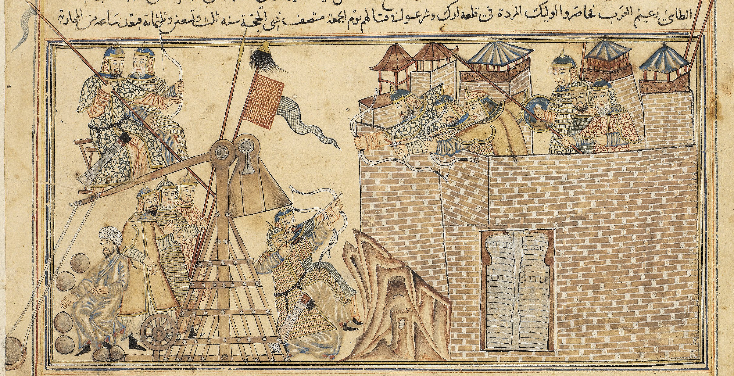
As for Ireland, the interior would go on as usual, with independent petty—kings here and there. However, Viking presence on the coast and permanent settlement at places like Dublin, Wexford, Waterford, Limerick and Cork would have changed the general pattern somewhat. These cities appear to have had a Scandinavian elite, yet most of their inhabitants (possibly with the exception o Dublin) were Irish.
220px-Brain_Boru_sculpture_outside_Chapel_Royal_outside_Dublin_Castle.JPG

Brian Boru
The insecurity of Viking raids has resulted into an exodus of Irish scholars, who would visit other European courts, bringing Irish knowledge and culture over to the Continent.

In the southern parts of the island, we could have witnessed some political consolidation. Mainly in the form of Munster subjugating Leinster and the Viking settlements as tributaries or vassals, yet preserving their autonomy. This was mainly the feat of Brian Boru.

Scandinavia
The realms of Denmark and Norway would have gradually accepted Christianity. In Denmark, this would have been under Harald Bluetooth in the 980s, with the establishment of the Archbishopric f Lund. In Norway, Christianity was adopt by Olaf Tryggvason in 995, after the end of the rule of a pagan zealot Haakan Sigurdson Jarl.

However, the people would not entirely abandon their old belief. Many of the churches would have been built on already sacred places, and Mjollnir could have been easily swapped for the sign of the Cross.

In Sweden, Christianity would proceed rather slowly, with a few churches, later bishoprics set up at Birka, and Skara in Vastergotland. While Sweden would get a Christian king in 990s, he would not be in a position to impose Christianity on his subjects. For the most part, Chrisitan churches would be built, but Asatru practices would go on, in Uppsala, the major pagan center of the land especially. Thus, even by 1000AD, the vast majority of Swedes would still be Norse pagans.

Sweden would, for its part, still be divided into two kingdoms: Svealand around Uppsala and Gotaland (Geaten) in the south.
300px-Ansgarius_predikar_Christna_l%C3%A4ran_i_Sverige_by_Hugo_Hamilton.jpg

Early missionary attempts in Sweden have failed
Iceland would long be resistant to Christianity, however under pressure from Norway and seeking to prevent civil war, the speaker of the Althing, Thorgeir Thorgelsson, decided in favour of Christianity.

Mentioning the Althing, I should return back to the peculiar political system of Iceland. The country was effectively a republic, with an annual gathering called the Althing at Thingvellir. Speaking in modern terminology, the system was anarcho-capitalistic, with chieftains exercising real power in their districts, and this being the basis of their legitimacy in the Althing. Therefore, the state itself did not have any taxes nor armies: all law enforcement was private. As a result the society would adopt a blood-feud mentality.

This update would not be complete without further mentioning Norse exploration of the North Atlantic. The next major island the Norse would encounter after initial landings at Shetland, Orkney and Iceland would be Greenland

In 986 Erik the Red reaches Greenland, and the first settlement at Brattahlid is established. The name of the land itself appears to have been a marketing device: in no way would Greenland be greener than Iceland, as much of Greenland is covered in a thick ice sheet all year round, and it would have been more accurate to swap the place names of Greenland and Iceland.
Brattachurch.jpg

A reconstruction of a church in Greenland
The climate back then was considerably warmer, allowing birch trees to grow in the area. The Norse population in Greenland would consist of three areas: the largest Eastern Settlement, the smaller Western Settlement and the smallest Middle Settlement. The “settlements” were not villages per se, but rather collections of scattered farms. The inhabitants would mostly raise livestock and fish, and hunt caribou and seals.

The northern parts of Greenland would have been populated by the so-called Dorset-culture. The two peoples would not have interacted: the southern part of the island had been uninhabited and separated from the north by the thick and large ice sheet.
 
Chapter 46: Heirs of Slovien Moravia
The two major Slavic realms on the Danube: Moravia and Bulgaria, would greatly decline during the 10th century. Although Moravia would continue to exist in a much diminished form, Bulgaria collapses totally.

As a result of Pecheneg incursion, the Bulgarian state vanishes completely. The lowland regions of Wallachia are overrun by Pecheneg clans; and a rump duchy of Ahtum is established in the region of the Banate; another Vlach duchy is established in Oltenia. This area is mostly populated by Vlachs, an Eastern Romance people, descended from the Romanized populations of the Moesian limes.

To its northeast is a natural mountain fortress, the Transylvanian basin. The area has been a target of frequent Pecheneg raids. Populated by mostly Slavic Bulgarians and Vlachs, this area is ruled by a certain Gelou as the principality of Ardeal.

Interestingly enough, the area ruled by Vlach principalities roughly corresponds to the area of the Roman province of Dacia under Trajan.

As for the Pechenegs themselves in my previously map thy were for some reason labelled as Oghuz Turks, which was incorrect as they belong to the OghuR branch of the Turkic languges, along with Bolghar, Khazar and Hunnic; the ancient tongues of the Turkic peoples of the Western Steppe.

Magyar settlement in the Carpathian basin would have effectively put an end to the ongoing development of the Slovien kingdom.

The Magyars were a Uralic people, with their closest cousins being the Khanty and the Mansi in the marshy Ob regions of western Siberia. Living to far south, they would adopt the nomadic steppe lifestyle, and migrate westwards, before establishing themselves in the Carpathian basin. The incoming Magyars would have been a collection of eight major tribes or clans: Gyarmat, Jenoe, Keszi, Kér, Kuert, Megyer, Nyék and Tarján. Moreover, they would be joined by the Turkic Kabar people, in the form of the clans of Berény, Oszlár,Oers, Tarkány, Varsány, Szabar, Kálisz,Kazar and Szekély.
220px-HetVezer-ChroniconPictum.jpg

Seven captains of the Magyars, from a medieval chronicle


800px-Arpadfeszty.jpg

And more romanticised depiction of the same event
The thinly populated regions between the Tisa and Danube rivers would fast become dominated by the incoming Magyars. The second major area of Magyar settlement would have been Pannonia. That region had been populated by Sloviens and Carantanians previously, and a few German and Pannonian settlements as well.

Even after the Magyar would have dominated the area since the 920s, a strong Slavic majority would be present in places such as Moson in the northwestern part of Pannonia. In fact, the entire area to the northwest of the Rába River would have stayed Slavic throughout the 10th century.

The Zala and Vas regions as well would have remained predominantly Slavic, being a continuation of Carantanian (1) settlement in Carinthia, Carniola and Styria.

Magyar settlements would also be relatively dense in the region between Pressburg, Bitra and the Danube River. The Lesser Pannonia plain would thus be settled by Magyars to a great degree, forcing the Slovien(2) populations into the Carpathian Highlands, to the upper reaches of the Váh and Hron Rivers.

Any surviving Avar population (in southeastern Lower Austria) would have been likely greatly assimilated either into the local Slovien populations, or have joined the incoming Magyars. Similarly, the Pannonian Romance speakers, previously dwelling at Balaton, at Sopiania (3), in some towns on the Danube River like Szentendre and Hainburg, and more importantly along the Amber road, in the regions of Scarbantia(4) and Neusiedler See. The majority of the Pannonians would have assimilated for the most part, although in the time of Kocel and Svätopluk it appears still that they would have lived in those areas and spoken the Latin dialect.

Even after the Magyar takeover, Scarbantia would continue to be a major cultural centre of the Pannonians; unfortunately for them, their major population core at Balaton Lake would have been overrun by the Magyars, with some of them remaining in the Vesprem Mountains and in the Zala region, where they would mix with Slavic population.

Anyhow, Magyar dominance in the Carpathian basin would mean that their principality would include most of Pannonia, Slavonia, the Alfold, and Crisana by the late 10th century. The Hungarian prince Géza woulda accept Christianity and his son Vajk would be baptised as Stephen. Although the realm would face pagan (Tengrii) revolts, especially in the Alfoeld, by the year 1000 Hungary would be proclaimed as Christian kingdom and Stephen would receive his crown from the Pope. The seat of the first Hungarian archbishopric would be at the location of the capital: as Esztergrom (Ostrihom) on the Danube very close to its bend.

Further northwards, the regions of Moravian and Slovakia, once the core of the Slovien realm, would have now greatly diminished struggling to survive. The Mojmirid dynasty would have been overthrown after the death Mojmir II.; they would have been succeeded by the House of Divinsky originating from the Upper Váh regions. The Divinskys would have consolidated most of Central, the northern parts of western Slovakia, and Moravia. Eastern Slovakia would have become an independent Duchy under the Laborecky house based in Zemplín.

Bohemia to the west would have become a tributary state to the German Empire under Otto I., The Czechs, the dominating tribe ruling the region of Prague would have used their links with Germany to consolidate their power against internal opposition. Earlier on, they would have taken control of Silesia and Cracovia; yet these areas would be incorporated into the merging Polish state.

Bohemia by now would have been Christianized; the Bishopric of Prague would be subordinate to the Archbishopric of Mainz.

Further north, there would have been the various Polabian tribes, mainly the Obotrites and the Veleti. The Obodrites would be based in the region of Mecklenburg; the Veleti or the Lutices in the region of Brandenburg further south. Although they had been subjugated by the Germnas in the form of the establishment of the Billungian March and the Northern March, the Polabian tribes would rise in the Great Slav Rising – resulting in the collapse of Christian institutions in the region, and the expulsion or murder of any German settlers in the region. Thus, the Obodrite and Veleti realms would become again independent Polabian duchies.
Stralsund%2C_KHM%2C_Hiddenseeschmuck_Kopie%2C_Detail_%282007-03-10%29.JPG

Viking jewellery from 10th century Pommerania. Contact with the Norse was still very intense .
On the eastern side of the Oder River, we have the emergent state of Pomerania, by now still a pagan realm. The Pommeranians were involved in piracy in the Baltic Sea. Pommerania would have been subdued by Mieszko, yet upon his death it would reassume its independence with the exception of Danzig, which would remain under Polish rule.

To the southeast of Pommerania was the emergent Polish state. The initial core of the Polish state was the region of Greater Poland, around the Warthe River and the town of Gniezdno. This realm would be expanded to include Silesia, Cracovia and Mazovia under the rule of Mieszko I., who would have ruled during the greater part of the 10th century.
220px-MieszkoDagome.jpg

Mieszko I.
Mieszko I. is thus known for laying the foundations of the Polish state, and would also accept Christianity from the west. He would be succeeded by his son, Boleslaw Chrabry or Boleslaw the Bold. Boleslaw the Bold was an energetic ruler; let us just say for now that he would accept Chrisitainty, receive the royal crown from the Pope and an archbishopric would be set up at Gniezdno.

East of the Vistula estuary was the region of Prussia, populated by pagan Baltic tribes of whom the most important confederations were the Pruthenes and Yotvingians. Other tribes in the southern Baltic area would include the Skalvians and the Galindians. The Pruthenian tribal confederation was now beginning to consolidate, and with trade contacts with the Norse, the society begins to reform a little, while population grows.
800px-Baltic_Tribes_c_1200.svg.png

The Baltic peoples. This map appears to have been pretty valid by 10th century as well
Further to the north, there are powerful tribal chiefdom of the Lithuanians, expanding westwards into the territory of the Samogitians. To their north, the Curonians have picked up some Viking influence and Curonian pirates become very well a threat to any merchants trading in the Baltic. On the Daugava River basin, the Latgalians are gradually expanding northwards, into Livonian lands. The capital fortress of the Latgalians would have been Jersika; and during the 10th century, some sources claim that there has been some large-scale socio-political transformation, and the Principality of Jersika could very well be considered to be an early feudal state.


(1) Early Slovene

(2) Early Slovak

(3) Pécs

(4) Sopron/Odenburg
 
Chapter 47: The Oecumenical Survey of the Empire
The next brilliant emperor of the Rhomans was Basil II(1). Basil II had to face some major rebellions of Anatolian magnates, whch he manages to supress.

Basil II. Would have secured an alliance with the Kievan Rus – the nearly East Slavic realm along the Dnieper stretching as far north as the city of Homgardr/Novgorod. Originally with a Viking elite, under Vladimir of Kiev, these “Varangians” would have become assimilated to a large degree to the local East Slavic population.

As a lasting effect of the alliance with the Rus was the establishment of the Varangian Guard. This unit would play a similar role as the Praetorian guard of the pre-migration era Roman Empire. However, unlike the Praetorians, the Varangians would be foreign recruits, originating from northern Europe, mainly from the Rus, but also from Geaten, Sweden, Norway and Denmark, using the physical strength of the northerners, as well as their uninterest in Rhomaic politics.

The year 992 AD, using the Rhomaic calendar Annus Mundi 6500 was a very round one. This would be a perfect occasion for Basil II to conduct a general survey of the Empire “for many new districts were regained to the Empire by my predecessors, and we need to know more about these lands”

The Oecumenical Survey of the Empire conducted in 992 is considered one of the best sources for early medieval demographic history of the Empire. This survey would be conducted by Rhomaic bureaucrats and officials, travelling to every village, and asking the priests, the village chiefs or elders, local nobles or mayors to give them information about the village. Thus, this early census would not be counted on an individual scale, but rather would give us approximate figures. Early modern era nationalists would often cite ethnic data as a basis for their claims, but the overall report would contain the following categories:

· Diocese

· Nomos (District)

· Name of Locality

· Predominant language

· Religious Jurisdiction

· Total Population:

o Children

§ Boys

§ Girls

o Adults

§ Men

§ Women

o Elderly

§ Men

§ Women

· Number of priests

· Nobles and prominent noble families

· Economic activity (divided into columns : farmers, miners, artisans, merchants, scholars).

As for the results by Diocese, here we go:

a. Constantinople: 785 000 people, out of whom the gross majority are Greek

b. Thrace: 1 850 000 people. While mostly Greek, a sizeable tenth are Slavs and around 5% Vlachs

c. Macedonia: 1 710 000 people. Greeks form just over a half (57%), with a large Vlach (28%) minority, and considerable Slavic(8%) and Arnautian(7%, Albanian) populations as well.

d. Bithynia: 1 800 000 people. Mostly Greek (91%), with a considerable Galatian minority

e. Asiana: 2 200 000 people. Nine out of ten people are Greeks, and the rest are mostly Slavs.

f. Anatolikon: 1 100 000 people. Two thirds are Greeks, and the diocese houses a considerable Isaurian (21%) and Galatian (11%) presence.

g. Pontus: 1 700 000 people. Six out of ten are Greeks, a quarter of the population are Armenians, and roughly 14% are Iberians,that is Caucasian speaking Lazes.

h. Epirus: 2 340 000 people. Three-quarters are Greeks, the rest being Arnautes, Vlachs and Slavs.

i. Dacia: 1 150 000 people. Around two thirds are Slavs, the rest being Vlachs.

j. Paristrion: 740 000 people. Just over a half (52%) are Slavs, then there are Vlachs (22%) Tourks (16%), Greeks (7%) and Jews (3%)

k. Taurica: 350 000 people. A multicultural area of Greeks (64%), Varangians (16%), Tourks (10%), Armenians (7%) and Jews (3%)

l. Antioch: 300 000 people, mainly Greeks.

m. Cilicia and Cyprus: 2 200 000 people, mainly Greeks (71%), followed by Armenians and Syriacs

n. Osroene: 600 000 people, dominated by Syriacs

o. Syria: 2 785 000 people, dominated by Syriacs (78%) with a significant Greek presence (19%)

p. Phoenicia: 1 000 000 people, almost all of them Syriacs

q. Aram: 750 000 people: 85% Syriacs and 13% Arabs

r. Palestine: 2 230 000 people, populated by a mix of mainly Jews, Arabs and Syriacs

s. Alexandria: 395 000 people: 45% Greeks and 40% Copts, with the rest being mainly Jews and Armenians

t. Creta et Cyrenaica: 1 120 000: primarily Greek (71%) ,with significant Lybian (12%), Arab (11%) and Coptic (7%) communities

u. Italia: 2 800 000 people, mainly Italians (61%) and Greeks (37%)

v. Venetia 550 000 people, almost all of them Latins

w. Dalmatia: 450 000 people, mainly Latins (79%) but also Slavs (21%)

All in all, the empire would have had some 30 905 000 people:

1. Greeks: 15 185 000 (49%)

2. Syriacs: 5 362 500 (17%)

3. Latins: 2 607 500 (8%)

4. Slavs: 1 867 500 (6%)

5. Vlachs: 1 325 000 (4%)

6. Armenians: 992 500 (3%)

7. Arabs: 925 000 (3%)

8. Jews: 685 000 (2%)

9. Arnautes: 392 500 (1%)

10. Copts: 380 000 (1%)

11. Galatians: 290 000(1%)

12. Isaurians: 267 500 (1%)

13. Iberians: 230 000 (1%)

14. Tourks: 155 000 (1%)

15. Lybes: 135 000 (0%)

16. Varangians: 75 000 (0%)

17. Kurds: 35 000 (0%)

But let us get back to Basil´s policies. In foreign policy, he would seek to “consolidate” the northern borders of the realm. Dalmatia was no longer to be a naval exclave: it was to be connected by land to the bulk of Rhomaic possessions. This would mean the conquest of Dioclea and Pagania: effectively incorporating all the Balkan Slavic realms with the exception of Croatia.

Croatia would rather accept Rhomaic suzerainty and become a tributary state, than fight a bloody war with the Rhomaic Empire. The “integrated” areas of the western Balkans, together with previously held Dalmatian coastal towns would be organized as the Diocese of Dalmatia (2).

On the western front, Basil campaign in Sicily, regaining also the western half of the island from Tafirca and further campaign in southern Italy result in the consolidation of a large part of the local domains. Calabria, Basilicata and Apulia are all connected, with the Duchy of Benevento still controlling the Campanian hinterlands.

With the reign of Basil II., the Rhomaic Empire was high on the saddle. Its territorial extent is now very similar to that of the Eastern Roman Empire, with the exception of Palmyra and Egypt, the latter being a Rhomaic tributary. Moreover, the Rhomaic Empire would control the Perateia or Taurican coast (3), Sicily, Campania, Basilicata, Apulia, coastal Dalmatia, Serbia, and Venice. The Eastern Mediterranean, the Aegean and Marble Seas would effectively be a Rhomaic Mare Nostrum: the Black and Adriatic seas would be dominated by Rhomaic fleet as well.


(1) Historically, he had annexed Bulgaria to the Empire. Here, we will still have him as a grand conqueror, but well give him other tasks.

(2) This Diocese of Dalmatia would cover the OTL territories of Dalmatia, Herzegovina, Montengro, Rashka and Kosovo and Metohija, and would cover Rhomaic-held parts of the eponymous early Roman province.

(3) Southern Crimea
 
Writing an Eastern European update. Q: What religion should Volga Bulgaria adopt?
  • Manicheism?
  • Nestorianism?
  • Zoroastrianism?
  • Zoroastrian heresy at Baku?
Historically, they adopted islam from Baghdad.
 
Chapter 48: Fall of Khazaria and Baptism of Rus
And so we happen to reach the vast East European Plains, the lands of the boreal taiga inhabited by the Uralic peoples, the deciduous forests of the Eastern Slavs and the Western Steppe of the Turkic peoples.

The westernmost people of the Steppe are the Pechenegs, having installed themselves between the lower Danube and the lower Dnieper, also include the lower reaches of the Dniester and the Prut. Even further, their realm would extend as far as the Don estuary in the east.

The Pechenegs have subjugated also a handful of Pontic Greek colonies located on the far shore of the Black Sea. Those settlements had also been one of the last refuges of the Marcionites, a very specific Gnostic community originating in northern Anatolia. On the other side, at the upper valleys of the Prut and Dniester, that is, in Upper Moldavia, were the domains of the Slavic tribes – Tivertsi and Uliches- who would be suzerain of the Pechenegs. The Pechenegs would have eventually allied with the Rhomaic Empire to raid the lands of the Khazars

The Crimean Peninsula remains as it was, populated mainly by Crimean Goths in the north and centre, and Greeks on the Pontic coast

The northern neighbours of the Pecheneg would be the Rus. This originally Varangian state would during the course of the 10th century be fully slavicized. The Rus realm would be greatly expanded during the 10th century, to encompass all the independent tribal realms of the East Slavs: to conquer the Pinsk marshes, Volhynia, Galicia up to the foothills of the Eastern Carpathians. In the east, the realm would incorporate the Oka river basin, the tribes of the Krivichi, Radimichi and the Meshchera.

One of the greatest rulers of the Rus was Sviatoslav I. the Brave, whose major feat was the defeat of the Khazars. Allying himself with the Pechenegs to counter superior Bolghar and Khazar cavalry, Sviatoslav eventually would conquer Sarkel and sack the Khazar capital of Atil. The Rus established outposts at Sarkel/Belaya Vezha and Tmutarakan – gaining full control of the Don trade route.

Sviatoslav would be followed by Yaropolk, who by turn would be succeeded by Vladimir I. (Vladimir Sviatoslavich, or Varangian: Valdemarr Sveinaldsson.
250px-Sviatoslav_by_Eugene_Lanceray_1886.JPG

Sviatoslav of Kiev
Vladimir, during the first phase of his reign, would remain a (Slavic) pagan, taking up to eight hundred beautiful Slavic and Finnic concubines, erecting pagan shrines and temples. The Rus pantheon would include six major deities: Perun, the god of thunder and war , favoured by the Varangian elite; Slavic Stribog and Dazhbog; Mokosh worshipped by the Finnic peoples, and Khors and Simargl of Iranic origin.

However Vladimir sought to adopt ultimately some major world religion. Sending envoys all over the world to bring priests and scholars of all religious traditions, he soon dismissed the Manichean priests, for alcohol is the joy of his nobles and his subjects. His envoys were most impressed by the beauty of Rhomaic liturgy, claiming that they knew not whether they were in Heaven or Earth.

The Baptism of Rus goes on in a similar way as it happened well historically, and early Rus history goes in very much the almost same way as it would go in the world with a strict Arab monotheist religion.
175px-Vasnetsov_Bapt_Vladimir.jpg

Baptism of Vladimir
As for Khazaria, after Sviatoslavs campaign, Khazaria would be destroyed as a major power, despite retaining independence. It would be reduced to the region between the Terek and the Itil River, centered on some of the cities on the coast of the Khazar or Caspian Sea. The Circassian, Alan and Caucasian Avars would assert their own independence.

The Alans, an Iranian people dwelling on the northern foothills of the Caucasus Mountains, would ensure an alliance with the Rhomaic Empire, with their king adopting Christianity. His people, however, would accept this new religion relatively mildly, if at all.

Their western neighbours the Circassians, known to the Greeks as Kassogs would under Rhomaic influence accept Christianity. This conversion appears to be largely superficial and not fullhearted, as many of their tribesmen would remain pagan.

Beyond the lower Itil river was the emergent realm of the Cumans. The Cumans were a Kipchak Turkic people, with a strong Tengri religious tradition. They would hold the dog and wolf as a sacred animal. In fact, individual clans would be named after different types of dogs.

At the confluence of the Upper Volga and the Kama rivers would stand the realm of Bolgharia. Being a major trade centre, it would command fur trade from Permians going down the Kama River, while through the Volga River, Varangian merchants from Scandinavia and Merya would descend further southwards as far as Persia. Other trade partners would include local partners such as the Cheremis, the Mordvin but also the Yugrans beyond the Urals, Bjarmaland and Nenetsia along the Arctic Sea. The city of Bolghar would develop to a thriving city, rivalling even the city of Qtespon in Mesopotamia. Built of stone and brick, the city of Bolghar would thus have become the largest city on the Itil River.
BulgarRus.jpg


Due to increased trade contacts with the Iranian plateau, the Bolghars would adopt Zoroastrianism from Persia. The high reverence of fire would in fact make very much sense in the continental climate of the Bolghar realm, especially during the severe winters.

The legend has it that the Bolgharian king was severely ill together with his wife. The local shamans and feltchers tried to cure him, but nothing helped, and the illness just worsened A Zoroastrian merchant, highly proficient in medicine happened to be present at the city of Bolghar itself. After hearing about this trouble, he agreed to help, on the condition that they accept his religion. They agreed and embrace the Religion of Fire.

After the defeat of Khazaria, Bolgharians would take over as the major power on the Volga River, monopolizing the trade on the Volga River.

While the Mordvins would remain an independent tribal people, in a periphery between the major powers of Rus, Bolgharia and Cumania, the Cheremis would not be able to hold onto their independence. They would be subjugated by the Merya, who had created a principality on the Upper Volga. This principality would act effectively as a buffer between Rus and Bolgharia. Ethnically Finnic, it would have come under the sphere of the Rus influence.

Ultimately we have the northern taigas. The area was populated by the Komi, the Vepsians, known to the Vikings as Bjarmians, and the Nenets. Out of these nations, only the Veps would have had considerable contact with the Vikings, to somehow change their society, mainly by incorporating them into the trade network of Eastern Europe.

(1) Historically, Volga Bulgaria would embrace Islam from Baghdad. However, their nearest trade partners would have been in Tabarestan, Iran. Other options would Nestorianism and Manicheism.
 
However it appears that historically the merchant-medic was from Bukhara: so perhaps Manicheiism could be made into the Bolghar religion after all. Manicheism has some elements similar to islam (fasting, no alcohol), so it could work
 
Chapter 49: Of Kartvelia, Armenia and Aghbania
When one speaks of the “Southern Caucasus”, one usually thinks of three geocultural entities: the Orthodox Kartvelian-speaking region at the upper Kura River and the Lazic Riviera, the Mipahysite Armenian highlands extending from the Upper Euphrates and Araxes Rivers to incorporate the lake districts of Sevan and Van and ultimately the lowland regions of the Kura and Araxes delta facing the Caspian Sea populated by Aghbanian and Tat peoples.
240px-VittfarneGeorgien_155.jpg

Caucasus Mountains in Svaneti
Neither of these entities would be a united country a historian would from hindsight label as Georgia, Armenia or Azerbaijan. Rather, each would be a collection of independent statelets, duchies and petty kingdoms.

During most of the 10th century the Kartvelian regions would be fragmented into the realms of Abkhazia, Tao-Klarjeti and Kakheti-Hereti and Kartli. Towards the end of the century, David III of Tao would integrate Kartli, while the succession in Abkhazia would be so, that a succession crisis would erupt, and David III would be one of the contenders. This he would succeed in 1008 and further in 1010 he would seek to integrate Kakheti-Hereti.
250px-Bediacup.jpg

Cup of King David III. of Georgia
Of course, the Kartvelian linguistic family would contain the varieties of Lazic, spoken in Rhomaic territory, Svan in Svaneti and Mingrelian in Abkhazia, Mingrelia and Guria. Contrary to a world with an Arab monotheist religion, the Mingrelian language would continue to be spoken along the entire Kartvelian coast of the Pontic Sea; and Mingrelian or Zan would remain as a vibrant language rather than be reduced to a “sister language” of Georgian proper.

The Kartlian language would have its core of speakers in the Kura valley: with some dialect groups distinguishing the central varieties (around Kartli), western varieties (in Tao-Klarjeti), northeastern (in the mountain valleys of the Caucasus) and eastern (Kakheti and Hereti).

As for Armenia, the highland region itself would be fragmented as well, with an Armenian Kingdom taking up the region between Lake Sevan and the upper reaches of the Araxes; a lordship of Taron at the Upper Euphrates, a Duchy of Vaspourakan around Lake Van, and counties of Syunik, and Artsakh.
800px-%D4%B2%D5%A1%D5%A3%D6%80%D5%A1%D5%BF%D5%B8%D6%82%D5%B6%D5%AB_%D5%BF%D5%A1%D6%80%D5%A1%D5%A6.jpg

The traditional Armenian woman costume from the period
The notion of a unified Armenian state was now rather relative than absolute. However, the Armenian language remains more-less uniform throughout the entire region

While the Paulician movement by now was mostly, or at least formally extinguished, a heretic branch called Tondrakians arose. The movement could be described as a continuation of Paulicianism; yet it was social revolutionary. It was used as a resistance movement of class warfare against the extant feudal system- directed against the nobility and clergy. Organized as early Christian communities rather than with an episcopal structure, their errors could be described as:

  1. They deny priestly ordination, which the apostles received from Christ.
  2. They deny the Holy Communion as the true body and blood of Christ.
  3. They deny Baptism as being mere bath water.
  4. They consider Sunday as on a level with other days.
  5. They refuse genuflection.
  6. They deny the veneration of the cross.
  7. They ordain each other and thus follow self-conferred priesthood.
  8. They do not accept marriage as a sacrament.
  9. They reject the ritual slaughter of animals as being a Jewish practice.
  10. They are sexually promiscuous.
The Armenian Apostolic Church would remain as the state sponsored religion, despite soft power from the Rhomaic Empire to seek communion with the Chalcedonian Church. This was particularly true for the western statelets, which would be solidly in the Rhomaic sphere of influence.
Echmiadzin_tempietto.jpg

Manuscript of the Etchmiadzin Gospel
As for the lowland regions facing the Caspian Sea, known as Aghbania (1) used to be very heterogenous, as of having initially as many as 26 languages. However, by the 10th century, this number has shrunken significantly.

Most of these ancient tongues would be spoken in the region between the Kura river and the Caucasus Mountains, and would include Avar, Tsakhur, Rutul,Lezgin, Kryz , Jek, Budukh and Krynalukh languages: all of them being of the Northeastern Caucasian stock. Among them, Lezgin and Udi would become most prominent, with Udi being the most widespread. The western regions, between the Kura and Araxes Rivers, would gradually become more and more culturally influenced by Armenia, to such an extent, that the local languages would be, in many cases dropped in favour of Armenian or Udi, which would have the greatest capacity to resist cultural assimilation due to it being a liturgical and written language.

On the Apsheron Peninsula, and along the Caspian coast, the populace would have spoken an Iranian language known as Adhari(2) and practice Zurvanism. Further south, in the Shirvan steppe, many Khazars have descended into the area and settle especially in the eastern Arran region.

Thus Aghbania becomes a cultural melting pot, with the western highlands in the process of Armenianization, the north speaking Lezgic languages, especially Udi, the south settled by Khazars and Apsheron peninsula populated by Adhari-speaking Iranians. Such ethno-religious diversity would scarcely be without political turmoil as well. The Khazars would establish their own Khanate in the area, under the so-called Jospehian dynasty (after the last Khagan of Khazaria). This Jospehian dynasty would have established their own Khaganate of Shirvan, dismantling the older Kingdom of Aghbania, which would fragment into several successor states.
800px-Gandzasar111.jpg

Gandzasar Monastery, one of the major religious landmarks in Aghbania
First, the western highlands would be joint to the extant Armenian principalities of Artsakh. Secondly, the lowlying Kura-Araxes delta region would become the Shirvan Khanate. And finally , the northern regions, still populated by Lezgic, Adhari, and Udi peoples, would become the principalities of Utik and Lezgia

(1) Roughly corresponding to Azerbaijan

(2) Referring to the Tat language of Azerbaijan. Tat is an Azeri exonym
 
Chapter 50: Slave Republics of the Persian Gulf
The land of Mazoun had been transformed by the Mazdakite revolutionaries into a quasi-utopian republic, with the social organization directly based upon Mazdakite philosophy.

The State of Mazoun would have two major institutions: The Sacred Council, consisting purely of Mazdakite clerics, which would effectively deal with the “grand decisions”, that is, deciding the questions of war and peace, and preserving the general architecture of the society and caring for the constitutional order.

The other major institution would be the Grand Council of State, which would decide the practical day-to-day affairs of the state. This Grand Council of State would be elected from amongst the free citizens of Mazoun, and from amongst them they would choose the Rais (1) of Mazoun, who would be the head of state, however most of his decisions would not be upon his choice entirely, and would need to be consulted with the Grand Council of State.

As the major reforms would have been implemented, and the system would get going, the Sacred Council would be less and less involved (2), and most of the affairs be left to the Grand Council of State. Therefore, Mazoun would very well shift from a theocratic regime to a rather republican form of government.
images

Mazoun had a strong seafaring tradition
Mazoun would prosper greatly from trade with India, and would Mazoun merchants would command maritime traffic from the straits of Hormuz (the island of Hormuz becoming a Mazouni trade post) to the Indus River estuary, coming in contact also with the tribesmen of Makran. Mazoun would on one hand seek to diverge trade with India from the Red Sea basin to the Persian Gulf, on the other hand, they would seek to collect tolls from any ships travelling through the Straits of Hormuz, and acting like pirates to any ships that would not.

The major thorn in the eye for Mazouni thalassocracy would have been the port of Salalah on the Dhofari coast: the last port to acquire supplies for any ship passing from Himyar to the Kathiawari coast. For that reason, the port would be repeatedly razed and sacked by Mazouni pirates, and Red Sea trade with India, would for the most part shift southwards, to the Somali Coast and then to the island of Socotra.
800px-Oman-Oasis.jpg

Desert landscape in Mazoun
Continued pressure from both Mazoun and Egypt, as well as invading desert tribesmen would result in a weakening of the kingdom of Himyar, which would have been on the rise during the 9th century: most importantly, this would mean the loss of control over Hadhramawt. This region would still be home to the declining monotheistic religion called Rahmanism, while also home to Miaphysite Christian community as well: however this would be replaced due to Mazouni influence by Mazdakism, and also adopt a republican form of government. Hadhramawt would become a tributary of Mazoun.
Salalah_Oman.jpg

The Monsoon season in Dhofar brings fog
Returning back to the Persian Gulf region, on its Arabic bank is the region of Beth Qatriye. The area would have been part of the Kingdom of Sawat until around the 940s. By then, the overall situation in the area had changed. Beth Qatriye would no longer be a mere appendix of lower Mesopotamia. Rather, the Qatriyan merchants would make great profit from trade, and increased maritime activity and a wealthy merchant class would feel generally alienated towards the Sawadi monarchy. Seeing a successful republican Mazoun nextdoor, Qatriye would as well fight a war of independence against Sawad and become a republic.

The Qatriyans would shape many of their institutions upon the existing model in Mazoun, yet they would customize their modle to the specifics of their Nestorian religion. This would mean very well that you could fill the Sacred Council with Nestorian bishops and monks, yet this would somehow not be a considered as a valid possibility. Rather, they would replace it by establishing an Elder Council of the Wise, a rather advisory body, which should ring the bells for the alarm should some problem arise. The members of the Elder Council would be co-opted by members already within.
800px-Fortummalmaa.jpg


While the realms of Mazoun and Qatriye would often be described as utopian societies, with an egalitarian model free from class or caste structures, and welfare programmes, this would be only possible at the expense of someone else. This “someone else” would be a great mass of slaves (called servants or labourers in Qatriye, although their conditions would be very much similar). These slaves would be bought at markets either in India, in Africa or even the northern steppes of Eurasia, and would work in the baking sun on large agricultural plantations of Dilmun and Qatar, or search for pearls in the Gulf.

Conditions in Qatriye would legally be better, for the “servants” or “labourers” would be given a wage, and after ten years in general they would become free, yet not acquiring any rights or becoming involved in the political process. They could, however, buy themselves a small filed and house, or work as a peasant infeudiated to his liege lord.


(1) Rais is both Arabci and Persian for president, so this should do.

(2) And play a role somewhere between the Upper House and the Constitutional Court
 
Chapter 51: Zaku of Jaguda, Who is he?
The kingdom of Sawad had been a centre of civilization and science throughout the early ninth century (1). Its kings would have managed to consolidate the kingdom during the 9th century, however this realm would ultimately fall to the Bavundid kingdom.

The Bavundids (2), a dynasty of Dailamite origin, would have ruled over much of northwestern Iran, roughly corresponding to the region of ancient Media; to include also the coastal regions of Dailam and Taberestan. They would go on to conquer the rump Mihranid realm in Persia, in the early 10th century, before descending into the plains of Khuzestan in 945 and then into the Mesopotamian kingdom of Sawad. Their conquests would later continue eastwards, capturing Kerman in 960s and Gorgan in the 980s.
220px-Daylamite_infantryman.jpg

Bavandid infantrymen
The Bavundids would also subdue the mountain tribes of Kurds and Lurs, who had been independent since the collapse of the Sassanid Empire. The Bavundids themselves would have been Zoroastrians, and seek to restore the glory of the Sassanid Empire, although in practice only managing to recreate the borders of the Parthian Arsacid dynasty. This they would manage to do by consolidating Persia and Sawad.

Within their realm, however, there would be significant non-Zoroastrian populations. These would include the Manichean-majority regions of Media, the Kurds and Lurs practising the Yazdani religion, and the Nestorians of Sawad and Rey. Furthermore, there would remain persistent Mandean communities in Khuzestan and Jewish communities in Anbar. The attitude to the different populations would be distinguished.

The Nestorians would be accepted as more-less equal to the Zoroastrians. Any restrictive policy in Mesopotamia would, well, stir up popular revolts, and if you wish to efficiently integrate a large region with differences in religion and language, you ought not to impose anything unto them.
320px-Mural_of_a_Cleric_of_the_Church_of_the_East.jpg

Mural of a Nestorian cleric, Sawad
The Bavandid attitude to the Jews would remain as it had been historically, very favourable and amicable (3). The attention of Zoroastrian clerics, missionaries and inquistors would focus mainly upon their Iranian compatriots practicing other denominations: especially severe would be the persecutions directed against Manicheans, for Manicheanism would be perceived as the greatest threat to Orthodox Zoroastrianism. In the mountains, the Lur people would, for the most part, accept Zoroastrianism.

This period would also see a rather strong migration of Persians into Khuzestan, especially in its northeastern part, shifting linguistic and cultural border to some extent. On the other hand, the region of Hormuz, seized by Mazoun, would have become mostly Aramaic-speaking in this period.

As for upper Mesopotamia, we used to have two statelets, one based around the Khabour and the other on the upper Tigris. The Duchy of Gozarto would come to dominate the region in mid-10th century, conquering the kingdom of Adiabene, as well as seizing some areas from the oasis-republic of Palmyra. The new Syriac state would again need to overcome religious differences, for the tensions between the preferred Syriac Orthodox Church, the rival Church of the East, and the declining Bardaisanite community.

As for the eastern parts of the Iranian highlands, we have the Kouroshids reigning supreme. The Kouroshids themselves would however fall victim to the establishment of Turkic guard (similar to the existence of the Varangian guard in the Rhomaic empire, the Iranian dynasties would employ Turkic foreign soldiers).

The problem with this was that a certain Alp Tegin (4), a commander of the Turkic guards would take over the region Jaguda (5). In 977 after the death of Alp Tegin a certain Sabuktigin would become appointed as the ruler of the town by the Turkish garrison of the city.
Mahmud_ibn_Sebuktegin_attacks_the_fortress_of_Zarang.jpg

Zaku of Jaguda attacking Zaranj
He and his son Zaku would go on to conquer much of the eastern Iranian cultural region, practically annihilating the Kouroshid Empire, to conquer Khorasan and setting his border on the Oxus, to incorporate also Segestan and collect tribute from the tribes of Makran.

During this time, state organization has descended from the original Sassanid governance with autonomous satrapies into a rather feudal system, of vassalage and appanages, given to loyal members of the military regiments. The Turkic guard would become the new administrators of a vast empire, populated by a conglomerate of diverse peoples and religions. The whole area would, well hold together by the weapons of the Turkic guard.

Sabuktigin and his Turkic companions would be of Manichean faith: and this would have become the religion in the city of Jaguda. Manicheanism would be actively propagated by the Turkic conquerors and Manicheanism would, well, be able to supplant both the Buddhist faith in the Zabulestan valley, but also the ancient solar religion of Segestan known as Zunism.

When Sabuktigin dies in 998, he would have conquered a vast empire. This he would leave to his son Zaku of Jaguda (6). This empire would serve as a basecamp for a vast invasion of India, which will soon materialize…

The rule of the Turkic soldiers in eastern Iran (7) would somehow mean a cultural transformation as well. Especially the valley of the Helmand River would experience a cultural shift from the previously dominant Buddhism and Zunist solar practices to the Manichean religion imposed by the Turkic conquerors. This change would be rather gradual, at first materializing in the cities and the the major valleys, while the mountainous and inaccessible locations would preserve their old faith for the time being.

As for the regions of Makran (8), as mentioned previously, the area would become a tributary for the emergent empire of the Jagudids. The society would return to their previous tribal a clan-based systems. In religious terms, the area would be a mixture of Zoroastrianism in the west, the old Zuni faith in the north and Buddhism in the east. The coastal regions would have come under the influence of Mazouni traders, while the influence of the Turks of the Jagudid realm could be more visible in the north.


(1) Akin to the Islamic Golden Age, which was mostly due to Assyrian scholars.

(2) Roughly equivalent to both the Buyids and Ziyarids

(3) Remember the Persian King Cyrus who allowed the Jews to return from Babylonian exile.

(4) Yes, this guy did exist historically

(5) The city of Ghazni and environs. This is the pre-islamic name

(6) ATL equivalent of Mahmud of Ghazni. Enjoy

(7) Yes, I avoid using the word Afghanistan

(8) Balochistan
 
Top