Nazi Space Spy
Banned
About five years back, Lord Caedus graciously offered to allow me to use X-in-Canada as a template for a potential True North reboot. I am hoping to get this project underway in the same manner I did The Yankee Dominion, which is to start with the building of an election map than simulate the election and subsequent worldbuilding. The difference between TYD and X-in-Canada is that the lions share of worldbuilding has already been developed by Lord Caedus, which will hopefully result in a more streamlined and focused process moving forward. @Noravea made this map for me a few years back, and I've been itching to use it as a base for this project.
Once again, many thanks to Lord Caedus for once more for sharing his well-crafted Canadian lore with me. This project is the derivative of his efforts, and I owe him all the credit for every aspect of this concept.

SEAT COUNT
Alaska: 6 seats.
Alberta: 34 seats.
British Columbia: 42 seats.
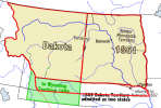
Dakota: 13 seats.
Maine: 12 seats.
Manitoba: 14 seats.
Michigan: 86 seats.
Minnesota: 49 seats.
Montana: 14 seats.
New Brunswick: 10 seats.
New Hampshire: 17 seats.
Newfoundland & Labrador: 7 seats.
Nova Scotia: 11 seats.
Ontario: 121 seats.
Oregon: 108 seats.
Prince Edward Island: 4 seats.
Quebec: 78 seats.
Saskatchewan: 14 seats.
Wisconsin: 51 seats.
The Territories: 3 seats.
TOTAL: 695 seats.
Figured this would be a neat opportunity for DRA/cartography nerds to geek out creatively.
Goals to Accomplish:
Once again, many thanks to Lord Caedus for once more for sharing his well-crafted Canadian lore with me. This project is the derivative of his efforts, and I owe him all the credit for every aspect of this concept.
SEAT COUNT
Alaska: 6 seats.
Alberta: 34 seats.
British Columbia: 42 seats.
Dakota: 13 seats.
Maine: 12 seats.
Manitoba: 14 seats.
Michigan: 86 seats.
Minnesota: 49 seats.
Montana: 14 seats.
New Brunswick: 10 seats.
New Hampshire: 17 seats.
Newfoundland & Labrador: 7 seats.
Nova Scotia: 11 seats.
Ontario: 121 seats.
Oregon: 108 seats.
Prince Edward Island: 4 seats.
Quebec: 78 seats.
Saskatchewan: 14 seats.
Wisconsin: 51 seats.
The Territories: 3 seats.
TOTAL: 695 seats.
Figured this would be a neat opportunity for DRA/cartography nerds to geek out creatively.
Goals to Accomplish:
- Redraw the Canadian provinces to reflect current OTL electoral district boundaries.
- Draw the alt-Canadian provinces boundaries in DRA.
- Slightly alter the provincial borders (particularly Oregon/Montana) to reflect the boundaries of the original X-in-Canada project.
- Create insets for major and secondary cities, as well as for portions of Michigan (which will be hard to draw on the map due to the 86 seats).
- Create a comprehensive list of MPs for the project.