Okay, so hear me out.

Keep in mind, these are not the grand plans for a Potomac canal system for goods-shipping that I'm talking about. These are not the vast, continent-carving canals people on this site have wet dreams about. This is in a much smaller scale. This is like Venice.

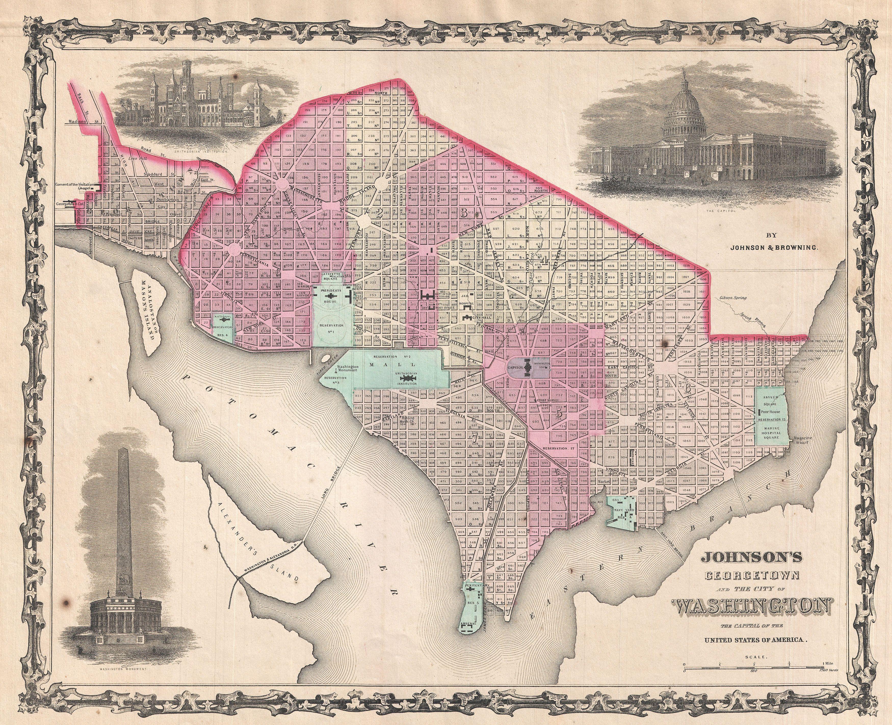
So, I was just browsing the web and reading some articles, and I came across something interesting. There was an article about the necessity for canals in New York City and Boston if global warming makes water levels reach too high. While that's an interesting discussion in and of itself, it got me thinking. The Hudson River, I presume, is what would make a canal system like that of Amsterdam or Venice possible in New York. Could the Potomac be the same? And, when Washington, D.C. was constructed, could a change in personalities (say, a more theatrical and grandiose President than Washington) lead to a D.C. connected by canals?

I know what you're thinking. What about the swamp? I thought that, too. Then I came across this. I found a Washington Post article that claimed that "only 2% of [Washington, D.C.] was classifiable as a swamp." It also claimed that the rest of the city was fertile, green, and empty, perfect for a new city.

So, how about it? Could Washington, D.C. have canal roads like Venice or Amsterdam? And, if it could, is it plausible, perhaps being a part of some Presidential glory project?

(And, yes, I'm asking this mostly for a certain timeline in my sig, but this is also a question that's been bugging me ever since I visited D.C. a few years back: how to make D.C. either even more touristy or more economically relevant. I'm surprised his particular solution hasn't been asked about before on this site.)
 
Last edited:
It would be expensive. And one of Washington's big problems has always been that getting it public funding for infrastructure improvement is surprisingly fraught politically. Before the 1860's or so, I don't think it was heavily populated enough to justify ambitious projects like this anyways.
 
It would be expensive. And one of Washington's big problems has always been that getting it public funding for infrastructure improvement is surprisingly fraught politically. Before the 1860's or so, I don't think it was heavily populated enough to justify ambitious projects like this anyways.

That's why I was thinking it could be a personal Presidential glory project. Or, maybe, some rich nineteenth century billionaire could fund it after laying it out for the government? I don't know if it will work monetarily and politically, really, but that's the challenge, after all!:)
 
That's why I was thinking it could be a personal Presidential glory project. Or, maybe, some rich nineteenth century billionaire could fund it after laying it out for the government? I don't know if it will work monetarily and politically, really, but that's the challenge, after all!:)

Presidents didn't have that kind of power back then, and the ones that were improvement-focused were far more interested in things like the National Road or the Erie Canal, things that would benefit the whole country rather than just one city. And the robber barons were probably coming along too late to make this work. As for what might succeed here, I think you'd need to go back to the planning and construction of the city and include this, which means a POD in or before 1790 when the Residence Act was passed authorizing the construction of a new capital.
 
DC actually DID have canals until the mid 1800s - all that is left today is the tidal pool that the Jefferson Memorial overlooks. I will find what sources I can, but your question is as much about how to keep them around as it is to build more in the first place.

edit: a map from 1861

1861_Johnson_Map_of_Washington_D.C._and_Georgetown_-_Geographicus_-_WashingtonDC-johnson-1861.jpg


And 2016:

MAR-WhatOnceWas-pic3.jpg


It was replaced with railroads by the 1850s and never worked as intended anyway. Maybe one way to keep it around is to have it designed all in one go instead of piecemeal and allow it to handle the tides, which it never really did properly. Maybe the Navy can find an excuse to keep it around until the 1900s when romanticism and the Beautiful Cities movement decides it has to be preserved and maintained.
 
Last edited:

Skallagrim

Banned
I know what you're thinking. What about the swamp? I thought that, too. Then I came across this. I found a Washington Post article that claimed that "only 2% of [Washington, D.C.] was classifiable as a swamp." I also claimed that the rest of the city was fertile, green, and empty, perfect for a new city.


DC actually DID have canals until the mid 1800s (...)

It was replaced with railroads by the 1850s and never worked as intended anyway. Maybe one way to keep it around is to have it designed all in one go instead of piecemeal and allow it to handle the tides, which it never really did properly. Maybe the Navy can find an excuse to keep it around until the 1900s when romanticism and the Beautiful Cities movement decides it has to be preserved and maintained.


It may just be possible to combine the grandiose and the useful. Suppose a grandiose canal system being designed all at once. The early US wouldn't even be that strange a time for it. With its tendency towards elegant (and somewhat bombastic) palladian architecture, the spirit of the time had more than a little in common with the later Beaux-Arts and City Beautiful movements.

At the same time, a well-organised canal system could have a great economic function for the new capital: it allows many parts of the city to be supplied by ship. Furthermore, having a good water management system can help drain what swamp there is, thus optimising the city's amount of usable land.
 
DC actually DID have canals until the mid 1800s - all that is left today is the tidal pool that the Jefferson Memorial overlooks. I will find what sources I can, but your question is as much about how to keep them around as it is to build more in the first place.

It may just be possible to combine the grandiose and the useful. Suppose a grandiose canal system being designed all at once. The early US wouldn't even be that strange a time for it. With its tendency towards elegant (and somewhat bombastic) palladian architecture, the spirit of the time had more than a little in common with the later Beaux-Arts and City Beautiful movements.

At the same time, a well-organised canal system could have a great economic function for the new capital: it allows many parts of the city to be supplied by ship. Furthermore, having a good water management system can help drain what swamp there is, thus optimising the city's amount of usable land.
That's really great information, thanks a ton. I didn't know the canals in washington had actually been a thing either, which is pretty neat, too. How much of an economic impact do you think it would have on the city? Could it become a trading hub of any kind, and maybe a bigger city than OTL? Maybe it wouldn't cede some of its land to Virginia in the nineteenth century like it did and it could grow some more.

Also, the whole "Tiber Creek" thing by the Capitol Building really shows how far they were willing to take this whole Rome thing. It's crazy.
 
Last edited:

Deleted member 97083

In the 19th century or even beginning of the 20th century, that sounds like a malaria magnet. That reason alone might prevent it.
 
In the 19th century or even beginning of the 20th century, that sounds like a malaria magnet. That reason alone might prevent it.

From a modern perspective, yes. But they thought bad odors, among other things, caused sicknesses like malaria and yellow fever. It actually wasn't until the mid-nineteenth century that they discovered mosquitoes and still water were the cause, I believe. So it maybe could still be done, but it would have to be done early on in Washington, D.C.'s lifetime.
 

Skallagrim

Banned
Isn't it also the case that canals directly connected to the flowing Potomac would be less malarial than some adjacent swamp? If the canal system is used to drain the swampland, that may well reduce the malarial nature of the DC area.

(Disclaimer: I'm far from an expert on that, I'm just repeating what I've heard from others.)

That seems logical, although I'm neither a doctor nor a civil engineer.
 

Deleted member 97083

From a modern perspective, yes. But they thought bad odors, among other things, caused sicknesses like malaria and yellow fever. It actually wasn't until the mid-nineteenth century that they discovered mosquitoes and still water were the cause, I believe. So it maybe could still be done, but it would have to be done early on in Washington, D.C.'s lifetime.
They thought that poisonous swamp gas was one of the kinds of bad air, though, so effectively, they knew marshy water played a role even if they didn't realize mosquitoes were the direct vector.
 
They thought that poisonous swamp gas was one of the kinds of bad air, though, so effectively, they knew marshy water played a role even if they didn't realize mosquitoes were the direct vector.
Oh, I see. Good on them. Do you know if canals built from the Potomac would be more flowing and less susceptible to mosquitoes? I'm not a doctor or a civil engineer, either, so I don't know.
 

Deleted member 97083

Oh, I see. Good on them. Do you know if canals built from the Potomac would be more flowing and less susceptible to mosquitoes? I'm not a doctor or a civil engineer, either, so I don't know.
Well if the canals have locks and pumps, it doesn't matter if they're adjacent to the Potomac, because water flow would be blocked by the locks most of the time. But maybe the movement of the pumps and constant boat traffic would kill the mosquito larvae, I'm not sure.

Today, freshwater canals are stocked with mosquito-eating fish. So I could be wrong, but I would assume that a freshwater canal is susceptible to mosquitoes, which would include a 19th century canal connected to the Potomac. There are apparently saltwater mosquitoes as well on the East Coast.

Are there mosquito-eating fish in the Potomac? Then they spread...
 
Would totally get behind a modern DC with lazy canals underneath cherry blossoms.


But diverging from the mosquito question; would building/planning this have a better chance at success later on than 1790? Say after the British looting in the War of 1812?
 
Looking at a topographic map of the area, I think it would be hard to get Venice-style canals much north-east-ish of Pennsylvania Avenue or so, though. They'd need to be locked there, or pretty deep, so not very Venice-y. They'd mostly be to the southwest-is of Pennsylvania Avenue to be Venice-y, wouldn't they?
 
I wish I could remember where I saw it (I think it might've been a post here many many years ago) but I seem to recall that there was once an early design for DC back during its original conception that envisioned it as an island city located on the Potomac, with a canal system a la Venice. Unfortunately I can't find any information on plans for the city beyond the L'Enfant Plan and McMillan Plan, the two that were actually implemented historically. I'll keep trying to find it in the meantime.
 
I mean, the one we had was a disaster.

EDIT: To be clear, the Washington City Canal had a serious problem, as in it had pollution, carcasses, and a problem with people falling in it at night. This is why it was covered over.
 
Last edited:
I think a big question you have to wrestle with is what the canal is useful for. OTL, the canal seems to have been basically a precursor to anything a railroad could have done. So we've got freight barges and smaller ferry boats scooting around, probably some boats carrying mail, and some folks engaged in longer-range travel, probably up to Baltimore. Additionally, it's worth considering that Washington was hoped to be a decent port city, which it really never became. They also wanted a good facility for the Navy, which it was perhaps better at. But in both ways, OTL, pre-existing cities dominated both roles. In fact, the city got off to a slow start in general, after the initial boom period of establishing DC itself, most Americans didn't view Washington as a desirable place to live.

I agree with others' assertions that the best time to establish the canals is in the very beginning, either L'Enfant himself or Ellicott. Perhaps there is more influence from people in the Administration/Congress on the plan and someone likes the idea of canals.

Perhaps as part of the American Movement (coined and led by Henry Clay in the world we know, but any smart Whiggish leader would arrive in much the same place), there is an effort to have the District be turned into a useful city, other than just the hub of government. I don't know how far it could be pushed constitutionally or politically, but maybe some sort of subsidy for moving industry into the City. I think your best bet in this case is to make every effort to increase the involvement of the Navy within the District, that would bring in both industry and residents, as well as possibly excusing a more extensive canal network.

edit:
By the way, here is a map of Washington DC showing the drainage/sewage system as well as the extent of flooding in 1889, which seems to have been pretty high. I think this is a good guide for anyone who wanted to map out where some of these canals might have been readily built. Also contained in this link is lots of other maps, including many where you can trace the slowly disappearing traces of the canals. See around 1850 for its best look.
 
Last edited:
Top