You are using an out of date browser. It may not display this or other websites correctly.
You should upgrade or use an alternative browser.
You should upgrade or use an alternative browser.
A Blank Map Thread
- Thread starter Matt
- Start date
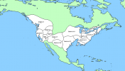
Western North America with the Colorado River flowing into Lake Cahuilla instead of directly into the sea. First is just rivers + coasts, while second also includes rough elevation as shades of gray. I did not draw some of the tributaries of the Missisippi River, which should be visible in the eastern portion of the map. If you use this as part of a larger map, make sure to add those.


So from i've seen, the Pacific-centered Worlda maps are the only type of Worlda that seem to not have graticule lines.
So i decided to make one that has lines.

So i decided to make one that has lines.
New Britain Mapping
Banned
Not to mention after WW2, both Koreas were split along the 38th graditude lineSo from i've seen, the Pacific-centered Worlda maps are the only type of Worlda that seem to not have graticule lines.
So i decided to make one that has lines.
View attachment 647084
Hi folks, does anyone have a mirror for the files that used to be in this folder from earlier in the thread? Very big blank province maps, but I only snagged the Europe one when it was first put up.

qazse
Gone Fishin'
Cute.Here's a nano worlda, 16 times smaller than the standard format. I reckon this has been done before, but this is not copied from anyone else.
View attachment 648571
Looking at High Rock I assume this is post Warp in the West. Did you estimate the borders or have they finally define them?A Blank Map of Tamriel with Subdivisions

Looking at High Rock I assume this is post Warp in the West. Did you estimate the borders or have they finally define them?
Yeah, High Rock is after Warp in the West. The borders are estimated from geography and ESO regions.
Last edited:
ok, that explains it I have not looked at ESO stuff enough to recognize thoseYeah, High Rock is pre-Warp in the West. The borders are estimated from geography and ESO regions.
Try this one, maybe: https://www.alternatehistory.com/forum/threads/request-maps-flags-here.228562/post-10487601Are there any good blank maps of Italy?
If you need a bigger one, the VT-BAM is huge. You can find Italy in the middle of file 107 of the merge, which is linked from here: https://www.alternatehistory.com/forum/threads/the-vt-bam-project.427414/post-19507628
Panem, before the 74th Hunger Games (as estimated from the Hunger Games Wiki's descriptions)
Labelled and non-labelled.
A mild correction: It's not labelled here, but District 6 would be in the Lower Peninsula of Michigan.
View attachment 652193
View attachment 652194
Panem, before the 74th Hunger Games (as estimated from the Hunger Games Wiki's descriptions)
Labelled and non-labelled.
I know that this is really basic, but I can't find the blank world map everyone is using. Does anyone have that?
There are quite a few sizes of maps (WorldA, MBAM, etc). The wiki has some good links: https://www.alternatehistory.com/wiki/doku.php?id=resources:mapsI know that this is really basic, but I can't find the blank world map everyone is using. Does anyone have that?
If you can't find the one you want there, if you say more specifically which one you would like, I'm sure someone will have it.
Share: