I posted a WIP of this a few pages back. It's pretty much done now except for internal divisions in Russia, India, and Canada. Any comments/suggestions/blind fits of rage?
Why Russian Empire not divided Galicia on Russian and Polish parts?
I posted a WIP of this a few pages back. It's pretty much done now except for internal divisions in Russia, India, and Canada. Any comments/suggestions/blind fits of rage?
A rather simple question: what does SSA stand for?
Alex Richards.... have you got a map for your location?
What is Britain an analogue of?
I was thinking about adding a key for the final version. And I wasn't entirely sure about South America, so I'm glad you like it.A key would be nice, I don't know the color codes. I like mega-Korea, South America and Africa.
That's exactly what's happening.Looks like Republican China slowly consuming the Imperial Remnant?.
The Midwestern state in North America? That's the Republic of America, which is basically just Über Iowa, plus a somewhat dwarfed Chicago. The blob in the republican/Mongolian/Russian border region is an objectivist/libertarian movement thingy, sort of analogous to the communist movement. The difference being that communism- and socialism in general- didn't really catch on in the old world. Socialism IS pretty big in the Americas though.I'd like to know what the white state in the North Central Plains and the green spot in eastern Xinjiang are.
In western Russia right? That's from the river patches I used for making some of the borders. I'm planning on cleaning it up when I put internal divisions in.You have a few resevoirs on there.

Even before Flanders gained it's independence there were some that suggested that it would be better if they got rid of the outdated province structure. but implementing this reform would be difficult in the condition Belgium was in. When the delegates of the Flemish government met in Antwerp to discuss how to run the new Flemish Republic it was decided to abolish the provinces in favor for smaller, more regional departments. The Departments where ideal for neighboring communes to work closer together and have a regional policy.
[snipped]
How? Wouldn't it be Država Srpske Austrije (DSA) or (less likely because it sounds awkward and confusing) Srpska Austrijska Država (SDA)?State of Serbian Austria. It's conveniently the same initials in Serbian.
Here's a (rather fanciful) map of Putin's vision of the Restoration of the Russian Empire and a New World Order (under St. Petersburg's control), now realized.
Notice how Putin is now Emperor since the Proclamation of the New Russian Empire on 9 May, 2005.
snip
How? Wouldn't it be Država Srpske Austrije (DSA) or (less likely because it sounds awkward and confusing) Srpska Austrijska Država (SDA)?
.Even before Flanders gained it's independence there were some that suggested that it would be better if they got rid of the outdated province structure. but implementing this reform would be difficult in the condition Belgium was in. When the delegates of the Flemish government met in Antwerp to discuss how to run the new Flemish Republic it was decided to abolish the provinces in favor for smaller, more regional departments. The Departments where ideal for neighboring communes to work closer together and have a regional policy.
Dammit. It looks like for some bizarre reason when translating 'State of Serbia Austria' you get that, wheras using the more gramatically correct 'State of Serbian Austria' you get Stanje Srpskog Austrije.
Typical. Bloody typical
Note of that exact location, but I did do (and post) this map from another part of the Empire a while back.
Absolutely batshit in terms of backstory,
(Minor quibble - Manchurian nation? Not big enough to seriously cripple the Chinese, big enough to permanently piss them off. Seems like a move of pure dickery [1]...
Bruce
[1]SUPERpowerDickery
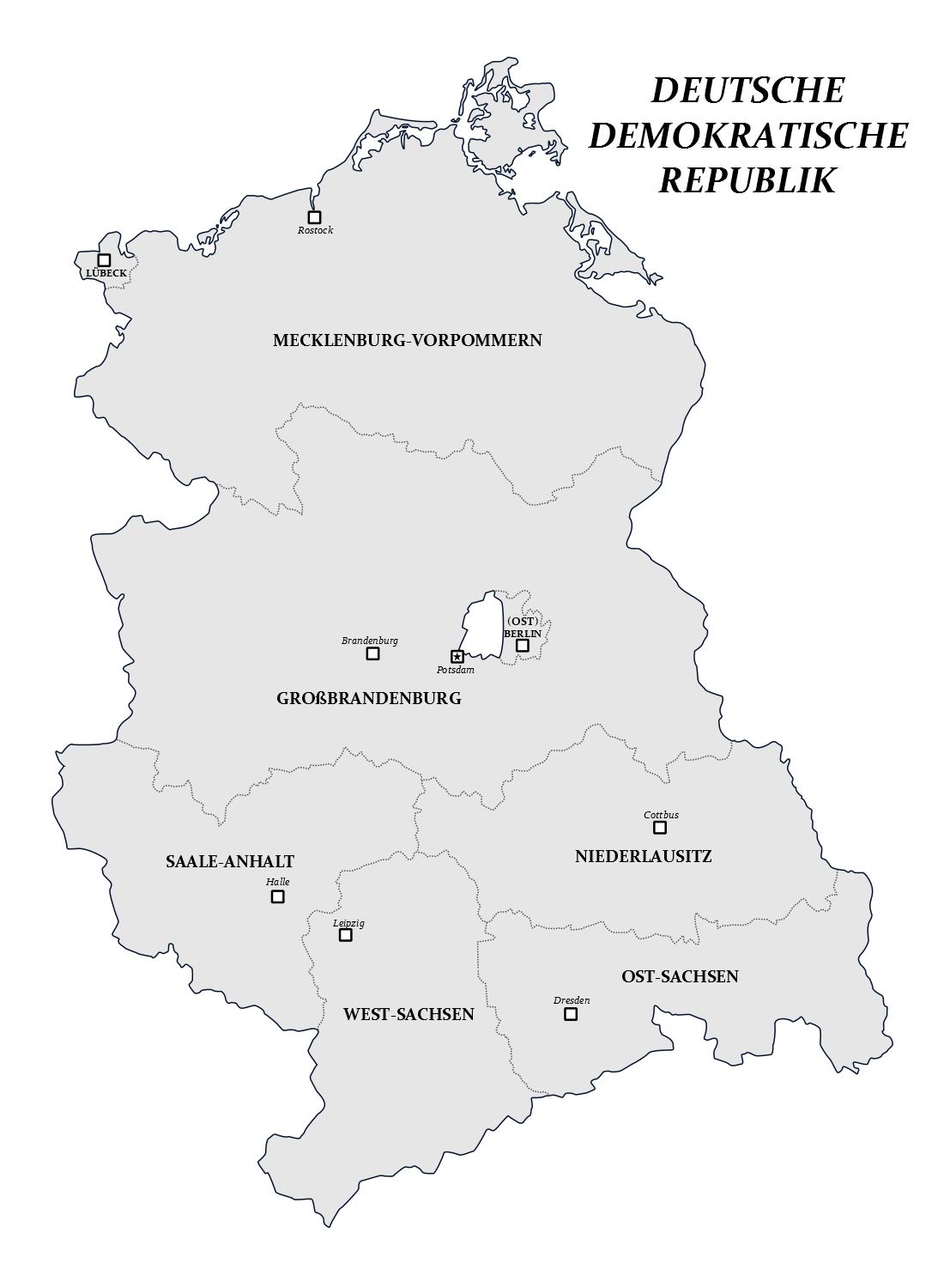
Apparently there's only a German page for this on Wikipedia.
So… a permanently frozen giant lake, also permanently irradiated and therefore useful to no one?
In western Russia right? That's from the river patches I used for making some of the borders. I'm planning on cleaning it up when I put internal divisions in.
Potsdam as the national capital
A fantasy map I made, still no locations, but I like the spirally archipelago shape
that's terriying, one would fervently hope that they show at least a little respect for the city.