Is this a WIP?
Yeah. I apologize if I posted it in the wrong thread.
Is this a WIP?
After about 2 years, I've finally completed my elevation map of Tellurus.View attachment 380421
Did you ask for permission first? You need to at least go back and give credit.Yep, and not proud of it.
Shouldn’t this go in the alternate planets and suns thread?After about 2 years, I've finally completed my elevation map of Tellurus.View attachment 380421
Shouldn’t this go in the alternate planets and suns thread?
Hey @Aqua817, I know I left this place a few months ago,
Yep, and not proud of it.
That makes sense.
1) Where is it's capital? I noticed Chicago was never nuked, or occupied by a foreign power, so I'm betting it's there.
2) Why's the radiation in the DC zone so awful? Unlike most areas it looks like it never got cleaned up.
3) Also, I don't know if this is a mistake or purposeful, but I noticed the Sea Levels dropped around the 2060's, but then came back in the final map. Is that purposeful or a mistake?
The latest next gen Worlda base map is version 3.0I have a WIP that I'm doing rn, it's of an alternate future map.
View attachment 380444
Note: I used Hadril's next gen Worlda as my basemap
Trust me, I have no wish to return.Nobody is obliged to keep away from this site, just as nobody is obliged to stay here!

Hey @Aqua817, I know I left this place a few months ago, but I made a series of West African maps a while back as well. I don't think I ever posted them here. Give me likes.
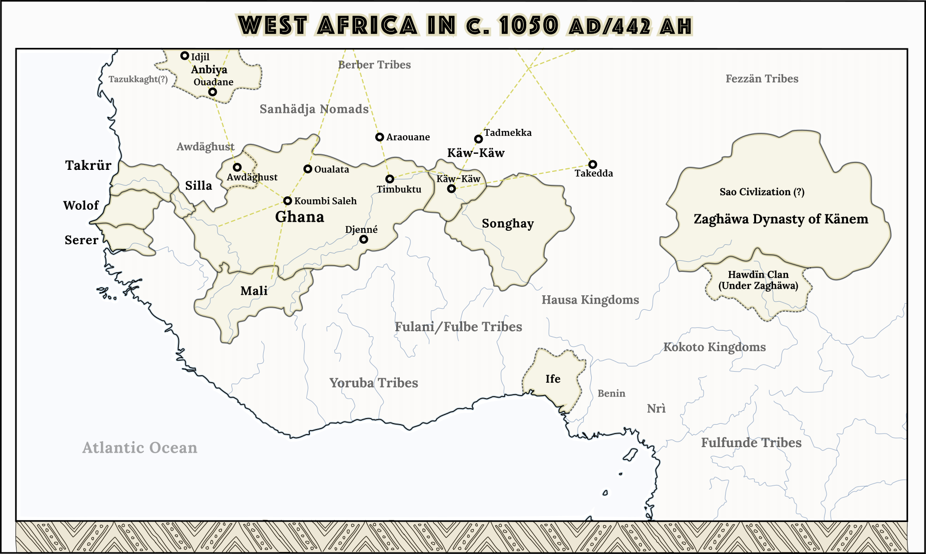
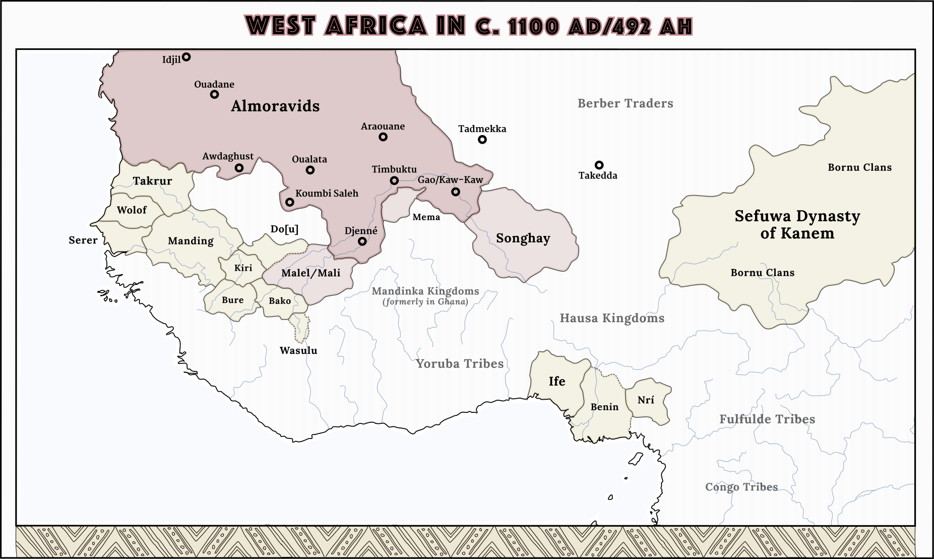
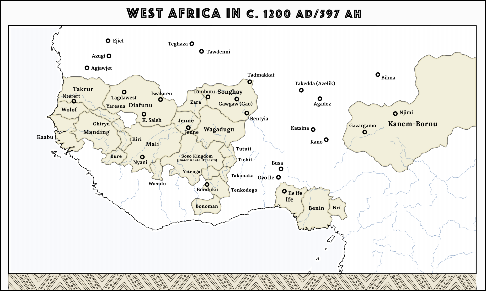
We just need pre-colonial Africa maps in generalyou get my like and my 'yes we need more west africa maps'
because we really do need more otl west africa maps pre-dating colonialism
We just need pre-colonial Africa maps in general
Well, it's not like I have anything better to do.We just need more maps.
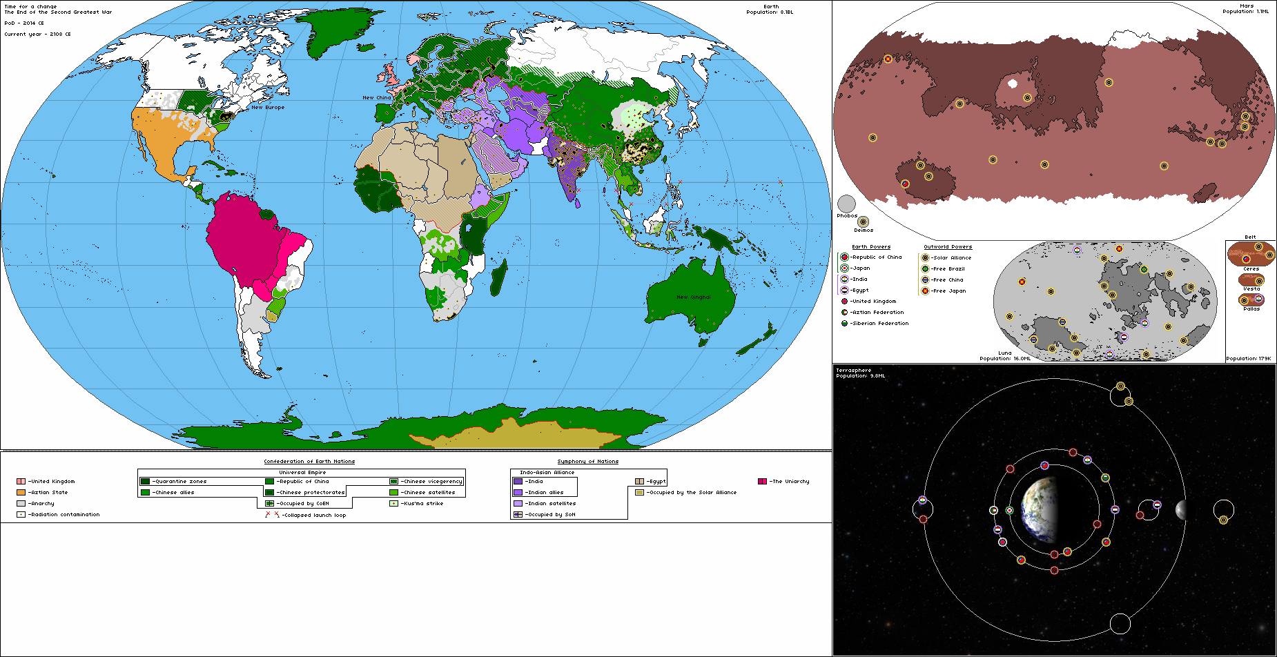
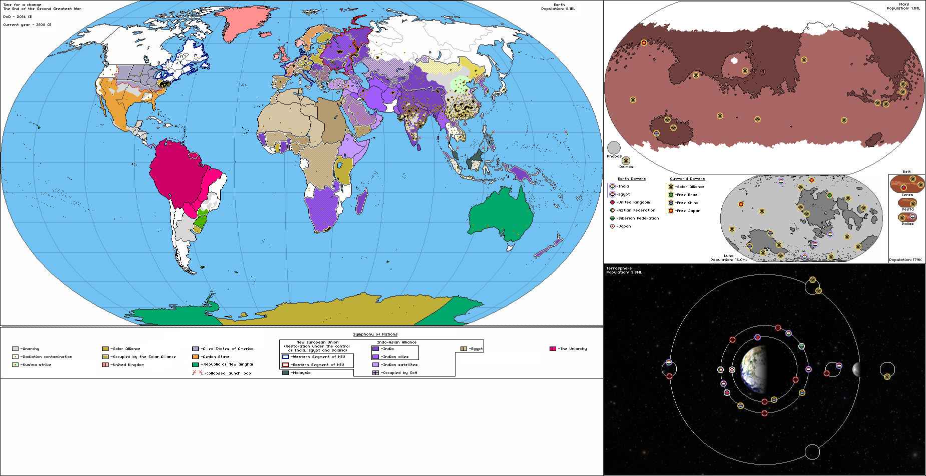
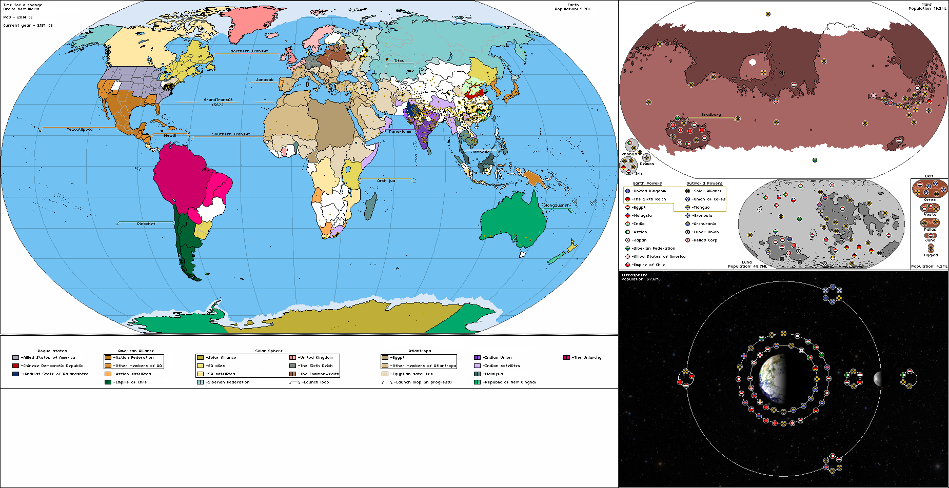
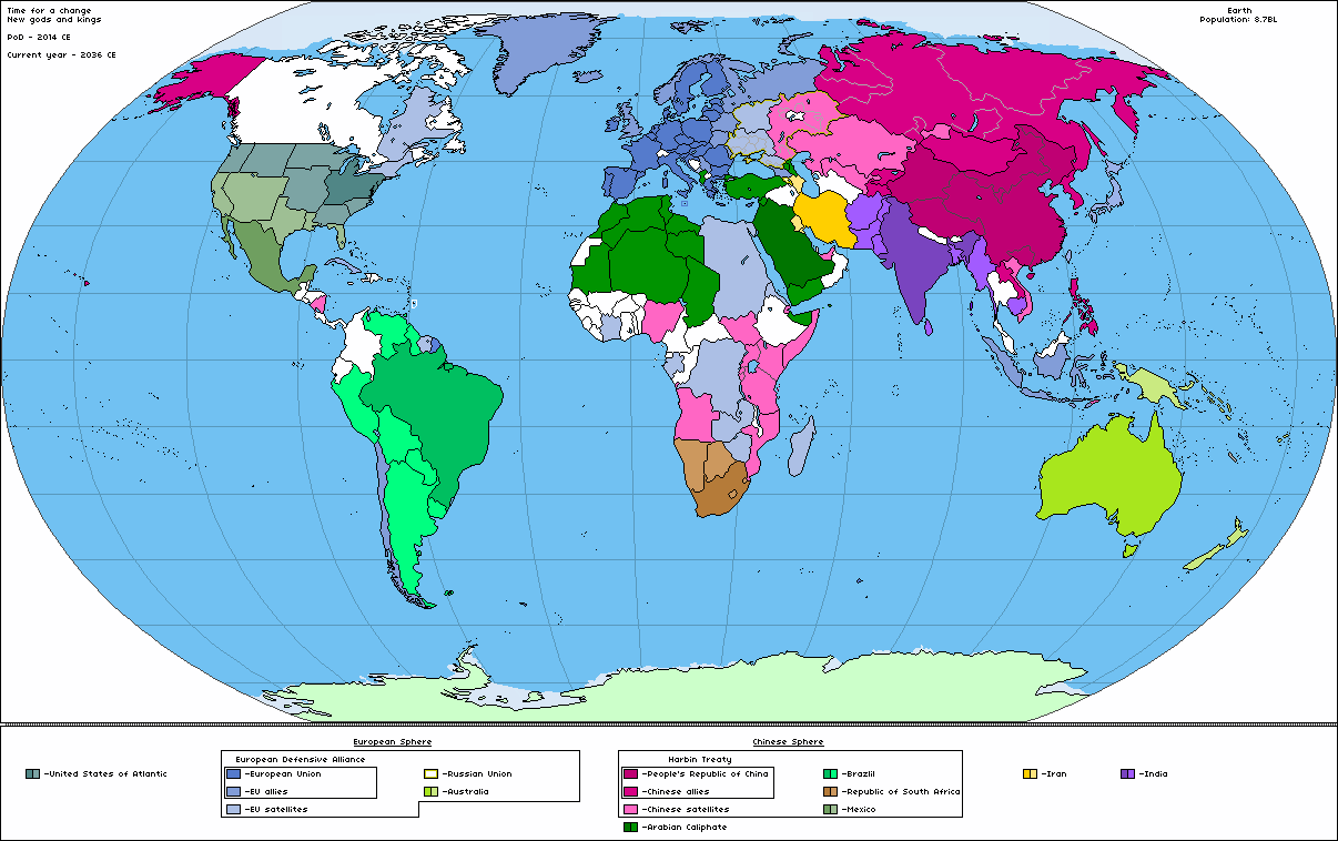
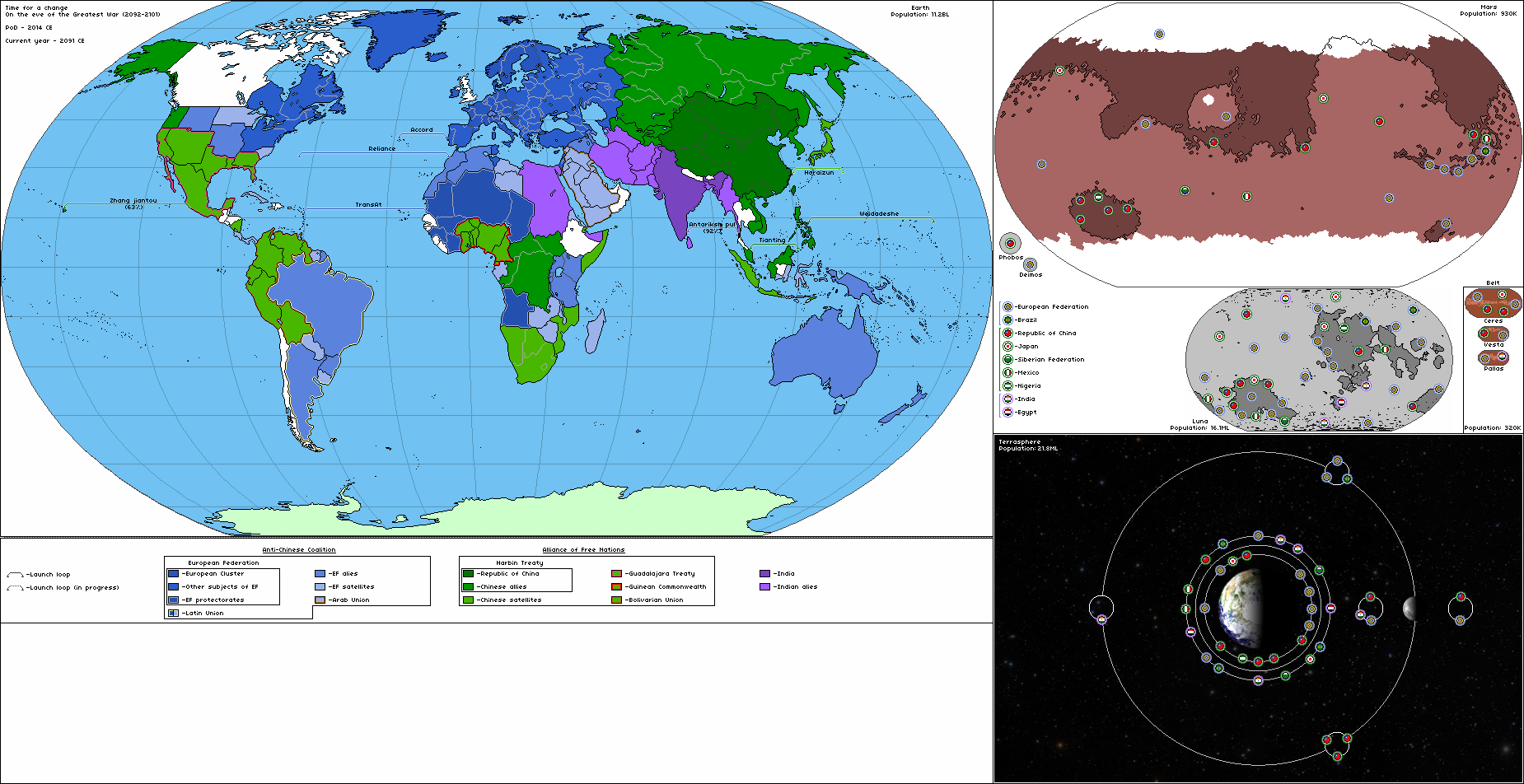
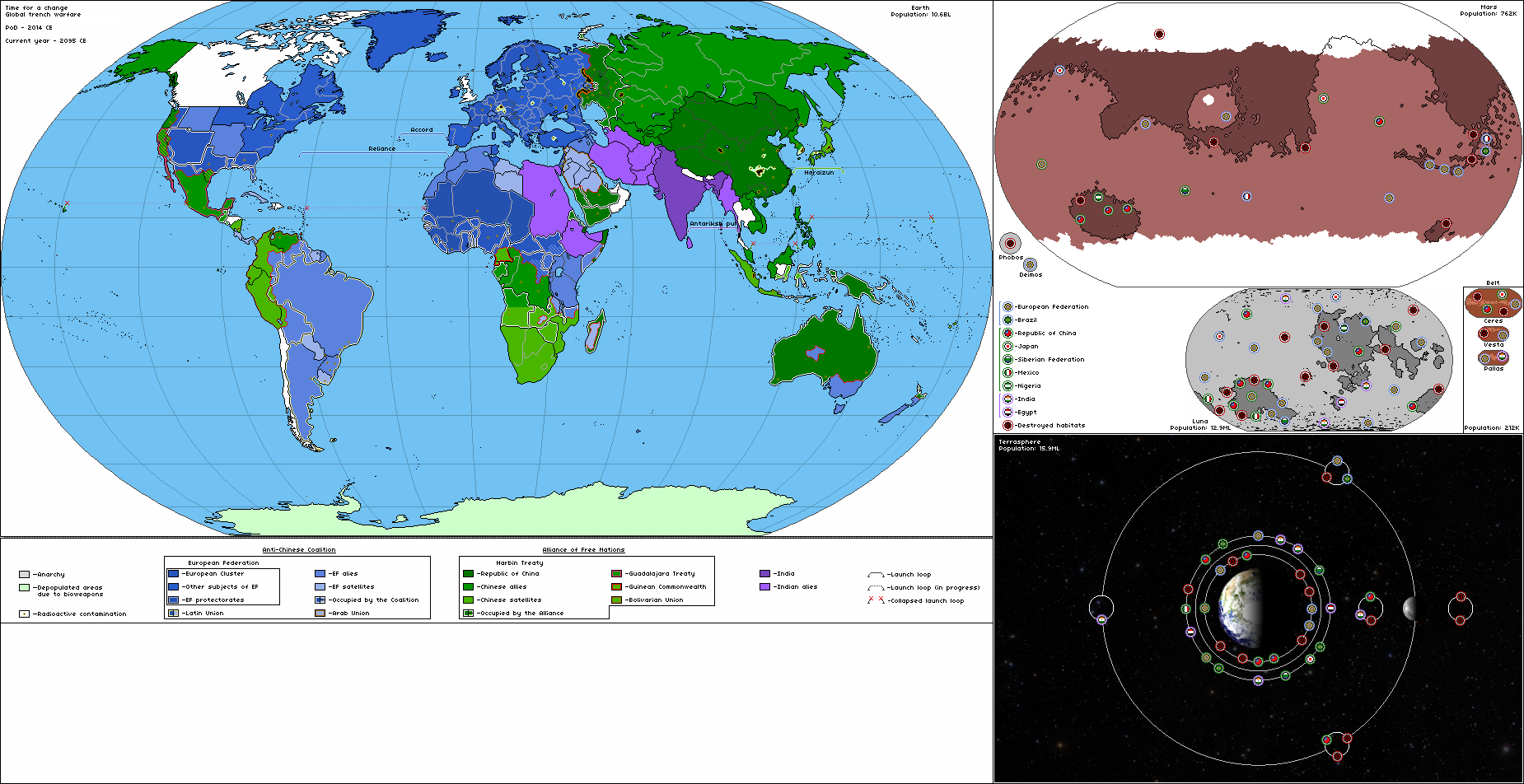
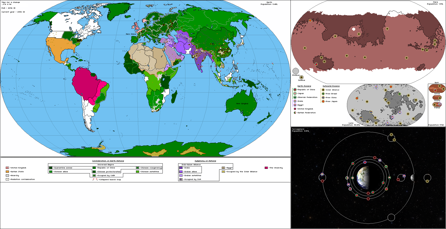
It is TL in the form of a set of maps, which tells about the alternative future of the Earth from 2036 to 2151.
PoD - The Great Depression destroyed the old world order in 2014. Only the EU, China and India were able to survive the crisis and became the new superpowers. Soon they unleashed a new cold war
New World Order
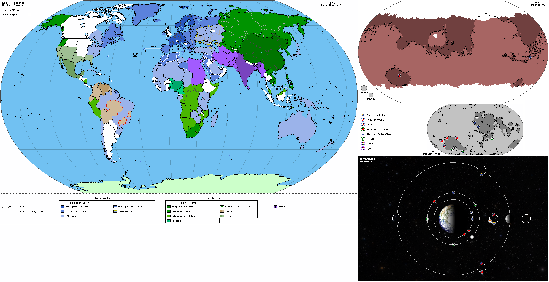
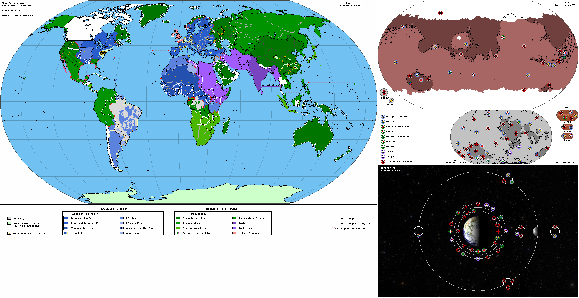
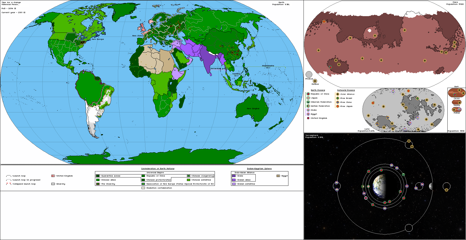
 Kus'ma is a three-kilometer asteroid covered with radio-absorbing material and equipped with an engine. It was created by the European Federation in the early 2070s as a weapon of retaliation in case China to seize the Earth. But the Greatest War began and ended before Kus'ma was ready. Kus'ma came under the authority of Solar Alliance who brought the project to fruition. The asteroid made a gravitational maneuver near the sun and crashed into the earth at a speed of 60 kilometers per second near Beijing. This event marked the end of the war and the Chinese statehood.