You are using an out of date browser. It may not display this or other websites correctly.
You should upgrade or use an alternative browser.
You should upgrade or use an alternative browser.
Map Thread XVII
- Thread starter Upvoteanthology
- Start date
- Status
- Not open for further replies.
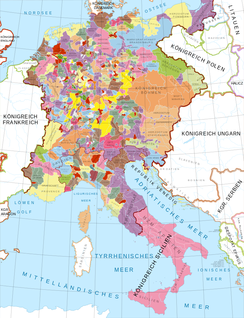
Now we need a Holy Roman Empire of the world-dominating german nationmoar raj
View attachment 359313
/s
Now we need a Holy Roman Empire of the world-dominating german nation
/s
Neither Holy nor German, but it would be an Empire.
It would be the empire.Neither Holy nor German, but it would be an Empire.
Hmm, what about french, anglo-holland (and possibly Songhai/Berber or something like that) Brazil and united Guyana as a part of "Spain in exile"? (not exactly what you ask for, but not SO different?Ok. Quick thought. Has anyone done a map were Brazil was divided into three (French, Dutch, and English) Brazils while the Guianas are a united Portuguese speaking country?
ST15RM
Banned
Too many small duchies. Too much work.Now we need a Holy Roman Empire of the world-dominating german nation
/s
Too many small duchies. Too much work.
It could just show the Imperial Circle level.
With lots of zoom maps.
Hey, I'm not asking you to make an entire shelf of albums' worth of postage-stamp sized states.
Deleted member 97083
If you partition the Electoral Rhenish circle and mediatize the rest of the states, it's not too bad. You've got to think like a Bonaparte.*loud screaming of agony*
Skallagrim
Banned
If you partition the Electoral Rhenish circle and mediatize the rest of the states, it's not too bad. You've got to think like a Bonaparte.
These heretical mediatising tendencies must be curtailed at once! Give me ALL the insignificant microstates!
I dunnoWhat about this one?

There's a point where gore becomes...Strangely pleasing.
Those squiggly borders are just pretty. I don't know what other adjective to use. Except Barvaria though. A disunited Barvaria translates into a dystopia of cartography in my head. The only thing that could ruin this would be a Germany with straight borders.
Isaac Beach
Banned
What about this one?

Y'know, if someone came up to me and said the HRE was a conspiracy theory, and their entire rationale was that this many horribly dysfunctional small nations couldn't possibly exist at once, I'd be inclined to believe them. What a mess.
True... although Wittelsbach Bavaria had/has the palatinate and Franconia in it I couldn't imagine it otherwise unless it's a dystopia.Except Barvaria though. A disunited Barvaria translates into a dystopia of cartography in my head.
ST15RM
Banned
What about this one?
Why? WHY??
To quote Voltaire: "The Holy Roman Empire is neither Holy, nor Roman, nor an Empire."
Don't forget Bavaria split down into sub-duchies rather than pass on as a complete inheritanceTrue... although Wittelsbach Bavaria had/has the palatinate and Franconia in it I couldn't imagine it otherwise unless it's a dystopia.
- Status
- Not open for further replies.
Share: