You are using an out of date browser. It may not display this or other websites correctly.
You should upgrade or use an alternative browser.
You should upgrade or use an alternative browser.
Alternate States
- Thread starter The Kiat
- Start date
How do you manipulate maps like this?
I want to do maps but I'm not sure at to what the best way to mark the territories, boundaries, fill in sections with color to denote different entities etc...
I use Adobe Photoshop, and zoom in real close. Some maps I made, I manipulate it pixel by pixel. You could use simple MSPaint too, but I like Photoshop. I think I found the base map on Wikipedia when looking up New Amsterdam. I did that one more than a year ago when I wrote my An Alternate History of the Netherlands https://www.alternatehistory.com/discussion/showthread.php?t=132933 It's not that good of a map, but when I was making all these maps I intended them to just be visual aids.

Connecticut, which kept Rhode and Long Islands. Basically ends up like New York State would have.
I use Adobe Photoshop, and zoom in real close. Some maps I made, I manipulate it pixel by pixel. You could use simple MSPaint too, but I like Photoshop. I think I found the base map on Wikipedia when looking up New Amsterdam. I did that one more than a year ago when I wrote my An Alternate History of the Netherlands https://www.alternatehistory.com/discussion/showthread.php?t=132933 It's not that good of a map, but when I was making all these maps I intended them to just be visual aids.
Thanks for the tip.
Time for some experimentation...

Highlander
Banned
How come in alternate U.S. maps, where there's no major territorial difference, the Western states always have different borders? I mean, more than just some petty butterflies.
Because if you look at a lot of the history behind the formation of western states, they are quite arbitrary, or depend on a small handful of people.
Texas could have legally been split up into five states after its annexation, and Oklahoma could have been split into two with the Native American Sequoyah in the east.
I don't think the Texans would like that, too much.
AmIndHistoryAuthor
Banned
A very crude map showing Texas in the aftermath of a failed near future secession movement. The movement faced an anti secession movement that split off two states from it. In black, the new state of Rio Grande. In grey, the new state of Pecos. There may be other candidates for state names, but they likely wouldn't choose South Texas or West Texas. Perhaps names like Seguin (after Juan Seguin) or Gonzalez (after Henry B Gonzalez).

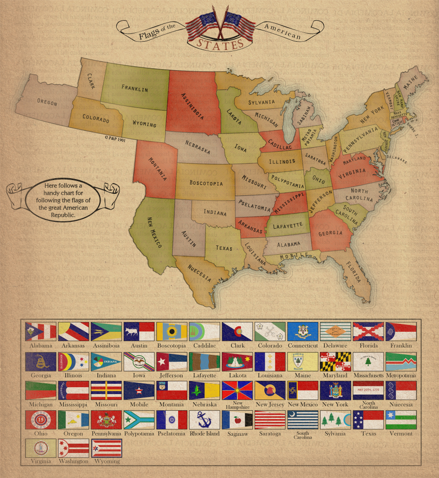
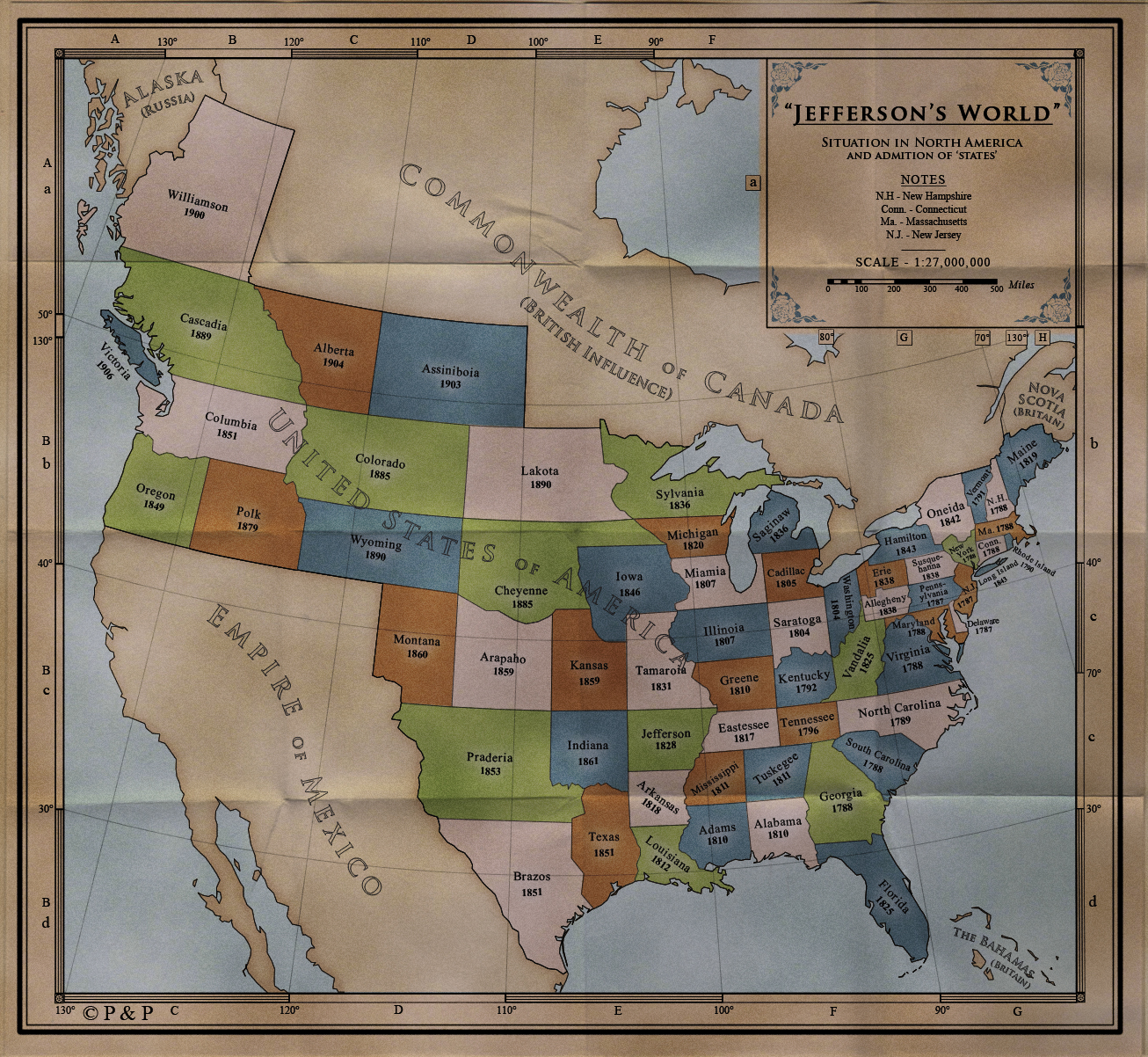
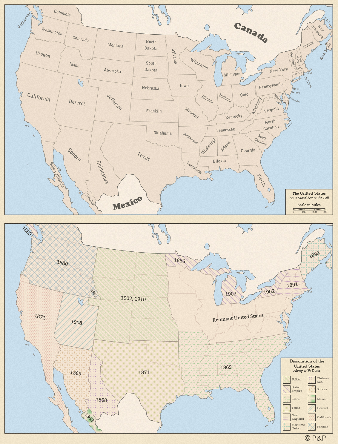
Three maps that I think have particularly creative states.
I like the top map better.
Texas could have legally been split up into five states after its annexation, and Oklahoma could have been split into two with the Native American Sequoyah in the east.
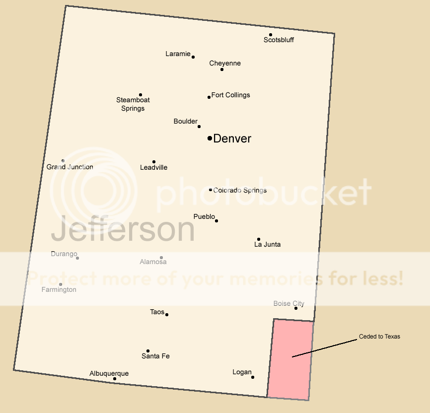
If you use the Rio Grande as the border, then Texas was divided up; part of it went to New Mexico, part went to Colorado, part went to Oklahoma, and a little bit went to Wyoming.
Here is a map of the 62 states of The United States.
Dakota - Red
Basically The Dakota Territory does not split into North and South.
Houston - Yellow
One of the five states to join the Union when The Republic of Texas was annexed. Named after Sam Houston.
Rio Grande - Sky Blue
One of the five states to join the Union when The Republic of Texas was annexed. Named after The Rio Grande River
Crockett - Purple
One of the five states to join the Union when The Republic of Texas was annexed. Named after Texas Revolutionary David Crockett.
Texas - Brown
One of the five states to join the Union when The Republic of Texas was annexed. The official successor state of The Republic of Texas.
Oklahoma - Orange
One of the five states to join the Union when The Republic of Texas was annexed. Half of The Indian Territory opted to join the state instead of forming a new one.
Seuoyah - Green
Native American State created from The Indian Territory
South (Baja) California - Pink
Joined California during The Bear FLag Revolt/Revolution. When The California Republic joined The Union it was split between North California and South California.
Superior - Maroon.
Formed from the upper peninsula of Michigan. Named after Lake Superior.
Puerto Rico - Light Brown
Admited into The Union around the same time as Hawaii and Alaska.
Cuba - Dark Blue
Bacame The Cuban Territory after the Spanish-American War. Admitted into The Union during Theodore Roosevelt's presidency.
Long Island - Light Red
Seceded from New York State in the 1980s due to a dispute about State Taxation.
Quebec - Dark Grey
One of the Fifteen Original Colonies. Joind The Revolution after Benedict Arnold succefully invaded The Canadian Colonies.
Canada - Forest Green
One of the Fifteen Original Colonies. Joind The Revolution after Benedict Arnold succefully invaded The Canadian Colonies.
Panama (Canal) - Mustard Yellow
Joined the Union in 1979 from The Panama Canal Zone. Often seen as the "Misfit State" due to it's distance from the rest of the nation, small size and population.
One possible opion is the balkanazation of Texas. Congeress stated that if they annexed exas hey reserved the right to chop it up into at leas five states
Do you enjoy playing 'pin the Colorado on the United States'?Three maps that I think have particularly creative states.
Now to post a few of mine.

Tallest Skil
Banned
Quebec - Dark Grey
One of the Fifteen Original Colonies. Joind The Revolution after Benedict Arnold succefully invaded The Canadian Colonies.
Canada - Forest Green
One of the Fifteen Original Colonies. Joind The Revolution after Benedict Arnold succefully invaded The Canadian Colonies.
The only problem I have with this is the improbability that the rest of what we know as Canada not becoming part of the United States after Upper and Lower Canada's secession from the British Empire as either territory after the American Revolutionary War or after a (far more successful, American-wise) War of 1812. Other than this, a fine map.
Share: