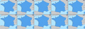
Anyone have a full color version of one of these, like they have with the QBAMs?
You are using an out of date browser. It may not display this or other websites correctly.
You should upgrade or use an alternative browser.
You should upgrade or use an alternative browser.
The M-BAM Main Thread
- Thread starter Pogoboy20
- Start date
Minor changes to Nunavut mostly around Southampton Island

Patch for Sierra Leone's new province and districts (there are no maps for the next level subdivision)

Patch for Sierra Leone's new province and districts (there are no maps for the next level subdivision)
Since your posts are colored in im gonna assume you have a full colored m-bam. If im right could you post it please? Noone else has posted one yetMinor changes to Nunavut mostly around Southampton Island
View attachment 815005
Patch for Sierra Leone's new province and districts (there are no maps for the next level subdivision)
View attachment 815006
I am very sorry, it is still in the works, I just coloured those ones in to differentiate between countries.Since your posts are colored in im gonna assume you have a full colored m-bam. If im right could you post it please? Noone else has posted one yet
Two new patches, Latvia with its post-2021 subdivisions, Mali with its 2 new regions (sadly, there is no information on the new cercles of Mali)


Also, Equatorial Guinea needs to have the province of Djibloho, Ethiopia also has new districts that need to be tackled, and Algeria has several new subdivisions which I cannot find second-level subdivisions for (mostly in the south).
Also, Equatorial Guinea needs to have the province of Djibloho, Ethiopia also has new districts that need to be tackled, and Algeria has several new subdivisions which I cannot find second-level subdivisions for (mostly in the south).
MBAM keeps the parallels horizontal, so the international border between the Soviet Union and Japan should be a horizontal line, not a tilted one.Historical map of the Karafuto Prefecture (South Sakhalin) in the interwar period.
Oh I did not know that thanks for the infoMBAM keeps the parallels horizontal, so the international border between the Soviet Union and Japan should be a horizontal line, not a tilted one.
Corsica to France
Elsaß-Lothringen shown as imperial territory
Bosnia and Herzegovina shown as condominium
French departments shown as first level
Poland shown without autonomy
Montenegro given part of Kosovo
Finland given land it lost in Winter War
Italian border with Austria fixed (probably still wrong)
Right, just to let you know these French regions would be the 1982 ones. France's first level subdivisions back in 1914 were departments.View attachment 815414I attempted to fix that other 1914 map.
Corsica to France
Elsaß-Lothringen shown as imperial territory
Bosnia and Herzegovina shown as condominium
French departments shown as first level
Poland shown without autonomy
Montenegro given part of Kosovo
Finland given land it lost in Winter War
Italian border with Austria fixed (probably still wrong)
(1914 Europe)
These patches should work for France
Edit: as pointed out by Votre Idéolinguiste Local, the small bit of Alpes-Maritimes before 1860 should be part of Var department, it has been fixed
Attachments
Last edited:
The Germans finally annexed Luxmeburg it seems...View attachment 815414I attempted to fix that other 1914 map.
Corsica to France
Elsaß-Lothringen shown as imperial territory
Bosnia and Herzegovina shown as condominium
French departments shown as first level
Poland shown without autonomy
Montenegro given part of Kosovo
Finland given land it lost in Winter War
Italian border with Austria fixed (probably still wrong)
There were border corrections between France n Prussia (1829) & France n Bavaria (1825)View attachment 815544
These patches should work for France (that map still shows France as owning some land around Nice when it was only given to France in 1947)
Blue: Territory ceded by Prussia to France
Black: Territory ceded by France to Prussia
Yellow: Territory ceded by Bavaria to France
Green: Territory ceded by France to Bavaria
No full map has been posted here at least, you might be able to find some ~1500 maps in the document on page 262.Does anyone have a M-BAM OTL map of Europe in 1500 AD?
I need it as a reference for my map.
Unfortunately not.No full map has been posted here at least, you might be able to find some ~1500 maps in the document on page 262.
Does anyone have M-BAM maps of France's provinces and généralités before the Revolution, and departments immediately after (1790 and 1798)?
the old M-Bam language map thread is dead so here is a map I made a while back:

languages/ethnicities? or what have you, in Europe circa 1910. sorry for the lack of description, adding text to maps is a slog. if I have more time I'll make a list of all the languages featured. Also I haven't been able to find any data on Calo and Quinqui so I couldn't add them, the border between Norwegian Bokmål and Nynorsk is *rough*
and I'm not quite sure where to put the dividing line between dialect and variety/language when it cones to german so here is a german dialect map I made more recently

based mostly on this. Maybe it'll help someone finish the job.
languages/ethnicities? or what have you, in Europe circa 1910. sorry for the lack of description, adding text to maps is a slog. if I have more time I'll make a list of all the languages featured. Also I haven't been able to find any data on Calo and Quinqui so I couldn't add them, the border between Norwegian Bokmål and Nynorsk is *rough*
and I'm not quite sure where to put the dividing line between dialect and variety/language when it cones to german so here is a german dialect map I made more recently
based mostly on this. Maybe it'll help someone finish the job.
Share:

