The Carpathians are kinda misplaced on this map, aren't they?Map with deployment plans for the eastern front. I made this map as a starting point for my thread "WW1 Aufmarsch II Ost in maps" about an 'east first' ATL.
More information about:
Deployment Directives 1912, Aufmarsch II, East
Pre-war Military Planning (Russian Empire)
Pre-war Military Planning (Austria-Hungary)
View attachment 795846
You are using an out of date browser. It may not display this or other websites correctly.
You should upgrade or use an alternative browser.
You should upgrade or use an alternative browser.
No, I don't think so. The Carpathians are quite a wide mountain range, maybe it depends on your definition?The Carpathians are kinda misplaced on this map, aren't they?
No, I mean they are positioned too South. Just take a look at Zsolna, or the distance between Krakow and the ranges compared to the other maps.No, I don't think so. The Carpathians are quite a wide mountain range, maybe it depends on your definition?
Hm, I see what you mean. Yeah, that background is less accurate anyway, it's one of my earlier maps. I switched to using an elevation model as a background for a reason.No, I mean they are positioned too South. Just take a look at Zsolna, or the distance between Krakow and the ranges compared to the other maps.
")
Which are amazing, btw.I switched to using an elevation model as a background for a reason.
Map of the Ardennes / Eifel in 1914, showing the World War I era fortresses of Belgium and Germany. I made this map for the thread "How will Belgium react to a French violation of its neutrality in 1914?".

Last edited:
Map of the Ardennes and Eifel showing the military / strategic railways built by Germany in the period 1909 to 1918. These railways were important for supplying the Western Front during World War I.

The Vennbahn between Stolberg and Sankt Vith was the first to be doubled, the second track was completed in 1909. The second track between Sankt Vith and Gerolstein (Westeifelbahn) was completed in 1910. In the meantime, a completely new double-track line was built between the Ahrtalbahn (coming from Remagen) and Weywertz. These extended Ahrtalbahn and Vennquerbahn were completed in 1912. The connection between Malmedy and Stavelot was opened in January 1914. This created a direct railway connection between the West Rhine Railway and the Belgian border. This was important for the implementation of the 'Schlieffen Plan'. However, the famous railway bridge of Remagen (Ludendorff-Bridge) was only opened in 1919, this bridge connected the Ahrtalbahn with the East Rhine Railway.
The railway between Bertix and Carignan was almost complete when war breaks out. The Belgians have been building this railway line for 14 years! The last few kilometers to the French border were completed by the German army, after which it started using this railway on 18 September 1914. This created a direct connection from Remagen via Jünkerath, Weywertz, Stavelot, Couvy, Libramont and Bertrix to Carignan. An important supply link to the western front, which was used intensively. A second track was therefore opened in 1917. When the railway came into French hands in 1918, the 2 km to the border was immediately broken up. Apparently the French were quite frustrated about this railway… While on 20 August 1914, Joffre personally ordered to complete this railway, so that the French army could enter the Ardennes more quickly.
In 1917, more cross-border connections between Germany and Belgium were opened: The railways between Couvy and Sankt Vith, Vielsalm and Sankt Vith and between Tongeren and Aachen. The latter railway line relieves the railway junction of Liège and forms a connection with Antwerp and the west of Belgium.
Today, most of these railways have been broken up. Only the railway between Tongeren and Aachen is still used intensively, because it forms a direct connection between the port of Antwerp and Germany. Cycle paths have been built on many former railways in the Ardennes and Eifel (see Ravel network). The Vennbahn is nowadays a popular cycling route.
Last edited:
Map of (northern) Serbia in 1914. I made this map for the thread "What happens to Serbia and Montenegro after a Central Powers victory?".

Last edited:
Map of the territorial expansion of Serbia and Montenegro during the 19th century, up to 1913.
Sources:
Map borders Serbia until 1833
Map borders Serbia until 1992
Map borders Montenegro until 1913

Sources:
Map borders Serbia until 1833
Map borders Serbia until 1992
Map borders Montenegro until 1913
So Austria shrank and Serbia grew. Did Austria lose Serbia to the Ottoman Empire or grant it independence?Map of the territorial expansion of Serbia and Montenegro during the 19th century, up to 1913.
Sources:
Map borders Serbia until 1833
Map borders Serbia until 1992
Map borders Montenegro until 1913
View attachment 859023
Austria annexed Serbia in 1718 (Treaty of Passarowitz), only to lose it again to the Ottoman Empire in 1739 (Treaty of Belgrade). It was not until 1817 that the Principality of Serbia was recognized as an autonomous state within the Ottoman Empire.So Austria shrank and Serbia grew. Did Austria lose Serbia to the Ottoman Empire or grant it independence?
I don't suppose you have a close up of the krakau fortress, please?Map of Poland in 1914, showing the World War I era fortresses of Germany, Russia and Austria-Hungary. I made this map for the thread 'Alternate Battle of Poland 1914'.
View attachment 816575
No, but that's a good reason to make one! More information about Krakau Fortress can be found at www.festungen.infoI don't suppose you have a close up of the krakau fortress, please?
Last edited:
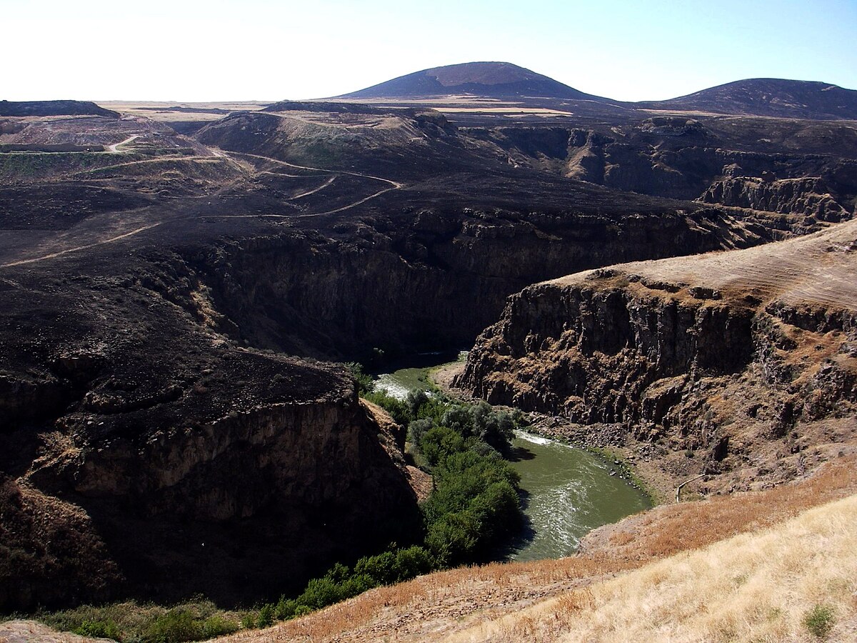
A map of the border region between Russia and the Ottoman Empire, the Southwest Caucasus, in 1914.
Relative to my earlier maps, I have reversed the color scale. This does more justice to the landscape: An open highland with barren mountains and overgrown valleys. This is in contrast to central Europe, where the mountains are densely forested and the lowlands are open.

Relative to my earlier maps, I have reversed the color scale. This does more justice to the landscape: An open highland with barren mountains and overgrown valleys. This is in contrast to central Europe, where the mountains are densely forested and the lowlands are open.
Last edited:
Maybe you could have shown the Arpacay river on the map which now also forms the boundary between Kars and Armenia and always strategicaly and politicaly importantA map of the border region between Russia and the Ottoman Empire, the Southwest Caucasus, in 1914.
Relative to my earlier maps, I have reversed the color scale. This does more justice to the landscape: An open highland with barren mountains and overgrown valleys. This is in contrast to central Europe, where the mountains are densely forested and the lowlands are open.
View attachment 869520
Akhuryan (river) - Wikipedia
Thanks for the feedback! I have added the Akhuryan River to the map.Maybe you could have shown the Arpacay river on the map which now also forms the boundary between Kars and Armenia and always strategicaly and politicaly important
Akhuryan (river) - Wikipedia
en.m.wikipedia.org
Map of Cilicia (part of the Ottoman Empire) showing the construction of the infamous Baghdad railway, also known as Berlin-Baghdad railway. This map concerns the most challenging part of the railway, with the tunnels through the Taurus and Amanus mountains.

At times, over 35,000 workers were employed in the construction of the line, often under extreme and dangerous conditions. "The railway stands for the suffering of Armenian forced laborers." The mountain sections in particular caused considerable difficulties, which repeatedly presented the construction engineers, such as Heinrich August Meißner, with major challenges. The crossing of the Cilician Gates and the Taurus Mountains in Asia Minor are the greatest achievements of this railway construction. The route through the Taurus rises to a maximum height of 1,478 meters. In addition to 37 tunnels over a length of twenty kilometers, which had to be blasted through the rock, bridges and viaducts, including the Gavurdere Viaduct, had to be built.
For the Ottoman Empire, the railway was decisive for the war because it was the only way to ensure that the southern front on the Suez Canal was adequately supplied with troops and weapons and to effectively combat the Arab insurgents.
In 1914, only 1,094 kilometers had been completed. The gaps, mainly due to the unfinished tunnels through the Taurus Mountains, were bridged by narrow-gauge field railroads with a track gauge of 600 mm, which meant reloading all goods each time.
From October 1915, in the course of the Armenian genocide, the railway served as a means of transportation for the systematic deportation of Armenians from their settlement areas towards the Syrian Desert. The construction of the railway was delayed due to the expulsion of Armenian experts and workers; there was also a lack of Armenian doctors in the health service.
Last edited:
Share: