Bob Hope's [Historically correct Coasts and Rivers] Blank Maps

PATCHES 1
View attachment 711449 CASPIAN, ARAL & DANUBE EDITED 17.01.2022.

View attachment 711450 IBERIA

View attachment 708393 LENA RIVER
View attachment 708394 MEANDER & NILE
View attachment 708395 MISSISSIPPI
View attachment 708396 PO
View attachment 708397
SOUTHERN ASIA

View attachment 708399YELLOW RIVER

View attachment 711218 EDITED 16.01.2022. TO INCLUDE FLANDERS

View attachment 709907 RANN OF KUTCH

"Possibly in this period, the delta sedimentation—which now extends the coastline by three miles a century—remained insufficient, and the sea still reached too far inland, to support a population even as large as the modest population of the late precolonial era. Whatever the condition of the coast, all scholars accept that during the 11th century, Pagan established its authority in Lower Burma and this conquest facilitated growing cultural exchange, if not with local Mons, then with India and with Theravada stronghold Sri Lanka. From a geopolitical standpoint, Anawrahta's conquest of Thaton checked the Khmer advance in the Tenasserim coast"

From the Wikipedia page on the Kingdom of Thaton and Anawrahta the founder of Imperial Pagan.

Drawing of the projected coast on a map.
That's much more than I was able to find for this area, have you seen anything else relevant here?
 
You should take out the hydroelectric dam's reservoirs, there lots of them in the Parana river and its tributaries.
 
Incase you want to be more specific about the Netherlands, this video and its sources should help for from 1000 to 1250


for earlier
 
Last edited:
I felt a little sad on the lack of posts I've seen on this awesome thread, and I'm not sure where else to post this lol, but here's my go at some changes to the 600 BC Coastlines in the Middle East
600 BC Old.png

The Template I was using for 600 BC-ish before
600 BC New.png

My attempt at showing some love
600 BC Red Dots.png

What I changed
I'll post the sources that I found if you wish
 
Anyways.

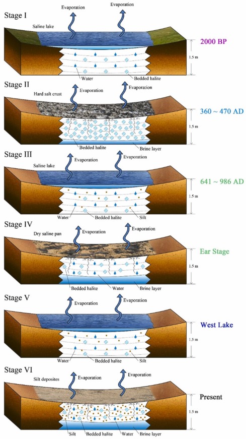
@Bob Hope in case ur still doing that ur coastlines corrected Q-BAM I found this for the Lop Nur


"4.2. The linkage between the Lop Nur's reduction and the decline of the ancient Loulan Kingdom

Historical records and archaeological excavations of ruins in the region indicate that the Loulan Kingdom disappeared in 500 C.E. Our dating results of the shorelines shown on multiple space-borne SAR images indicate that Lop Nur had vanished by 470 C.E."

And there's more of course.

1-s2.0-S2214581822000155-gr8.jpg
 
I felt a little sad on the lack of posts I've seen on this awesome thread, and I'm not sure where else to post this lol, but here's my go at some changes to the 600 BC Coastlines in the Middle East
View attachment 811813
The Template I was using for 600 BC-ish before
View attachment 811814
My attempt at showing some love
View attachment 811815
What I changed
I'll post the sources that I found if you wish

Do you have any patch for the Lop Nur at different time periods?.

 
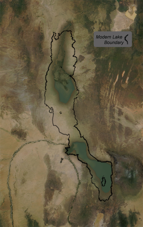
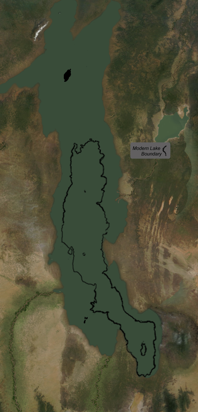
https://education.nationalgeographic.org/resource/paleogeography-lake-turkana/

High Holocene
The Lake Turkana Basin swelled with water approximately 9,000-7,500 years ago. This warmer, wetter time is sometimes nicknamed the African Humid Period. During this time, much of the Sahara desert was transformed to a more lush savannah ecosystem.

high-holocene.jpg


Low Holocene

Following the African Humid Period, very dry conditions led to Lake Turkana actually splitting into two bodies of water. The depth of the water dropped nearly 30 meters (98 feet) at this time. Scientists study the chemical makeup of rocks and sediment to re-construct the environment at this time.

low-holocene.jpg
 
https://education.nationalgeographic.org/resource/paleogeography-lake-turkana/

High Holocene
The Lake Turkana Basin swelled with water approximately 9,000-7,500 years ago. This warmer, wetter time is sometimes nicknamed the African Humid Period. During this time, much of the Sahara desert was transformed to a more lush savannah ecosystem.

Low Holocene

Following the African Humid Period, very dry conditions led to Lake Turkana actually splitting into two bodies of water. The depth of the water dropped nearly 30 meters (98 feet) at this time. Scientists study the chemical makeup of rocks and sediment to re-construct the environment at this time.
Were there any changes in the local ecosystem when the lake split, such as 1 species splitting off or anything in regards to evolution?
 
Top