Well...at least it's well drawn...A warning had been given. Apparently it wasn't heeded.
To ease the mind have some Batman Comic showing the Eastern Europe nation of Markovia
View attachment 742739
You are using an out of date browser. It may not display this or other websites correctly.
You should upgrade or use an alternative browser.
You should upgrade or use an alternative browser.
Return of Horrible Educational Maps
- Thread starter Westphalian
- Start date
Is this another "Turkish Delight" ?Enlarge thumbnail at your own risk.
You have been warned.
View attachment 742115
You. Have. Been. Warned.
Maybe it's my imagination, but Turkic-language maps seem very well-represented in the realm of bad educational cartography
When you have several turkish coffees, drawing lines is hardIs this another "Turkish Delight" ?
Maybe it's my imagination, but Turkic-language maps seem very well-represented in the realm of bad educational cartography
Admittedly this one was (rather obviously) deliberately bad.
Still if you were to try to get some education from it the results could easily be horrible after all...

Still if you were to try to get some education from it the results could easily be horrible after all...
Whew lad. There’s a lot of ethnic slurs in that map.Admittedly this one was (rather obviously) deliberately bad.
Still if you were to try to get some education from it the results could easily be horrible after all...
View attachment 742743
What happened in Kamchatka?Admittedly this one was (rather obviously) deliberately bad.
Still if you were to try to get some education from it the results could easily be horrible after all...
View attachment 742743
Yeah, but as a work of political satire, it's pretty hilariousWhew lad. There’s a lot of ethnic slurs in that map.
*Singapore buys Australia.*Admittedly this one was (rather obviously) deliberately bad.
Still if you were to try to get some education from it the results could easily be horrible after all...
View attachment 742743
Lee Kuan Yew:

Last edited:
It's probably from the American comic and not from the Turkish city of BatmanIs this another "Turkish Delight" ?
Maybe it's my imagination, but Turkic-language maps seem very well-represented in the realm of bad educational cartography
Hahaha! I've wondered before if the good citizens of Batman have ever tried to capitalize on that name for some additional tourism revenue... but given its location way too close to some unpleasant border situations, I'm thinking the answer is "no" ....It's probably from the American comic and not from the Turkish city of Batman
Whew lad. There’s a lot of ethnic slurs in that map.
That is part of the reason why any education from that map would be horrible.
Pic unrelated
No, it's overdone.Yeah, but as a work of political satire, it's pretty hilarious
rip literally every major canal. And every island.That is part of the reason why any education from that map would be horrible.
Pic unrelated
View attachment 743089
And Iran and Turkey.rip literally every major canal. And every island.
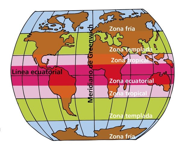
Australia crossing the equator? I guess the continental drift finally caught up.
Also kinda funny that they marked out the Greenwich Meridian while at the same time not depicting the British isles at all...
Keychain largely unrelated (although that Queensland thingie seems to indicate that the yellow blob between Arabia and india is also some Australia north of the equator...)
Unified Ireland.
West German Denmark.
Funky Franco-Belgium border.
Greece East Thrace.
Independent Corsica, Sardinia and Sicily.
Well...it's not the worst map ever.
Mark1878
Donor
Spain was part of NATO and Finland was neutral so the colours are wrong there.Unified Ireland.
West German Denmark.
Funky Franco-Belgium border.
Greece East Thrace.
Independent Corsica, Sardinia and Sicily.
Well...it's not the worst map ever.
But you are like me you have missed the biggest error.
Yes the Communists are red so looks OK
Except.......
Read the colour key at top left.
Last edited:
I...um...yeah...Spain was part of NATO and Finland was neutral so the colours are wrong there.
And you are like me you have missed the biggest error.
Yes the Communists are red so looks OK
Except.......
Read the colour key at top left.
Share:
