Thank you for adding me in.Dropping by to say that as of today the compilation doc is now up to date! The prior update happened in July of 2021.
https://docs.google.com/document/d/14LEJv7zYhiuviBklCwkqw7f8ugOy3eH-PXZ-7rN0jRo/edit#
You are using an out of date browser. It may not display this or other websites correctly.
You should upgrade or use an alternative browser.
You should upgrade or use an alternative browser.
Q-Bam Historical Map Thread
- Thread starter The Alternative
- Start date
-
- Tags
- historical maps q-bam
Posted by "Cryptic_3vil", thought this could be helpful.
He also writes down some names to make the map easier to read...
- Big sky blue one in the south: Al Marah
- Orange one below it: Alkatheery
- Red one in the south: Qahtan
- Yellow one below it: Yam Hamdan
- Brown one in the middle: 'atibah
- Long red one in the north: Harb
- Blue one in the north: Shamr
- Pink one east of the blue one: Thafir
- Olive one at the very top: 'anzah
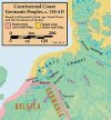
The way memory plays tricks on you is astonishing. I was sure that amidst the Roman maps there was one of Majorian's Empire.
No chance of seeing that, eh?
Western Roman Empire in 461 before his assassination, didn't add the administrative diocese/provinces because I'm not sure when exactly most of them ceased to exist, and I'm not even sure the divisions were even relevant anymore
Thank you very much. You didn't have to do it, but thank you.View attachment 708751
Western Roman Empire in 461 before his assassination, didn't add the administrative diocese/provinces because I'm not sure when exactly most of them ceased to exist, and I'm not even sure the divisions were even relevant anymore
Posted by "Cryptic_3vil", thought this could be helpful.
He also writes down some names to make the map easier to read...
- Big sky blue one in the south: Al Marah
- Orange one below it: Alkatheery
- Red one in the south: Qahtan
- Yellow one below it: Yam Hamdan
- Brown one in the middle: 'atibah
- Long red one in the north: Harb
- Blue one in the north: Shamr
- Pink one east of the blue one: Thafir
- Olive one at the very top: 'anzah
I have, partially as a result of data from @wietze and @James the AH Fan, found data on Jutland.
Interestingly, seems that until about 1250 the Limsfjorden was open at the western end. Its where Cnut gathered his fleet before attacking England. There was also a larger entrance to the north which closed due to Aeolian action {windswept sand].
This is the resulting patch;
 or just Jutland

The full maps have been adjusted Bob Hope's [historically correct coasts and rivers] blank maps
Denmark now looks like this;

Interestingly, seems that until about 1250 the Limsfjorden was open at the western end. Its where Cnut gathered his fleet before attacking England. There was also a larger entrance to the north which closed due to Aeolian action {windswept sand].
Yesss, I've been wanting a North Sea one for a while, needs Jutland though
This is the resulting patch;
The full maps have been adjusted Bob Hope's [historically correct coasts and rivers] blank maps
Denmark now looks like this;
What first got me interested in Historical Coasts was the Rann of Kutch, it was one of the first things I adjusted on my own maps before re-adopting the main map.
Imagine my chagrin when examining my dated maps to find I had completely forgotten to look at that area.
The Rann only started to silt up after an earthquake in 1819 cut off most of it's water and it got refills from the Arabian Gulf on an irregular basis.

I will update the main maps later
EDIT; Updated
Imagine my chagrin when examining my dated maps to find I had completely forgotten to look at that area.
The Rann only started to silt up after an earthquake in 1819 cut off most of it's water and it got refills from the Arabian Gulf on an irregular basis.
I will update the main maps later
EDIT; Updated
Last edited:
I don't know if you have seen these yet but I made a Patch sometime ago for Northern France and Borneo that you might be interested in.I have, partially as a result of data from @wietze and @James the AH Fan, found data on Jutland.
Interestingly, seems that until about 1250 the Limsfjorden was open at the western end. Its where Cnut gathered his fleet before attacking England. There was also a larger entrance to the north which closed due to Aeolian action {windswept sand].
This is the resulting patch;
View attachment 709229 or just Jutland View attachment 709230
The full maps have been adjusted Bob Hope's [historically correct coasts and rivers] blank maps
Denmark now looks like this;
View attachment 709231
There should be edits on Sumatra, Bali and Sulewesi but only Sulewesi do I really trust myself to be able to do accurately.Unrelated and not really the best but

South Borneo Patch for 10,000 BC to 1300 AD based off this video by Lazardi Wong Jogja
And

Northern France in the English Channel, 100 BC to 1040 AD based off this video by Ollie Bye
Last edited:
Hi Pecu,I don't know if you have seen these yet but I made a Patch sometime ago for Northern France and Borneo that you might be interested in.
There should be edits on Sumatra, Bali and Sulewesi but only Sulewesi do I really trust myself to be able to do accurately.
Thanks for these, I try not to use these sorts of Videos, much as I admire them, unless I can get corroborating evidence from elsewhere, otherwise its just relying on someone to have got the right data/ drawn it correctly/ not made a mistake.
However, they are useful in bringing me to areas I didn't know about so thank you for that. I was already looking for data on Indonesia, I'll start looking for northern France.
I assume from your message that you are from Sulawesi, what in particular should I look for there.
Oh, I'm not from Sulawesi but I did see something some year ago on Sulawesi's coastline haven changed in historical times.Hi Pecu,
Thanks for these, I try not to use these sorts of Videos, much as I admire them, unless I can get corroborating evidence from elsewhere, otherwise its just relying on someone to have got the right data/ drawn it correctly/ not made a mistake.
However, they are useful in bringing me to areas I didn't know about so thank you for that. I was already looking for data on Indonesia, I'll start looking for northern France.
I assume from your message that you are from Sulawesi, what in particular should I look for there.
Okay, I think I will b able to find the source that France Map is based on, if I do I'll link it here.
ThanksOh, I'm not from Sulawesi but I did see something some year ago on Sulawesi's coastline haven changed in historical times.
Okay, I think I will b able to find the source that France Map is based on, if I do I'll link it here.
The data is contradictory. Whilst it is obvious there are some changes in the area the sources differ.Oh, I'm not from Sulawesi but I did see something some year ago on Sulawesi's coastline haven changed in historical times.
Okay, I think I will b able to find the source that France Map is based on, if I do I'll link it here.
I think Ollie has taken his coastline from this prediction of global warming
that last wikipedia(?) source if def just the modern coastline.The data is contradictory. Whilst it is obvious there are some changes in the area the sources differ.
View attachment 710470View attachment 710471View attachment 710472
I think Ollie has taken his coastline from this prediction of global warming
View attachment 710473
came from a French website; https://www.thelocal.fr/20190527/where-in-france-will-be-most-affected-by-rising-sea-levels/that last wikipedia(?) source if def just the modern coastline.
i meant this onescame from a French website; https://www.thelocal.fr/20190527/where-in-france-will-be-most-affected-by-rising-sea-levels/
Attachments
You're right, I hadn't realisedi meant this ones
Okay, thanks for educating me on the dangers of relying heavily in video mappers.The data is contradictory. Whilst it is obvious there are some changes in the area the sources differ.
View attachment 710470View attachment 710471View attachment 710472
I think Ollie has taken his coastline from this prediction of global warming
View attachment 710473
However, I found this for the Niger-Delta of which data on the paper was being gathered starting from the 1980s.
Never ever, ever, use youtube mappers as sources. These videos are primarily for entertainment, not as an actual resource. There's a reason they never put their sources in the video or the description. These videos should only be used to do further research on nations in the area, not as a borderpool.
As for the Walloonian coast
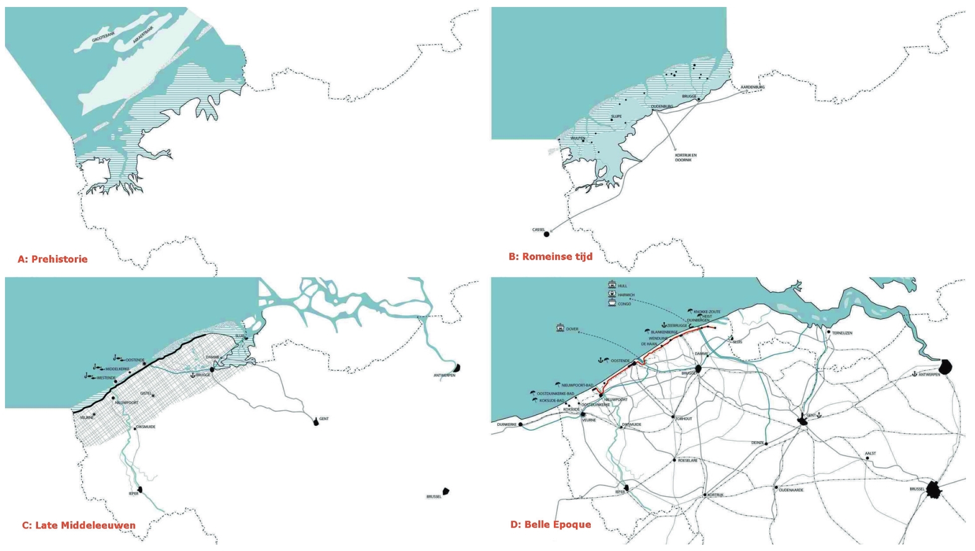

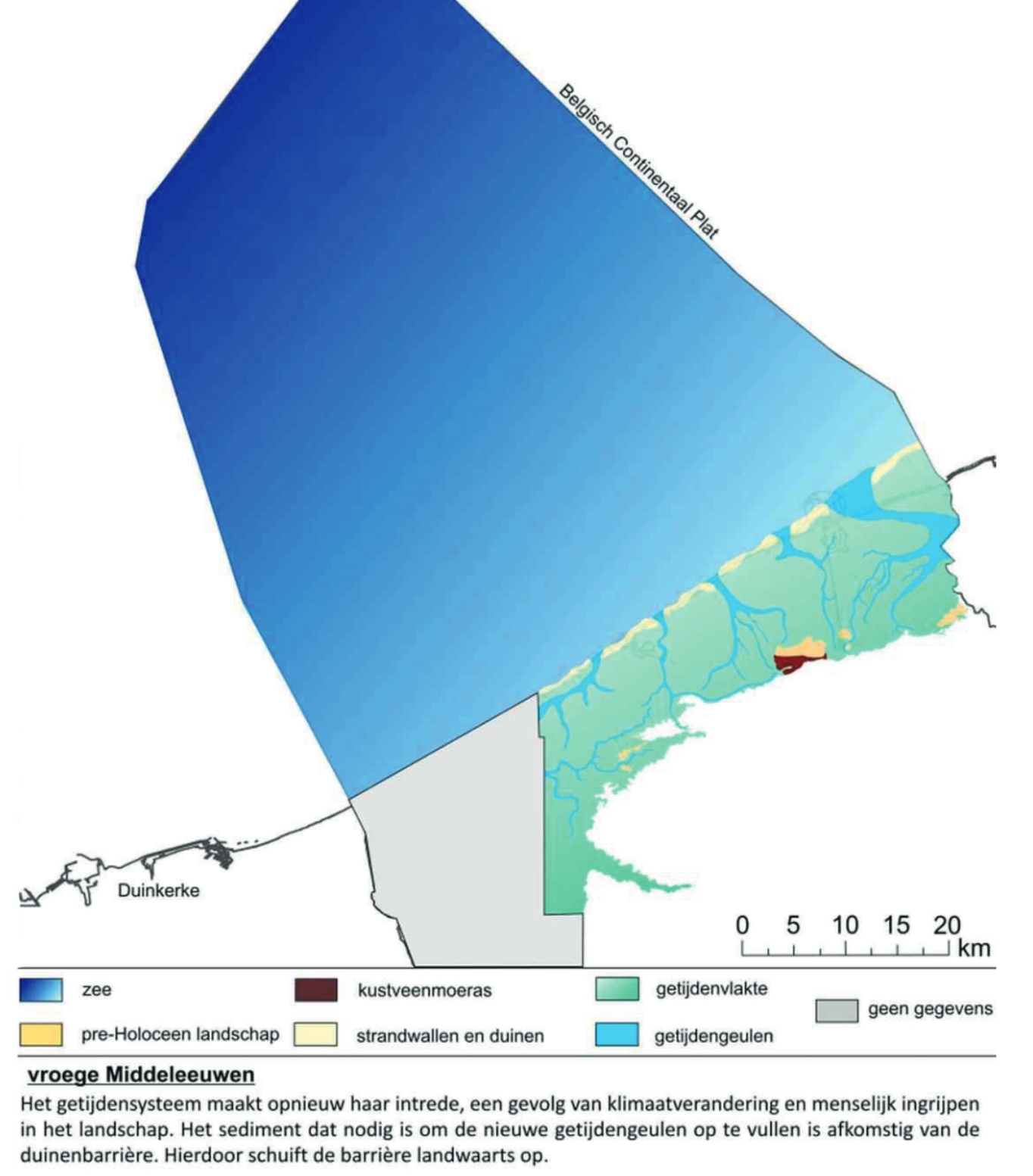

As for the Walloonian coast
Yes, I've seen various of these, they all say the coast advances in some areas and recedes in others but none of them give any details.Okay, thanks for educating me on the dangers of relying heavily in video mappers.
However, I found this for the Niger-Delta of which data on the paper was being gathered starting from the 1980s.
Wow, only the last comes up in image search, what is the source?Never ever, ever, use youtube mappers as sources. These videos are primarily for entertainment, not as an actual resource. There's a reason they never put their sources in the video or the description. These videos should only be used to do further research on nations in the area, not as a borderpool.
As for the Walloonian coast
Share: