FWIU the "korenization" method in Central Asia was a rather fraught process... certain ethnicities almost being created out of whole cloth, based on the preponderance of the local dialect.... made more difficult by the fact that when some local inhabitants were asked about their tribal or ethnic identity, they'd simply answer "Muslim"....
You are using an out of date browser. It may not display this or other websites correctly.
You should upgrade or use an alternative browser.
You should upgrade or use an alternative browser.
Proposals and War Aims That Didn't Happen Map Thread
- Thread starter Beedok
- Start date
Of course, the Tajiks had a unique situation in that they are Persian, unlike the majority of the Central Asian inhabitants, who are Turkic in one form or another.FWIU the "korenization" method in Central Asia was a rather fraught process... certain ethnicities almost being created out of whole cloth, based on the preponderance of the local dialect.... made more difficult by the fact that when some local inhabitants were asked about their tribal or ethnic identity, they'd simply answer "Muslim"....
Even then though, the lines weren't completely clear, especially in urban areas like Samarkand and Kokand (and, judging from the map, Bukhara)... from what I've read, in the cities the Turkic dialects were under heavier Persian influence, than in the nomadic/semi-nomadic tribes on the steppes... where one ended and the other began was sort of a term of artOf course, the Tajiks had a unique situation in that they are Persian, unlike the majority of the Central Asian inhabitants, who are Turkic in one form or another.
")
In the Russian Empire, the epithet "Sart" (now maybe considered derogatory) was used for town-dwellers, while in rural areas Khirgiz, Khazakh, or Turkmen were assigned as appropriate... but the lines between them were a bit blurry....
Was there even a Tajik minority in Bukhara and Samarkand?
Yes, and still is - according to some sources Tajiks are still the ethnic majority in both, though not all still speak Tajik as a 1st language.Was there even a Tajik minority in Bukhara and Samarkand?
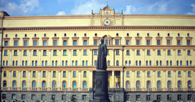
Operation Cedar was a plan put together by the KGB from 1959-1972, with the aim to disrupt operations across the U.S., Canada, and Western Europe. While it was ultimately never put into action, and some of these never got far beyond the planning stage, it could've included the following:
- Destroying the Hungry Horse Dam. This attack was to begin 3 kilometers (2 mi) down the South Fork River, where operatives would destroy pylons on top of a mountain to knock out power transmission from the dam, after which they would seize control of it the following night and sabotage it. There were also plans to do the same with the Flathead Dam.
- Destroying oil and gas pipelines and refineries across Canada "from British Columbia to Montreal."
- Cutting a pipeline running from el Paso, Texas to Costa Mesa, California.
- Destroying key power stations along the Delaware River to cut power to New York state. Once power had been sufficiently disrupted, operatives would then move into New York City and begin planting explosives to destroy piers and warehouses.
- Plans for targeting oil pipelines, fuel and lubricant depots, and electrical substations in West Germany.
- Plans for targeting power transmission lines, oil pipelines, bridges, tunnels, and military installations "within a 120-km radius of selected sites in Italy."
- Caches of arms hidden throughout West Germany, Switzerland, Italy and presumably others to destroy railroads, transmission lines and radio towers
- A plan to distract Western public opinion from the Prague Spring by sabotaging a major pipeline near the Bodensee, which was also calculated to pollute the water supplies for West Germany and Austria.
That part alone would have started WWIII had the West found out the Soviets did it.Operation Cedar was a plan put together by the KGB from 1959-1972, with the aim to disrupt operations across the U.S., Canada, and Western Europe.
Source?

Top 5 KGB operations on U.S. soil
Russia's famed intelligence agency was often successful in getting American secrets.
 bigthink.com
10 Dastardly Secret Operations Of The KGB - Listverse
Like the CIA, the Soviet (and now Russian) spy agency known as the KGB has engaged in decades of secret operations across the world, ranging from
 listverse.com
This is cool!Proposals for the borders of the nascent United States during the Paris conference, quoting wikipedia:
French Proposition:

And the Spanish Proposition:

In case anyone is interested in making maps, the description of the borders proposed by Spain are:
"Let us start at the western end of Lake Superior and follow the lake shores along as far as the end of Lake Erie or Oswego. These are positions which cannot leave lands back of them in dispute." [...] "Now we will drop the line down to the confluence of the Grand Kanawha with the Ohio," he continued, "thence to the apex of the innermost [i.e. westernmost] angle of South Carolina, so as to continue the demarcation toward some outstanding point, say a lake [Ou the Mitchell's Map used by the negotiators there is single lake near the boundary of East Florida, about 83° west longitude.], in the Apalache country, or the river George [the Altamaha river], without however going all the way, simply marking the beginning of the line so as to indicate it would go that way. We would have to stop before we get to the boundary of Georgia or of Florida until we know what their real boundaries are." Altamaha River is chosen in this representation.
Like, just the existence of the plans? I think we'd have a couple dozen WWIIIs by now if plans were impetus for either side to attack.That part alone would have started WWIII had the West found out the Soviets did it.
Nah, we’ve had worse things actually happen and war didn’t break out.That part alone would have started WWIII had the West found out the Soviets did it.
That's a very crude map. This one from wikipedia is more accurate even though it's a little later:What if Belgium had been given all of the Netherlands' Catholic lands, though.

No, like if the plan went throughLike, just the existence of the plans?
Today I learned that after Free France captured St. Pierre and Miquelon during Christmas of 1941 that the British and Americans proposed "neutralization" of the islets because of their still-existent ties to the Vichy regime... by having a joint occupation of the place by US and Canadian forces. Secretary of State Cordell Hull initially wanted to return the islands to Vichy France as soon as possible, while Churchill made the counterproposal of continued occupation, just by anyone but either French government.
If that compromise were to be accepted by de Gaulle, that may have led to the islands being given the option to either rejoin France or potentially to join Canada, something which French Canadians may insist to be put up for referendum because during the course of the war French Canadians were quite supportive of Pétain and his policies, especially in regard to his patronage of Catholicism. That last part is pure speculation but it might be the only way that that territory could realistically be attached to Canada outside of an earlier Franco-British War in the 19th or early 20th century.
If that compromise were to be accepted by de Gaulle, that may have led to the islands being given the option to either rejoin France or potentially to join Canada, something which French Canadians may insist to be put up for referendum because during the course of the war French Canadians were quite supportive of Pétain and his policies, especially in regard to his patronage of Catholicism. That last part is pure speculation but it might be the only way that that territory could realistically be attached to Canada outside of an earlier Franco-British War in the 19th or early 20th century.
Why exactly is Bulgaria gaining territory? Were they expecting Bulgaria to be on the Allied side?
Also, why is Serbia losing land to the south if the Allies win?
Entente is there REALLY nice to Bulgaria... while I can maybe see Romania and Serbia (damn, still no sea port or Dalmatia isn´t going to Italy?) compensated for their losses, im less sure about Greece /strip of northern Epirus for western Thrace? not seems as good deal to me)
Also, Austria annexing all of Serbia (and Albania) is hillarious
Also, Austria annexing all of Serbia (and Albania) is hillarious
i think its supposed to show them gaining all of macedoniaWhy exactly is Bulgaria gaining territory? Were they expecting Bulgaria to be on the Allied side?
Also, why is Serbia losing land to the south if the Allies win?
Why exactly is Bulgaria gaining territory? Were they expecting Bulgaria to be on the Allied side?
Also, why is Serbia losing land to the south if the Allies win?
Given the text of the newspaper article in the link it seems that the map maker accidentally put Bulgaria's gains on the wrong map.
Share: