WIP Map Thread

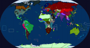
i'm working on an AH cold war map where the UN is never formed and having a devil of a time deciding which of these is more plausible for 1950

mNDATE.png
 
Something (loosely) based on Tirant lo Blanch, a chivalric romance notable for being an early alternate history story and also apparently one of Miguel de Cervantes' favorites in the genre. The story goes that an exceptional knight from Brittany goes around fighting Arabs and Turks in North Africa and the Middle East, and manages to resurrect the Eastern Roman Empire but dies just before he can become Emperor. The scenario I'm going with here follows that in broad strokes (including the ERE returning to something of its former glory and a 100-year peace with the Turks, both from the epilogue), but is closer to actual history in the details (for instance, the Emperor that asks Tirant for help wouldn't be "Frederick" but, probably, John VIII Paialogos). The ERE gets back on its feet and consolidates its holdings in Europe, and, now that I think of it, might end up taking some of the former Serbian Empire based on a highly questionable claim via Helena Dragaš; in any case, the real star of the show in Eastern Europe is the collection of lands under Jagiellonian rule, an immense military and economic power that's extended its considerable influence into the Balkans and the Russian states.

I'm planning on the final map to be vector-based, so this is basically just a sketch.
Screenshot 2021-01-05 110732.png
 

xsampa

Banned
Not sure: that would tend to make it look Prussian dominated, and I wanted to give the idea of a fairly equal partnership between the NEU and Prussia's wee North German Confederation [1]

[1] Wee by the standards of Monarchy world's mega-states.
Wouldn’t the megastates have multiple layers of governance?
 
A not terribly original crapsack world I've been working on on and off.
As you can probably tell, needs a legend, notes, neater borders and some overall tidying up.
 

Attachments

  • 2mrise.png
    2mrise.png
    126.6 KB · Views: 245

SuperZtar64

Banned
So I was re-reading Look to the West and I realized, to my horror, that in the year of our lord 2021 Thande is still using the old rectangular worlda map from well over a decade ago as the base for his world maps.

And, to my knowledge, somehow no one has tried to apply the timeline to the modern worlda format, so i'm taking it upon myself to fix that conundrum. I decided to start with a 1727 map, the POD year, to get my bearings and make all the future maps far easier to make, but it's... hard. North America is killing me and I don't even want to think about Central Asia or what to map in the Caucasus. Germany is still staring at me like a black hole on the face of Europe too but I am absolutely determined to make this into something workable. I plan to swiftly go onto 1748, 1759, 1766, 1772, and 1793 before reassessing from there.
LTTW1727new.png


(If anyone has any sources for these areas, please, let me know, thanks...)
 

xsampa

Banned
One of the maps on my towering, tottering WIP stack is a redo of Tony Jones' "Monarchy World", with some modifications such as Prussia not being idiots and forming an alliance with the NEU countries. Now, to distinguish them as a group, I want a color scheme, and I initially went for shades of light orange to go with Dutch orange, but upon inspection it doesn't contrast enough with British pink. I want to use a color that will stand out from British pinks and dark low saturation reds as well as Russian dark greens and Chinese imperial bright greens: any suggestions?

This is Europe so far.

View attachment 611905
Are you going to distinguish between colonies and the metropole?
 
So I was re-reading Look to the West and I realized, to my horror, that in the year of our lord 2021 Thande is still using the old rectangular worlda map from well over a decade ago as the base for his world maps.

And, to my knowledge, somehow no one has tried to apply the timeline to the modern worlda format, so i'm taking it upon myself to fix that conundrum. I decided to start with a 1727 map, the POD year, to get my bearings and make all the future maps far easier to make, but it's... hard. North America is killing me and I don't even want to think about Central Asia or what to map in the Caucasus. Germany is still staring at me like a black hole on the face of Europe too but I am absolutely determined to make this into something workable. I plan to swiftly go onto 1748, 1759, 1766, 1772, and 1793 before reassessing from there.

(If anyone has any sources for these areas, please, let me know, thanks...)

There was this old thread where some others tried to create a series of maps for LTTW. If this doesn't supplant your project, I think their work should come in handy.
 

SuperZtar64

Banned
There was this old thread where some others tried to create a series of maps for LTTW. If this doesn't supplant your project, I think their work should come in handy.
thank you, i'll keep it in mind when I get to the 19th century. I like to do all my maps from scratch even when I have a basemap but I'll use the borders in my later additions, if I ever get that far.
 
1610793592902.png


In the past I've almost always found that posting a map here makes me psyche myself out and never finish it... here's hoping this one bucks the trend!
 
unknown.png


Well, still working on the Runeterra map, in general now I just need to put the cities and region names, I'm not sure about the aesthetic I chose, maybe I'll change it; I updated the coasts and rivers of Ionia with a better render than the official map

PS: Taking advantage of the occasion, I was never sure but I suspect that the projection of the official map is a Mercator projection, but it seems wrong? Supposedly the two lines above the equator (the three lines were taken from a development image of the official map) are the tropic and polar circle of the northern hemisphere of the planet, but I'm not sure about that (nor if these lines are canonical today), besides that supposedly this whole map is only about 1/6 of the entire planet? So idk, if anyone can confirm that it is a Mercator projection I would be very grateful
 
Tentatively messing around with filters and effects for a commission of a Confederate wank. Full map is going to include both North and South America.

O52vCvQ.jpg
 
1611396670036.png


Basically just have to add labels and a key (and a writeup... and I should probably mess more with the colors...) and then I'll be done!
 
Last edited:
Top