You are using an out of date browser. It may not display this or other websites correctly.
You should upgrade or use an alternative browser.
You should upgrade or use an alternative browser.
Request Maps/Flags/Coats of Arms/Heraldry here, II
- Thread starter Pragmatic Progressive
- Start date
Best I can do I'm afraid:I like this idea.
I know how the flag should look like!
Take this flag, add yellow in the shield (while the borders are still black), and in the center of the shield, add a pillar in it.
What do you think?
View attachment 599602
Ok, you were right in wanting some image, that's awful.
A lot of graveyards here, so:
- First row is what your request seemed to be, with three lines. (1: adidas; 3: dead circus; 4: dead on a tree-sided road)
- Second row: the attributes you linked should be, if I remember correctly, for separation lines. Meaning with three you get four fields. Even like this there isn't one that should be acceptable in heraldry. (1: dead of the mountain range; 2: the buried graveyard; 3: dead under the sea; 4: some fence)
- Third row: a cake, trees growing in a cemetery, and a couple with less dead.
- Fourth row: probably the only one acceptable in heraldry (if it is), next a test for vouté and in the end our inevitable saxon friend.
Now that you made me work, I expect to see your final design when you will have one.
A slightly different thought on it all:Thanks. I now see what you meant.
Will definitely post my design when final!
This is perfect!Best I can do I'm afraid:
View attachment 612814
I will take it!
Thank you very much!
I will credit you using the @ on my story thread.
Last edited:
I have a symbol request, can someone create a symbol of two hands holding a spiral galaxy?
Best I can suggest is following some of the links in the footnotes on this page: https://en.wikipedia.org/wiki/Sixth_Periodic_Review_of_Westminster_constituenciesDoes anyone have a copy of the original 2013 uk boundary review?
You might want to look here too: https://www.electoralcalculus.co.uk/boundaries2013.html
Thank youBest I can suggest is following some of the links in the footnotes on this page: https://en.wikipedia.org/wiki/Sixth_Periodic_Review_of_Westminster_constituencies
You might want to look here too: https://www.electoralcalculus.co.uk/boundaries2013.html
@Jay An
You've re-posted the same request a few times over the last four weeks without any response, so I think it's unlikely that anyone feels able to do it at the moment. This might just be to do with the season, but it may be that no-one will respond - sorry.
(I'm not a map-maker, so I can't help at all.)
Based on the fact that you've been asking since July it is fair to conclude that the resounding lack of a response indicates NO.Can SOMEONE PLEASE FOR god's sake make a Wikipedia style map of the Korean Peninsula with North Gangwon and Gangwon into One province, Sejong City is there, Gyeonggi Province splits into North and South Gyeonggi (see https://en.m.wikipedia.org/wiki/Partition_of_Gyeonggi_Province), Dokdo is in it, Pyongyang is in the map, And also this aswell, The Committee for the 5 Northern Korean Provinces up north
Just atleast edit the wiki photo by erasing and redraw the border lines
With this images
It happens. Let it go.
Hello everyone,
So I need a present day map of South Asia with its subdivisions, in QBAM.. Does anyone in here have access to that?
So I need a present day map of South Asia with its subdivisions, in QBAM.. Does anyone in here have access to that?
There's one in the main QBam thread.Hello everyone,
So I need a present day map of South Asia with its subdivisions, in QBAM.. Does anyone in here have access to that?
So I need a present day map of South Asia with its subdivisions, in QBAM.. Does anyone in here have access to that?
See post 3305 for a link to the whole QBAM (as of 20 Oct 2020), from which you can crop out what you want.There's one in the main QBam thread.
Not an editable map and also without climate stuff but these sites should be able to show 1 meter rise.
Thanks. Too bad I am......not that great at maps. Or drawing.
I'm looking for two maps
1. A blank unterraformed Venus map, one that shows the cloud cover rather than the theoretical continents.
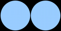
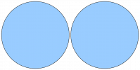
2. A map divided into two circles, each representing a hemisphere
1. A blank unterraformed Venus map, one that shows the cloud cover rather than the theoretical continents.
2. A map divided into two circles, each representing a hemisphere
I'm looking for two maps
1. A blank unterraformed Venus map, one that shows the cloud cover rather than the theoretical continents.
2. A map divided into two circles, each representing a hemisphere
Ummmm, what would a cloud map even show? It is just clouds. Wouldn't just having a monocolored sphere be enough?
Also Hemisphere map for Earth or Venus?
I actually found an image containing the basemap I'm looking for, I just can't find the basemap itselfUmmmm, what would a cloud map even show? It is just clouds. Wouldn't just having a monocolored sphere be enough?
Also Hemisphere map for Earth or Venus?

So if someone could find this Venus map (which I swear I've seen elsewhere) that'd be great
As for the hemisphere map I just need it blank at first, with only water. I'm drawing the land myself
Try post 491 in the Alternate Planets, Suns, Stars and Solar Systems thread. It has the same image as the one you posted, plus basemaps.I just can't find the basemap itself
So basically just two blue circles?As for the hemisphere map I just need it blank at first, with only water. I'm drawing the land myself
Here's two options - one with a black background and one with a transparent background. The latter has a black border to the hemispheres so the blue circle is a few pixels smaller.

 (click the thumbnails for the full-size versions)
Share: