He did that in M-BAM, not Q-BAM.I think @Drex already did a proposed states of Brazil patch....
You are using an out of date browser. It may not display this or other websites correctly.
You should upgrade or use an alternative browser.
You should upgrade or use an alternative browser.
The Q-BAM Improvement and Core Thread
- Thread starter iori
- Start date
He did that in M-BAM, not Q-BAM.
Wrong, in 8K-BAM.
I just realized the problem. There's no patch of the municipalities of Brazil!
First off, I just wanted to say; I really admire your work. It's an incredible accomplishment and everybody who's worked to make the Qbams deserves a heavy hand of applause.
Just wondered though, why is there a thousand year gap before the AWoI ? Also, is there anywhere that has a record of maps from the medieval period/Early-early modern period? Specifically interested in around 1200, 1400 and 1650.
Just wondered though, why is there a thousand year gap before the AWoI ? Also, is there anywhere that has a record of maps from the medieval period/Early-early modern period? Specifically interested in around 1200, 1400 and 1650.
Last edited:
They are in the Q-BAM Historical Maps Thread.First off, I just wanted to say; I really admire your work. It's an incredible accomplishment and everybody who's worked to make the Qbams deserves a heavy hand of applause.
Just wondered though, why is there a thousand year gap before the AWoI ? Also, is there anywhere that has a record of maps from the medieval period/Early-early modern period? Specifically interested in around 1200, 1400 and 1650.
Alongside the various religious, linguistic and ethnic maps, I think a population density Worlda/Qbam may also be needed, with major urban centers outlined
So... San Quintin Municipality has finally split off from Ensenada Municipality this February. A patch is needed there.
Also, borders of the Baladiyat of Libya are here. Someone should start working on it.
Also, borders of the Baladiyat of Libya are here. Someone should start working on it.
Last edited:
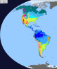
Question: Why do some Mexican states have second- or third-level subdivisions, but the rest have fourth-level subdivisions?
Municipalities are the standard second level subdivision of Mexico. However some states merge them into larger areas while others do not.Question: Why do some Mexican states have second- or third-level subdivisions, but the rest have fourth-level subdivisions?
While working on my historical map I realized that the border between Alberta and British Columbia should match with the western border of Glacier County in Montana, I would try to fix this myself, but I don't know exactly where is the problem: Canada, the US counties or both


The placement of the reservation is the problem. Where the Continental Divide is, is where Glacier National Park is.I don't know exactly where is the problem: Canada, the US counties or both
While working on my historical map I realized that the border between Alberta and British Columbia should match with the western border of Glacier County in Montana, I would try to fix this myself, but I don't know exactly where is the problem: Canada, the US counties or both
View attachment 593448View attachment 593449
I don't know the relation between Reservations and National Parks, but could national parks exist within Indian ReservationsThe placement of the reservation is the problem. Where the Continental Divide is, is where Glacier National Park is.
View attachment 593477
I have been revising the whole border, and I found the same problem with counties in Minnesota, however there, the difference is not that remarkable (just one pixel at first) but the further west you go, the greater the difference...The placement of the reservation is the problem. Where the Continental Divide is, is where Glacier National Park is.
I realized that Canada borders correspond to older versions of the Qbam map, is it possible then, that the borders in Canada should be patched?
Last edited:
Share: