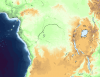
Well specifically I was hoping for the Congo Basin at the moment. I might need other parts of the world later on but I'll cross that bridge when I get to it.no, but i can help u out what region do u need?
You are using an out of date browser. It may not display this or other websites correctly.
You should upgrade or use an alternative browser.
You should upgrade or use an alternative browser.
The XK-BAM map series
- Thread starter Klime
- Start date
Caspian Sea level fell from -26 to -28 meters below Ocean level. It's part of cyclic hesitation of Caspian Sea level during HoloceneFirst, why is the Caspian Sea different between 1930 and 2019? what caused it to shrink just like the Aral did?
good luck on whatever ur doingWell specifically I was hoping for the Congo Basin at the moment. I might need other parts of the world later on but I'll cross that bridge when I get to it.
Attachments
This can be of help about the Caspian Sea levelsI have two questions.
First, why is the Caspian Sea different between 1930 and 2019? what caused it to shrink just like the Aral did?
View attachment 582357
Second, in the 2019 2K map there are missing administrative divisions for Belize, Guatemala, El Salvador, Haiti, the Dominican Republic, the UK, Iceland, Switzerland, Croatia, Bosnia, Albania, Montenegro, Macedonia, Moldova, Latvia, Armenia, Azerbaijan, Jordan, the UAE, Kuwait, Qatar, Bhutan, and the Philippines.
Will it be updated soon? tell me because if it isn't then I'll try to make my own administrative divisions for use in my personal maps, not for the official 2K one.
Little Markerwaard patch for you all
Also the 2015 proposed Venezuelan state of Esequibo,
good luck on whatever ur doing
I was hoping for a softer gradient than the normal base topographic map, as that already has info for a change every 100m, but thanks for the help nonetheless!
Last edited:
2K Bam patch for the Viceroyalty of the Rio de la Plata, around 1806 or so. Some sources cite Puno as part of Peru at the time, so in case you wanna go with that, you might wanna change the Peru-Upper Peru Border around the Titicaca to the modern border.
How did no one fix this in 2 years but on the 8k blank map in Klime's folder SA borders are still there:

In addition on the South African coast in topographic and other maps there is no black coast line
This is true on the rivers map, on the climate map, etc
Also how does a diagonal one pixel wide coastline work? Surely the coastline is rarely matching the diagonal and would be in one of the corner tiles? It seems like as nice as single pixel lines look it should be extremely rare for them to occur. For the coast line to line up exactly at the corner seems unlikely
Before:

After:

I have fixed the coastline and lakes not connected to borders but I have no idea how I'm meant to know which pixels should be water/land or water in the Eswanti/Lesotho/South Africa borders
I know this is a few hundred pixels different in size but the coast is different almost in every pixel.
What are the rulers for the three colours?
Land: 90% land?
Coast: 50% land 50% water? (This would lead to some rare tiles where this is no coast tile between land and water because the border is at the edge?
Water: 90% water
Indeed what are the rules for country borders too?
In addition on the South African coast in topographic and other maps there is no black coast line
This is true on the rivers map, on the climate map, etc
Also how does a diagonal one pixel wide coastline work? Surely the coastline is rarely matching the diagonal and would be in one of the corner tiles? It seems like as nice as single pixel lines look it should be extremely rare for them to occur. For the coast line to line up exactly at the corner seems unlikely
Before:
After:
I have fixed the coastline and lakes not connected to borders but I have no idea how I'm meant to know which pixels should be water/land or water in the Eswanti/Lesotho/South Africa borders
I know this is a few hundred pixels different in size but the coast is different almost in every pixel.
What are the rulers for the three colours?
Land: 90% land?
Coast: 50% land 50% water? (This would lead to some rare tiles where this is no coast tile between land and water because the border is at the edge?
Water: 90% water
Indeed what are the rules for country borders too?
Last edited:
Ya this "border" between land and sea gave me a lot of confusion working on higher and lower sea levels, there doesn't seem to be a standard other then somehow some GIS program outputted themHow did no one fix this in 2 years but on the 8k blank map in Klime's folder SA borders are still there:
View attachment 590857
In addition on the South African coast in topographic and other maps there is no black coast line
This is true on the rivers map, on the climate map, etc
Also how does a diagonal one pixel wide coastline work? Surely the coastline is rarely matching the diagonal and would be in one of the corner tiles? It seems like as nice as single pixel lines look it should be extremely rare for them to occur. For the coast line to line up exactly at the corner seems unlikely
Before:
View attachment 590860
After:
View attachment 590861
I have fixed the coastline and lakes not connected to borders but I have no idea how I'm meant to know which pixels should be water/land or water in the Eswanti/Lesotho/South Africa borders
I know this is a few hundred pixels different in size but the coast is different almost in every pixel.
What are the rulers for the three colours?
Land: 90% land?
Coast: 50% land 50% water? (This would lead to some rare tiles where this is no coast tile between land and water because the border is at the edge?
Water: 90% water
Indeed what are the rules for country borders too?
Ya this "border" between land and sea gave me a lot of confusion working on higher and lower sea levels, there doesn't seem to be a standard other then somehow some GIS program outputted them
As a community I hope we can come together and make a decision on this . What did you end up deciding?
Edit: I made a thread on this topic I hope you can share your experience there
Too many soviet-era reservoirs in Russia.here's an 1836 map made by someone on discord
Flevoland does not exist yet.
What is a good source to see all of the post-WWII reservoirs built in the USSR?Too many soviet-era reservoirs in Russia.
I don't know.What is a good source to see all of the post-WWII reservoirs built in the USSR?
But you could go on google maps and just look at which lakes have dams at their start (Also basically all the lakes along the course of the Volga, Don and Dnieper are reservoirs.

Narva, Cheboksary, Gorky, Veselovskoye, Proletarskoye, Krasnodar reservoirs are not shown here.
This is brilliant, I've been looking for something like this for ages.
Not the OP but I patched them inNarva, Cheboksary, Gorky, Veselovskoye, Proletarskoye, Krasnodar reservoirs are not shown here.
EDIT: So there are a lot of dams/hydro-plants missing on this map (referring to labels), especially in Brazil. To put it bluntly, essentially every single black pixel inside Brazil is a dam. With that in mind, I tried working on a 2nd patch, but it became way to clustered.
Last edited:
Share: