Map Thread XIX

Status
Not open for further replies.
"It’s a Bandal/Vandal (Romance North African) map of the alexandrine Roman Protectorate (Autoritu) of what is a continuation of the semi legendary Batembuzi (Temvuzi) kingdom, a kingdom which IRL is supposed to have existed in Uganda at the turn of the last millennium, before the Kitara Empire"

Nicely done. Does it say "Sylvan Anarchy" in that area to the West?
 
Not AH, it's an OTL anachronous map of the western Balkans showing Slavic states throughout the middle ages (hence the overlapping borders), but hey, maybe I got the borders a little wrong, so technically, it is AH, just with a very small, inconsequential POD (really, I just don't know where else to put a map). It shows the Banate of Bosnia, not the kingdom, which was much, much larger. I'm mainly avoiding it because too many overlapping borders would be a big mess. OBV, not every border change between 610 and 1325 can be shown this one map, it's just a snapshot, showing mostly just the major stuff.

FwjpVBO.jpg
 
Not AH, it's an OTL anachronous map of the western Balkans showing Slavic states throughout the middle ages (hence the overlapping borders), but hey, maybe I got the borders a little wrong, so technically, it is AH, just with a very small, inconsequential POD (really, I just don't know where else to put a map). It shows the Banate of Bosnia, not the kingdom, which was much, much larger. I'm mainly avoiding it because too many overlapping borders would be a big mess. OBV, not every border change between 610 and 1325 can be shown this one map, it's just a snapshot, showing mostly just the major stuff.

Interesting. There certainly has been a fair amount of population movement over the centuries. What time period is represented by the colored areas labelled on the map as "K. of Croatia" and "GP of Serbia?" (I'm a touch confused, since the medieval black border for Serbia about matches the blue fill for Serbia, but the black border for Croatia extends well beyond the green area. )
 
Not AH, it's an OTL anachronous map of the western Balkans showing Slavic states throughout the middle ages (hence the overlapping borders), but hey, maybe I got the borders a little wrong, so technically, it is AH, just with a very small, inconsequential POD (really, I just don't know where else to put a map). It shows the Banate of Bosnia, not the kingdom, which was much, much larger. I'm mainly avoiding it because too many overlapping borders would be a big mess. OBV, not every border change between 610 and 1325 can be shown this one map, it's just a snapshot, showing mostly just the major stuff.

FwjpVBO.jpg

I would like to give this 100 likes, but the board won't let me.
 
In all these post-apocalyptic settings with historical allusions for place or country names, it makes me wonder who comes up with this in-universe.
 
Interesting. There certainly has been a fair amount of population movement over the centuries. What time period is represented by the colored areas labelled on the map as "K. of Croatia" and "GP of Serbia?" (I'm a touch confused, since the medieval black border for Serbia about matches the blue fill for Serbia, but the black border for Croatia extends well beyond the green area. )

Ah yes, I see how that would be a bit confusing. The black shows initial settlement areas. The black borders show the land that emperor Heraclius let the Serbs settle, the black shows the 2 original Croatian duchies. The coloured areas show the borders of the Kingdom of Croatia and the Grand Principality of Serbia in the early Middle Ages.

OFC, all of the borders are very rough as they were not super clear things at the time.
 
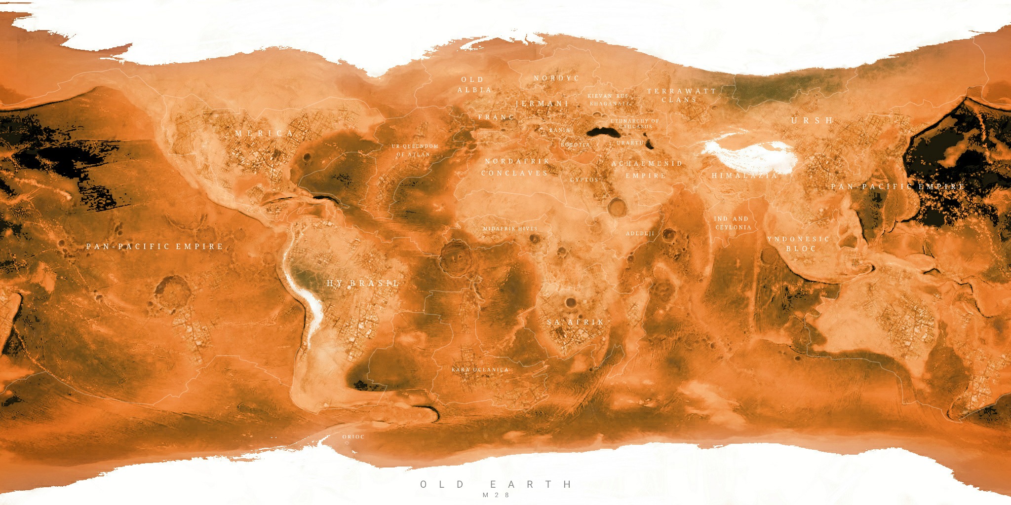
thanks this is from captive state right

not to be rude but what I meant by a map of earth from captive state was a world map of earth just after the aliens took over and I also want a writeup of the lore.
Dude, it's generally not considered good form to just demand stuff from people after they already made a map for you. Even if you were paying them that was pretty excessively blunt.
 
ALT1 1_1938.png

The Great Eurasian Revolution:
This is a map of an ATL of my 1914-Timeline (I have several names but haven't decided yet. Current front-runner is "The Springtime Revolution") in which the Entente (France, British Empire, Belgium, Hungary) won WW1 instead of the Allies (Germany, Russia, Bohemia-Galicia, South Slavia, Romania, Afghanistan and Iran (last two very nominally mostly just allowing Russian armies to cross into British India)). This is 20 years after the end of WW1.
Some other things not on this map:
1. Austria-Hungary was partitioned by Russia and Germany in 1914 before WW1. Italy annexed Dalmatia and South Tyrol. Czechia and Galicia-Lodomeria were united under a Romanov monarch, Hungary (Hungary proper and Slovakia) became independent (still under Hapsburgs), Austria proper and Slovenia were annexed into Germany (under Hapsburgs), Romania gained Transylvania while Serbia annexed Bosnia, Vojvodina and Croatia.
Therefore in WW1 (1915-1918) Hungary would join the Entente.
2. In the timeline of this map there was Danubia which fell to communist revolution soon after it was established. It was as established a "weird zombie reverse Austria Hungary", which did not include Galicia and Included Hungary, Austria, Bohemia and Illyria as nominally equal members. As it existed it was Hungarian dominated.
3. Notes 7 and 13 might have been clear enough but I wish to spell it out. The Chinese Provisional Government replaced the Chinese military "governor" warlords with governors who were from Japan, Britain and France who were military officers of their home nations and commanded various expeditionary forces also have basically unlimited authority in their specific province, regarding its governance/administration, combat against communists and raising+commanding of various troops.
4. If it was not clear the blurb below USCR refers to a possible World War 2.
 
Last edited:
View attachment 526620
The Great Eurasian Revolution:
This is a map of an ATL of my 1914-Timeline (I have several names but haven't decided yet. Current front-runner is "The Springtime Revolution") in which the Entente (France, British Empire, Belgium, Hungary) won WW1 instead of the Allies (Germany, Russia, Bohemia-Galicia, South Slavia, Romania, Afghanistan and Iran (last two very nominally mostly just allowing Russian armies to cross into British India)). This is 20 years after the end of WW1.
Some other things not on this map:
1. Austria-Hungary was partitioned by Russia and Germany in 1914 before WW1. Italy annexed Dalmatia and South Tyrol. Czechia and Galicia-Lodomeria were united under a Romanov monarch, Hungary (Hungary proper and Slovakia) became independent (still under Hapsburgs), Austria proper and Slovenia were annexed into Germany (under Hapsburgs), Romania gained Transylvania while Serbia annexed Bosnia, Vojvodina and Croatia.
Therefore in WW1 (1915-1918) Hungary would join the Entente.
2. In the timeline of this map there was Danubia which fell to communist revolution soon after it was established. It was as established a "weird zombie reverse Austria Hungary", which did not include Galicia and Included Hungary, Austria, Bohemia and Illyria as nominally equal members. As it existed it was Hungarian dominated.
3. Notes 7 and 13 might have been clear enough but I wish to spell it out. The Chinese Provisional Government replaced the Chinese military "governor" warlords with governors who were from Japan, Britain and France who were military officers of their home nations and commanded various expeditionary forces also have basically unlimited authority in their specific province, regarding its governance/administration, combat against communists and raising+commanding of various troops.
4. If it was not clear the blurb below USCR refers to a possible World War 2.
This is cool
 
View attachment 526620
The Great Eurasian Revolution:
This is a map of an ATL of my 1914-Timeline (I have several names but haven't decided yet. Current front-runner is "The Springtime Revolution") in which the Entente (France, British Empire, Belgium, Hungary) won WW1 instead of the Allies (Germany, Russia, Bohemia-Galicia, South Slavia, Romania, Afghanistan and Iran (last two very nominally mostly just allowing Russian armies to cross into British India)). This is 20 years after the end of WW1.
Some other things not on this map:
1. Austria-Hungary was partitioned by Russia and Germany in 1914 before WW1. Italy annexed Dalmatia and South Tyrol. Czechia and Galicia-Lodomeria were united under a Romanov monarch, Hungary (Hungary proper and Slovakia) became independent (still under Hapsburgs), Austria proper and Slovenia were annexed into Germany (under Hapsburgs), Romania gained Transylvania while Serbia annexed Bosnia, Vojvodina and Croatia.
Therefore in WW1 (1915-1918) Hungary would join the Entente.
2. In the timeline of this map there was Danubia which fell to communist revolution soon after it was established. It was as established a "weird zombie reverse Austria Hungary", which did not include Galicia and Included Hungary, Austria, Bohemia and Illyria as nominally equal members. As it existed it was Hungarian dominated.
3. Notes 7 and 13 might have been clear enough but I wish to spell it out. The Chinese Provisional Government replaced the Chinese military "governor" warlords with governors who were from Japan, Britain and France who were military officers of their home nations and commanded various expeditionary forces also have basically unlimited authority in their specific province, regarding its governance/administration, combat against communists and raising+commanding of various troops.
4. If it was not clear the blurb below USCR refers to a possible World War 2.
Very nice map, but where do you guys find this basemap? i scrolled through the blank map thread and could not find it
 
A small post-ISOT Oneshot: 2020 Luxemburg, Monaco, Andorra, Liechtenstein, San Marino, Holy See, and Malta ISOTed to a virgin earth, with ASB support in supplies. 200 years later.

micronationmap.png
 
Top
Status
Not open for further replies.
Top