So you're telling me Alaska doesn't have the second amendment. The one place in the US where it's existence is most necessary.Not to get political but what

You are using an out of date browser. It may not display this or other websites correctly.
You should upgrade or use an alternative browser.
You should upgrade or use an alternative browser.
Return of Horrible Educational Maps
- Thread starter Westphalian
- Start date
Easier to hide stains.Why does a kid’s room need color? I’ve never understood that trope.
I guess it's time for a truly horrible education:

Admittedly the horrible education is not the map, but the text below it, have an ad-hoc translation (but mind you, the fact-twisting is very serious here):
The Program of the British plutocrats, their American allies and the Jewish masterminds:
1) Poland had to start the war
2) Norway was meant to be the springboard for an attack into the undefended northern flank of the Reich
3) France and the other British auxiliaries were to attack the German industrial heartland though the Netherlands and Belgium
4) In the south Italy was to be thrown out of Africa and as a 'Prisoner of the Mediterranean' being eliminated as a German ally
5) Greece and Yugoslavia were meant as deployment area to create another front line in the southeast
6) As final killing blow the bolshevik steamroller was supposed storm over the German people, destroying everything
All these plans failed! Each new attempt to attack ended in a new defeat for our enemies.
After three years of war the Axis powers and the associated young nations of Europe stand together and victorious against a crumbling plutocrat-bloshevik front.
The new Europe is unbeatable!
(end of translation)
Well, that's propaganda for You...
I agree horrifying. A few things do jump out.I guess it's time for a truly horrible education:
1) the Vichy government is considered to be an unnamed neutral like Switzerland.
2) Corsica is a neutral, but inside Axis controlled seas. I guess that makes sense...
3) The standard German use of England for the entire UK.
4) The Estonian Islands are shown in Black rather than Striped. Unclear if this is due to the Germans considering them German territory, or just that it is tough to draw the stripes.
Vichy France was neutral. It was influenced by Germany, but it was not part of the Axis or an ally of the Axis.I agree horrifying. A few things do jump out.
1) the Vichy government is considered to be an unnamed neutral like Switzerland.
2) Corsica is a neutral, but inside Axis controlled seas. I guess that makes sense...
3) The standard German use of England for the entire UK.
4) The Estonian Islands are shown in Black rather than Striped. Unclear if this is due to the Germans considering them German territory, or just that it is tough to draw the stripes.
By that standard, I believe that Denmark would have been counted as a Neutral until August 23, 1943. The map shows the Axis in Egypt which they'd been pushed back from in December of 1941 (+/- a few months)Vichy France was neutral. It was influenced by Germany, but it was not part of the Axis or an ally of the Axis.
You are wrong. Denmark was occupied by German troops, Vichy France was not.By that standard, I believe that Denmark would have been counted as a Neutral until August 23, 1943. The map shows the Axis in Egypt which they'd been pushed back from in December of 1941 (+/- a few months)
Please look up Case Anton, your statement that Vichy France wasn't occupied is funny.You are wrong. Denmark was occupied by German troops, Vichy France was not.
The map shown was made before Case Anton.Please look up Case Anton, your statement that Vichy France wasn't occupied is funny.
In which case the Denmark was still a Protectorate (who functionally had more of a democracy than Vichy France).The map shown was made before Case Anton.
Seriously, can we figure out when this map had to have been set? At the widest, it must be sometime between the beginning of Barbarossa (June 1941) and the end of 1942 (by which point the Germans had been kicked out of Egypt)
It very obviously shows the Free Zone. The Free Zone has no German troops, and thus no German authority. Denmark does have German troops, and thus real power is in the hands of the Germans.In which case the Denmark was still a Protectorate (who functionally had more of a democracy than Vichy France).
Seriously, can we figure out when this map had to have been set? At the widest, it must be sometime between the beginning of Barbarossa (June 1941) and the end of 1942 (by which point the Germans had been kicked out of Egypt)
my own take on projection alignments (not using a globe because that's cheating)
I've never heard of Hotine Oblique before! I disagree with some of your other choice, but that one you certainly put in the right place!
Alex Richards
Donor
So how does this fit into 'Lawful Evil'?
Peters also tried to claim that his map projection was better because it preserved fidelity of area, shape and distance, despite this being mathematically impossible.
Seriously, can we figure out when this map had to have been set? At the widest, it must be sometime between the beginning of Barbarossa (June 1941) and the end of 1942 (by which point the Germans had been kicked out of Egypt)
Well, given the shown frontlines (Stalingrad, Caucasus, El Alamein) combined with Vichy France still unoccupied it must be late 1942, but before November.
Anyways, have another map of Europe. Given what it depicts it must have been some kind of museum exhibit or something like that and as such it is meant to be educational. But oh the shapes...
Personal favorite: the Jutland peninsula almost as large as Britain, sounds about legit...
https://usamapnew.blogspot.com/2018/02/europe-map-1933.html?m=0
I just found this.
I want to believ it's just someone who is trolling, or an attept at an alternate history map. For the sake of my sanity, I hope it's the first...
Crazy Boris
Banned
https://usamapnew.blogspot.com/2018/02/europe-map-1933.html?m=0
I just found this.
I want to believ it's just someone who is trolling, or an attept at an alternate history map. For the sake of my sanity, I hope it's the first...
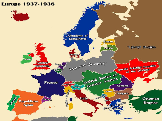
I'm guessing this is some kind of Central Powers victory AH
Maybe. I think France's borders are somewhere close to OTL pre-WWI. I'm sort of surprised there is no Polish Tributary state and the Russians are nowhere near as bad off as OTL Brest-Litvosk.I'm guessing this is some kind of Central Powers victory AH
Bulgaria certainly gained, and the Ottomans might have in an area off the map, the question is the Italians. Did the AustroHungarians ever talk about making buffer states out of Northern Italy?
Wow, that old thing... Literally one of the first AH maps I ever saw, once I started getting into the genre.
Crazy Boris
Banned
Maybe. I think France's borders are somewhere close to OTL pre-WWI. I'm sort of surprised there is no Polish Tributary state and the Russians are nowhere near as bad off as OTL Brest-Litvosk.
Bulgaria certainly gained, and the Ottomans might have in an area off the map, the question is the Italians. Did the AustroHungarians ever talk about making buffer states out of Northern Italy?
Not that I know of, I think the only CP goal against Italy was the Ottomans wanted the Dodecanese back.
I can't imagine the Austrians even had any plans for Italy, since they were technically allied up until around a year into the war when Italy joined the entente.
Given the quality of the map, does whether or not they actually planned something or whether or not it would be plausible really matter to this mapmaker?Maybe. I think France's borders are somewhere close to OTL pre-WWI. I'm sort of surprised there is no Polish Tributary state and the Russians are nowhere near as bad off as OTL Brest-Litvosk.
Bulgaria certainly gained, and the Ottomans might have in an area off the map, the question is the Italians. Did the AustroHungarians ever talk about making buffer states out of Northern Italy?
Share: