The NextGen OTL Worlda Series

I have an issue with the third one, what if a country claims the entirety of another? Wouldn't it be visually indistinguishable from what the third one also appears as?
The difference is the color in which it's outlined. The claim is in the standard color, the tributary outline is in the territory color
 
Big September Status Update Post Thing

I've been thinking over the discussion on borders, claims, and outlines, and want to weigh in again.

On the topic of the "red outline", I agree with @Chris S here. The red outline color is a holdover from the good ol' days when the UCS had like 20 colors total (Oh how far we've come ;)). There really was no way to show border disputes between uncolored countries other than recoloring the border. This color border remains in color schemes for niche scenarios, and is not very often used today.

After a lot of consideration, I've decided to simplify and codify coloring/outlining rules.
The following should be more in line with the traditional outlining system.

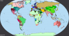
View attachment 484312

What's next?

I plan going through all 70 maps to standardize the outlining to fit the pattern above. I also plan on using this opportunity to do another full review of all 70 for historical errors.
I have no idea how long this will take, but it is unlikely it will be done within the month. My goal is to have this done by the end of thanksgiving break, but that is by no means a binding release date.

I've uploaded a small update to the NCS. The changelog is as follows:

-Adjusted Saragossa
-Added secondary Vietnam, Cambodia, Thailand
-Added separate Philippines
-Added New Guinea color
-Added Kosovo Color
-Changed tertiary Arabia
-Changed Ghana
-Changed Argentina to a nice blue.
-Added Secondary Argentina
-Added Secondary Brazil
-Added Amazon Natives


And yes, I know it's still august.

Hey- Can I give some advice? I'd recommend drawing the puppet outline along the border with the puppet master. Makes it look like claims otherwise.
 
In fact, @hadaril, I went ahead and made my own proposal for the rework. I personally think it covers a lot more options.
upload_2019-8-31_15-43-13.png
 
I have some problems/questions with both of these.

In .3 of Pen's proposal, how do we know which .2 has authority over it?

How would a colony be shown? It is not part of the parent nation but has no autonomy.

How would claims by administrative divisions on other administrative divisions be shown?

At risk of triggering a proliferation of colour scheme proposals, I have tried to fix this by creating a proposal of my own, which attempts to apply consistent principles. Fills show how an area is administered regardless of its theoretical status, and coloured outlines help show the unity of individual countries composed of multiple colours.

ColourKeyProposals.png


In this example, the China country administers only a small part of its territory. Most of it is controlled by autonomous warlords. Tibet and Mongolia have declared independence from China. They claim significant areas as part of their territory, which are bordered in red since China disputes these borders and does not recognise their independence. Tibet and Mongolia are also administrative divisions of China's territory. Tuva is a protectorate of Russia, with its independence disputed by both Mongolia and China. China also has border disputes with several of its neighbours. There is also an internal border dispute between Hebei and Henan. The entirety of this mess is outlined with China's main colour since it is all de jure the same country.

China possesses overseas possessions in Indonesia. Sumatra and Malaya are administered as colonies, while Singapore and Borneo are administered directly by the Chinese government.

Laos and Vietnam are Chinese tributaries. They have the same colour as the warlords since they are also semi-independent entities, but unlike the warlords they have black borders separating them from China, and are not part of the China outline since they are different countries. Cochin China is an autonomous state part of Vietnam. Thailand is currently invading Laos. Its military occupation is shown in a darker colour since it is directly administered by the military.

Another thing, @hadaril, If you are using the China patches I made with a different colour for the south, I suggest you either remove that or add the two south china colours I proposed to the key.
 
1840 map kinda, heavily based on the 1848 map, but i tweaked some things here and there

upload_2019-8-31_16-7-11.png


Feedback is welcome, along with fixing whatever i inevitable fucked up
 

Attachments

  • upload_2019-8-31_15-52-11.png
    upload_2019-8-31_15-52-11.png
    105 KB · Views: 413
Agreed on all of the above, sans coloring colonies as the darkest color.

I would just add on to that image specifying that an outline outside of a solid, level 1 border indicates a claim, just for clarity's sake. Update that image with that text and remove the colony color and I'll pin it and make it the official scheme. Nicely done!
 
upload_2019-8-31_21-30-32.png


Alright, I'm done

Although I would like to mention:

1. Balochistan is the Minor Iranian color even though that's supposed to be for Kurdistan because Balochi is Iranian
2. I didn't really know how to show having both Britain and America claiming the Oregon Territory, so excuse the poorly made dotted lines
 
Agreed on all of the above, sans coloring colonies as the darkest color.

I would just add on to that image specifying that an outline outside of a solid, level 1 border indicates a claim, just for clarity's sake. Update that image with that text and remove the colony color and I'll pin it and make it the official scheme. Nicely done!
I decided to show claims with red borders, are you saying you would prefer it to be with outlines instead like normal?

What is the darkest colour actually supposed to be used for?
 
Woops, didn't see that part. My bad! Personally I'm not really quite sure what the darkest color should be used for. Personally I only have ever used it in niche scenarios and for the obvious exception of the way I shade the HRE.
 
Woops, didn't see that part. My bad! Personally I'm not really quite sure what the darkest color should be used for. Personally I only have ever used it in niche scenarios and for the obvious exception of the way I shade the HRE.
How's this?

ColourKeyProposals.png
 
Woops, didn't see that part. My bad! Personally I'm not really quite sure what the darkest color should be used for. Personally I only have ever used it in niche scenarios and for the obvious exception of the way I shade the HRE.
So, are we going with crown lands? (i.e. Congo Free State, crown colonies, etc)?
 
Looks good to me. Adding to first post.
I think that will work for now; I would add the exception that royal domains (see: france and the crown of spain in medieval maps, for example) would probably not count here. I would consider them under the normal color, as they have the "normal" level of government. Color 5 would be less local government than expected, but you would expect the crown lands of the kingdom of france to have the standard level of government, and the vassals more.
 
Top