Collaborative timeline: Dunes of the Desert, a Timeline without Islam

While true, one has to account for the fact that modern Hinduism was most definitely influenced by its interactions with Buddhism and Jainism. Central Asia is going to remain fairly Buddhist. Buddhism might even spread westward into the Iranian Plateau. Afghanistan before its inhabitants embraced Islam followed Buddhism and Hinduism among other faiths.
On research I found that Turkic muslim invaders basically genocided Buddhist priesthood, leaving no one for buddhists to follow and the brahmins basically managed to convert the entirety of the Buddhists by 12th century. So yes Buddhism will be way more dominant both outside and inside India for the same reasons.
Maybe even St. Thomas christians have better time because of more contact with christian egypt and mesopotamia. Who would have thought screwing Islam screws Hinduism lol amirite

I wouldn't necessarily say that this be a Hinduism-screw. First of all, the St. Thomas Christians were a small minority in South India without any political authority. Also, Hinduism is not a monolithic religion. It takes in influences from the outside and has had countless reformation movements. Some schools of Hinduism follow monotheism, while others follow polytheism, while others such as the school of Advaita Vedanta teach that there is no difference between God, the Universe, and everyone and everything. I would posit that there would people who follow Buddhist ethics while perfoming Hindu rituals akin to the Buddhism practiced in Southeast Asia, East Asia, and Sri Lanka. Buddhism in its original form is a transtheistic religion that neither affirms nor refutes the existence of deities. Many Buddhists believe that Hindu deities are just to be a higher form of life also bound by the cycle of rebirth.

Also, Islam had a profound impact on the way Hindus practiced their faith. Without Islam, Sikhism is never born nor are the teachings of Kabir. The highly influential Bhakti movement may not arise in the fashion it did in our history.
I would have to agree. However in the case of St. Thomas Christians, the community stagnated after islam took over egypt and mesopotamia and persia. ITTL Trade and ideas would continue to spread nestorian church throughout south india. IMO it would become majority in some city states on Malabar coast. We could see christian calicut trading with Zheng He. I dont think christianity would spread to south east asia however because it would have continued contact with an intact Hindu/Buddhist India which it didn't in OTL.
 
Seeing some good ideas over here; while no major butterflies have reaches the majority of the Indian Subcontinent just yet, I will have to think of what will happen to the Indus Basin.. modern Pakistan.
As for Central Asia, it is a competing zone for Nestorians, Manicheans and Buddhists right now, with Manicheans having the upper hand ( as for the eighth century), dominating in Sogdia and the Tarim Basin.
 
I would have to agree. However in the case of St. Thomas Christians, the community stagnated after islam took over egypt and mesopotamia and persia. ITTL Trade and ideas would continue to spread nestorian church throughout south india. IMO it would become majority in some city states on Malabar coast. We could see christian calicut trading with Zheng He. I dont think christianity would spread to south east asia however because it would have continued contact with an intact Hindu/Buddhist India which it didn't in OTL.


You have to understand that the Christianity in South India was influenced by local culture and could only thrive because of the tolerant rule of the rulers of the region. However, I still doubt that the St Thomas Christians would be a majority in the South. Even if the religion was to become more popular I doubt that they would become a majority. Nonetheless, I could see them fitting a specific niche in Indian society. I could see them being important to trade.

The reason Islamic states could even exist in India was due to the large support of Hindus in these kingdoms. Ultimately, after the original Muslim invasion of North India, the tried and tested policy of converting entire populations was put to bed. They simply could maintain their rule by allowing Hindus to exist in society and a be a part of the political structure. With that said, discrimination towards Hindus and other non-Muslims persisted in many forms throughout the years.
 
Chapter 37: An Introduction to India
Geography


The Indian Subcontinent has been considered to be a world in itself by many. Separated by a mountain wall of the Himalayas from Tibet to its north, the region shaped like a squashed diamond has been seen as distinct from the rest of Asia.

The size of the Indian Subcontinent is huge; comparable to that of the Middle East and Arabia put together, or that of the entirety of the West Roman Empire. However, unlike the aforementioned likely-sized megaregions, India in its entirety is a hospitable environment, with a climate allowing dense population.
5qv0bvyrd9h01.png


It is a land of contrasts, with environments varying from the Thar Desert in the west to the mountainous jungle in the east in the Arakanese Mountains; from the low-lying delta of the Ganges and the Brahmaputra at the Gulf of Bengal, to the foothills of the Himalayas.

This Subcontinent has relatively clear geographic boundaries. Undisputedly, the snow-capped and ice-capped peaks of the Himalaya range over 8000 meters high make a clear border with the more arid regions in the Tibetan Plateau, which are on leeward side of the mountains; the mountain jungle in the east hinders any meaningful land route to Burma except a narrow coastal corridor. The only direction, to which India is open, is the northwest. Generally it is held, that the geographic borders of the Subcontinent end at the western end of the Indus river basin, although Persian shahs and Alexander the Great would claim the entirety of the Indus basin as theirs.

The arid corridor from the region of Kabulistan and possibly Zabulistan to a certain degree is the only land invasion route to India; this has been the base of Alexander’s campaign in India. The coastal region of Makran can be effectively ignored, for it is a thinly populated tribal area, with a hostile environment, preventing any large-scale military invasion.

Of course, the Konkani and Malabar coasts are open to cultural exchange and trade further westwards across the Sea of Mazoun, to trade with the areas of the Persian Gulf and with Egypt and the Mediterranean, as has been happening since antiquity with Mesopotamia, or more recently with the Romans in the case of the Malabar. The population of the littoral may however sleep in peace, for none of the countries across the sea were powerful and populous enough to launch a maritime invasion of the coast, for India is simply too populous and too large to invade.
300px-Varanasiganga.jpg

The northern half of India is dominated by the fertile Indo-Gangetic plain, an agricultural region with a dense population and the heartland of the Indian civilization. As one continues southwards, it continues uphill into the Deccan plateau in the southern part of the Subcontinent, bordered by the slopes of the Western and Eastern Ghats, which separate the plateau from the coastal areas. The Western Ghats are steeper and higher than the eastern ones; as a result, the entirety of the Deccan plateau is drained by rivers heading east, which cut through the Eastern Ghats.

Languages

From the linguistic point of view, there would have been several linguistic families spread out across the Subcontinent.

The northern half of the Subcontinent would have been dominated by the Indo-Aryan speakers. The Indo-Aryan languages form the easternmost branch of the Indo-European language family, and appear to have entered India via the arid corridor from the regions to the south of the Hindukush.

The earliest known language of the Indo-Aryan stock is Vedic, which would have thrived in the region until around 500 BC. At that point in time, its role as the ceremonial language would be replaced by Sanskrit.

The grammar of Classical Sanskrit was described by an early Indian scholar named Panini, who lived around the fifth century BC. Sanskrit would continue to play a role similar to that of Classical Syria, Koiné and Latin in the Mediterranean, as a classical, liturgical and intellectual language for the Indian Subcontinent for the centuries to come.

In contrast to the Sanskrit (literally “excellent, distinguished speech”) were the Prakrits, which were vernacular varieties, which would have been patronized by kings and nobles, and utilized by poets. The Prakrits would develop in what is labelled as the Middle Aryan period, roughly between 600 Bc and 1000 AD.

Of cultural significance were especially two forms, which would become used as liturgical languages. The Gandhari language, stemming from the region around the Upper Indus Valley, would become a liturgical language for Buddhist canon. Pali or Magadhan Prakrit, developing in the eastern regions of India, would be the tongue of various Hindu hymns, as well as used by Theravada Buddhists. Ardhamagadhi spoken in the region of Uttar Pradesh would be used by the Jains in their religious literature

As time would go on, the dialects would diverge even further from the Sanskrit and Prakrit forms into the so-called apabhrámsa, meaning corrupt, or incorrect language. Notable was especially the variety spoken in the east, called Abahatta or Magadhi, which would be spoken in the regions of Bengal and Assam and roundabout.

The second most widely distributed language family was the Dravidian one. Dravidian languages are spoken in southern India, mainly to the Deccan plateau. The most prominent of these languages would have been Tamil, now in the phase called “Middle Tamil” by linguists. Other written Dravidian languages would include Kannada, Telugu, and Malayalam, which had already diverged significantly from Tamil for some three centuries.

The autochthonous hunter-gatherer populations of India would have spoken languages of the Austroasiatic stock. This language family is also distributed in Southeast Asia, especially by the Mon and Khmer languages. Most of its speakers were assimilated into either Indo-Aryan or Dravidian populations; yet pockets of speakers of the Munda branch have persisted in places like the Gondwana region or the Santali region on the borders between Bengal and Bihar. Belonging to another branch of Austroasiatic languages are the Khasi people of Meghalayana of northeast India

The foothills of the Himalayas have been inhabited by speakers of the Sino-Tibetan languages, living in places live Bhutan, or Arunachal Pradesh.

Religions
The native religious traditions of the Subcontinent are referred to as the Indian religions. While having considerable influences on one another, one can distinguish two, or rather let´s say three different traditions of religious thought

The first tradition stemmed from the original Indo-European religion of the invading Indo-Aryans. This early form is known as the Vedic religion, or Vedic Brahmanism. The word Brahman itself is the Hindu concept of the absolute. These two terms are sometimes distinguished, with Vedism denoting the pre-contact and Brahmanism to the post contact phase of the religion with the Indus Valley civilization.

The early Brahmanism would evolve into Hinduism and Vedanta a rather philosophical tradition speculating on the implicatives of the Upanishads, which were a set of speculative and philosophical texts.

Contact with the movements within the shramanic tradition, as well as interaction with foreign invaders would result in the rise of a number of schools within the Vedantic philosophy, most notably: Yoga, Dvaita, Advait ,and Bhakti.

The Bhakti movement was based around a resurgence of the worship of traditional gods, regardless of the social status of the believer involved. The movements were mostly centered on the incarnations of Vishnu and Shiva.

Thus by this time, Hinduism was divided into four major branches: Shaivism (around Shiva), Vaishnavism(around Vishnu), Bhakti and the rather esoteric tradition of Tantrism.

The second tradition is called the śramana, meaning ascetic. The most prominent religious traditions stemming from the Shramana tradition are Jainism and Buddhism. The lesser known Shramana traditions include Ajivika, Ajnana and Charvaka. The proponents of the shramana movement were wandering ascetics, challenging the practise of rituals of orthodox Vedic religion.

Concept found within all of the Shramana traditions are Samsara (cycle of life and death, that is, reincarnation), moksha (liberation from the cycle of reincarnation

There have been six major Shramanic movements preceding that of Buddhism:

1. Purana Kassapa taught amoralism, climing there is no such thing as a good or bad deed.

2. Makkhali Gosala founded the Ajivika movement. This showed a fatalistic philosophy denying the concept of free will. However, they believed in a soul

3. Ajita Kesakambali founded the Charvaka school, being a pure materialist.

4. Pakudha Kaccayana was a proponent of atomism in Indian philosophy, and thought that there are seven basic elements in the universe.

5. Mahavira was the founder of Jainism. Jainism taught five moral principles: ahimsa(non-violence), satya(truthfulness), asteya(non-stealing) and aparigarha(non-attachment)

6. Sanjaya Bellathiputta was founder of the Ajňana movement, believing in absolute agnosticism
Palitana.jpg


Ultimately, there remained the religious traditions older than the Vedic or Shramanic thought: the traditions of the indigenous peoples, which manifested themselves as Sarnaism among the Austroasiatic peoples, Donyipolo and Sanamism in the regions of arunachal Pradesh and Manipur, respectively.

Caste System
To understand the notion of caste system is the very basic in understanding the society in India. The social stratification in India resulted in the creation of a rather rigid system, composed of four major castes or classes in the society. The original term denoting the notion of caste in India is varna. Unlike feudal Europe, which would have considered three estates, the Indian varna system had four, as well as effectively a fifth caste composed of people who were outside the system.

The topmost caste were the Brahmins or the priestly caste; the Kshatriyas would be something like the nobility, the rulers, the state administration and the warriors, then you would have a caste of people involved in economic activity, that is traders, artisans, merchants and farmers, who would have been called the Vaishyas, and ultimately you would have a worker caste called the shudras.

Not all people were, however, part of the caste system. The people outside of the caste system (avarna) were either tribal indigenous groups, or Dalits, known as untouchables.

One would be born into a caste, and that would define very much the profession he was able to do, the quarter where one could live in and the scope of people whom one could marry. Normally, the upper castes would not come into contact with the lower ones.
 

Attachments

  • upload_2019-6-12_14-50-12.jpeg
    upload_2019-6-12_14-50-12.jpeg
    7.1 KB · Views: 473
Chapter 38: Realms of the Subcontinent
Southern India


From the political point of view, there would have been a multitude of dynasties spread out across the Subcontinent.

The Pandya dynasty was continuing to dominate the Tamil areas. The Tamil areas would remain starkly Hinduist, favouring the Shaivite and Vaishnavite denominations. The Pandya kingdom was known for its export of pearls.

The northern portions of the Tamil Nadu would have been ruled by the originally Sanskrit Pallava dynasty; during the last decade of the ninth century, however, they were overthrown by a local Tamil dynasty known as the Cholas. The Cholas were a zealous Shaivist Hindu dynasty, busy building temples and would later have a lasting impact on the culture of the region
220px-Gopuram_Corner_View_of_Thanjavur_Brihadeeswara_Temple..JPG

Further northwards, where the eastern coast bends from a vertical to a diagonal line on the map, was the realm of Vengi Nadu, ruled by the Eastern Chalukyas. The society in this country was based around the instituton of the caste system, with Brahmins holding influential positions in government and state service, the Kshatriya (nobility) being the ruling class, then a wealthy merchant class and the shudra would be the peasants and levies. Shaivite Hinduism would be the dominant form of religion, followed by Vaishite Hinduism. There would be also Buddhist and Jainist communiites in the country; the former in decline the latter still remaining vibrant. Although both disregarded the notion of a caste system, they would ultimately accept it.

Continuing along the coast we arrive to the realm of Kalinga in Andhra Pradesh and coastal Odisha. The rulers were at first Buddhists, later converting to Shaivism. Their rule saw a conversion from Mahaynana to Vajrayana Buddhism in the region, and there were numerous Buddhist pilgrimage sites, such as Ratnagiri and Nalanda

Eastern Odisha was home to the Somavamshi dynasty; and under their rule the region saw a return from Buddhism to Brahmanism.

Now moving inland, that is, westwards, are the lands ruled by the Bana dynasty. These include the Odishan hinterland and the state of Chhatisgarh. The area has been known as Gondwana; being at the northeastern end of the Deccan plateau meant that the society in this region had remained largely tribal.

Now heading west is the vast realm ruled by the Rashtrakuta dynasty, dominating the western half of the Deccan plateau, with the Narmada River forming more-less their northern border; their area being synonymous to the combined linguistic areas of the Marathi and Kannada languages.

The Rashtrakuta dynasty were probably of native Kannada origin, although this has been debated quite recently. This is reinforced by the fact that Kannada as spoken at court, although Sanskrit would have also been used.

The realm of the Rashrakuta was home to followers of Jainism, Vaishnavaism, Shaivism, Buddhism and Christianity.

The dynasty would have practised a policy of religious tolerance; it is assumed, however, that the ruling dynasty was inclined to Jainism. The majority of their scholars were Jains, and the core region, Karnataka had a Jainist majority. Numerous Jainist temples would have been built under the dynasty.

The kings would nevertheless also invoke and worship Hindu deities. One of the largest Hindu temples was built in the Ellora caves.
800px-Kailasha_temple_at_ellora.JPG


Buddhism was in decline in the region, retreating to enclaves such as Balligavi and Dambal.

While the Rashtrakuta were a hereditary monarchy, succession was not from father to eldest son. The heir would be chosen according to his abilities from among the members of the dynasty.

The vast realm would grow a variety of crops. Cotton would be grown in the northernmost regions; the Konkani coast would grow betel leaves, coconuts, rice and olives. Further inland, you could get tropical wood and incense. The minerals of the Deccan plateau provided copper and diamond deposits.

The Rashtrakuta kingdom was involved in westward trade, with Mesopotamia, Mazoun, Himyar, Egypt and the Mediterranean. You could even get Italian wine in the realm.

To the south of the Rashtrakuta was the Western Ganga kingdom, in southern Karnataka. While the kings were in majority patrons of all faiths in the region, that is Jainism, Shaivism, Brahmanism and Shaivnaism, the kings themselves were Jains, and Jainism would be the preferred religion, although southern India would lack the idea of religious zeal, familiar to the monotheist religions of the Occident.

Ultimately in the southwestern corner, on the Malabar Coast, was the realm of Keralaputra ruled by the Chera dynasty. The realm participated greatly in trade with the “Yavanas” or the Mediterranean world, mainly by exporting spices. This route also resulted in the establishment of Jewish and Christian communities. It is thought that the first group of Christians in the area was convert by the apostle Thomas, after whom the St. Thomas Christians are named. This community would be included under the jurisdiction of the Church of the East, also known as the Nestorian Church.

The arrival of Apostle Thomas roughly coincided with the time of the arrival of the first Brahmins to the region, who have followed already established Buddhist and Jain monks and preachers. The followers of Dravidian religion would gradually dwindle, as they would be converted to some of the more organized religions (1)

Across the strait, the Annarudhapura kingdom would rule the island of Ceylon. The kingdom would be Buddhist, with a strong position of the clergy. The kings would sponsor the Theravada school of Buddhism, and actively stopping the spread of the Mahayana denomination. Important was also the presence of the Tooth Relic of Buddha on the island.
Flag_of_Dutthagamani.png


Within the kingdom there would have been also followers of Hinduism, facing persecution from time to time, as well as a small community of Jains

The main agricultural product would have been rice, harvested in two seasons. The kingdom would export gems, spices, pearls and elephants. Cloth would have been imported from China and Eastern India, while wine, ceramics, silk would have been the major imports.

To the west of Ceylon lies a chain of coral atolls, known as the Maldives. The population there would have followed Buddhism, mainly the Theravada branch, but were also open to Mahayana and Vajrayana influences. Moreover, there seem to have been Hindu traditions continuing to lie on on the archipelago.

The vast majority of the Dhivehi were distantly related to the Sinhala of Ceylon, however, the population of some atolls, mainly Giraavaru, shows traits similar to the Dravidian peoples of southern India.

Northern India
The peninsula of Saurashtra, also known as Kathiawar is located in the Indian state of Gujarat; with some imagination, one can say that it is a mini-India, with the tip cut off. This area has been home to numerous statelets lasting throughout the ninth century, such as the Saindhava on the western coast, the Cara in the northwest and the remnant of the Chalukyas on the southern coast.

However, the dominating force in Gujarat, but not only Gujarat, but in all of the northern India became the Gurjara Pratihara Empire. Having defeated the Pala Empire on the middle and lower Ganges River, the Gurjara-Pratihara would now dominate the entire Ganges basin.

The Ganges Basin was by then populated by Mahayana, and to a lesser extent Tantric Buddhists. The university city of Nalanda was a major centre of education and knowledge throughout the Buddhist world. The region was known to be a home to many scholars. The Hindu traditions in the Ganges valley did not vanish completely; on the contrary, the area was the places where the epics of Mahabhrata and Ramayana were composed.

The lower Brahmaputra valley, that is, the region of Assam was organized as the Kamarupa kingdom. This was the easternmnost Indo-Aryan realm, which was mostly Hindu.

Further west was the area which would later come to be known as Bhutan. Populated by the Sino-Tibetan people, this region on the Himalayan foothills would not be yet unified into a single entity. Rather there would have numerous petty states, the most prominent of them being the Kingdom of Bhumthang. While keeping true to the ancient Bon traditions, the ideas of Buddhism, mainly the Mahayana sect would spread into the region. The people of Bhutan would go on to creat new sect , such as the Nyingmapa.

Even less could be said about the developments in Nepal. It may well be presumed that the realm was also predominantly Buddhist, as were the other realms in northern India.

Now heading far westwards into the Indus (or Sindh) valley (2). In the upper regions is the region known as Punjab. The area has been a mainly Buddhist region in the antiquity, known as Gandhara. However, gradually as dynasties changed and foreign invaders would take control of the region, Hinduism began gaining the upper ground. The Kabul Shahi dynasty now ruling over the entirety of Punjab was a Hindu one; however there was still significant Buddhist presence in the region.
800px-AMB_Temple_in_Soon_Sakasar_Valley_by_Usman_Ghani.JPG

The lower reaches of the Indus valley came under the rule of a Hindu Brahman dynasty. While the royalty themselves practised Brahminism, the majority populace would have been Buddhists. The Buddhist culture in the Indus valley showed influences not only from Hinduism, but also from Zoroastrianism and Greek philosophy (since the Indo-Greek kingdoms in the area).

(1) Nestorian presence in Kerala will be much larger than in OTL

(2) This will be quite tricky. Lets see what can be done out of this.
 
Chapter 39: A Manichaen Steppe?
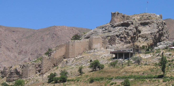
As had been mentioned in the previous posts, Sogdiana in this period would have remained a federation of city states, under the suzerainty of various foreign rulers.

While the Sogdian city states would have placed themselves under the suzerainty of the Kouroshids, the newly emerging Radmanid Empire towards the end of the century would fail to subjugate the area.

Therefore, the remained Kouroshids would have tried to hold on to the regions of Sogdia, Ferghana and Khwarezm. Out of the pretenders, Bindu, who was a brother-in-law of the “true heir” managed to become the new ruler.

Thus one speaks of the rise of the Binduid dynasty, although technically they were a continuation of the Kouroshids. However, historians prefer to divide the two phases, for the Binduid phase saw a geopolitical and cultural change. Geopolitically, the empire was confined to Transoxania that is to Sogdiana, northern Bactria, Khwarezm and Ferghana. The royal court would accept this shift and Sogdian would become the language spoken at court.

From the linguistic point of view, Sogdian would predominate in the Binduid realm, being the prestige, liturgical and religious language of the region. Therefore, it would displace Khwarezmian and to a lesser extent Tukhari Bactrian in the southeast, especially in the urban and transitional regions. Khwarezmian, would however remain as a vernacular in the lower and middle Oxus valley; furthermore Bactrian would continue to be used especially by the Buddhists of the upper reaces of the valley in the region of Tukharistan.

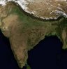
Sogdiana would have become a major centre of civilization, of literature, science and education in the region. At this time, Sogdiana would have become the centre of the Manichean community worldwide. The Manicheans of Central Asia would view their western coreligionists as rather lax, and would call themselves Denawar, that is, believers. The importance of Sogdia as the core of the Manichean community became reflected by the Archegos or Qahna, or the Manichean Pope if you wish, when he relocated to Samarqand in the late ninth century.

While by the late ninth century, the religions were largely equal in Sogdia itself with 30% Manicheans, 25% Nestorians, 15% Zoroastrians, 12% Buddhists, 8% Syriac and 5% Jewish, with the remaining 5% being practitioners of other faiths, the situation would have changed during the ninth century.
800px-ChineseShapedSogdianCoinKelpin8thCenturyCE.jpg

Sogdian coins had some Chinese influences

As by the end of the century, he distribution of religion has changed within the Binduid realm somewhat. Manichean grows to almost a half of the population, according to some estimates around 45%. The proportion of Buddhists amounts to almost half of that, with some 21% possibly – this is caused by the addition of the Tukhari valleys on the Upper Oxus. The third most numerous religion in the realm is Nestorianism, having sunken to a mere 16%. Zoroastrianism decreased even more dramatically to some 8%; this was caused by quite a significant portion of Zorastrians converting to Manicheism, or to a great number of mixed marriages. Smaller parts of the population would go on to practise Judaism (3%), Tengriism and Jacobite Syriac Christianity (2% each), while the remainder would be immigrant faiths
800px-Lions%2C_soie_polychrome_sogdienne%2C_Asie_centrale.jpg

Sogdian silk
Although the country was a monarchy, the lower levels of the state administration would not have been administered hereditarily. The topmost divisions, the satrapies, would have been governed a satrap chosen by the monarch. Those by turn would be divided into city-circuits or districts, which would have been administered in the form of a merchant republic. The region of Tokharistan would have been an exception to this pattern, as the satrapy itself would be divided into the counties of Saghaniyan, Kubadhiyan, Khuttal and Badakhshan, which would be ruled by the aristocracy.

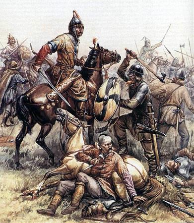
The immediate eastern or northeastern neighbour of the Binduid Empire was the Karakhanid or Karluk Khanate. This realm could be found in the Zhetysu and the Balkash basin; and has managed to unify the disunited clans and tribes in the region.

While linguistically similar (all belonging to the Turkic linguistic family), this steppe empire had been religiously diverse; with some tribes like the Chigils being Nestorian Christians, while other tribes such as the Turgesh and the Yagma being Manichean. While many of the khans were Tengri, in practise there would have been much religious syncretism going on, as the Chigils were Nestorians and the Turgesh were mostly Manicheans. In the 870s, the Karluk khan had accepted baptism at the cathedral of Taraz and proclaimed it to be the state religion. This would have been largely accepted by the Tengriists, who would however not want to let go of their old faith, but the Manicheans would not at all tolerate this.

This would result in the Turgesh and Yagma revolting and overthrowing the Khagan. The new Khagan would be a Manicheist zealot himself and would seek to enforce Manicheism on his subjects.

To the southeast of the Karakhanid realm was the Tarim Basin, and the western reahes of the area were still independent as the Kingdom of Khotan; a largely Buddhist, Saka-speaking realm, using Gandhari Prakrit as a ceremonial language. Other realms in the area were the Saka kingdoms of Shule and Shanshan.

The northern parts of the Tarim basin, but also in the Dzungar basin was the Kingdom of Qocho. This was found after the dispersal of the Uyghurs and the fall of the Uyghur Khanate, which had dominated the Eastern Steppe.
220px-Central_Asian_Buddhist_Monks.jpeg

Buddhist monks in Qocho

The Uyghur Khanate had been overthrown by the Yenisei Kirghyz, together with the Chinese imperial army. The ethnic Uyghur were dispersed; some would head south, eastablishing the Ganzhou Uyghur Kingdom in Gansu corridor; others would move westwards to the Tarim and Dzungar basin; to the area known to the Chinese as the Xinjiang.

The Uyghurs of Ganzhou would become to be known as the Yugur; they would live at the foothills of the Qilian Mountains, and practise mostly Manicheism, but also Buddhism.

The Yenisey Kirghyz would fail to form a unified empire; instead, each of the tribes, be they Kirghyz, Naiman, Kerait or Tatars would enjoy independence from one another.
91px-Uighur_Prince.jpg

Uyghur Khagan
But let us return to the fate of the Kingdom of Qocho. The Turkic Uyghur incomers would live side by side with local Arsian peoples. The Uyghurs in Qocho would have encountered a more advanced Buddhist civilization; and they would gradually abandon their own script, and adapt the alphabet of the local peoples, which would become known as the Old Uyghur Script. Chinese influences would be quite strong in the region; and Chinese language would be regarded as a prestige language, therefore also the Uyghur script would be written vertically under Chinese influence.
320px-Manichaean_Temple_Banner_%28MIK_III_6283%29.jpg

Manichean Uyghur Elect
The Manichean religion of the incomers was met with the Buddhist religion of the locals. This was complemented by Nestorian monks, who would have travelled along the Silk Road, building monasteries and schools, hospitals and churches and gaining followers. Despite a strong Buddhist presence, it was eventually contact along the Silk Road with Sogdians, who have been the decisive factor in retaining the Manichean identity of the Kingdom.

To the north of the Kingdom of Qocho remained the lands of the Nestorian Basmyls, who were guarding the Dzungar Gate, which is actually the most distant point from any ocean in the world.

Further westwards we have the Kimek-Cuman Confederation, also known simply as Cumania. Located between the Ob, Irtysh, Ural Rivers and Lake Balkash, this steppe empire roughly corresponds to the area which our readers may identify as Kazakhstan.

The Kimek-Cuman Confederation consisted of seven principal tribes. Two of them were of course the Kimek and the Cumans. Then we have the Bayandur, the Lanikaz, the Arjad, the Yamak and Tatars (sic).

Although founded by the Kimek, better known are the Cumans, also under the names as Kipchak or Polovtsian (to Slavic historians) people. The Kimek peoples inhabiting the eastern parts of the realm would have adopted Manicheism; the gross majority of the Kipchaks and the Cumans would however, remain Tengri.

The Kangar union on the Lower Jaxartes would have ceased to exist; its tribes would have migrated westwards to become knowns as the Pechenges, its lands being divided between the Karakhanids and the Oghuz Yagbus.

The Oghuz Yagbu State as a Turkic Nestorian realm continued to exist to the east of the Caspian Sea, also incorporating the lower Jaxartes regions as well. Its capital would have been transferred to the city of Yangikent on the lower Jaxartes.

The word Yagbu in itself meant an elected chief; that is that the leader of the entire confederation was to have been selected from among the leaders of the individual tribes or clans.

Looking now at the Western Steppe one can witness a weakening of Khazaria. The Khazars have lost practically all of their land east of the Itil River to the incoming Pechenegs; who would have held the lands between the Ural and the lower Itil Rivers.

However, we will stop here with the historical narrative; the Western Steppe would see some interesting developments and would interact with the European neighbours, so it will be the focus of some later update.

Rather, I shall use this space to explain the basics of Manicheism to the reader°,°as the religion has been mentioned quite often further above.

Manichaeism is one of the world’s major religions, originating in Mesopotamia. Mani himself originally belong to the Elcesaites, a Judeo-Christian sect. The religion itself could be either classified either as a Mazdan or Iranian religion, or be classified as a Gnostic religion; this could have been true in the early centuries of its existence; however in the ninth century, Manichaeism would have had much more followers than all the other Gnostic denominations put together.

Manichaism can be seen as the first rather successful attempt on creating a syncretic religion. Many himself admitted taking influences from Christianity, Zoroastrism and Buddhism; however the teachings of Jesus Christ, Zoroaster and Gautama Buddha were declared incomplete and the ultimate religion was to be the “Religion of Light”.
800px-Manichaean_Diagram_of_the_Universe_%28Detail_12%29.jpg

Left to right: Mani, Zoroaster, Buddha and Jesus
As for the basics, Manicheans believe in a Dualistic worldview. There is a realm of Light and a realm of Darkness; those being in constant struggle. This is an idea present in Zoroastrism as well. The material world would be considered evil, and the spiritual one the good one. Therefore, each person should seek to favour the interests of the spiritual to the needs of the flesh.
800px-Manichaean_picture_from_cave_25_at_Bezeklik_Caves.jpg

Worship of the Tree of Life in the Realm of Light
The creation is depicted as having the realms of Light (a peaceful blissful harmony) and Darkness (warlike anarchy) separate, with the Darkness invading the realm of Light. The realm of Light ultimately develops the ability to defend itself; and the world is created as a prison from the corpses of slain demons, but also it was to create a mechanism for the lost particles of the Light beings. The redemption of the fallen “Light” beings being the ultimate ends. Humanity is considered to be a creation of evil.

Humankind however could be salvated, and this mission began by Jesus the Splendour in the time of Adam, and would be carried on by several other prophets, although their messages would have been twisted. There are actually ttwo salvations: Salvation of the human soul, and salvation of the World Soul (liberation of the fallen Light) through human beings
800px-ManichaeanElectaeKocho10thCentury.jpg

Uyghur Manichean Electae from Qocho
What are the implications? Well the “elect” or clergy would be subject to vegetarianism, chastity, non-alcoholism, and forbidden to kill or hurt. The lay people would provide for the clergy, and were given more moderate commandments, esp. not to be miserly.

The Manichean faith would include five pillars, being, Commandments, Prayer, Alms,Fasting and Confession of Sins.

While Zoroastrians have a motto of “Good Thoughts, Good Words, Good Deeds”, Manicheans would have a credo of “Love, Faith, Fear of God and Wisdom”.

The Manichean Commandments would be also ten:

1. Prohibition of idolatry

2. Purity of the mouth: no blasphemy, lying, slander etc.

3. No meat and fervented beverages

4. No denigration of prophets

5. Be faithful to your spouse. No sex during fasting

6. Help the needy and don’t be greedy

7. Don’t help lapsed Manicheans

8. Do not hurt not only humans, but also animals

9. Do not steal

10. No magical practices, potions etc.

Prayer was four times a day, at dawn, midday, sunset and after dark. Prayer was directed towards the Sun and Moon; if not visible then towards the Pole Star.
220px-Manicheans.jpg

Manichaen Priests from the Tarim Basin
Alms meant providing for the “Elect” or clergy in the form of a tithe. Fasting was observed at Sundays, when even the laymen would be subject to the strict moral code of the “Elect”. Annually, there would also be a 30-day fast, terminanting with the celebration of Bema.

The Confession of Sins would take place on Mondays, for Hearers (laymen) and Elect (clergy) alike. The grand confession would be at the end of the fast, with a collective confession of sins committed throughout the year.

The liturgical year was divided to commemorate the major phases of Manis life: birth, call of the angel, dispatch of the prophet, passion and death, and martyrdom of first apostles. The greatest festival would be Bema (comparable to Christian Easter in its nature) The month-long Manichean fast would extend from 8Feb to 8 March
 
Chapter 40: Vikings - Plunder, Trade and Havoc
Scandinavia: The Homeland of the Vikings

The developments in Scandinavia during the ninth century would have been felt in a large part of Europe. The Jutish peninsula, the Danish islands, the firths of the Norwegian coast and the forests and clearings in Scania, Gotaland and Sweden would have been populated by North Germanic peoples, known to the outsiders as the Vikings.

The word Viking was used by the peoples on the other banks of the Noth Seas to relate to the dwellers of the firths; in the east, where the Old Norse would be more merchant-adventurers then looters and raiders they would be known mainly as Ruotsi (from the word to row), thus meaning sea people (hence the word Rus). Another name relating to them was Varangians, meaning oathbound, for many Varangians would form the Varangian Guard, a personal bodyguard of the Rhomaic Emperor.

Historians speak of a “Viking Age” in Northern Europe, caused by a demographic expansion in Scandinavia, resulting in overpopulation. This resulted in mercantile and military expansion, which was often demonstrated to the maritime populations under the form of Viking raids.

As for the Danes, they have already established themselves as a kingdom on the Jutland peninsula, on the Danish island and in Scania. Quite often, they have been at odds with their southern neighbours the Saxons, who had been crushed by Charlemagne. To defend themselves against the Saxons, they had built a border wall called Danevirke; this border defence would have been expanded and reinforced after the incorporation of Saxony to Francia.

Further northeast was the realm of the Geat, also known as Gotaland, extending from Goteborg to the islands of Gotland and Oland. Around Lake Malaren and in the region of Uppsala was the petty kingdom of Svealand; on the western side of the Scandinavian mountians, on the Atlantic and North Sea coast with many firths was the realm of Norway.

As for the large areas of Scandinavia roughly north of the Uppsala-Trondheim line, those areas would have remained unoccupied by Norse, and inhabited by the Sámi peoples, who would have lived as reindeer herdsmen. To the Norse, their northern neighbours would have been known as Kvens, and the area as Kvenland.

Havoc in Britain
The British Isles would have been one of the first targets of the raiding Norsemen. The Anglo-Saxon kingdoms would have fallen one after the other, with Northumbria falling (with a rump kingdom persisting in Lothian), followed by Mercia. The lands ruled by the Vikings would come to be known as the Danelaw.

This would reduce the zone of Anglo-Saxon dominance to a line running roughly from Chester to London, to a region comprising Wessex, southwestern Mercia, Sussex and Kent. This would have given the Brythonic populace some breathing space. Unfortunately, however, this also the period of the of the Latinate Brittanic language in the area of Verulamium; a small latinate population of around 15 000 people would continue to survive in the southern border regions with Wales. That peninsula would have remained still disunited throughout the entire century.

As for the Danelaw, a large part of its people would flee to Saxon-held lands. With a stronger Frankish Empire, not having to fight Muslims, the Vikings would give up raiding Francia and would focus more on England; therefore, Yorkshire will have much more Danish presence than OTL.

In Ireland, the Vikings would have raided the coasts, and establish numerous coastal cities as maritime bases, such as Dublin, Cork, Limerick, Waterford and Wexford.

As for the northern part of the British Island, known to the Romans as Caledonia, one could all but wonder how there could be such a diverse population north of the Hadrian Wall. There was the remnant of Northumbria in Lothian; then you had a Cumbric to its west (the old realm of Strathclyde). The coastal areas in the southwestern corner would have however been populated by a mixed population of Vikings and Irish, or Gall-Gaidel as they would have called themselves. This would be simplified later to the form of Galloway. Further northwards the Scots of DalRiata and the Picts of Fortriu would have united themselves in the 840s, thus creating a kingdom of Alba. The core of Alba was the North Sea coast, for the western coast had been overrun by Vikings. The local populace, a mix of Norse and Gaels, would have organized themselves into two realms: the Yarldom of Orkney and the Lordship of the Isles, based around the Isle of Man

Exploration of the Northern Sea
The Norse had already reached the Orkney, Shetland and Faroes by the 800s, displacing, enslaving or mixing with the local Gaelic and Pictish population, with many Gaelic hermits known as Papar.
Vidfamne-01.jpg
Vidfamne-01.jpg
Vidfamne-01.jpg

Modern reconstruction of the Viking Knarr

The Norse arrival to Iceland is traditionally been dated to 874 AD. Previous Gaelic inhabitants of Iceland were known as the Papar and have settled the peninsula of Reykjanes at hafnir and on the Vestmanneyrar Island off the southwestern coast. The first Norse settlements would have been established at Husavik and Bardharstrom.

The settlers were not Norwegians, at least not all of them. While some of them would have been dissidents to King Harald Fairhair of the newly unified Norway, others would have been Swedes, but many more would have been Irish or Scots ; quite a few would have been Norse-Gaels. It is likely that the Scottish and Irish would have arrived unvoluntarily as thralls and serfs, while the Norse would have been the ruling population.

The Norse have not reached Greenland just yet.

Founding of Rus
Varangian (that is) Swedish merchants would discover trade routes leading to the southern seas: to the Black Sea, giving access to trade with the Rhomaic Empire via the Dnieper, Daugava and Vistula rivers, and to the Caspian through the Itil or Volga river.

They would establish a network of trade posts, such as Holmsgardr (Novgorod), Aldeijuborg (Old Ladoga), Pallteskja (Polotsk), Smalleskja (Smolensk),Súrsdalar (Suzdal), Móramar (Murom) and Radhstofa (Rostov). Collectively they would have been known to the Varangians as the Gardhariki. That was not to be viewed as the unified state of Kievan Rus just yet, but rather as a cultural area of East Slavic settlement. Varangians would be engaged in trade, piracy and serving as mercenaries.

The Varangians are likely to have ruled the area around Kiev and Holmgardr under the name of the Rus Khaganate. This early state, with also Khazar influences (such as using the trident tagma, or the title of the Khagan) was however overthrown in 862 by a rebellion of both Slavic and Chudic (Baltic Finnic) peoples. All of the major settlements would have been burnt.

Soon however the tribes failed agree with each other and strife would occur. Thus he tribes invited the Varangians to come and rule them, to restore order and peace. The Varangians would thus return and under the leadership of Hrorekr (Rurik) establish a principality at Holmgardr (Novgorod). Trade would have shifted once more from the Itil trade route (because of decline of the Khazars and havoc in Persia?) to the Dnieper
220px-Monument_To_Prince_Rurik_Oleg_Novgorod_Staraya_Ladoga.jpg

Monument to Hrorekr and Helgi and Ladoga
Upon his death Hrorekr would be succeeded by Helgi (Oleg), who would unite the majority of the East Slavic lands, or at least their core by conquering the rival city-state of Kiev, which however becomes his new capital. Thus one can start talking about the state of Kievan Rus.

Kievan Rus must not be viewed as a precedent to Muscovy, no. Musocvy was a Slavic, Orthodox state, with Tatar influences and Merya substratum. Kievan Rus was a pagan tribal confederation or chiefdom, with a Varyag nobility or upperclass, an East Slavic, but also Finnic population of Izhorans, Votes, Veps and Chudes. Moreover, there would have also been Baltic Galindians in the realm, although by now mostly assimilated. Muscovy was geopolitically based on the tributaries of the Volga, Rus was based on the north-south axis from Holmgardr to Kiev, thus connecting norse Scandinavia with, and open to, Rhomaic influences.

By 874 however, the Rus welcomed some disciples of Cyril and Methodius; and an Archbishop of Rus, residing in Kiev was consecrated.

Rival to the Rus, the Varyags trading on the Itil trade route have prompted the consolidation of a more centralized tribal realm among the Merya. Its capital is Arsa, and the location has a great number of artifacts pointing to native Merya presence, especially beaver-themed objects. On the other hand, Runic inscriptions also hint Varyag presence. The principality was located in the Upper Valley and from there to the border of the Middle Oka basin. This Merya State, will, due to butterflies, a slightly more prosperous Iran and my personal sympathy to the Finno-Ugric peoples of Russia continue to play an important role in the region.

Balticum
The southern and eastern banks of the Baltic Sea would also see some more development. In Esthonia e.g., the population in this period increased dramatically, and several forts with wooden palisade have been built.

In Pomerania, Slavic tribes had been in contact with their Germanic northern neighbours ever since their settlement in the region. Scandinavian trade posts had been larger than the early Slavic ones, which would have been built in their vicinity. Major Scandinavian trade posts in the Mecklenburg region would include Reric, Dierkow and Haithabu; in Pomerania it would be Wolin, Ralswiek, Menzlin and at Kolberg. Wolin is thought to have been identical with Jomsburg, the legendary base of the Jomsviking


Viking stone ships in Pomerania
170px-WalMenz.jpg


Scandinavian settlements would have also been set up in the regions of the Baltic tribes: at Truso (near Elblang) and Krup/ Viskiautian (at the southwestern end of the Curonian lagoon) among the Prussians and at Grobin in Curonia (until the mid-ninth century, when the Curonians rebelled and destroyed the Gotland colony).

Major exports from the Baltic coast would include amber; one would trade also livestock, horses, honey, wax and salt. Linen, iron and silver would be used for payments, with iron in the form of small daggers and silver in the form of coins. Of course one must not forget that Viking raids in the area had a primary motif of acquiring slaves.

From the political point of view, one can witness the emergence of more organized tribal chiefdoms, among the Pomeranians, with the Obodrites in Meckhlenburg and around Ljubica (Luebeck), Veletis in Brandenburg and West Pomeranian, Rani on the Ruegen, and Kashubia between the lower Oder and Vistula.

The Baltic tribes would not have been so organized as the Pomeranians, with larger tribal chiefdoms of the Prussians, Sudovians, Samogitians, Polochians and mainly Curonians
 
Chapter 41: The Pontic Basin
Caucasus

The Caucasian Mountains are sometimes perceived as the border separating the European and Asian continents. To the south of these mountains is the area drained by the Kura and the Araxes rivers, by the Rioni, which is known as the southern Caucasus.

The kingdom of Apkhazeti, known to Rhomaic sources as Lazica and to most of us as Abkhazia, would continue to maintain its independence on the eastern shore of the Pontic Sea, beneath the ridges of the Caucasus, to encompass Sukhumi, but also Mingrelia, Imereti and Guria. With its capital at Kutaisi, this kingdom would have remained open to Rhomaic cultural and ecclesiastical influences.

For the Kartvelian regions on the upper Kura valley, the area would have underwent both periods of fragmentation, but also integration. Notably, king Adarnase IV would unify the eastern Kartvelan regions, including the duchies of Tao-Klarjeti, of Kakheti and Javakheti held as appanages and duchies, as powerful landed vassals. This inland Georgian state was under the ruler of the Bagrationi dynasty, with its own autocephalous church under the Catholicosate of Mtskheta; ths jurisdiction would have also been expanded to include Apkhzeti during the later half of the ninth century. Thus the Catholicosate of Colchis would have been merged with Catholicosate of Mtskheta, unifying the Kartvelian linguistic space in the context of canonical jursidictions

The region of Iberia and Abkhazia would by no means have been linguistically unified. Iberian or Georgian would have dominated the Iberian realm; Lazic would be spoken in Tao-Klarjeti and by Kartvelian speakers in Rhomaic lands; a distinct Kartvelian language would have been spoken in Svaneti, and Mingrelian would have been spoken on the Pontic coast. Furthermore, there would have been speakers also of other Caucasian languages in the area, as well as Rhomaic and Armenian merchants

The Kingdom of Armenia could be found to the south of the Iberian (yes, Iberia is the name under which inland Georgia has been known) realm. Armenia in this period would have mostly been unified as a state under the Bagrationi dynasty. Smaller independent duchies and counties would exist in Syunik, Artsakh and Vaspurakan; and to the west of the borders of Bagrationi Armenia, the followers of the dualistic Gnostic Paulician sect would have established their own state around Tephrike.

The Bagratouni Armenian kingdom would have been located in the valleys of the upper Araxes and the upper Euphrates. The mountainous terrain would have meant a challenge to a centralized state, and the area would actually be ruled inderctly by local aristocracy.

Most of the Paulicians would have been ethnic Armenians, who would have lived in the mountainous borderlands in the eastern part of the Rhomaic Empire; the Paulicians have assimilated by this time the followers of another Gnostic movement, the Archontics.

The Paulician State around Tephrike and in the regions south was by definition hostile to the neighbouring Rhomaic Empire; should the empire be on its offensive, it would have been quite an early target for the empire to invade. The hilly landscape was thus heavily fortified, with many castles appearing in inaccessible terrain. Of course, the Paulician state would have been run as a theocratic realm, ruled by the leaders of the Paulician sect.
Divrigi1.jpg

Tephrike, the Paulician capital

To the east of Armenia lay the Aghbanian realm. Aghbania would have been under a large cultural influence from neighbouring Armenia, although the area had been vassal to the Khazars. Most of the inhabitants of the inland regions, that is of the Kura and Araxes valleys and plains would have been actually Miaphysites, belonging to the Church of Aghbania, while the coastal areas, mainly the Apsheron peninsula, was inhabited primarily by Tats, an Iranian people, practicising Zurvanism.

Across the ridge of the High Caucasus lie the vast expanses of the Pontic-Caspian steppe. Most of the western steppe would have been continued to be dominated by the Turkic Oghur Khazars, while the areas between the lower Itil River and the Ural River would be roamed by the Cumans, known also as the Polovtsi. Near the source of the Itil River would have been the lands of the Bashkirs, and from there northwestwards was the kingdom of Boulgaria, near the estuary of the Kama River into the Itil.
Volga Boulgaria would have commanded much of the trade between the Varangians, the Khazars and the Permian peoples. Indeed, the city of Bulgar was a major fur market and also a contact point for the Uralic tribes. As for the ethnic makeup of the Bolgarian population, the majority would have been Turkic, with some Uralic admixture as well. The Oghur Turkic tribes were: Sabir, Barsil, Bilar ,Balanjar; also Uralic tribes of Esegel and Paskatir.

The Khazar khanate would be in a decline by the late ninth century, with its major settlements being on the coast of the Caspian (or as it was known back then, the Khazar) Sea. These would include Semender, Balanjar and Derbent. The cities of Atil (1), Sarkel and Tana (2) would have been major Khazar cities on the river banks, serving also as administrative and military centers, but also as major trade posts.

Apart from the dominating Khazars, there would have been also many Armenian merchant sliving in the cities, mainly in Atil and the Daghestani coast, the western parts not so much, who would have established a major foothold of Miaphysite chrisitianity in the realm. The Alans dwelling on the northern foothills of the Caucasus, along with the Cricassians, would have become a major target for Rhomaic missionaries. The western borders of Khazaria would remain on the lower Dnieper, with Khazaria controlling also the greater part of Crimea; populated mostly by Orthodox Crimean Goths, an eastern Germanic people.
27_big.jpg

Khazars art
The Khazars had allowed Variags to sail through their lands and raid other countries further south, on condition with sharing the loot. While this arrangement was alright for the time being, who knows for how long will the Rus and the Khazars be able to cooperate.

West of the Khazars, between the lower Dnieper and the Dniester rivers would be the land of the Pechenegs. They were a people closely related to the Khazars, and in their westward movement, they expelled the Magyars living in the area previously.

The Rhomaic Emperors sought to get the newly displaced Magyars, a Finno-Ugric people dwellin g previously in the same lands the Pechenegs have conquered, to attack the biggest Rhomaic headache in the Balkans, called Bulgaria.

With strong Rhomaic border defences on the Haemos (3) Mountains, the Bulgarian state was restricted to the lower Danube basin that is Lower Moesia, Wallachia, Moldavia and Transylvania.

The late ninth century was marked by the rule of Boris I. (852-889). Careful manoevering would have allowed Boris to assert autocephaly; all Rhomaic preists were banished, and Slavic priests, exiled from Moravia would be welcomed. Furthermore, Italian missionaries from Benevento would have been invited to Bulgaria as well, establishing themselves mainly in the region of Oltenia.
800px-Borismeetingdisciples.JPG

Boris welcoming the disciples of Cyril and Methodius
As a result of the proximity of Rhomaic borders, the location of the capital at Pliska is changed for Severin, lying at the Iron Gate of the Danube at the Danube gorge. This change of the capital city means also a shift in the cultural indetity of the Bulgarian state. Severin is located actually at the center of the Vlach ethnic region – should there be any other city in the Bulgarian realm with more East Romance speakers that would possibly have been Vidin. Such a decision would be in stark contrast to adopting Church Slavonic

Thus Bulgaria would become known in Latin documents as “Regnum Bulgarorum et Blachorum”, with the Bulgars being the Slavic inhabitants of the realm, and the Vlachs being the eastern Romance peoples inhabiting the country. The Slavs would have by now mostly assimilated the Turkic population, and populate the lowland region of Moesia, Walachia and Moldavia, as well as the Transylvanian basin. The Vlachs would dominate the region of Dacia Ripense, Oltenia and the valleys of the Carpathian Mountains.

The Western Balkans continue to be a rather disunited region, fragmented into the realms of Rashka (Serbia) Duklia (Montenegro), Pagania (Herzegovina) and Croatia, which would by now unify the lands from Lika to the Bosna River.

The lands between the Sava and the Drava would have been known as Savia, or Pannonian Croatia, and be a vassal of East Francia.

Ultimately there was the realm of Moravia. With its core at the Moravia and Váh basins, this early West Slavic State would halt Frankish eastward expansion. Although not pagans anymore, King Rastislav sought to end continuous Frankish interference by putting a halt to Frankish influence among the clergy. This was stopped by the Rhomaic mission of Saint Cyril and Methodius, who would have established an independent Slavic liturgy, while remaining under the jurisdiction of Rome.

This was changed by his successor Svätopluk, who favoured Latin liturgy, and achieved great military glory in expanding the borders of the realm, to incorporate Bohemia, Pannonia, Vistulia, Silesia and Sorbia.

However, after his death, the realm fell into a succession crisis and a civil war between Mojmír II. And Svätopluk II. The Magyars would take advantage and seize the Pannonia basin…
Sz%C3%A9kely_Bertalan_V%C3%A9rszerz%C5%91d%C3%A9s.jpg

Magyar Blood oath

(1) Near Astrakhan

(2) Near Azov

(3) Balkan
 
Overview 900: Society
DoDgov.png

Here we can see the forms of the organization of society throughout Afro-Eurasia in 900AD

  1. Tribal: Tribal organization prevails in most of the settled areas on the fringes of civilization; most of the tribally organized peoples would be pagans, and their realms would be based around hillforts and led by chieftains. Tribal areas would include by this time the entirety of the Baltic Sea basin, Scandinavia, the Uralic and East Slavic speaking area, extending into parts of Siberia as well.
    1. Clan-based (light brown/beige) : Sami and Uralic/ Siberian
    2. Chiefdoms: (dark brown) much of Sahel, Slavic and Baltic Europe
  2. Nomadic (golden): Nomadic pastoralism is dominant across the Eurasian Steppe. Taking advantage of empty land to feed their herds, and live in mobile yurts. Internal dynamics are between various clans.
  3. Caste(purple): The caste system of India is thought to be a rather strict version of feudalism, closely connected to the Hindu religion. While the it is noblemean and monarchs who effectively rule the country, it is the priestly caste (brahmins) who hold the highest social respect
  4. Eranshahr(orange): The social structure based on the principles of the ancient Sassanid Empire, now prevailing in Mihranid Persia and Media as well. Within this form of government, there is an absolute fusion church and state, and a state organized religion. The Eranshahr also used bureaucratic and feudal elements as well. The society is thus organized around castles and cities.
  5. Imperia(purple)l: The Imperial government is that of the former Roman Empire, now present only in Rhomania. The government combines bureaucratic and feudal elements, yet unlike Eranshahr there remains a certain amount of division between church and state. While the society is increasingly militarised and castles paky a significant role, urban centers remain nevertheless dominant.
  6. Bureaucracy(green): Bureaucratic governments rely on nonelected appointed officers who administer parts of their realm in the name of the sovereign and are appointed for a fixed amount of time, or can be replaced immediately.
  7. Feudal (blue) : The feudal system emerged in Western Europe in the aftermath of Germanic conquests. The land is distributed to heriditary noblemen who then provide troops and loyalty. Thus form of government dominates Francia and much of western Europe.
  8. Republic(pink): The republican form of government is that where the ruler is elected amongst eligible members of the citizenry. In many cases, the republics have developed into a form of oligarchy, dominated by trade and plutocratic merchants. Such a government can be seen in the coastal cities of Phoenicia, in Palmyra and in Somalia
  9. Theocracy(white): Theocratic governments ruled by the clergy include the Papacy, Mazoun (Oman) and the Paulician State in Anatolia
    1. Monastic:none
    2. Holy Orders (not yet present)
  10. Hierocratic (hieros+aristocratic) The monarch relies on both the clergy and the bureaucracy to administer the realm. Militaristic nobility do not own any significant portion of land, and civic and military organization are strictly separated. Present in Egypt.
 
Overview 900: Languages
DoDling.png

So I used the colour scheme for THICC expanded version to draw the culture map... The major linguistic families played out quite well, the banches as Germanic or Romance are not clearly distinguishable :(
 
So this is gonna be it for now . Here we have the overview for the year 900 AD. If anyone wants to join in developping the timeline, feel free to do so, especially if you are interested in developping the destinies of some of the regions like Scandinavia, Western Europe and Iberian Peninsula and the British Isles, India or the Sahel. These regions (except Britain) I have like next to zero previous knowledge of what was going on there, and how it fill affect them.
All feedback from my readers, in form of critique or suggestions and ideas is welcome.
 
Chapter 42: The Reforms of Porphyrogennetos
The Amorian dynasty was succeeded by the Macedonians on the Rhomaic throne. The Macedonian dynasty rose to power under Basil I. It has given the empire a series of capable rulers, who have managed to reconquer many lost territories.

The reign of Basil I. (867-886) has been marked by struggle with the Paulicians, who had fortified themselves in Tephrike in Anatolian Mesopotamia.
220px-Detail_of_the_Imperial_Gate_mosaic_in_Hagia_Sophia_showing_Leo_VI_the_Wise.jpg

Leo VI paying homage to Lord Jesus Christ
His heir Leo VI reigned between 886 and 912. His immediate concern were the northern borders with Bulgaria; however in the subsequent war he was defeated and had to make concessions. While defeated on the northern front, Leo pressed hard on several other border regions of the empire as well. In the southeast, he utterly defeats the Paulicians in 902 and conquers the theocratic state of the Paulicians, which has caused many frowns and worries to the empire.

The securing of the eastern frontier is also tied to further consolidation of imperial domain in Syria: full integration of the County of Tripoli in 901 and conquest of the Beqaa Valley around Zahle at the upper Orontes in 903, effectively threatening the independence of the Phoenician merchant republics.(1)

Leo is also remembered as a lawgiver; for he has had the Codex Iustinianus translated from Latin to Greek : the result would be known as Basilika. Not only has the Roman law been translated, but Novels (new law) was established to deal with urgent issues, such as prohibiting fourth marriages; but also abolishing inherited obsolete institutions such as the Curiae, the Consulate or the Senate, still de iure existing.
800px-Cyprus-lazarus-church_hg.jpg

Church in Larnaca: an example of Rhomaic architecture from the reign of Leo VI.
Leos interest in public affairs also resulted in the composition of Klerotologion, seeking to establish order in the rather complex court titles at the Rhomaic imperial palace. The Klerotologion establishes rules of protocol at imperial banquets, the order of the dignitaries and foreign ambassadors. The Klerotologion is however under the shadow of a later work De Ceremoniis by Porphyrogenetos.

His understanding of economy and trade can be studied in the Book of the Eparch; military affairs are described in a work of his known as the Tactica. This work would later serve as an inspiration or manual for many generals who would rise during the Rhomaic “Age of Reconquest”. (2)

Due to his many academic and theoretical treatises, he is remembered in history as Leo the Wise; he was briefly succeeded by Alexander reigning for a year, before the Sceptre was handed over to Constantine VII. Porphyrogennetos.
220px-Constantine_VII_Porphyrogenitus.jpg

Constantine VII

In the form of Constantine VII. (913-959), the empire got a well-versed scholar and a reformer. In the early years of his reign, that is, during the regency, Rhomaic troops manage to achieve a brilliant victory against Bulgaria; pushing the border northwards towards the Danube, incorporating the former province of Lower Moesia, which becomes known in the Empire as Paristrion.

Constantine VII is also known to be the author of two great treatises: De Ceremoniis and De Administrando Imperio.

From the political point of view, De Administrando Imperio was much more interesting: it spoke of the histories and character of the empire´s neighbouring peoples, such as the Turks, Pechenegs, Rus´, South Slavs, Arameans, Egyptians, Lombards, Armenians and Georgians. The book makes a manual on how to deal with the nations surrounding the Empire, especially the “Scythian” that is Eurasian nomad hordes. Furthermore it makes a geographic and historical overview of the empires neighbours. The second part deals with events going on in the provinces of the Empire; these would have been considerably reformed under Constantine VII.

The Empire was now reorganized into Dioceses; each being relatively large, around the size of a kingdom in its own right. The Dioceses would be further subdivided into prefectures or nomos; these would be county-tier areas

These Dioceses would be headed by vicar or Katepanos, chosen by the Diocesan Council. One third of the council would be made by the delegates of the various prefectures, another third consisted of the "estates"- amongst them commanders of the local garrisons, important noble families, church hierarchy, representatives of the cities, and one third consisted of imperial nominees.

So you are quite curious of how the dioceses would look, right? Well take a look here:
upload_2019-6-26_10-11-27.png

The city of Constantinople is outside of any diocesan structure; it is administered separately as the Magistrate of Constantinople. As for the rest here we go:

1. Diocese of Thrace Capital: Hadrianople

2. Diocese of Macedonia Capital: Thessaloniki

3. Diocese of Bithynia Capital: Nicomedia

4. Diocese of Asiana Capital: Ephesus

5. Diocese of Anatolikon Capital: Ikonium

6. Diocese of Pontus Capital: Trebizond

7. Diocese of Epeiros Capital: Nicopolis

8. Diocese of Dacia Capital: Naissus

9. Diocese of Paristrion Capital: Dulostorum

10. Diocese of Taurika Capital: Chersones

11. Diocese of Antioch Capital: Antioch

12. Diocese of Cilicia Capital: Tarsus

13. Diocese of Osroene Capital: Edessa

14. Diocese of Syria Capital: Aleppo

15. Diocese of Italy Capital: Taranto

16. Diocese of Crete Capital: Chandax?

The Exarchate of Africa is practically outside of this structure; it has been independent for quite some time in all but name; and the Exarchs of Africa would have very well liked to have taken control over Sicily and Calabria. The Diocese of Antioch, Cilicia, Osroene and Syria would have been combined into one diocese of Syria in the first drafts. However, the Emperor decided to cut it into smaller pieces in order to prevent such a large whole to be united under one ruler (coupist potential), but also to acknowledge the diverse ethnic makeup of the region. For Osroene and Syria would be predominantly Aramaic-speaking; a sizeble Armenian presence would be in Cilicia. Furthermore Macedonia, Paristrion and Dacia would have been populated mainly by Vlachs, that is, Eastern Romance speakers; Paristrion would have also a sizeable Slavic Bulgarian population. Northern Epirus would be home to “Illyrians”, that is, Albanians; yet unmentioned are the Isaurian and Phrygian speakers of Anatolikon. Of course, the Diocese of Italy would also have had more “Latin” speakers than Greek ones. Such was the makeup of the languages in the empire.

In 953 Constantine would have his armies prepare for war. His goal: establish a Rhomaic foothold in Egypt. His aim would be to strike from the naval bases in Sicily and Calabria to seize Cyrenaica; the Aegean navy would hit upon the Nile Delta, while the Cypriot and Cilician fleet would strike on the Palestinian coast. The issue was, well that Egypt, since the ascendance of Vahram of Alexandria, who sought to establish Egypt as a Mediterranean power.

Egypt, controlling by this time major outposts on the Red Sea, as well as the Palestinian coast up to Mount Carmel, was prospering due to trade with India, and building itself a proper fleet.

The Rhomaic invasion was launched as planned; yet the Egyptians had made an alliance with Tracađu (3), the Exarch of Africa; and the Phoenician city states. Thus, following the initial successful disembarkment at Cyrenaica, the Rhomaic troops were forced to defend the island of Sicily,in what they failed to do so. The Rhomaic army manages also Damietta and Pelusim, two major forts in Lower Egypt, and proceeds to attack Alexandria. Meanwhile, Israel “backstabs” Egypt by seizing the Palestinian coast; with the Exception of Gaza, which is conquered by the Rhomaic Empire. With the conquest of Alexandria, Rhomaic troops go on to occupy the entire Nile Delta. At this point, Egypt surrenders

The resulting peace has Tafirca becoming formally independent, and acquiring the western half of the island of Sicily; the Hellenophone eastern part remains in Rhomaic hands. Cyrenaic coast, as well as the coastline until Alexandria is annexed by the Empire, as well as Gaza and the northern coast of Sinai. Israel is allowed to keep its Mediterranean coast, at least for now… Egypt is now cut off all of its Mediterranean influence, and has become effectively a Rhomaic vassal. The Egyptian state itself however would not be fully annexed; indeed the Emperors have no interest in doing so. Rather, give Egypt full control over their internal affairs, yet establish them as a tributary state to the mighty Rhomaic Empire. However, now Rhomaic rulers are more careful than their predecessors, and direct imperial control is established in Alexandria.(4)


(1) The sack of Thessalonica by Leo of Tripoli doesn’t happen, well due to butterflies. Therefore, the city manages to play a larger role in the empire, and the Rhomaic positions in the Balkans are therefore stronger.

(2) In OTL, Tactica would contain Leo´s ideas regarding the adoption of the idea of “holy war” in Christianity as a response to muslim Jihad. Without that, no such idea arises.

(3) Tafircan for Arcadius

(4) As for the administrative purposes, Cyrenaica is merged with Crete into Creta et Cyrenaica, with its capital being in Cyrenaica. The OTL Marsa Matrouh province is added into this jurisdiction as well, while Alexandria becomes a magistrate, that is has a status akin to Constantinople; Gaza and northern Sinai are organized as a Diocese of Palestina.
 
The Amorian dynasty was succeeded by the Macedonians on the Rhomaic throne. The Macedonian dynasty rose to power under Basil I. It has given the empire a series of capable rulers, who have managed to reconquer many lost territories.

The reign of Basil I. (867-886) has been marked by struggle with the Paulicians, who had fortified themselves in Tephrike in Anatolian Mesopotamia.
220px-Detail_of_the_Imperial_Gate_mosaic_in_Hagia_Sophia_showing_Leo_VI_the_Wise.jpg

Leo VI paying homage to Lord Jesus Christ
His heir Leo VI reigned between 886 and 912. His immediate concern were the northern borders with Bulgaria; however in the subsequent war he was defeated and had to make concessions. While defeated on the northern front, Leo pressed hard on several other border regions of the empire as well. In the southeast, he utterly defeats the Paulicians in 902 and conquers the theocratic state of the Paulicians, which has caused many frowns and worries to the empire.

The securing of the eastern frontier is also tied to further consolidation of imperial domain in Syria: full integration of the County of Tripoli in 901 and conquest of the Beqaa Valley around Zahle at the upper Orontes in 903, effectively threatening the independence of the Phoenician merchant republics.(1)

Leo is also remembered as a lawgiver; for he has had the Codex Iustinianus translated from Latin to Greek : the result would be known as Basilika. Not only has the Roman law been translated, but Novels (new law) was established to deal with urgent issues, such as prohibiting fourth marriages; but also abolishing inherited obsolete institutions such as the Curiae, the Consulate or the Senate, still de iure existing.
800px-Cyprus-lazarus-church_hg.jpg

Church in Larnaca: an example of Rhomaic architecture from the reign of Leo VI.
Leos interest in public affairs also resulted in the composition of Klerotologion, seeking to establish order in the rather complex court titles at the Rhomaic imperial palace. The Klerotologion establishes rules of protocol at imperial banquets, the order of the dignitaries and foreign ambassadors. The Klerotologion is however under the shadow of a later work De Ceremoniis by Porphyrogenetos.

His understanding of economy and trade can be studied in the Book of the Eparch; military affairs are described in a work of his known as the Tactica. This work would later serve as an inspiration or manual for many generals who would rise during the Rhomaic “Age of Reconquest”. (2)

Due to his many academic and theoretical treatises, he is remembered in history as Leo the Wise; he was briefly succeeded by Alexander reigning for a year, before the Sceptre was handed over to Constantine VII. Porphyrogennetos.
220px-Constantine_VII_Porphyrogenitus.jpg

Constantine VII

In the form of Constantine VII. (913-959), the empire got a well-versed scholar and a reformer. In the early years of his reign, that is, during the regency, Rhomaic troops manage to achieve a brilliant victory against Bulgaria; pushing the border northwards towards the Danube, incorporating the former province of Lower Moesia, which becomes known in the Empire as Paristrion.

Constantine VII is also known to be the author of two great treatises: De Ceremoniis and De Administrando Imperio.

From the political point of view, De Administrando Imperio was much more interesting: it spoke of the histories and character of the empire´s neighbouring peoples, such as the Turks, Pechenegs, Rus´, South Slavs, Arameans, Egyptians, Lombards, Armenians and Georgians. The book makes a manual on how to deal with the nations surrounding the Empire, especially the “Scythian” that is Eurasian nomad hordes. Furthermore it makes a geographic and historical overview of the empires neighbours. The second part deals with events going on in the provinces of the Empire; these would have been considerably reformed under Constantine VII.

The Empire was now reorganized into Dioceses; each being relatively large, around the size of a kingdom in its own right. The Dioceses would be further subdivided into prefectures or nomos; these would be county-tier areas

These Dioceses would be headed by vicar or Katepanos, chosen by the Diocesan Council. One third of the council would be made by the delegates of the various prefectures, another third consisted of the "estates"- amongst them commanders of the local garrisons, important noble families, church hierarchy, representatives of the cities, and one third consisted of imperial nominees.

So you are quite curious of how the dioceses would look, right? Well take a look here:
View attachment 468090
The city of Constantinople is outside of any diocesan structure; it is administered separately as the Magistrate of Constantinople. As for the rest here we go:

1. Diocese of Thrace Capital: Hadrianople

2. Diocese of Macedonia Capital: Thessaloniki

3. Diocese of Bithynia Capital: Nicomedia

4. Diocese of Asiana Capital: Ephesus

5. Diocese of Anatolikon Capital: Ikonium

6. Diocese of Pontus Capital: Trebizond

7. Diocese of Epeiros Capital: Nicopolis

8. Diocese of Dacia Capital: Naissus

9. Diocese of Paristrion Capital: Dulostorum

10. Diocese of Taurika Capital: Chersones

11. Diocese of Antioch Capital: Antioch

12. Diocese of Cilicia Capital: Tarsus

13. Diocese of Osroene Capital: Edessa

14. Diocese of Syria Capital: Aleppo

15. Diocese of Italy Capital: Taranto

16. Diocese of Crete Capital: Chandax?

The Exarchate of Africa is practically outside of this structure; it has been independent for quite some time in all but name; and the Exarchs of Africa would have very well liked to have taken control over Sicily and Calabria. The Diocese of Antioch, Cilicia, Osroene and Syria would have been combined into one diocese of Syria in the first drafts. However, the Emperor decided to cut it into smaller pieces in order to prevent such a large whole to be united under one ruler (coupist potential), but also to acknowledge the diverse ethnic makeup of the region. For Osroene and Syria would be predominantly Aramaic-speaking; a sizeble Armenian presence would be in Cilicia. Furthermore Macedonia, Paristrion and Dacia would have been populated mainly by Vlachs, that is, Eastern Romance speakers; Paristrion would have also a sizeable Slavic Bulgarian population. Northern Epirus would be home to “Illyrians”, that is, Albanians; yet unmentioned are the Isaurian and Phrygian speakers of Anatolikon. Of course, the Diocese of Italy would also have had more “Latin” speakers than Greek ones. Such was the makeup of the languages in the empire.

In 953 Constantine would have his armies prepare for war. His goal: establish a Rhomaic foothold in Egypt. His aim would be to strike from the naval bases in Sicily and Calabria to seize Cyrenaica; the Aegean navy would hit upon the Nile Delta, while the Cypriot and Cilician fleet would strike on the Palestinian coast. The issue was, well that Egypt, since the ascendance of Vahram of Alexandria, who sought to establish Egypt as a Mediterranean power.

Egypt, controlling by this time major outposts on the Red Sea, as well as the Palestinian coast up to Mount Carmel, was prospering due to trade with India, and building itself a proper fleet.

The Rhomaic invasion was launched as planned; yet the Egyptians had made an alliance with Tracađu (3), the Exarch of Africa; and the Phoenician city states. Thus, following the initial successful disembarkment at Cyrenaica, the Rhomaic troops were forced to defend the island of Sicily,in what they failed to do so. The Rhomaic army manages also Damietta and Pelusim, two major forts in Lower Egypt, and proceeds to attack Alexandria. Meanwhile, Israel “backstabs” Egypt by seizing the Palestinian coast; with the Exception of Gaza, which is conquered by the Rhomaic Empire. With the conquest of Alexandria, Rhomaic troops go on to occupy the entire Nile Delta. At this point, Egypt surrenders

The resulting peace has Tafirca becoming formally independent, and acquiring the western half of the island of Sicily; the Hellenophone eastern part remains in Rhomaic hands. Cyrenaic coast, as well as the coastline until Alexandria is annexed by the Empire, as well as Gaza and the northern coast of Sinai. Israel is allowed to keep its Mediterranean coast, at least for now… Egypt is now cut off all of its Mediterranean influence, and has become effectively a Rhomaic vassal. The Egyptian state itself however would not be fully annexed; indeed the Emperors have no interest in doing so. Rather, give Egypt full control over their internal affairs, yet establish them as a tributary state to the mighty Rhomaic Empire. However, now Rhomaic rulers are more careful than their predecessors, and direct imperial control is established in Alexandria.(4)


(1) The sack of Thessalonica by Leo of Tripoli doesn’t happen, well due to butterflies. Therefore, the city manages to play a larger role in the empire, and the Rhomaic positions in the Balkans are therefore stronger.

(2) In OTL, Tactica would contain Leo´s ideas regarding the adoption of the idea of “holy war” in Christianity as a response to muslim Jihad. Without that, no such idea arises.

(3) Tafircan for Arcadius

(4) As for the administrative purposes, Cyrenaica is merged with Crete into Creta et Cyrenaica, with its capital being in Cyrenaica. The OTL Marsa Matrouh province is added into this jurisdiction as well, while Alexandria becomes a magistrate, that is has a status akin to Constantinople; Gaza and northern Sinai are organized as a Diocese of Palestina.
Good upddate, but I dont think that the ecarchate would be able to project power into tripoli. I also dont think that the anatolian languages still existed.
 
Good upddate, but I dont think that the ecarchate would be able to project power into tripoli. I also dont think that the anatolian languages still existed.
As for now, Tibwitana (Tripolitania) is under control of the Kingdom of Tafirca. Thanks for a suggestion, they can lose control of it quite soon in the North African update :)
Indeed your are right. If they would have in fact still existed, they would be reduced to a handful of remote locations. By 1000AD they are gone.
 
Last edited:
Top