Affiliated States of Boreoamerica thread

Sevier and Crockett but no Houston? Also, have you heard of the pig drives? In OTL folks would drive their herds of pigs over the mountains to sell in the east (or Cincinnatti or Chicago).

I think the likeliest course for Houston's life in TTL is that he permanently became a Cherokee citizen. The high point of his career in OTL coincides with TTL Cherokee's adoption of a modern constitution. Houston and others like him were instrumental in creating it.

To give a little more context, the constitution was approved at some point around the year 1840. The village chiefs in the different parts of Cherokee were united for the first time in many years in the decision to name and back an emperor. The last several emperors had not been able to count on the support of all parts of Cherokee. We see that in the account of Watauga's history, where Watauga was able to make a treaty with the towns on the Little Tanasi even as it remained at war with the rest of the nation. But by the 1830s there was a clear desire to create a unified state government capable of representing all the Cherokee and preventing further encroachment on their territory. Sequoyah, the great teacher of literacy, was chosen as emperor because the chiefs wanted him to help write a constitution. Mixed-blood and adopted members of the nation were then key contributors, since they had more familiarity with organized statecraft.

(edit)
And I failed to respond to your tip on the pig drives. No, I hadn't seen that before, and I love it. And that's the sort of thing that would live on in the cultural memory of the ASB. The great cattle drives of the west most likely didn't exist - Texas ranchers almost certainly drove their cattle to ports on the Gulf rather than to trains bound for Chicago. Could hog drivers become stock characters in the literature of this timeline?
 
Last edited:
Here is the next century of history for the Imperial Commonwealth. This can also serve as the start for a chronology of European wars in the 18th century, something that's been sorely lacking. Obviously a lot still needs to be done to fill in detail for those final 40 years.

family tree2.png


Karl of the Palatinate

Karl ascended the thrones of Sweden and Poland without much fuss, but the Russian boyars were more reluctant to accept this Protestant Westerner. He secured his throne after two years of violent unrest. He is considered the founder of the "Wittelsbach-Rurik" royal house, which has ruled the empire ever since.

Karl I and X is credited with introducing absolutism to the empire, though only in Sweden. Absolutism took much longer to bring about in Russia and never really happened in Poland. The Swedish military became a well-oiled machine under the king's personal command. Some of those military reforms started to gradually extend to Poland and Russia, but Karl was not able to control the governments there like he did in Sweden.

In military affairs Karl had to fight off a combined attack from Brandenburg and Austria, a recurring event of the 18th century and beyond. As a result of this war, he strengthened his hold on Prussia and Pomerania, blocking Brandenburg's access to the sea.

During Karl's rule Sweden again started to pay attention to its former colony in North America, modern Christiana. After negotiating with the Penn family, Karl formed a small land company that bought and sold plots in the colony to settlers from Sweden, Finland, and the allied German state of Holstein-Gottorp. The tsar also sponsored the first trade and colonization attempts in the Pacific, which resulted in several small forts in Alaska, Oregon, and Hawaii.

Karl had married a daughter of a Hessian landgrave when just a teenager, before coming to the throne; but he married most of his many children off to Polish and Russian magnates. By the time of his death in 1738, he believed he had established his dynasty in all three kingdoms. However, the empire was in for one more fight over the succession.

The Karlovichi (Kasimir, Ivan, and Fridrich)

Kasimir's reign began in war. Austria and Brandenburg had again been intriguing with Polsh nobles who feared that their kingdom was drifting toward hereditary succession and domination by Russia. When the Sejm made Kasimir king, a significant group immediately announced that they did not accept the result, then gathered their forces in the southwest to join with the invading armies. Kasimir, caught off guard, was slow to respond. Large areas of Poland fell to rebel and foreign troops before he could mount an organized counterattack.

After two years in the field, Kasimir succumbed to an infection that had spread through camp, an inauspicious misfortune in a war of succession. His brother Ivan carried on the fight, launching at the invader the full strength of Sweden's military discipline, the vast resources of Russia, and the fighting spirit of the remaining loyal Poles. He even secured an alliance with Russia's old enemy, the Turks, who attacked Austrian territory from the south. Ivan VI and IV secured his hold on Poland after another three years of fighting. He had to permanently renounce any Polish pretensions to Silesia and return Transylvania to the Austrians, but in general the war had strengthened his position. The magnates who had led the opposition were executed or exiled, or lost their lands and titles. Some who had played a minor role in the rebellion threw themselves at the king's mercy, tripping over each other in their rush to profess their newfound loyalty. Many were later dispatched to govern distant corners of the empire.

Ivan also exploited his postwar popularity to compel Russia's boyars to accept the principle of hereditary succession, the very thing the Polish szlachta had been so afraid of. He made no attempt to introduce such a law in Poland, but it was clear now that no one who was not from the House of Wittelsbach-Rurik would have much chance of winning an election for king.

But Ivan also died after just a few years, passing the thrones to the third son of Karl of the Palatinate, Fridrich I. Fridrich already had an infant son when he came to power, and he and his wife Anastasia Golitsyn would have one more, along with their three daughters. The dynasty's loyalists breathed a sigh of relief.

Fridrich's productive reign lasted just under twenty years. Under him the empire truly stepped into its role as a great power. Rather than fight for survival, he struggled for influence against shifting alliances of rival kings and emperors. Fighting along the southern border saw Poland re-conquer Transylvania and convert Moldavia into a vassal state. Fridrich's children were married not to local nobility, but to the sons and daughters of European royal houses.

Dmitri I and VI

The next tsar was named for his maternal grandfather Dmitri Golitsyn, a great Russian magnate who had become a close ally of the imperial family. His long reign - exactly forty years - saw Russia greatly expand its influence in the Far East and the Pacific.
 
Last edited:
To revisit a post from last month:

For those of you keeping count, I'm very nearly done with the state-by-state histories that have been the bread and butter of this thread since I started. I only count six states left, here they are in order of how much has been done already:
  • Turks and Caicos: In universe, the islands achieved statehood last summer. I had vague plans to write it as a real-time news event, then scaled down to an in-universe magazine article, and right now it's not much more than a photo essay. I guess that might be enough to share, but I've had writers' block for months when it came to writing the article.

Looking through older posts, I realized that there was actually quite a bit of content on Turks and Caicos. I've compiled it on my site and added some context. I'll copy it here so that it's shared, but this has already been posted.

Early history
Turks and Caicos is geographically part of the Bahamian archipelago, and before colonization its people were from the same group, known as the Lucayans. The Lucayans disappeared in the aftermath of Spanish slaving and disease.

The Turks and Caicos islands were later colonized by English sailors coming from Bermuda, who developed the islands for salt production. Turks and Caicos' sandy beaches and shallow seas were perfect for raking salt. Eventually, the Bahamas disputed Bermuda's control, and the Congress of the Nations ultimately settled the issue in Bermuda's favor. More details of this history are on the Bermuda page.

The flag and the Aquamarine Revolution
turks-caicos-final-wavy-flag.png


A local citizen, Lucinda Knowles, created a version of the flag of Turks and Caicos around 2002. A few months later, with help from a writer for the islands' newspaper and a graphic artist from Cuba, she published an official description and began to promote it more widely. Its symbolism is multi-layered. The striped design reflects the islands' past as a possession of Virginia, but the stripes are wavy as befitting an island territory. There are seven stripes for the seven populated islands. The aquamarine represents the seas around the islands: they are in the same shallow banks as the Bahamas, resulting in the characteristic bright aqua color to the sea. The yellow stripes call to mind sunlight shimmering on the water, representing a new dawn for Turks and Caicos. There are two of them, one for the Turks islands and one for the Caicos. The white stripe in the center represents peace and friendship among the islands and between the islands and their neighbors. It also resembles mounds of salt raked up from an evaporation pool, recalling the industry that drove the Turks and Caicos for most of their recorded history.

The flag caught on quickly both as an expression of civic pride and as a nice piece of branding for Turks and Caicos' tourist industry, which was going through a period of almost explosive growth.

That growth was the origin of the turbulence of the ensuing period. The islands were flush with cash and drawing new workers, some staying just for the tourist season, others moving in permanently. The newcomers can be forgiven for not immediately getting involved in local politics, but this meant that that Turks and Caicos continued to be governed by the same clique of politicians. Most local leaders had gotten their start when the islands were a sleepy backwater, but now found themselves managing a rapidly growing population and tax revenues exponentially greater than what they had known before. Opportunities for corruption abounded. Bermudan state officials uncovered uncovered many of them. So rotten did Turks and Caicos' government seem to be that in 2011 the state assembly voted to dissolve it. A state-appointed board of local leaders was formed to govern the islands while necessary reforms could be put in place.

Five years later, the board was still there. Progress on the promised anti-corruption reforms from the board and the state assembly had been slow. And during that time, the islands' tourism had continued to grow, and many of the new citizens had started to get involved in the local community. Political coalitions formed around the issue of restoring self-government to the islands. Frustrated islanders began a demonstration outside the government house in February 2016, which stretched out for days. People from Providenciales, the main tourist center, crossed to Grand Turk to join the demonstration, and many who could not demonstrated in Providenciales Town. Business was crippled at the height of the tourist season. The unofficial Turks and Caicos flag was ubiquitous among the participants in what the press called the "Aquamarine Revolution". It reached a dramatic climax when most of the appointed board members came out of the government house to join the protesters.

The Aquamarine Revolution brought Turks and Caicos to the attention of the entire ASB. People asked how it was that Bermuda, of all places, had apparently been allowed to be the last colonial power in the confederation. Confederal officials stepped in to put pressure on Bermuda. A new committee of state and local leaders was formed to make a final draft of a reform package, and elections were scheduled to quickly restore Turks and Caicos' local assembly. The new assembly met in late 2016. In early 2017, it adopted the new-famous flag as the official flag of Turks and Caicos.

The movement did not go away. It shifted toward promoting statehood and organized as a new political party. Pro-statehood members won a clear majority in the local assembly and most of Turks and Caicos' delegates in the Bermudan state assembly. A new, binding referendum took place at the same time as the next round of elections, in March 2018. With a strong feeling of momentum, and a flag to rally around, supporters of Turks and Caicos statehood were enthusiastic about their chances for success.

Statehood

The referendum produced a solid majority in favor of statehood. Bermuda and Turks-Caicos agreed to take one year to work out the details of a separation. The date was pushed back to May so that the celebrations can be free of distractions from the winter-spring tourist season.

Now I don't know if I explicitly stated this, but I implied in one or two places that statehood was completed last summer, just months after the referendum. I had been thinking that it would be a nominal statehood - representation in Parliament and so forth - while everyone continued to hash out the details of the separation. I think it's all the Brexit news that has convinced me to rethink that timeline. Turks and Caicos is not "just" separating from Bermuda. As the recent history shows, it also is recovering from a lot of political turbulence in the past decade. Its current autonomous government is just over two years old. It's still cleaning up from a major, wide-ranging corruption scandal. So while the statehood party might be in a hurry, everyone else, at every level, wants to move slowly and make sure to get it right. So, the official timetable is: Referendum last march, then take 14 months to sort out all the political and financial details of the separation. Another election will choose Turks and Caicos' parliamentary delegation this month. In May, statehood will be celebrated as a new governor is inaugurated in Cockburn Town, the delegation is seated in New Amsterdam, and parties and parades happen all over the place.

(That's not to say there haven't been parties and parades already. Islanders have recognized the tourism potential of an independence celebration and have held celebrations throughout the winter for the enjoyment of visitors. But they want the official Statehood Day to be for the local people, at a time when more people will be free to attend - so not at the height of the tourist season.)

So this does give us time to potentially do some real-time current event stuff with Turks and Caicos in the next couple of months. We'll see. If anyone else wants to contribute to this, please share your ideas.
 
Last edited:
The flag of Watauga

watauga-flag.png

Watauga's flag is a combination of two militia flags from the age of the Wars of Independence. Sevier had adopted for his regiment a striped flag based on the model of Virginia. The buff and green colors came from the men's uniforms and were chosen to distinguish the flag from Virginia's red and blue. Other local militia defending the passes into Watauga used a plain blue flag inscribed with the word Liberty. Veterans of these different militia - those who went off to fight in the east versus those that stayed to defend the home front - often ended up as rivals in the postwar years. Combining the two flags symbolized unity among all citizens. The word disappeared in later years, leaving only a plain blue diagonal.

The flag is affectionately known as "the Sash and Stripes."
 
Last edited:

Gian

Banned
Hey @False Dmitri, remember your map of Catholic archdioceses/ecclesiatical provinces in the ASB. I was thinking I would also do the same using the 8K-BAM, but wit subdivisions representing the dioceses, kind of like this:

US_Roman_Catholic_dioceses_map.png


Also, it would make a lot more sense to put Lower Virginia as a diocese under the Archdiocese of Baltimore instead of Wilmington
 
Hey @False Dmitri, remember your map of Catholic archdioceses/ecclesiatical provinces in the ASB. I was thinking I would also do the same using the 8K-BAM, but wit subdivisions representing the dioceses, kind of like this:

I literally started that last weekend as a doodle, but didn't save it. That would be great if you did it, or if not, honestly I probably will try it again this weekend.

Dividing it into bishoprics, like

Also, it would make a lot more sense to put Lower Virginia as a diocese under the Archdiocese of Baltimore instead of Wilmington

I want Maryland to be a separate church province, as a historically Catholic state. LV and Carolina have lower Catholic populations, not enough to warrant an archbishop of their own, but there are separate bishoprics in the different states.
 

Gian

Banned
I literally started that last weekend as a doodle, but didn't save it. That would be great if you did it, or if not, honestly I probably will try it again this weekend.

Dividing it into bishoprics, like

I could try ofc. But, I would need the subdivisions of practically every other state at this point.
 
I could try ofc. But, I would need the subdivisions of practically every other state at this point.

Weird, I left a half sentence. Dividing it into bishoprics, like in the OTL map, would be hard for some but doable for others, is what I was going to say.
 

Gian

Banned
Also, here's a small update, showing Carolina's ethnic divides:

Please tell me if this is accurate @False Dmitri (also how to go about doing Watauga and the Civilized Tribes (would they have large African populations on their borders as IOTL)
CEGoqzA.png
 
Also, here's a small update, showing Carolina's ethnic divides:

Please tell me if this is accurate @False Dmitri (also how to go about doing Watauga and the Civilized Tribes (would they have large African populations on their borders as IOTL)

Can you clarify why on their borders specifically?

I'm hesitant to say a lot about the relationship between those tribes and Black people before I've read about the topic in more depth. Some things that I can say for sure:
  • Cherokee's institution of slavery was adopted from Carolina. Compared to the other tribes, there were pretty clear lines between the races. The other four also had African slavery in various forms, but adoption and intermarriage across the racial boundary was comparatively common.
  • On the other hand, there were areas where outsiders obtained or leased land to plant cotton and other crops, and this has resulted in some distinct racial/ethnic communities. People certainly discovered the potential of the "Black Belt" region for growing cotton - or parts of it, at least. Parts of that crescent that are within Muscoguia were leased by Spanish planters, whose slaves left descendants that would be a distinct population today. There might be a similar situation with the Virginians in Chicasaw and Louisianans in Choctaw, but not as extensive.
  • Some pockets of Chicasaw can be considered Virginian and Afro-English. These pockets follow the routes of old settlement trails between the Ohio valley and the Gulf.
  • Chicasaw's main port city is not at Memphis, but the site of OTL Randolph, Tennessee. That would be colored as a diverse city similar to ones you've already done.
  • The capital cities are: Pontotoc, Chicasaw (near Tupelo, Mississippi); Kunsha, Choctaw (in Jasper County, Mississippi); Echota, Cherokee (in Monroe County, Tennessee); Toquebache, Muscoguia (near Tallassee, Alabama); and Calusahachi, Seminol (near Fort Myers, Florida). All are at least mid-sized cities today and have diverse populations. Other than Randolph and the state capitals, I haven't yet discovered the major cities of the region.
  • Ethnic Seminoles define themselves as a mixed, tri-racial people. So most of the state would be a single "Seminol" color regardless of the specific racial admixtures that predominate in the different regions. An exception is the extreme south, which has a lot of Cubans.
  • The ethnic Chicasaw and Choctaw should be colored as closely related; so should the Muscogui and Seminol.
  • Watauga is mostly Piedmonter, with Virginian in the northeast corner and Cherokee in the southeast.
Those are the admittedly vague and disconnected thoughts that I have right now. I love the work so far.
 
Last edited:

Gian

Banned
So here's another update:
4PrXWjs.png

  • Decided to fill in Louisiana, plus some extra bits to indicate the state capitals (even the ones that are practically invisible atm
  • Decided to create two more distinctive African colors for both Afro-Louisianans and the Africans in the Native "Black Belt" that I'll just call the Zambos (IOTL these referred to mixed-race descendants of Africans and Natives). The alternative ofc would be to bring those three together but put them (plus the Gullah, Accomac, and potentially the West Dominican and Black Caribeño people) under a separate "African"* category altogether
  • Some of these borders are basically complete blobs because I don't know where the precise ethnic boundary should go.
*that is, neither Anglo-Celtic, Gallic, or Hispanic

I should note though that I kind of adopted the colors used for the Native tribes from the COVFEFE color set
 
So here's another update:
  • Decided to fill in Louisiana, plus some extra bits to indicate the state capitals (even the ones that are practically invisible atm
A small thing: I haven't posted anything about it, but I've been trying to sketch out ideas for a reservation of sorts for the Natchez people within Lower Louisiana, roughly the size and location of Adams County, Mississippi. By now they are quite integrated, the Natchez nobility having taken Bonapartist titles and joined Louisianan society; but a distinct Natchez ethnic enclave still exists. As for political status, I've steered away anything resembling OTL reservations, but certainly some existed and continue to exist. These include colonial-era reservations in Virginia and Carolina, and I have posted things about the Indian towns of Massachusetts. Generally these are no larger than a single township, so they won't appear on this map.

  • Decided to create two more distinctive African colors for both Afro-Louisianans and the Africans in the Native "Black Belt" that I'll just call the Zambos (IOTL these referred to mixed-race descendants of Africans and Natives). The alternative ofc would be to bring those three together but put them (plus the Gullah, Accomac, and potentially the West Dominican and Black Caribeño people) under a separate "African"* category altogether
*that is, neither Anglo-Celtic, Gallic, or Hispanic

There is definitely more than one way to classify the different groups, since you have three ancestral races intermixing in different ways. Forming the broad categories based on language makes as much sense as any. That doesn't negate the solidarity among African-descended ethnic groups all over the different states.

"Zambo"... the name makes me wince a little because of its history in OTL, but it's a logical choice, especially in the southern part of that region where Spanish had some influence.

Like I said @False Dmitri, I really need those maps showing the ethnic boundaries (particularly for Poutaxia, Ohio, Illinois, East Florida, etc)

So for Ohio, the stereotype map contains a lot of ethnic information, and the post on Ohio's provinces explains them. If you want me to make a rough ethnic map, I can get on that next week.

East Florida has the linguistic map. The Spanish-speaking areas are largely Florida Mestizo / Caribeño. The areas speaking Apalachi, Timucua, Guale, and Tocobaga could plausibly also be colored Caribeño, or could be combined as an "indigenous Floridano" color. If you go with the latter choice, the indigenous color would be a little bigger than what the language map shows, since plenty of people identify as indigenous but speak mostly Spanish. The red English-speaking zone in the north is actually mostly Gullah. The yellow Muscogui-speaking spots are actually Seminol.

The descriptions of Poutaxia's provinces also have a lot of info that you could use as the basis for colors, but again, if you need something more, I can help next week.

Illinois - same thing. I just noticed that you've got Illinois populations around Chicagou; those should be Canadien instead. The areas of Illinois adjacent to Chicagou would also be colored Canadien; likewise the northern border area touching that Yankee enclave is Yankee on the Illinois side, too. The three southeastern counties are Virginian. Most of the rest is ethnic Illinois.
 
Map of currency names, using @Gian 's map and based on @Tsochar 's work. For those who haven't had the pleasure of reading it, just know that despite these different names, currency is regulated at the confederal level and the different currencies are all interchangeable and worth the same. (However, the types of denominations differ from state to state, because of course they do.)

currency map.png
 

Gian

Banned
A small thing: I haven't posted anything about it, but I've been trying to sketch out ideas for a reservation of sorts for the Natchez people within Lower Louisiana, roughly the size and location of Adams County, Mississippi. By now they are quite integrated, the Natchez nobility having taken Bonapartist titles and joined Louisianan society; but a distinct Natchez ethnic enclave still exists. As for political status, I've steered away anything resembling OTL reservations, but certainly some existed and continue to exist. These include colonial-era reservations in Virginia and Carolina, and I have posted things about the Indian towns of Massachusetts. Generally these are no larger than a single township, so they won't appear on this map.


There is definitely more than one way to classify the different groups, since you have three ancestral races intermixing in different ways. Forming the broad categories based on language makes as much sense as any. That doesn't negate the solidarity among African-descended ethnic groups all over the different states.

"Zambo"... the name makes me wince a little because of its history in OTL, but it's a logical choice, especially in the southern part of that region where Spanish had some influence.


So for Ohio, the stereotype map contains a lot of ethnic information, and the post on Ohio's provinces explains them. If you want me to make a rough ethnic map, I can get on that next week.

East Florida has the linguistic map. The Spanish-speaking areas are largely Florida Mestizo / Caribeño. The areas speaking Apalachi, Timucua, Guale, and Tocobaga could plausibly also be colored Caribeño, or could be combined as an "indigenous Floridano" color. If you go with the latter choice, the indigenous color would be a little bigger than what the language map shows, since plenty of people identify as indigenous but speak mostly Spanish. The red English-speaking zone in the north is actually mostly Gullah. The yellow Muscogui-speaking spots are actually Seminol.

The descriptions of Poutaxia's provinces also have a lot of info that you could use as the basis for colors, but again, if you need something more, I can help next week.

Illinois - same thing. I just noticed that you've got Illinois populations around Chicagou; those should be Canadien instead. The areas of Illinois adjacent to Chicagou would also be colored Canadien; likewise the northern border area touching that Yankee enclave is Yankee on the Illinois side, too. The three southeastern counties are Virginian. Most of the rest is ethnic Illinois.

I would love ethnic maps for Ohio, Poutaxia, and Illinois (if that's OK)
 

Gian

Banned
So I was thinking about Rupertsland @False Dmitri, maybe one of its subdivisions could be New Iceland:

http://ib.frath.net/w/New_Iceland
https://en.wikipedia.org/wiki/Icelandic_Canadians

Icelandic settlers would still probably come to North America (especially after the eruption of Askja in the 1870s), with many IOTL settling in the Lake Winnipeg area. Perhaps the English authorities also do the same thing. Later, when the Assiniboinan Revolt happens, the Icelanders don't join in.
 
Last edited:

Gian

Banned
Anyways, @False Dmitri, here's the next batch (I did the best I could with NH).

If you're wondering what those specks of blue and red in East Florida and Seminol are, I would actually imagine that there would still be plenty of vacation homes/retirement communities across the two states, (especially given the warm climate attracting lots of snowbirds from New England, Canada, and New Netherland (hence some orange spots near Miami).

upload_2019-3-21_8-37-44.png
 
I would love ethnic maps for Ohio, Poutaxia, and Illinois (if that's OK)

Here is one for Illinois. Feel free to take some creative liberties with it, including more patches of high diversity and possibly some pockets of Germans.

illinois-ethnic.png


Also related to your map, I've mapped Pennsylvania's counties. Red lines show OTL borders.
Pennsylvania counties.png
 
Last edited:
So I was thinking about Rupertsland @False Dmitri, maybe one of its subdivisions could be New Iceland:

http://ib.frath.net/w/New_Iceland
https://en.wikipedia.org/wiki/Icelandic_Canadians

Icelandic settlers would still probably come to North America (especially after the eruption of Askja in the 1870s), with many IOTL settling in the Lake Winnipeg area. Perhaps the English authorities also do the same thing. Later, when the Assiniboinan Revolt happens, the Icelanders don't join in.

Using inspiration from Ill Bethisad can get dicey, since I'm a longtime IB member and want to avoid getting this project mixed up with that one. Even though the ASB's ideas come from OTL history, it's hard to ignore the similarities between it and the North American League over there.

That being said, the Icelandic communities on Lake Winnipeg are definitely one of the most distinctive features of that region OTL. It's probably a good thing to refer to it in this timeline. I've already said that Icelandic is the main language of Noquet Island (OTL Washington Island) in Lake Michigan, because of a similar settlement project in the 1870s to the one that brought Icelandic people to Manitoba.

Either way, that part of Lake Winnipeg was outside the boundaries of Assiniboia even when it was still a colony. The northern border of Assiniboia is a bit to the south of the OTL border... maybe that's precisely because the area was heavily Icelandic and not sympathetic to the rebellion.
 
Christiana: update
I've been trying to improve the material on Christiana. It took a very long time to unravel all the threads of the state's history, even longer to weave them back together. The result is an almost absurdly complex history for such a small place. One nice thing is that this language map is (I'm pretty sure) the first state-level map I ever did for the ASB, and it's still 100% valid. No retcons needed.

Realm of Christiana
Rike Kristiana
new sweden flag.png

christiana-modern-languages_1.png


Christiana began as the colony of New Sweden. Swedish language and culture remain a core part of its identity today. This map shows the present linguistic situation in Christiana. Selected cities with particular historical importance are shown.

Today, the most populous parts of the state are still English-speaking, while the large but less populated eastern lobe is largely Swedish. Small Dutch-speaking communities persist in places where New Netherland had made land grants in the 17th century; NN's closeness to Christiana helped the people there maintain the Dutch language.

The Lenape were longstanding allies of the Swedes and the groups intermarried widely, meaning that most people in the eastern part of the state have both Lenape and Swedish ancestry. In the north the Lenape language predominates; in the south, Swedish. Germans were important in the settlement of parts of the state, notably the southwestern part near Pennsylvania and the area around the town of Gottorp. Most of these German settlements have integrated into the Swedish-speaking community, but minorities of German speakers can be found in many towns today.

The flag of Christiana can also be seen on the map. It combines Sweden's cross with the Penn coat of arms.

The name of the state also reflects a mix of traditions. It comes from Fort Kristina, the base of Swedish power that was named for Queen Kristina of Sweden. When they ruled Christiana as a colony, the English mostly called it the "Province of Delaware Bay". They kept the name Christina for the capital town. As Swedish society developed under English rule, they began to call their colony "Provins Kristina" after the town, hearkening back to the Swedish queen who had given the town its name. At some point, the name warped into "Christiana" among English speakers. Local legend attributes the name change to a printing error, but no one knows if that's true.

Eventually the longer name spread to the Swedes themselves. Upon independence from England, it became the official name of the new state. When the state restored links with the Swedish monarchy, the king at first used the title "Sovereign of New Sweden"; the name "Realm of New Sweden" was occasionally used as late as the 1960s, when Christiana's government formally rejected it, legislating that the sovereign's title should only be "Sovereign of Christiana".

History

signac-kristina_1.jpg


The New Sweden colony was founded under the rule of Queen Kristina in 1638. The little colony quickly made an impact on the fur trade economy through an alliance with the Susquehannock tribe. The population of Swedes and Finns expanded from the initial post to establish a line of forts and settlements along the lower Poutaxat (Delaware) River.

The colony prospered, but suffered from continual shortages of manpower and investment. This made it a target for the rivals that surrounded it. Maryland constantly made moves to occupy land along Poutaxat Bay, particularly the Hornkills, the strategic point at the south end of the bay's entrance. The Dutch also wanted the territory and the lucrative business with the Susquehannocks. From the start, the Swedes had to compete with Dutch posts along the river. A Dutch invasion finally took over the colony in 1655. Christiana was absorbed into the New Netherland colony.

Under the rule of New Netherland, the brisk trade with the Susquehannocks continued. Dutch settlers moved in, receiving grants of land at Cape Mey and along the shore of the bay. These grants anchored Dutch-speaking settlements that survive to the present day.

In the next section, it's worth noting that I've fleshed out some details of the Jacobite Wars. The competitor for the throne was not William of Orange, but James II's surviving younger brother Henry. So instead of a bloodless invasion, England had a(nother) protracted civil war on its hands. This further hurt its colonization efforts in America.
edmund-andros.jpg

n 1664, New Netherland in turn fell to an English invasion. After a few years passing back and forth, the colony returned permanently to the Dutch, ceding to England the former Swedish colony along with all the land west of the Poutaxat. The king's brother James, Duke of York and future King James II, was granted the former Swedish territory to rule as his own. Naming it New York, the duke sent the experienced soldier Edmund Andros to govern it.

Andros proved a capable and hard-nosed administrator who quickly learned to use continental politics to the advantage of himself and his patron. He contracted experienced Swedish traders to renew their alliance with the Susquehannocks and also formed ties with his closer neighbors, the Lenapes.

While Andros was still organizing his government, the Susquahannocks suffered a severe defeat to the Iroquois League. Andros moved quickly to position himself as an arbiter of the peace, and different bands of the Susquehannocks agreed to relocate to different places, essentially ending their existence as an independent power. Some were brought to Iroquoia, where they remained for a while as a separate, dependent people until intermarriage absorbed them into the Iroquois nations. Lord Baltimore enticed others to move to Maryland, where they established new towns on the Potomac; a generation later the Maryland Susquehannocks were relocated again to the colony's northern border. But the largest share came to the Poutaxat. Andros welcomed them as old allies, and they settled inside the boundaries of "New York". They founded new villages or moved into existing towns of Swedes and Lenapes.

It is worth mentioning here that the Lenape people, who the English sometimes called the Delawares, had an important traditional role as mediators for the region. Other Indians acknowledged them as the oldest Angonquian group and honored them as "grandfathers". This traditional role was also of use to the English and became part of the developing identity of Christiana. Besides this title, the Iroquois often called the Lenape "women", a label that Europeans constantly misinterpreted as a label of derision, but which really reinforced the idea that they acted as mediators and advisors to other tribes in the region - the role of women in Iroquois public life.
The 1680s were a time of great and rapid changes in the Middle Atlantic region. The start of the decade saw the beginning of Pennsylvania, a colony founded explicitly for settlement, not just trade. William Penn aggressively drew colonists and promoted agriculture, so within just a few years the colony was a substantial new regional power. Pennsylvania's grant included most of Christiana's territory west of the river. While Penn tolerated the Swedes living there, many of them gradually moved east to live in a colony where they still formed a majority. Across the river from their town of Upland, Swedish settlers founded New Upland and made it the new seat of their governing council. As the original Upland was forgotten, the word "New" was dropped from the name of the new town, and today it is the legislative capital, Upland.

Then in 1685 the Duke of York, now king, sold his colony to a new company of landowners. William Penn was one of the largest shareholders. The name "New York" lapsed, replaced by "Province of Delaware Bay." But the king did not intend to leave the colony to govern itself. At the same time that he relinquished proprietorship, he incorporated it into a new government under more direct royal control, the Dominion of New England. Andros was sent from Christiana to Boston to govern the sprawling new federation.

But this dominion was not to last, nor was James's reign. A conspiracy of Whigs in Parliament replaced the king with his brother Henry, provoking the Jacobite Wars. The revolution had consequences up and down the Boreoamerican seaboard. In New England, each colony resumed control of its own affairs, while Andros was sent back to England in chains. Maryland, by contrast, declared for James and immediately began a war with Virginia, which backed Henry. During the war Maryland finally occupied the Hornkills while successfully repelling Virginia's advance - with Pennsylvania quietly sending aid. The war took some years to die down, and in the aftermath Christiana was once again transformed.

penn.jpg


As one of Christiana's major landowners and the only one in America, Penn was well placed to gain control of its government in the wake of Andros' ouster. In the chaotic period of the Jacobite Wars, when the outcome was far from clear, Penn's agents in England worked both sides, quietly currying favor with key players so that regardless of which sovereign prevailed, Penn could claim to be his loyal supporter. When the new regime came to power without a clear colonial policy, Penn won recognition of his authority in Pennsylvania and his power in "Delaware Bay" as a separate but dependent colony.

Penn and his successors did not annex Christiana's territory but had the power and responsibility to manage its affairs. The English founded new towns and expanded some of the Swedish ones. New Castle and Christiana in particular grew into bustling ports. The Swedes continued to exist as a separate community. In some ways their status was comparable to Indian groups. While Quaker and other English landowners took most of the best land near the river and used their status to dominate the government, the Swedes maintained a parallel governing court in New Upland.

Christiana's Swedes maintained some links with the home country. From the late 1680s the Church of Sweden sent clergy to support the community. The arrival of Swedish clergy, along with some German missionaries, did much to revitalize the Lutheran religion in Christiana. It accelerated the cross-acculturation of the Swedes and their Lenape and Susquehannock neighbors, because now the children of mixed marriages were consistently baptized and educated. In the 1720s Pennsylvania allowed investors in Sweden and New Sweden to pool money to form a land company that bought and resold plots in the colony's interior. These interactions marked the start of cooperation between Pennsylvania and the Kingdom of Sweden.

By midcentury, New Swedish society was showing signs of cultural and demographic revival. Intermarriage with the Indians and a generally good economy helped to increase their numbers. In the chief towns, an Anglo-Swedish culture was also taking shape. Swedish and Swedish-Lenape people followed the Pennamites into Poutaxia and Allegheny to build new settlements. Moravian missionaries drew some Lenape to separate settlements in the west.

Pennsylvania was in a difficult phase of its "drift toward independence" and was in conflict with England and with its perpetual rival Virginia. To keep the Swedes loyal to the Pennamite side, the Penns offered the community a greater share of power in the colony. The Swedes, as well as the children of Lenape-Swedish marriages, began to participate more in colonial government; at this point, however, their government at Upland remained separate from and subordinate to the English-dominated government in the city of Christiana.

b-d-a-sin.jpg


Full integration of society came after Pennsylvania's revolution. Christiana became a Mixed state, the first such state to be accepted among the community of English states. This new Christianer polity emerged in stages and involved the coming together of several different parties: the English, Swedish, and Lenape residents of the colony; the Pennsylvania government; the Lenape and allied settlements of the interior; and, finally, the Swedish crown and some of its allies in Europe.

First, the New Swedish and Lenape societies formally merged. This was as much a tribal unification as a civil one: the ethnic Swedes and Lenape of the Poutaxat valley agreed to unite as one people, and the council at Upland would govern them together. Shortly after, English colonial society formally accepted and united with the Swedes and Lenapes. The Assembly, dominated by the English, combined with the Governing Court and moved to Upland, where a new legislative house was built.

Christiana was now in a position to claim jurisdiction over - or at least a close connection to - other Lenape settlements in the interior, especially in Ohio. Pennsylvania and Christiana cooperated to send agents into Ohio to form links with these bands. Pennsylvania brought its resources and military, while Christianer coming west had tribal, kin, and church connections with many western Lenape. At the onset, state leaders believed that they could simply incorporate all the western Lenape into this emerging state-tribe, but it was not so simple. Many Lenape preferred an independent existence. Some began to call themselves "Munsee," one of the traditional Lenape clans, rather than Lenape or Delaware, as a way to differentiate themselves. Others who had adopted Moravian Christianity wanted to stay in their separate communities. Despite these divisions, the new state of Christiana became an influential player in western politics in the 1770s and 80s.

dmitri-iv-question-mark.jpg


The complex political situation of this era led to what must be the most unexpected consequence of the English revolutions: the restoration of the Swedish monarchy in Christiana. To understand how this came about, it's important to understand the array of forces exerting themselves on the little state during this time.

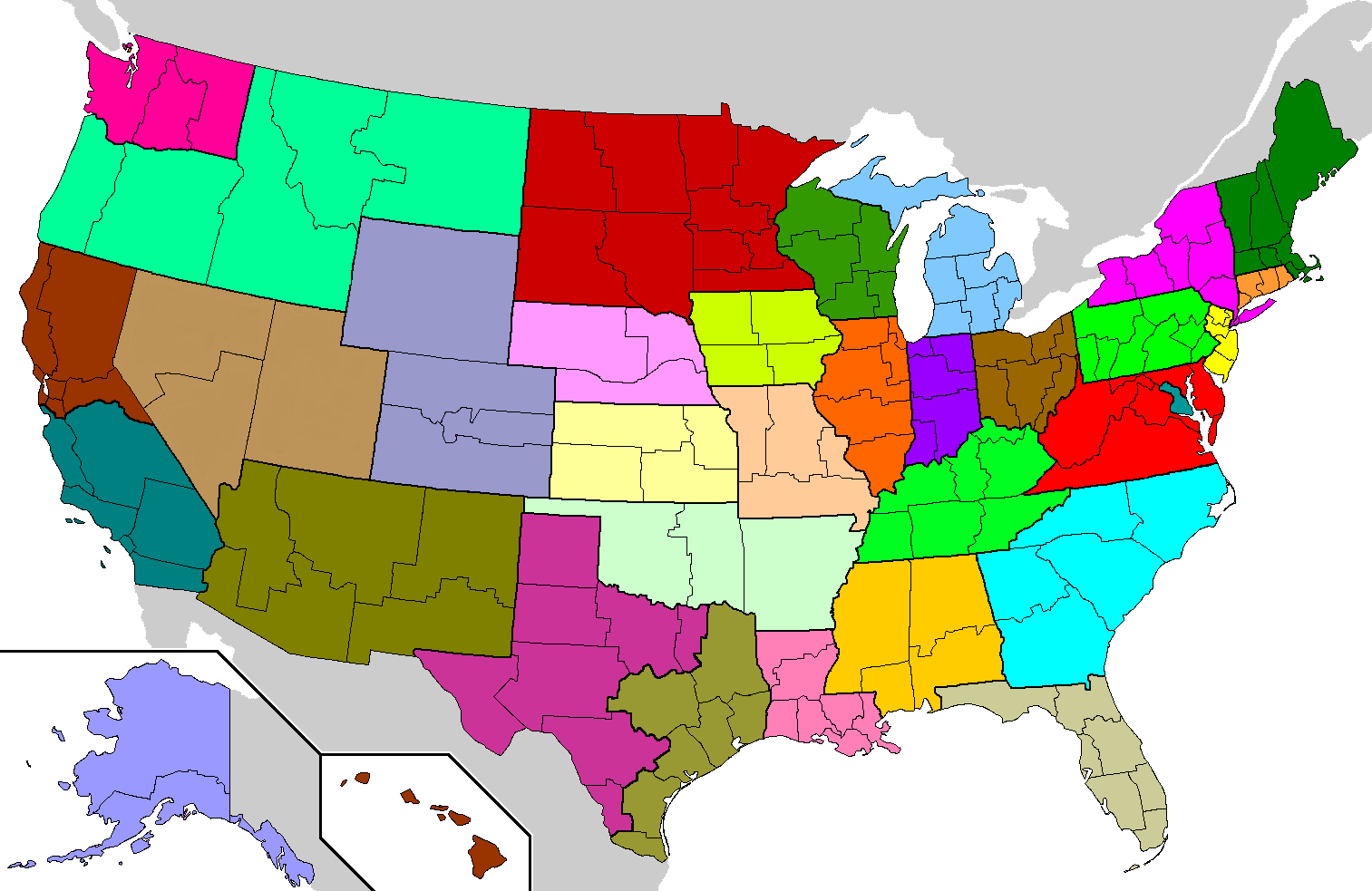
The first thing to understand is that Pennsylvania was trying to expand its continental influence at a time when its alliances were shifting and uncertain. It had cast off English support by declaring independence, but the coalition of new republics was also starting to crumble. Conflict between Massachusetts Bay and Plymouth led the latter to reverse its revolution in 1779 and restore a loyalist government; the rest of southern New England would follow suit in the following years. Meanwhile, land disputes in the Allegheny and Ohio regions were stirring up old tensions between Pennsylvania and Virginia. Closer links were forming with the Iroquois, and the old Jacobite states of Maryland and the Bahamas remained in the Pennamite camp, but the state government perceived an urgent need to find new allies.

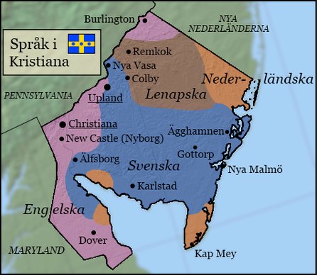
Meanwhile, Christianer were struggling to create a new state identity out of their ethnic and cultural jumble. Different population groups - English, Swedes, Dutch, Lenape, Susquehannocks - had some things to tie them together, but besides being a Pennamite dependency, what did the whole state have to unite it?

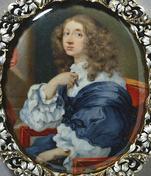
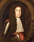
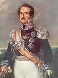
It was in this environment that Pennsylvania's leaders began to talk with the representatives of the Swedish government - the clergymen and land company agents appointed by the Crown who had been present in Christiana for years. They began to discuss a closer partnership between Pennsylvania and Sweden that could give the former a much-needed European ally, and the latter the prestige and commercial opportunities that came from having a North American dominion. Christiana, meanwhile, would have the unifying figure it so needed. In 1790, the unlikely deal was announced: Christiana would acknowledge the Swedish King Dimitri as its sovereign.

Other English states were immediately scandalized by this "pact with the devil." Sweden was by now in a firm personal and imperial union with Russia and Poland, and many Boreoamericans feared that "Russian hordes" would soon be swarming all over America. But the restoration was not so simple. The character of the new monarchy was modeled on the modern Dominion of New England. Christiana's elected government would be able to act without the king's interference, and elections would continue undisturbed. Pennsylvania would continue to supervise Christiana, and indeed would have more power over the state's actions than Sweden would.

Pennsylvania realized, in fact, that circumstances severely constrained what Sweden could do with Christiana. A new order was emerging in continental trade and diplomacy; there was less room for a completely new player. Christiana had an autonomous government and was participating on its own in the Anglo-American Congresses, so Sweden's influence on its governance was limited. The deal placed limits on number of troops that Sweden could send to the colony, and anyway the empire, for all its size, lacked the funds to send massive forces to America. And once the troops arrived, Sweden would depend on local allies for influence, especially Pennsylvania and the Lenape of the interior. In short, Pennsylvania truly believed it could control the Swedish king and his armies.

A Christianer delegation went to Europe to recognize King Dimitri as sovereign of "the most ancient of the peoples of America" - a reference to the Lenape. The king was given the title "Sovereign of New Sweden;" to this day "Sovereign" remains his legal title, though colloquially he is usually called "the king" or even "the tsar."

The new arrangement spurred a new wave of immigration. Most of the 18th century newcomers settled in the wide area east of the river, in what we know as South Jersey. The king personally sponsored the Gottorp Migration, a large-scale project drawing peasants from Holstein-Gottorp, together with other Germans from neighboring regions. In addition, many Finns and Fennoswedes arrived, along with some people from the Baltic states.

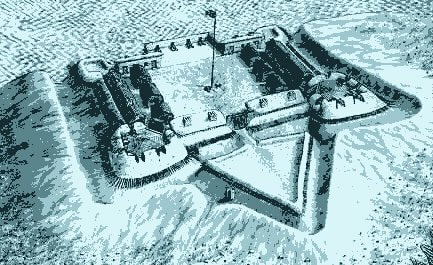
Confirming the fears of Pennsylvania's neighbors, a significant military force came from Europe. The bulk of the forces were Swedish, but there were also some Russians and a small but prominent contingent of Polish cavalry. Most of these forces were sent west to posts in Poutaxia and Ohio; the Poles in particular became renowned in the Ohio country. But they still depended on the support of Pennsylvania and the western Lenape to make any real gains in continental trade.

In this way, Christianer people and European troops became an important part of the growing Pennsylvania alliance in the west. Coshocton in eastern Ohio was the seat of the alliance's power . Despite the traditional role of the Lenape as mediators, this alliance was becoming a major regional power.

fortmiami_orig.jpg


For good and for ill, Christiana would now be involved in Europe's wars against revolutionary France. Fighting flared up in 1793, which saw English and French forces fighting in the Gulf of Saint Lawrence and the Great Lakes. Sweden sent a new battalion to attack French positions in western Ohio. The campaign won some successes, but at this point Pennsylvania refused to join the war; as predicted, Sweden could not achieve lasting gains without the state's support. However, these operations helped to draw Pennsylvania into the anti-French alliance when more widespread war came to Boreoamerica.

War broke out all over the eastern continent in 1802 - the War of the League of Saint Joseph. Pennsylvania and Christiana joined with England, Maryland, New Netherland, and Iroquoia to fight the French and Virginians. Christianer, Swedish and Polish forces fought throughout the western theater of the war, in particular the valleys of the Ohio, Cantucky, and Illinois Rivers. It was the last and bloodiest imperial war in Boreoamerican history.

The war lasted until 1808, but Russia made peace with France a few years before that. The greater part of Sweden's European forces were withdrawn. But the war had a lasting impact on Christiana's cultural footprint. Some soldiers decided to join Christianer Swedes in settling permanently in Ohio, Allegheny, and Poutaxia at war's end. Others headed back east to Christiana itself, which still had available land.

Treaties now put stricter limits on what individual states could do to rule their settlements in the interior. Sweden would remain active in Christiana in the following years, but it gave up on military adventures in America, focusing instead on investing in trade and, later, industry.

emancipated_2_orig.jpg


When the war ended, Christiana possessed a good deal of land and settlements in the regions of Poutaxia and Ohio. Gradually, it was forced to give up control of them. Its towns in Poutaxia become subject to the new State of Poutaxia. Christiana remained one of the parties to the Ohio Alliance and therefore had some say in its government, but Ohio too was slowly transforming into a unified state.

The continent's deliberative bodies emerged with more power over Boreoamerican diplomacy. Christiana had representatives in both Congress of the Nations and the Grand Council. As these bodies evolved into a permanent confederation, it became clear that this alliance, soon to be named the ASB, would replace Pennsylvania's role in Christiana's external affairs.

In the early decades of the nineteenth century, Christiana adopted a new constitution. It shed the vestiges of its tribal system and extended citizenship to all peoples within its borders. Quakers and Moravians took the lead in calling for the abolition of slavery, which they achieved in the 1820s. The state's Black population had never been very big, but now it grew a bit as freedmen, both legal and fugitives, relocated there from states to the south. Christiana was coming into its own. Its brief period as a regional power was ending, but it was governing itself for the first time.

sodhouse.jpg


Directly elected confederal parliaments began to meet in the 1860s. It was now clear: the ASB was to be a confederation of equal states and equal citizens. Pennsylvania finally gave up its supervisory role over Christiana in the 1870s, though their state governments continued to cooperate in many areas.

Christiana continued to exert an influence on other states because it served as the point of entry for a new wave of immigrants from Sweden. Drawn by the prospect of farming the plains of Dakota and the Upper Country, many Swedish families passed through Christiana on their journey west. Very often, a new village on the prairies would be anchored by a core of "old Swede" settlers - actually Swedish-Lenape - which then attracted newcomers from Europe. In this way Christianer culture found its way to the most distant parts of the confederation.

Investment from Sweden and from larger American states fueled Christiana's industrialization. By the turn of the twentieth century, Christiana was considered part of the group of "Central States" with a high standard of living and a good deal of political clout. It was probably the wealthiest state with a Mixed or indigenous population. Some of this investment was military: the capital was home to a shipyard that produced iron warships for the Swedish navy.

The relationship to the monarchy became more fraught as global tensions rose. The 1890s saw the formation of global imperial institutions, generally dominated by Russia. Christiana participated but did what it could to keep direct Russian influence at bay. By now the empire's rivalry with other European powers was causing most of the ASB to look nervously at the little realm on its coast. Fearing that Christiana could become a flash point, Parliament voted in the 1910s to ban foreign warships in Boreoamerican waters. The confederal government took over the shipyards and used them to begin work on a new Confederal Navy. Once the war had come and gone, Sweden (and Poland and Russia) confirmed the warship ban by treaty. People called it "Christiana's true independence."

urban-stendahl-actualy-carl-bj-rkman.jpg


Christiana's odd relationship with a global empire continued to set it apart and drove much of its history for the past century.

In the 1920s and 30s the state was known as a hotbed of socialism, culminating in the elevation of Urban Stendahl as Chief Minister of the ASB. Stendahl was both the first Socialist and the first Christianer to reach the chief ministry. Socialists were naturally hostile to the idea of monarchy, and during their time in power the state government was quite ambivalent about its connection to Sweden, not willing to repudiate it, but not embracing it, either.

Anti-Russian sentiment reached its peak in the 1950s and 60s, making it rather difficult to be a patriotic Christianer. The "Kronor Wars" pitted conservatives against socialists. On the surface, the issue was whether to keep using the imperial kronor alongside the state-issued currency. The state currency was interchangeable with confederal dollars, while the imperial kronor made business and travel easier between Christiana and the other realms of the Imperial Commonwealth, which now numbered over thirty. But people used the discussion on currency to channel their feelings on Sweden, the monarchy, the empire, the Lutheran Church, and the meaning of Christianer identity. Debates frequently got ugly. Joseph Mansfield, president of the Grand Council of State, expressed worry that the acrimony could hurt the ASB's relations with Sweden and the other imperial commonwealth realms.

Christiana temporarily stopped participating in imperial institutions, officially to protest certain authoritarian actions by Russia. It also formally ended all uses of the old name "New Sweden," legislating that the king's only title be "Sovereign of Christiana." But it still did not take the step of ending the monarchy, or even getting rid of imperial currency.

In the 1980s, led by reformists in the smaller European realms, the Imperial Commonwealth took on its modern, liberalized form. Christiana became a full and permanent participant again. The cultural struggles of recent decades began to subside as the people grew more accepting of the monarchy as a component of Christiana's mixed culture. The state consciously embraced an identity that emphasized its European and Indian roots. An example is the governor's mounted honor guard, which traditionally wear wings of eagle feathers derived from the old Polish hussars. During the height of the Kronor Wars these uniforms had been toned down. In the 90s, the wings returned with great fanfare. These days, they are so popular that Christianer put on imitation wings to cheer on the state football team. Such a celebration of imperial history would not have been done in the past.

Christiana remains a complicated place. Its people are the ancient Lenape, the stolid Nordics, the enterprising English; marginalized indigenous, wealthy Central Staters; loyal monarchists, left-wing firebrands - all rolled into one. It's a small state that's been punching above its weight for years. When it comes to the contradictions of life in the ASB, we can bet that it will continue to lead the way.

And here is Turquoise Blue's old description of Christiana's politics, also still valid (though the sitting government may have changed in the four years since she posted it).
Social Democrats: Soft social democracy, possibly "Third Way". Affiliated with federal Socialists.
Liberal People's: Liberalism, Conservative liberalism. Affiliated with federal Whigs.
Conservative: Conservatism, Christian democracy. Affiliated with federal Democrats.
National Socialist: Democratic socialism, left-wing, affiliated with the Freedom Party.
Green: Environmentalism, Agrarianism. Centrist, affiliated with federal Green Party.
Progressive: Social liberalism, Centre-left, affiliated with federal Progressive Party.
Dutch People's: Liberalism, Centrism, Dutch minority rights. No federal affiliation.

Due to Christiana's PR parliament, there exist 7 parties that have representation. The current coalition is a LP-C-G-DP one.
 
Last edited:
Top