The NextGen OTL Worlda Series

Polar Maps
Not strictly Worlda but I thought @hadaril you might want to add these to the wiki somewhere as a resource:

Antarctic Lines.PNG
Antarctica Claims.PNG
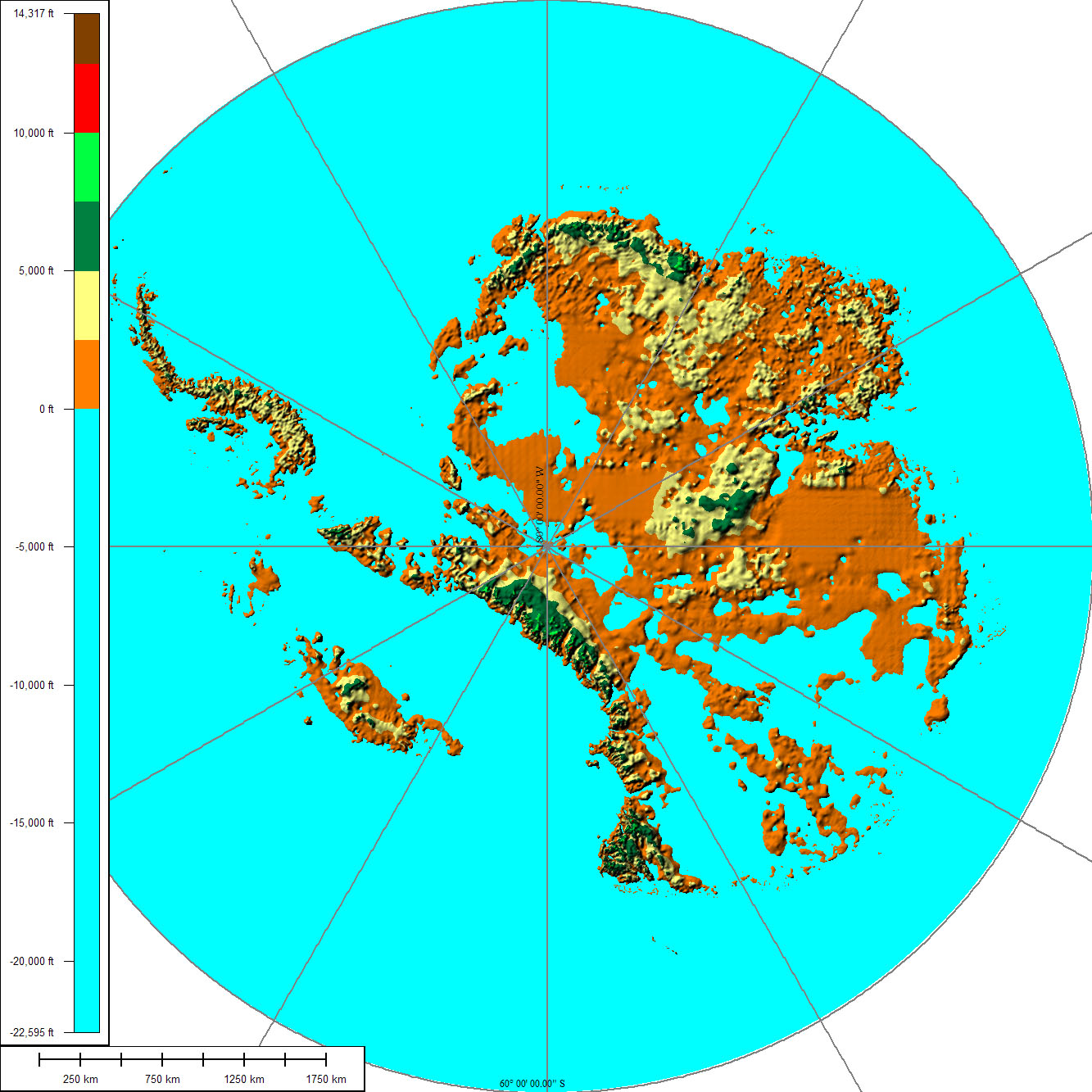
Antartica Clean.PNG

Arctic Lines.PNG
Arctic.PNG
Polar Lines.PNG


These maps show everything either north or south of the 60th parallels using an Azimuthal projection.
These are scaled to match a regular Worlda map. That is to say the distance across this map (200 pixels) is the same distance as 200 pixels along the equator.

Edit: Fixed a single pixel missing in the arctic maps.
 
Last edited:
That's actually inaccurate since it should look more like the one at right:

090825151004_1_900x600.jpg


It's a lot like how before the Cenozoic Icehouse, Greenland was connected to mainland North America and Svalbard to Russia, but glacial erosion has reduced them to islands.

I'm not sure how GWS works, though, was Antarctica still mostly glaciated during the Pleistocene, since if it was there wold be little correction for isostatic rebound and it would look pretty much like this:

AntarcticBedrock2.jpg
 
How do you get the Tw Cen MT Condense font to be smooth? Every time I try and put it down it comes out rather blurry.

For example:
8eda1384bc.png


They aren't neat like found on the actual pieces. I'm using paint dot net if that helps, but it doesn't seem to be working at all.
 
How do you get the Tw Cen MT Condense font to be smooth? Every time I try and put it down it comes out rather blurry.

For example:
8eda1384bc.png


They aren't neat like found on the actual pieces. I'm using paint dot net if that helps, but it doesn't seem to be working at all.
You have to turn off anti-aliasing (the little swirly thing on the font bar on PDN)
 

Gian

Banned
That's actually inaccurate since it should look more like the one at right:

090825151004_1_900x600.jpg


It's a lot like how before the Cenozoic Icehouse, Greenland was connected to mainland North America and Svalbard to Russia, but glacial erosion has reduced them to islands.

I'm not sure how GWS works, though, was Antarctica still mostly glaciated during the Pleistocene, since if it was there wold be little correction for isostatic rebound and it would look pretty much like this:

AntarcticBedrock2.jpg

It just is. That's why it was categorized under the "ASB - Environmental" category of the Wikia.

So yeah, can someone make the map now?
 
IIRC wasn't Ulster under British control more or less for the duration of the Irish independence war?

You’re right! I took it from the older 1919 basemap without thinking much of it but yes you are correct. Belfast and it’s surrounding areas should be under British control while Sourh Armagh and Derry should be largely republican.

EDIT: Fixed!
 

Deleted member 83898

Some questions about the 1848 map:

Aceh is shown as being under direct Dutch control — wasn’t it independent at that point?

Sarawak isn’t shown on the map, but hadn’t Brooke been granted land by the Sultan of Brunei by that point? Perhaps if Brooke’s Sarawak is regarded as still being a vassal of Brunei, it would make sense to display them on the map as one polity?

EDIT: Also, what are the names of 1) the landlocked Bornean polity, south of Sulu and Brunei and 2) the independent polity in central Sumatra (is it Jambi?)?
 
Fixed Europe link and posted the updates for the 1914-45 tibet fixes (which apparently didn't ever get uploaded :thinking: )
 
Top