You are using an out of date browser. It may not display this or other websites correctly.
You should upgrade or use an alternative browser.
You should upgrade or use an alternative browser.
The Q-BAM Improvement and Core Thread
- Thread starter iori
- Start date
Has anyone ever made ice sheet patches for Ellesmere / Baffin Islands and Alaska?
Working on it. Would've been done months ago if I didn't have so much other work to get done.
Baffin island so far;
Very much still a WIP, just putting it out here to stake a claim to the Canadian Arctic islands before anyone else starts trying.
I Was going to do Alaska as well, but never got round to starting it, so I wouldn't mind if someone else gave it a go.
Not sure if this is the right thread to ask in, but does anyone have a q-bam with a green antartica?
It turns out that the white version of the Q-BAM map doesn't quite patch up with the grey patches. I've tried it with Namibia and Mozambique, but it is just... plain off.
Edit: My fault; I looked for the wrong one.
Edit: My fault; I looked for the wrong one.
Last edited:
Does anyone have a QBAM of the Polish-Lithuanian Commonwealth at its height? The only one I can find was made quite a while ago.
Any chance for a patch on Eritrea (subregions) and Botswana (sub-districts), as well as updates on US counties?
Does anyone have a QBAM of the Polish-Lithuanian Commonwealth at its height? The only one I can find was made quite a while ago.
Would this do?
P.S. You should ask in the historical Q-BAM thread next time.
Nice, tho AFAIK some of those water bodies are wrong and also I just realized that I'm talking to Bain so hi
Subregions on Eritrea are WIP and no up to date map with the sub-districts of Botswana has been found, same case for LibyaAny chance for a patch on Eritrea (subregions) and Botswana (sub-districts), as well as updates on US counties?
You could perhaps provide us with the most recent version availbale for the sub-districts of Botswana. Libya is a no-go; I can't even find any second level subdivisions of Libya from the Gadaffi era, let alone the current state.Subregions on Eritrea are WIP and no up to date map with the sub-districts of Botswana has been found, same case for Libya
Kosta
Banned
Has anyone ever successfully drawn the proposed borders of the Treaty of Sèvres? The historical thread has a map of 1919 but the borders in Anatolia just aren't quite right. I've been trying to hand drawn them on my own but I'm not satisfied with how my results have turned out so far.
I don't know which version of Botswana's districts is the most recent, since I've seen like 5 variablesYou could perhaps provide us with the most recent version availbale for the sub-districts of Botswana. Libya is a no-go; I can't even find any second level subdivisions of Libya from the Gadaffi era, let alone the current state.
I suppose either of them may do for a start.I don't know which version of Botswana's districts is the most recent, since I've seen like 5 variables
https://upload.wikimedia.org/wikipedia/commons/0/09/Botswana_sub-districts.png
http://www.maplibrary.org/library/stacks/Africa/Botswana/index.htm
So I wanted to ask you which version is better. I've been fixing borders within the whole map to match them with the next picture
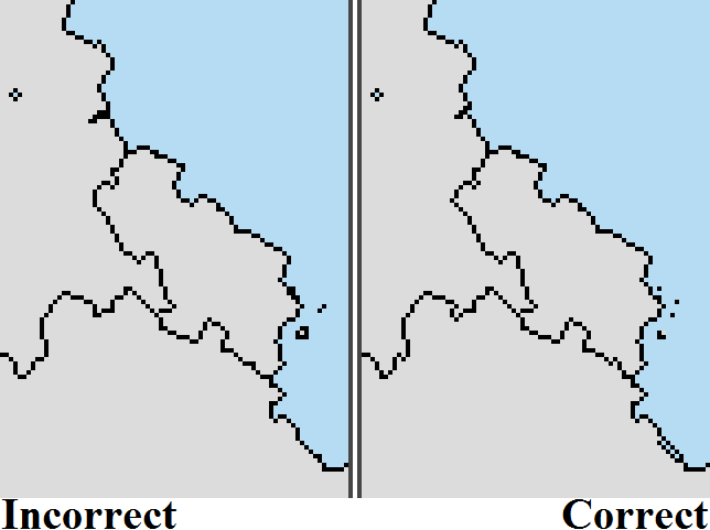
Here are some samples of the current version (X2, Incorrect) and the version I'm working on now (X1, Correct)
X1 X2


I'll update Q-BAM whenever I'm finished with it. I only have Asia to do rn so it shouldn't take much.
Here are some samples of the current version (X2, Incorrect) and the version I'm working on now (X1, Correct)
X1 X2
I'll update Q-BAM whenever I'm finished with it. I only have Asia to do rn so it shouldn't take much.
Share: