Tomorrow Country

  • Thread starter Deleted member 101966
  • Start date

Deleted member 101966

Unfortunately I am probably scattered atoms TTL (if Grand Prairie made the list, then North Bay with an Air base definitely did), but I am quite curious about the province of New Canada. It would take the end of the world for Ontario and Quebec to unite into one province.
That southestern bulge on Manitoba is bugging me, and I would swear is was’nt there yesterday:confused:

Have you figured out total population figures for Canada?


Aussi St Pierre et Miquelon vas peut-être joindre Terre-neuve TTL?
Assuming France collapsed following the war.

- New Canada would be just as well called "Clay Belt", as that's its core area. Because the OTL Clay Belt is Ontario's most francophone region, I have English/French bilingualism coming fairly effortlessly to the province.

- That's the Treaty 3 line and how dare you suggest that Tomorrow Country is ever possibly subject to silent retcons

- The estimates change whenever I re-do them, but right now Canada is sitting at 27.5M with 10.6M concentrated in Peace River: the major unknown factor right now is how many American refugees will have settled in the country.

- S.P.M. has reorganized itself as a very small Canadian client republic, enjoying complete economic union without technically losing its independence. This comes in handy for UN General Assembly votes.

Once again @ksituan, you have delivered!
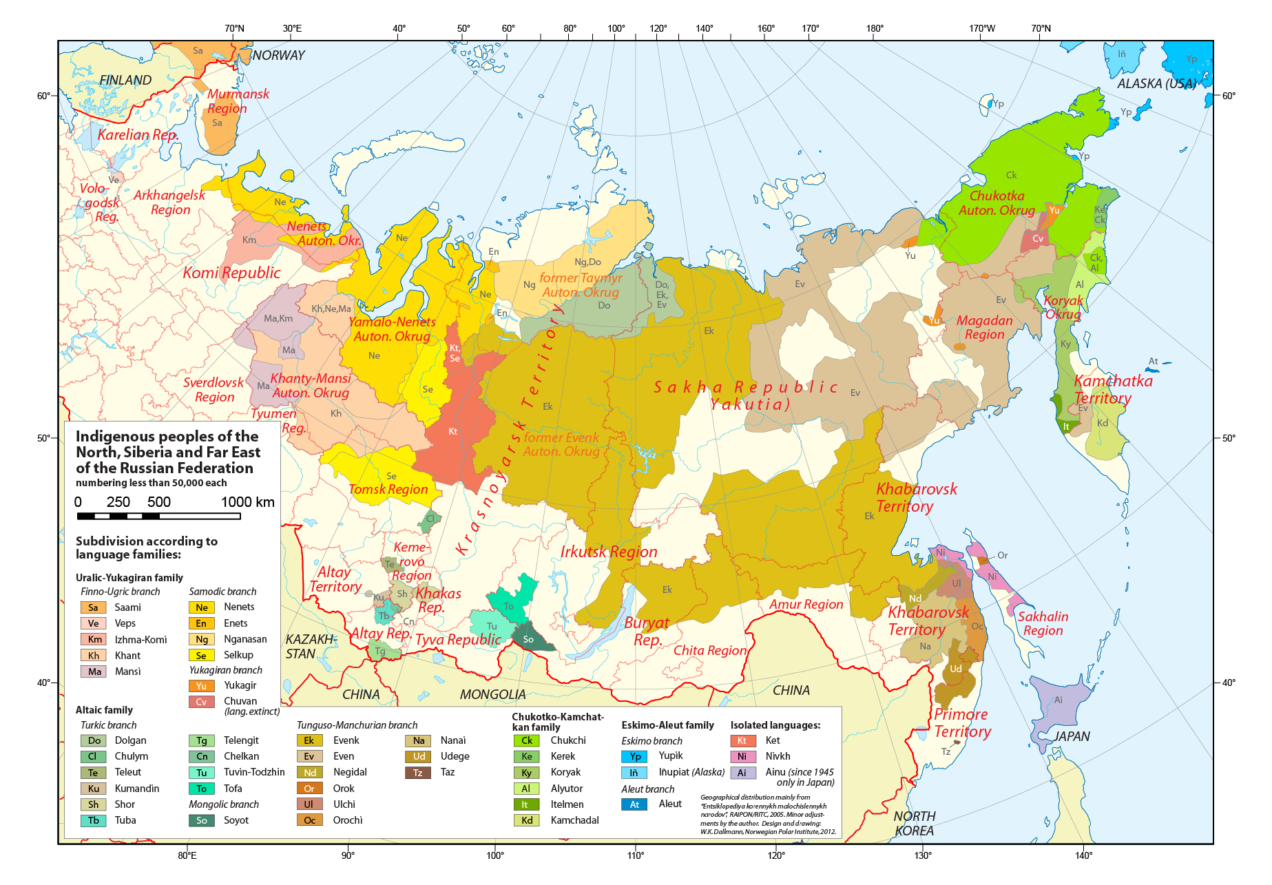
I’m really interested in what happens in Russia. I predict that East of the Urals and South of the Finnish border, it is mostly radioactive wasteland, and Siberia and the Far East would become fractured into indigenous states.

Yeah, Siberia is a topic that will take a lot of research - Canada has the benefit of its regional cities surviving, but as a primary nuclear power, Russia will have been targeted much more thoroughly. So the rural populations will probably have to carry the day, and none of the dots on the map will be places that I've ever heard of. The transition from cronyistic "federation" to actual decentralization will certainly be an interesting one...

Nice! What happened to New Zealand?

NZ completely dodged the shootout, making it the only developed country to survive into 2070 entirely intact. Among less fortunate former rich-world countries, this is a source of some resentment, but money buys a lot of friends and Auckland is by far the wealthiest large urban area in the world. Thanks to fairly beefy immigration quotas and robust natural increase, the Kiwi population has approximately tripled since the war.

The state of Tomorrow Country's Anglosphere is starting to interest me in a global context - the list of world cities 50 years after the war is shaping up to be a really beguiling mixture. Among the Five Eyes countries, I think we're looking at a top five consisting of Auckland, Grande Prairie, Kati Thanda, Albury-Wodonga, and Yellowknife.

What's up with the Perth region? (That's where I live) Good update, shows some of the rest of the world, what are things like in Europe?

Perth has been devastated by missile attack, as has every rich-world urban area with a population greater than five digits. In Canada and Australia the implications of this are surprisingly similar - the country left behind is quite capable of subsisting, but the demographic shift caused by the war makes indigenous grievances a bit more pressing.

I've left WA completely unchanged because I can't find any really convincing rationale to dismember it - a lot of Canadian provinces are divided between multiple separate indigenous treaty areas which is frequently a matter of legal concern, but Australia doesn't seem to have any treaties at all. The complete shift in rainfall patterns will take a lot of research to do real justice to, but all of the Australian states here are seeing a very pronounced and constantly ongoing population shift away from the coasts.

Europe is almost completely covered by the UN Authority in Europe, which provides emergency services from Lagos to a permanently crippled continent. A malfunctioning Gulf Stream has seen the already-kneecapped Authority infrastructure badly lashed by a succession of tropical storms, so a few pseudo-states on its periphery are currently applying to be removed from UN administration, although it's an open question how well these will correspond to any pre-war polity.
 
Last edited by a moderator:

Deleted member 101966

I realize I put most of my efforts into making really detailed finished maps, but of course for every finished product there's a lot of minor revisions that have to go into it! When I've been working on Canadian provincial maps, I haven't bothered to share these little updates, because very frequently I think I must be the only person in the world to have ever been interested in the agro-climatic characteristics of the Carmacks region. But now I'm setting out to make the first Tomorrow Country world map - and that, I think, will be more accessible to audiences not actively working for the territorial bureaucracy.

Here's the first of these flash updates:

unknown.png


With Australia greatly diminished, and with Indonesia struggling to keep its own house in order after a light wartime shellacking of Jakarta, New Guinea and its associated islands have temporarily shaken off both of their major overseers. The two Indonesian Papuan provinces have both achieved independence, kept apart from each other in the hopes that neither will prove an especially viable obstacle to Indonesia's soft power over the region, while never-governable Papua New Guinea is gracefully dissolving now that there's no point keeping up appearances for the rest of the British Commonwealth. (I've split off Bougainville first and foremost, but other regions will join the fray as I do more reading tomorrow.)
 
Australia
The Green Continent

This is really cool!

Actually, the whole thing’s really cool, so keep it up.

I am a bit puzzled as to a few things though:

Why were neither Darwin or Alice Springs nuked, even though Townsville was? Considering both are important military bases with a significant US presence.

Furthermore, why is Alice the capital? Wouldn’t somewhere like Bendigo or Tamworth be better, as much better connected and less isolated cities with a significant population catchment in the surrounding regions as well?

Yes, while the urban populations were mostly wiped out, I doubt this would so drastically transform relations with the indigenous population as is suggested. Many indigenous people have moved to the cities for work, and very significant non-indigenous populations exist in rural Queensland, NSW, and Victoria. Interesting nonetheless, and i especially like the state of Maralinga Tjarutja.

Is there a reason why Mandatory Australia has no significant coastal access? Was it because it was cheaper for the UN (which I’d personally like to see more of), or did Australia not want to give it away?

Nonetheless, I really like this TL, and I’m keen to see more. Keep up the good work!
 

Deleted member 101966

I am a bit puzzled as to a few things though:

My biggest problem with apocalypse maps as a genre is that they tend to be unbelievably shlocky with their green Biohazard Containment Zones and red Restricted Fallout Areas: I'm designing TC to be a lot more subtle because I think it makes everything feel more realistic, BUT, this definitely comes at the cost of making it harder to pick out what exactly has happened to each individual urban area. So here's the distinction that the map doesn't make: a lot of cities (especially remote regional capitals that were only big enough to merit one or two strikes) were obliterated, but have simply been re-established in the same place. On my Canadian map, this is the fate that befell Prince George and Edmonton (if you squint really hard, you'll see that Edmonton II has been established about ten kilometers upriver). In Australia, it's Darwin that has suffered similarly. (With this explained, my list of which Australian cities are major enough to have been targeted during the war has been scrupulously adapted from the classification scheme used by the ABS.)

I've taken Alice to be an almost exact analogue for Canada's Yellowknife, because the demographic similarities are pretty uncanny: both 25% Indigenous out of a total population of 20,000, both regional centers for a whole lot of empty nothing (in both cases totaling up to 40,000 and 50% Indigenous). So I totally missed that Alice is an army town, because Yellowknife definitely isn't! Whoops. I still think the geographic centralization makes it a fair enough choice for a continental capital, but then thanks to having never actually visited I'm imagining an incredibly different climate for the region (something similar to Oklahoma, in exchange for TC's Oklahoma looking, well, very similar to OTL's Australian interior). Future demographic maps should hopefully make the situation more clear.

As for indigenous issues, I'll resort to going back to my Canadian analogue, as I think the distributions and population shares are really quite comparable: yeah, urban Indigenous populations are large and significant (Winnipeg has 92,000, far exceeding the total count of Canada's largest actual reservation), but when it comes to influencing land policy, the underpopulated remote communities pull their weight. One of the big themes of TC (at least, in the British Commonwealth!) is that there's no major breakdown of law and order. Given the large amount of currently unproductive lands which have been placed under Indigenous title in both countries since the 1960s (for instance, about half of the Northern Territory's landmass), then, this means that any large-scale movement into the countryside (motivated by warmth in Canada and by precipitation in Australia) is going to have much more of a duty to negotiate than any historical settler population ever has. Of course, a serious discrepancy in the standards of living between very wealthy remote tribal councils and dirt-poor displaced urban Indigenous people will inevitably arise - fixing this is what Maralinga is intended to be set aside for, as Saskatchewan and Manitoba in Canada have enacted similar Indigenous-friendly land policies.

Finally, sea access: under the UN's purchase agreement, this difficult boundary mostly arises from South Australia's OTL local government policies, rather than any real concern for the Mandate's geographic viability. (Only the absolute least populated parts of the state were part of the transaction.) Most ship traffic to and from the Mandate will pass through South Australia's Port Augusta, but by 2070 a brand-new port city will probably have been constructed somewhere in the absolute depths of the Nullarbor just to eliminate that one single customs check.
 
You could always just say that Alice Springs was a target, but the bomb meant for it turned out to be a dud, like with Grande Prarie. Honestly, with the age of the US and Russia's arsenals, I'd imagine there would be quite a few duds!
 

Deleted member 101966

unknown.png


From left to right: West Papua, Papua, Sepik, Niugini, Papua New Guinea, New Britain, North Solomon, and the Solomon Islands. Yes, it's terrible. Rump PNG gets to keep Moresby and the mining towns, while the rest has more or less gracefully collapsed into a state of complete local autonomy (although much of the Highland Highway from Lae is actually paved now).
 

Isaac Beach

Banned
Heeeey, this is all pretty cool. Sorry to run it a bit late from the post, but can I ask what Tasmania's like? I notice my home city is the capital.
 

Deleted member 101966

Heeeey, this is all pretty cool. Sorry to run it a bit late from the post, but can I ask what Tasmania's like? I notice my home city is the capital.

Ah, Launceston, the Cape Breton of the Southern Hemisphere...

As far as I can tell, Tasmania (and maybe Victoria) are the Commonwealth's odd states out, as they lack an enormous currently-unpopulated area to expand into. So Tassie will be building more upwards than outwards: in this regard it will probably have quite a bit more in common with New Zealand (whose urban areas are undamaged and therefore somewhat futuristic) than with the sprawling new cities on the Australian mainland (Kati Thanda especially suffering from a bad case of Houston-itis due to thunderously quick growth combined with a loose regulatory environment). Besides the demographic fundamentals, though, I have little knowledge of the actual culture of the state, so I wouldn't go quite so far as to speculate over if the physical similarity between Tasmanian and Kiwi urban areas will lead to any meaningful affinity between the two peoples or not.
 

Deleted member 101966

unknown.png


If it's not coloured, pretend it's not there

The Yellow Sea Authority is one of three unfortunate parts of the globe obliterated enough to warrant direct UN rule from Lagos. Of those, it's been shrinking the fastest, as three of its highest-profile warlords have recently sold out and officially joined the international system. Other highlights:

- Already precariously diluted, Tibet has developed a system of no less than five semi-Tibetan buffer states intended to buy time for the central polity by settling as many refugees as possible. Yalong has already accumulated a 90%+ Han supermajority, although interestingly its close cultural ties with many of the stateless people still residing in the Authority has made it the most prosperous of any former Chinese state.

- Hetao and Ningxia stayed rogue for a very long time, but even they couldn't escape gradually accruing all the responsibilities of statehood. Managing irrigation infrastructure is hard! Understandably, these two centralized desert polities are each other's arch-rivals.

- Mongolia is listed among the number of fortunate nations to have completely evaded any damage during the war, and its little ring of economic client states is rapidly expanding, although the chance of Mongolians keeping much of any cultural prominence in a region rapidly becoming Officially Resettled seems quite slim.

- Guess which South Asian nuclear power won its exchange?
 

ST15RM

Banned
So @ksituan to start off with here are some maps to help you:
GCcKwlU.jpg

Here are the major ethic groups in the Former USSR (probably outdated)

Indg_Peoples_of_Russia_and_Siberia.png

And here are some minor/endangered groups in Siberia.
If you want more help feel free to PM me.
 

Deleted member 101966

unknown.png


Early draft of India, which I have responsibly made enormous. Here's some of the reasoning...

The great powers of the world left India and Pakistan to duke it out among themselves. But Pakistan's WMD collection just isn't big enough to devote multiple warheads to each Indian major city, so very few Indian urban areas were obliterated obliterated. Compared to what befell most NATO members in Tomorrow Country, this is a very gentle outcome. Furthermore, as one of the region's more legitimate federal democracies, India's regional authorities were much better positioned to provide emergency services after a decapitating strike against the national government. This more or less determined the final outcome of the rest of the war with Pakistan before it started, and set the stage for India to serve as one of the world's three postwar major powers (with Brazil and Nigeria, each leading a subcontinental power bloc). Indeed, the Indian Navy's first and only nuclear submarine (the relic Arihant) remains the only operational WMD platform on the planet.

Light orange is the Republic proper, which would be slightly diminished if dark orange didn't indicate its extensive collection of subordinate nations, all bound together by a single customs & currency union. The state boundaries are just kind of for fun: none of my modifications have an enormous significance, but administrative "improvements" are plentiful, as will be examined in a later map that's less of a WIP. (For now, check out the dismemberment of Uttar Pradesh. No longer will a single Indian state have a larger population than Brazil!)
 

ST15RM

Banned
Early draft of India, which I have responsibly made enormous. Here's some of the reasoning...

The great powers of the world left India and Pakistan to duke it out among themselves. But Pakistan's WMD collection just isn't big enough to devote multiple warheads to each Indian major city, so very few Indian urban areas were obliterated obliterated. Compared to what befell most NATO members in Tomorrow Country, this is a very gentle outcome. Furthermore, as one of the region's more legitimate federal democracies, India's regional authorities were much better positioned to provide emergency services after a decapitating strike against the national government. This more or less determined the final outcome of the rest of the war with Pakistan before it started, and set the stage for India to serve as one of the world's three postwar major powers (with Brazil and Nigeria, each leading a subcontinental power bloc). Indeed, the Indian Navy's first and only nuclear submarine (the relic Arihant) remains the only operational WMD platform on the planet.

Light orange is the Republic proper, which would be slightly diminished if dark orange didn't indicate its extensive collection of subordinate nations, all bound together by a single customs & currency union. The state boundaries are just kind of for fun: none of my modifications have an enormous significance, but administrative "improvements" are plentiful, as will be examined in a later map that's less of a WIP. (For now, check out the dismemberment of Uttar Pradesh. No longer will a single Indian state have a larger population than Brazil!)
So, I guess India is one of this TL's superpowers. Interesting.
 
Has the technology level (and quality of life) recovered or surpassed the time of the war? And if so, are there regional differences in the recovery level?
 

Deleted member 101966

Has the technology level (and quality of life) recovered or surpassed the time of the war? And if so, are there regional differences in the recovery level?

The sudden destruction of the East Asian industrial supply chains is the key. With no more plastic crap coming out of China, India, Africa, and Latin America are all in a position to meet demand by industrializing at post-war miracle rates. This has some really profound consequences: global HDI is certainly well above today, and global economic inequality might actually be at its lowest point since the dawn of human civilization.

These happy statistics aside, though, I figure the Chinese consumer-tech manufacturing complex will never successfully be replicated after the war. National governments maintain their top-level digital infrastructure with costly laboratory parts (an area in which New Zealand excels), but the merely very wealthy usually plump for prestigious relic smartphones. The quality of the new consumer tech is, these days, at least comparable to what was available before the war, but one conclusion is inescapable: without the price points that only global income disparity can provide, computers just don't have a place in every bedroom anymore. The Internet Era continues, but the era of the personal computer has quietly drawn to a close. By process of elimination, Wikipedia is the world's most popular website, and most wealthier-world public libraries and community halls maintain public terminals to access it.

2067 Canada is surprisingly close to 2017 Canada in GDP per head - although again the massive postwar drop in inequality makes everything feel a little newer and shinier. The improvement is most palpable in remote Indigenous communities, which have enormously benefited from being legally able to dictate the terms of settlement on their titled lands. By continental standards, it's a middle-of-the-road country with a bit more global clout than you'd expect, pretty comparable to France's position in Western Europe. (Imagine Canada's economy being roughly comparable to that of a Colombia that's undergone 50 boom years, and you'll start to get a sense of the pecking order that exists inside the Organization of American States.)
 
These happy statistics aside, though, I figure the Chinese consumer-tech manufacturing complex will never successfully be replicated after the war. National governments maintain their top-level digital infrastructure with costly laboratory parts (an area in which New Zealand excels), but the merely very wealthy usually plump for prestigious relic smartphones.
I do have to wonder at this point - New Zealand is well-kitted-out for production on basic necessities, but we've lacked any meaningful industrial base since at least the 1980s, especially in the high-tech sectors. To the best of my knowledge, there is no domestic production of digital infrastructure - we rely on the same Southeast Asian computer manufacture chains as everyone else.

Whether this capacity could be developed in fifty years, well, maybe - but there are broader issues of lacking the machinery to make the machinery to keep things running at a 2017 level. No doubt NZ is in a sunny position in any nuclear war scenario, but a small export-dependent nation which has spent three decades as a poster child for plugging into the globalised economy and emphasising comparative advantage is going to have a hard time adjusting.
 

Deleted member 101966

I do have to wonder at this point - New Zealand is well-kitted-out for production on basic necessities, but we've lacked any meaningful industrial base since at least the 1980s, especially in the high-tech sectors. To the best of my knowledge, there is no domestic production of digital infrastructure - we rely on the same Southeast Asian computer manufacture chains as everyone else.

Whether this capacity could be developed in fifty years, well, maybe - but there are broader issues of lacking the machinery to make the machinery to keep things running at a 2017 level. No doubt NZ is in a sunny position in any nuclear war scenario, but a small export-dependent nation which has spent three decades as a poster child for plugging into the globalised economy and emphasising comparative advantage is going to have a hard time adjusting.

True! I have to admit I've barely been thinking about the country's actual present mineral/industrial capabilities when I imagine it as a manufacturing center. My reasoning runs more along the lines that, as the only developed country left intact, NZ will be an extremely desirable place for anyone to move to - and will fully exploit this advantage by imposing as heavy a skills-based immigration system as it can get away with, leading to an extreme overconcentration of highly qualified innovators. Of course OTL this process hasn't exactly turned San Francisco into Shenzhen, but I figure the economics lean more in favour of domestic production in a world that's generally a lot more overregulated than our own (especially with ubiquitous digital communication somewhat disrupted).

Given the general 80s-tinged feel of Tomorrow Country's tech level, I think I'm kind of just subconsciously envisioning an NZ that's somehow bootstrapped itself into having a lot of the aspects that Japan did at the height of its export power (...i.e., it's a Pacific island complex with a much larger western neighbour, and that's about it).
 
@ksituan , got another question, based on the rather nasty states of Canada and Australia, compared to India escaping almost unscathed.

Which nuclear power survived the best after the war, and conversely, which non-nuclear (or neutral, even) nation suffered the worst?
 
Top