Map Thread XVII

Status
Not open for further replies.
Reposting here to ask the question to you all as well
Last map for tonight, the rivers of Rhodin are completed!
tellurus_rivers.png

Also, does anyone have a clue what the longest river might be so far?
 
Crosspost with the WIP thread. Don’t worry, Pax Californiana is still on the table. (This is a WIP)

“All the speed he took, all the turns he’d taken and the corners he’d cut in Night City, and still he’d see the matrix in his sleep, bright lattices of logic unfolding across that colorless void...”

cyberpunkyyeet_by_sirion101-dc8r9uh.png
 
I know this leaves a lot of questions unanswered, so fire away if you have any!

Handsome map, but the scenario puzzles me. Communist takeover of France in 1933? Romania and Yugoslavia also go commie without a war? Germany (which doesn't even get mentioned in the lineup of warring powers) somehow gets divided between Poland and France and nobody raises an eyebrow? Polish "united states of Europe?" How is that supposed to work (Given, among other things, that Poland's continued OTL borders are sort of a fuck you to the Ukrainians and the Belorussians)? Russia, etc. comes to Spain's aid...how, given the geography? Why did China join the Comintern when Chiang was anti-Communist? And now Nationalist China is a Japanese ally??? A defeat of the USSR is apparently quick and easy? What does atomic power have to do with island bases specifically? How does Japan manage to keep its war with China going, and why is China so fragmented?

Meh. Sorry if I'm coming across as hostile: I'm tired, grumpy, and have a rapidly developing cold, so I'm probably a bit of a bear right now.
 
Here´s map of french partition, part of my nazi occultists project (I should find some cool title for it :D)
(and there is basemap, not my work http://www.hist-geo.co.uk/france/)
France-Fleuves-Departements-1.png

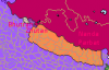
Neustria is attempt to "re-germanize" land of Franks and to get rid it of all this bad roman and jewish influence and decadence. Bretagne is, with exception of lot of bases for luftwaffe and kriegsmarine, and some minor SS activities, mostly leaved alone, as long as it behaves as good little puppet.
Aquitania is dumping ground for those, who are not aryan enough to live in Neustria or to settle east. There are some attempt to build some kind of Aquitaine or "better france" identity, based on antisemitism, anticlericalism and some reminiscence on Huguenots, but these efforts are week and Aquitaine stays defacto occupied territory under pretty harsh police regime with lot of partisan activity and terrorism here and there (yeah, Vendee riots are back!).
Gascony is bigger succes, not too disimilar to case of Bretagne (even if efforts make inhabitants considered themselves as Basques and/or descendants of Goths aren´t too successful for now). Gascony is used as base for various Basque and Spanish opposition organization for case of conflict with Spain.
Finally Occitania, stuck between Germanic and Latin Europe, is the most independent part of former France. There is sort of some "cathar revival" also.
Lands around Rhone (marked by number) are disputed between Italy and SS-Burgundy. Southern part is occupied by italian, northwestern SS or german and northeastern by combined troops (Italians on east, German on west).
 
Obviously not the most original of ideas, but none of the Naziblob maps I've seen really satisfied me. Here's my own take on a "plausible" German victory in World War II.
First time experimenting in a new style, would love any suggestions or critiques.

Beautiful map! For an (obviously terrible) Nazi victory that looks like a nice devision of Europe

Is Banat part of Germany TTL?

I can't tell from the map if Iceland is independent or not, and what about Greenland?

Whats the colonial situation? Is Vichy France now in control of all of the pre war French colonies? Have any been ceded to Germany? Or Italy (French Somaliland)? Indochina? I could see America occupying the French and Dutch Caribbean and forcing a sale.

What's going on in St. Petersburg/Adolfsburg?

Status of Anglo-Egyptian Sudan now that Egypt is out of the British sphere?

How strong is the German and other axis governments going into the 50's?

How many post soviet countries are there east of the Ural's?

What of the Pacific war?
 

A few more corrections:

"Rodos" is "Rhodos"; Trondheim should be marked as being leased to Germany; "Tabris" is "Täbris"; "Sues" is "Suez", everywhere; "Mosul" is "Mossul"; "Kerkuk" is "Kirkuk"; "Erserum" is "Erzurum"; "Rottes Meer" is "Rotes Meer"; and "Groß Syrt" should be "Große Syrte"! More important: It's "Großbritannien"!

"Kathrerinburg" should be "Katharinenburg". And it's "Leibstandarte".

There's also a mistake in Egypt, at "Macarius".

And even in Nazi Germany, it's still "international".

Astrachan is Altona now? That's funny, somehow. So is "Militärstadt Gespenst".

Oh, and turn "Busen" into "Meerbusen"! Because "Busen" alone means "female breast".


Edit: And if Nancy and Besancon became Nanzig and Bisanz, why isn't Burgundy a nazi puppet?
 
The changes in the Middle East are interesting.
Yeah the Levant was an actual proposal by Italian military planners. The idea was to make it a sort of Swiss-style federation with ethno-religious cantons made to be as homogenous as possible. Cyprus would be used as a staging area for interventions.
 
Aussie2.png


A vaguely-finished mockup of a doodle I made in class one day. Australia analogue with a different landmass; the country is quadri-lingual thanks to colonization by the Dutch and English and the continued presence of Aborigines and Polynesians.

Might flesh out later but it's mostly just been something I've been using to experiment with inkscape techniques a bit, figured it might be worth a share.
 
Top
Status
Not open for further replies.
Top