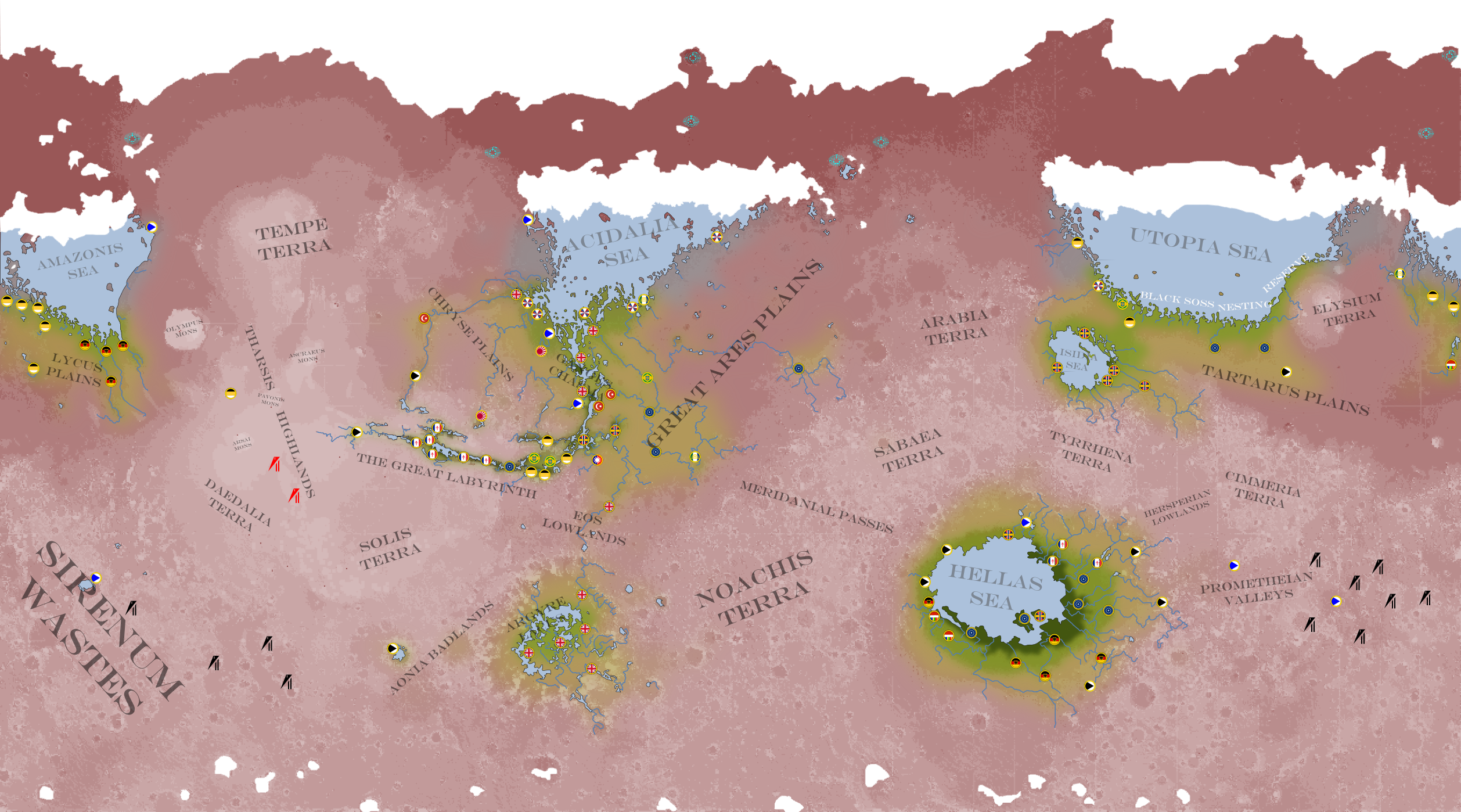
"Cavorite Mars' 1930s.
The North Sea Group (NSG) is Belgium, Denmark and the Netherlands; who operate a joint Voidship program
.
The Pacific Pact (EPP - what with it more accurately being El Pacto del Pacifico), is Chile, Colombia, Costa Rica, Cuba, and the United Mexican Republic, who also operate a joint Voidship program.
Map shows all settlements with over 5000 people, quite a lot of them are more for prestige than pragmatism. The population is growing rapidly, as the other powers try to prevent the post-Orleans Treaty British and French refugees from out-numbering everyone else by bringing their own people in.
Mars survived the Great War pretty well, being on the far side of the sun from earth at the time and no-combatent wanting to provoke the neutral powers or disturb the various Martian relics.
War may be coming to Mars though, for unlike the great chasms that have been parcelled up to everyones acknowledgement (if not desire), the fertile expanse of the Hellas Basin has become something of a free for all. The next time American fillibusters try something silly it might blow up in theirs, and eveyone elses faces.
-Germany once had a much larger presence in the Chaisma-Acidalia region, but conceded land to the Treaty of Orleans refugees, quite the source of ire to German hypernationalist Mars-dwellers.
-Hellas is deeper and more habitable than any other lowland reason, but had lower population after the Terror tore through mars, recent brinkmanship between Germany and the USA may change this as both side bring more and more in, and Hellas is now also a favoured destination for cosmopolitian immigrants.
-The treatment of the Green Soss varies widely by region, in Hellas they are effectively herded and used as a slave labour source, the less intelligent Argyre strains are treated with amusement and are used to watch goats and build drystone walls, Utopia-Isidis and Amazonis fearly try to ignore them, whilst a great range of treatment can be observed in the Chiasma-Acidalian basin (which also has the greatest range in intelligence amongst its strains).
Source:
https://iainfluff.deviantart.com/art/Cavorite-Mars-1930s-196770192