Micro-Worlda Development/Showcase Thread

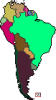
This is the new thread for the new 602x325 px quarter-pounder-size Worlda. Being done in Robinson from the start, because you can't stop me.

Why am I doing this? A certain someone asked for it, and I already had the quarter-size map.

Advantages / Upshots:
- Good for comparing to something bigger. Want Earth to be colonized by people from a Neptune-sized world? Well, now the Neptune-sized world doesn't have to be bigger than the Q-BAM to be proportional.
- Adorable.
- Will be easier to build than the M-BAM, even if the M-BAM was the same size (because the Micro-Worlda already has a base with a fair amount of data already there).
- Tininess makes it easier to change on large scales than the Worlda.
-From Petros: Could be useful for mini-maps depicting the religion/economic/language/bloc/alliance, or whatever else alongside the political borders larger map, showing the greatest extent of empires that remain in the larger map, or just cranking out a quick scenario without stressing over precise borders.


Disadvantages:
- Tiny. Britain's like 16 px tall.
- Now the Aral Sea's even smaller.

Next post is for the map showcase and also updates.
 
Last edited:
Map Showcase
Map Showcase

Blank Virgin Earth:

aBDcMi0.png

micro-worlda-corrections-blank-png.348116
xV58Dfy.png
k6cQPq0.png
7o3a93z.png
BufZgcq.png
goNfisy.png


G662rSq.png

Rivers:
micro-worlda-corrections-rivers-png.348117
xV58Dfy.png
rivers-in-png.287557

G662rSq.png

Nations:
micro-worlda-corrections-x2-png.348125
micro-worlda-corrections-grey-with-boxes-png.348119
S1UHLDm.png
UYUa5Vr.png

Rivers+Nations:
Nothing uploaded as of yet.


Updates
2016-09-05.1: Thread built.
2016-09-05.2: Minor update, but still covering maybe a thousand miles!
2016-09-06.1: Medium-scale update- the entire rest of South America, plus the coast of NA to the Gulf of Alaska
2016-09-06.2: South America political.
2016-09-06.3: Added the rest of Alaska, then Spain and Iceland.
2016-09-10.1: Finished the Americas. Added a little bit of Russia.
2016-09-17.1: The world is done. Europe+South America Political on the map.
2016-09-25.1: Sorry for not applying update earlier.
2017-10-23.1: Wow! We've got M O R E!

Contributors
Aquagel8last320- Original motivation, much of Europe
Tangle- Scaled map, East North America, Indonesia, Siberia
XO Mapping- South America, West North America, Political Map South America, Political Map Europe
Xhavnak- Korea, Australia, Russia, Indonesia
BMN- Africa, Arabia, Pacific Isles, Antarctica
False Dmitri- Overhaul, political maps, wiki page
 
Last edited:
Welp, we now have enough map sizes to order drinks at Starbucks.
Short: Micro-WorldA
Tall: Worlda
Grande: Q-BAM
Venti: M-BAM
Trenta: FY-BAM
 
Is there really a need for this?

If you want to go ahead and create this, you are certainly welcome, but I don't think there is really a pressing need for a new basemap.
 
I did the rest of South America. (EDIT: And the western coast of the USA!) Probably inaccurate, since all I did was trace over the existing WorldA base, but meh.
 

Attachments

  • microworldarestofsouthamerica.png
    microworldarestofsouthamerica.png
    11.7 KB · Views: 1,278
Last edited:
Is there really a need for this?
Yeah, there's not a need for it but it was in the request thread so there. Plus I'm having fun doing it!

I might be missing something, but isn't this just a compressed image of the worlda?
Yeah pretty much. My hope is that going a similar way to how the people with the M-BAM are doing it will still be okay for accuracy.

I did the rest of South America. (EDIT: And the western coast of the USA!) Probably inaccurate, since all I did was trace over the existing WorldA base, but meh.
Awesome! Will go over it and reupload to Imgur. (And don't worry- I've been using the Q-BAM as a trace!)
 
I did the rest of South America. (EDIT: And the western coast of the USA!) Probably inaccurate, since all I did was trace over the existing WorldA base, but meh.

I like where this is going.

Could be useful for mini-maps depicting the religion/economic/language/whatever situation alongside the political borders larger map, showing the greatest extent of empires that remain in the larger map, or just cranking out a quick scenario without stressing over precise borders.

Yeah, there's not a need for it but it was in the request thread so there. Plus I'm having fun doing it!

Keep up the good work.
 
Could be useful for mini-maps depicting the religion/economic/language/whatever situation alongside the political borders larger map, showing the greatest extent of empires that remain in the larger map, or just cranking out a quick scenario without stressing over precise borders.

I'm gonna add that to the advantages list, if you don't mind...

Also, currently going through previously updated and looking at the Q-BAM to try to match. It only just now occurred to me that because the Q-BAM is in Kavrayskiy projection it might be a bit different... I might use the WorldM or the Worlda itself for comparison as a backup.
 
Got it.

Anyway, here's a quickly traced bashed-out political map of south america:
 

Attachments

  • microworlda southpolitical.png
    microworlda southpolitical.png
    1.8 KB · Views: 1,226
Top