You are using an out of date browser. It may not display this or other websites correctly.
You should upgrade or use an alternative browser.
You should upgrade or use an alternative browser.
Groß-Deutschland map
- Thread starter JJohnson
- Start date
JJohnson
Banned
The red between Turkey/New Greece would go Greek in this timeline. Primsorky's a bit smaller to Germany. Arkhangelsk (mainland) and Nenetsia still remain Russian, while island Arkhangelsk goes Norwegian - they just had to put up with Volgaland and the German Primorsky ") And the Jewish Autonomous Oblast becomes British too
And the Jewish Autonomous Oblast becomes British too
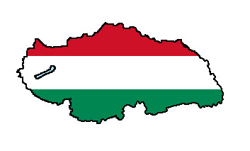
Can you thicken up Hungary a bit in the Transylvanian portion as well?
And good catch on Sakhalin going to Japan - I was intending that anyways. Khabarovsk I had intended to keep Russian so they could keep some ports - being a belligerent power, however, and having one nuclear bomb dropped on them, how far would Russia go before dropping the province?
And Mongolia/Communist China is an interesting option. I'm not completely well versed on the history of Mongolia, so I'll take a look on how that'll work. The intention is the 1900s borders of China/Russia, so the Jewish Oblast is still a border region. The Russian sphere of influence, and the regions 1-5 of Kansu, go Communist. This map might be a guide on that. China 1, China 2 (with semi-independent Tibet)
Also - Bulgaria and Macedonia should be separated into two countries
Good map!
And the Jewish Autonomous Oblast becomes British too Can you thicken up Hungary a bit in the Transylvanian portion as well?
And good catch on Sakhalin going to Japan - I was intending that anyways. Khabarovsk I had intended to keep Russian so they could keep some ports - being a belligerent power, however, and having one nuclear bomb dropped on them, how far would Russia go before dropping the province?
And Mongolia/Communist China is an interesting option. I'm not completely well versed on the history of Mongolia, so I'll take a look on how that'll work. The intention is the 1900s borders of China/Russia, so the Jewish Oblast is still a border region. The Russian sphere of influence, and the regions 1-5 of Kansu, go Communist. This map might be a guide on that. China 1, China 2 (with semi-independent Tibet)
Also - Bulgaria and Macedonia should be separated into two countries
Good map!
Last edited:
JJohnson
Banned
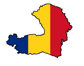
A slightly modified version of your map last page. Slovakia's a bit bigger, as is Hungary. Romania has all of Bessarabia/Moldova and the portion that Bulgaria took from it also. I chopped a bit of Turkey off so that Armenia has sea access, like it had back in 1919. There shouldn't be a Burgenland in the Austrian part of Germany, but I didn't feel like editing it out yet. Let me know what you think.
I'm not 100% sure of this being Hungary's final border, as it does put a number of Romanians in there, just I did want to capture a larger number of the ethnic Hungarians scattered about Transylvania in there.
Also, Dunkirk should go to the Netherlands...

I'm not 100% sure of this being Hungary's final border, as it does put a number of Romanians in there, just I did want to capture a larger number of the ethnic Hungarians scattered about Transylvania in there.
Also, Dunkirk should go to the Netherlands...
Last edited:
It's one nation in frankolio's world maps.Macedonia as part of Bulgaria? When was this?
JJohnson
Banned
For Greece, the Russo-Turkish war lasted longer, and depopulated Asia Minor of Turks, giving the Greeks more breathing room. World War I was fiercer against the Turks, and the Greeks claimed more land there than OTL Treaty of Sevres (about 1/3 of Asia Minor, the Aegean coast areas). World War II brought the Turks back on the Axis side in this timeline, and the Allies removed more land to Greece in the post-war settlement.
I like Constantinople being Greek. I admit it.
I like Constantinople being Greek. I admit it.
Macedonia as part of Bulgaria? When was this?
As a side note, here are some flag maps from the timeline:

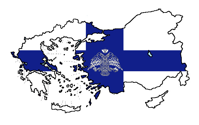
I like these. They're really good. Then again, they could be described as average if I were to compare them with some of the other maps I've seen you post.
Nietzsche
Banned
For Greece, the Russo-Turkish war lasted longer, and depopulated Asia Minor of Turks, giving the Greeks more breathing room. World War I was fiercer against the Turks, and the Greeks claimed more land there than OTL Treaty of Sevres (about 1/3 of Asia Minor, the Aegean coast areas). World War II brought the Turks back on the Axis side in this timeline, and the Allies removed more land to Greece in the post-war settlement.
I like Constantinople being Greek. I admit it.
That doesn't explain why Germany/Prussia suddenly dropped the Ottomans.
JJohnson
Banned
Bump for the thread here...
Would anyone be willing to create a province-map for the new Italy, Greece, and France? And one for the Kreise/Regierungsbezirke for Groß-Deutschland?
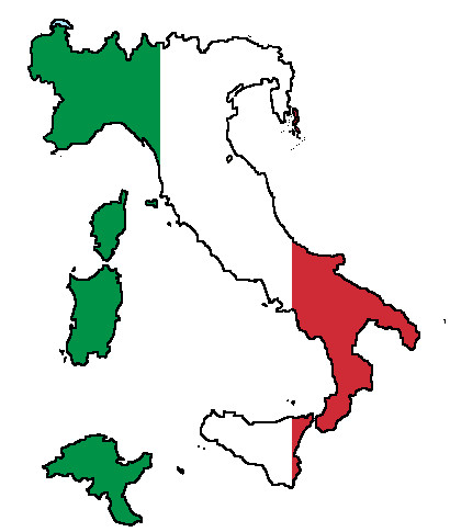
The New Italy:
Savoie and Haute Savoie; second map;
Savoie; Albertville, Chambery, Saint Jean
Haute Savoie: Annecy, Bonneville, Saint Julien, Thonon les Bains
Küstenland (map 1, map 2, 3, 4)
Trentino (red/orange remain in Germany)
County of Nice (map 2)
Corsica
the island directly right of Istria, left of Modrus-Fiume
Carthage from Tunisia: 1, 2, 3, 4, 7, 13, 16, 23, 24
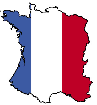
The New France:
OTL France minus: Alsace, Lorraine, Belfort,
St. Quentin
Vervins
Somme dept. (Abbeville, Amiens, Montdidier, Peronne)
Nord dept. (except Dunkirk, which belongs to Netherlands)
Pas-de-Calais dept. (second map)
The New Belgium
Red for Walloon (French Area)
Provinces for Belgium; Gemeinde;
Arrondissements from France:
St. Quentin
Vervins
Somme dept. (Abbeville, Amiens, Montdidier, Peronne)
Nord dept. (except Dunkirk, which belongs to Netherlands)
Pas-de-Calais dept. (second map)
Minus Eupen/Malmedy; second map;
The New Greece
OTL Greece
Bulgarian Smolyan, Kardzhali, Haskovo (added onto Thrace)
(blank map of Bulgaria for reference)
Turkey: Aegean Region, Marmara Region; provinces: everything west of Hatay, Samsun, Corum, Yozgat, Kayseri, Kahramanmaras, Gaziantep, Killis (should we give Greece Corum, Yozgat, Kayseri?)
Groß-Deutschland (as seen in Blomma's Maps)
Eupen and Malmedy
Kreise/Bezirke for Bohemia/Moravia (and the new ones for Saxony, Bavaria, and Silesia) (colored) (simplified version)
New East Prussia Regierungsbezirk map
New East and South Prussia Regierungsbezirk map
Alsace: OTL Upper/Lower Alsace, with Belfort added
Lorraine: OTL Lorraine in 3 Bezirke
Mecklenburg: roughly OTL Kreise (Neustrelitz+NeuBrandenburg, Wismar-Doberan->Bad Doberan, Ludwigslust+Hagenow, Waren+Malchin)
Saxony
Regierungsbezirk (on this map): Leipzig, Dresden(+Bautzen), Chemnitz(+Zwickau), Eger, Aussig)
Bavaria
Added to Niederbayern: Prachatitz, Bergreichenstein
Oberbayern: Markt-Eisenstein
Silesia
Regierungsbezirk Troppau added to Breslau, Oppeln, and Liegnitz
Pommerania, West Prussia, Brandenburg, Westphalia, Hanover, etc.:
Map of RB; Kreise as today.
Poland
Would anyone be willing to create a province-map for the new Italy, Greece, and France? And one for the Kreise/Regierungsbezirke for Groß-Deutschland?
The New Italy:
Savoie and Haute Savoie; second map;
Savoie; Albertville, Chambery, Saint Jean
Haute Savoie: Annecy, Bonneville, Saint Julien, Thonon les Bains
Küstenland (map 1, map 2, 3, 4)
Trentino (red/orange remain in Germany)
County of Nice (map 2)
Corsica
the island directly right of Istria, left of Modrus-Fiume
Carthage from Tunisia: 1, 2, 3, 4, 7, 13, 16, 23, 24
The New France:
OTL France minus: Alsace, Lorraine, Belfort,
St. Quentin
Vervins
Somme dept. (Abbeville, Amiens, Montdidier, Peronne)
Nord dept. (except Dunkirk, which belongs to Netherlands)
Pas-de-Calais dept. (second map)
The New Belgium
Red for Walloon (French Area)
Provinces for Belgium; Gemeinde;
Arrondissements from France:
St. Quentin
Vervins
Somme dept. (Abbeville, Amiens, Montdidier, Peronne)
Nord dept. (except Dunkirk, which belongs to Netherlands)
Pas-de-Calais dept. (second map)
Minus Eupen/Malmedy; second map;
The New Greece
OTL Greece
Bulgarian Smolyan, Kardzhali, Haskovo (added onto Thrace)
(blank map of Bulgaria for reference)
Turkey: Aegean Region, Marmara Region; provinces: everything west of Hatay, Samsun, Corum, Yozgat, Kayseri, Kahramanmaras, Gaziantep, Killis (should we give Greece Corum, Yozgat, Kayseri?)
Groß-Deutschland (as seen in Blomma's Maps)
Eupen and Malmedy
Kreise/Bezirke for Bohemia/Moravia (and the new ones for Saxony, Bavaria, and Silesia) (colored) (simplified version)
New East Prussia Regierungsbezirk map
New East and South Prussia Regierungsbezirk map
Alsace: OTL Upper/Lower Alsace, with Belfort added
Lorraine: OTL Lorraine in 3 Bezirke
Mecklenburg: roughly OTL Kreise (Neustrelitz+NeuBrandenburg, Wismar-Doberan->Bad Doberan, Ludwigslust+Hagenow, Waren+Malchin)
Saxony
Regierungsbezirk (on this map): Leipzig, Dresden(+Bautzen), Chemnitz(+Zwickau), Eger, Aussig)
Bavaria
Added to Niederbayern: Prachatitz, Bergreichenstein
Oberbayern: Markt-Eisenstein
Silesia
Regierungsbezirk Troppau added to Breslau, Oppeln, and Liegnitz
Pommerania, West Prussia, Brandenburg, Westphalia, Hanover, etc.:
Map of RB; Kreise as today.
Poland
Tellus
Banned
I already had a basemap with 1871 Germany so i based it off of that map and not the one you showed.

Excellent map! I just checked out this whole thread and though it has impressive examples, yours take my prize. The attention to detail is remarkable, the german borders definitely "greater" in scope, and you even managed to annex in Liechtenstein. Well done
JJohnson
Banned
As a political aside on this timeline, in this Germany, with fascism, socialism, and communism all debunked and pretty much 'politica non grata' - how would you posit the political parties would develop?
The French were fascists, the Soviets were communist, and the Polish were socialist/communist, and German collaborators with the three were all arrested after WW2 was over, and public trials conducted by the Allies. So a super-welfare state and progressive taxes might be out, German national pride would likely be how the British, Australians, and Americans view themselves, but how would the parties develop? SPD, CDU?
The French were fascists, the Soviets were communist, and the Polish were socialist/communist, and German collaborators with the three were all arrested after WW2 was over, and public trials conducted by the Allies. So a super-welfare state and progressive taxes might be out, German national pride would likely be how the British, Australians, and Americans view themselves, but how would the parties develop? SPD, CDU?
Hendryk
Banned
Leaving aside other issues, I really can't understand why a Germanwank TL would result in Turkey losing so much territory to Greece. It should be the other way around.That doesn't explain why Germany/Prussia suddenly dropped the Ottomans.
Share: