What do you think of these alternate US state boundaries?

I am writing a TL with a much more expansionist USA and they own much of North America. How plausible do you think these state boundaries are? Also, do you have any suggestions for names for the new states?
Larger USA Alt States.png
 
Last edited:
The US tried to invade Canada once, but was pushed back by Canadian forces all the way to Washington DC, and since that massive defeat, never tried again. I wonder what would get them to do so in this alternate universe...
But in any casei have some ideas:
Next to Alaska, one could have a state of Yukon, and east of that, Hudson. I'd probably leave Quebec with that name, and that mainland South Amercan territorty could perhaps be the state of Guyana. I think Baja California would/should/could just be added to California. I'm not sure what that state south of Hudson Bay is called in our timeline, but I'd go with something like Huron perhaps.... Not sure. And perhaps there would be a state called Yucatan on the Yucatan peninsula :)
 
How plausible do you think these state boundaries are?
It depends entirely on when the new lands in question were annexed.

The US tried to invade Canada once, but was pushed back by Canadian forces all the way to Washington DC
Well, no, but close enough.

since that massive defeat, never tried again.
Not a defeat, but hey.

I wonder what would get them to do so in this alternate universe...
The annexation bill of 1866.
 
As a Latin American, that's slightly horrifying.

But the borders look good. I think Americans might try to lump in the Dominican Republic with either Haiti or Puerto Rico because, since with an 1800s POD most of the people in Hispaniola wouldn't have the right to vote over literacy tests or literal slavery, they might want a single state to round up all the nonwhites in the Greater Antilles. And I feel like Belize might fit better with an Antillean state than with the rest of the Yucatán, although cultural insensitivity in the XIX to minorities might negate that as well. Yukon completely bordering Alaska is also slightly odd.
 
What are the PoDs? It's hard to answer without knowing, as, aside from Canada, most of those borders are OTL.

...Just noticed Haiti. That's the biggest question that I see off the top of my head.

As for borders, that northern border of *Saskatchewan and *Alberta should be aligned at the same latitude and form a quadripoint. At least from an aesthetics standpoint. Raise the British Columbian one to the same latitude, and have it run straight into the panhandle. That will give a little extension south, but I think it'd look better than having those straight lines off like so.

Also, should British Columbia just follow the continental divide? Without its norther half, is there any other reason for it to suddenly turn north? (again, without knowing the PoD, it's hard to tell).

Perhaps Sitka/Yukon only encompasses a western bit of that shown territory, with more added to that Northeast territory?

If you can give me some time, I'll see if I can draw some suggestions; they'd be easier than trying to describe them. Won't be til late tomorrow at earliest.
 

JJohnson

Banned
For Canada, try this:

alternate_division_of_canada_into_states_by_jjohnson1701-datn0xh.png


You get 12 states and 4 territories, or possibly more states.

Top row: Yukon, Nunatsik or Athabaska, North Hudson
Middle Row: Columbia, Saskatchewan (49° to 52° N, 114° W to 107° W at the southern portion), Manitoba, Winnipeg, West Hudson (green), East Hudson (orange), East Quebec (gray)
Bottom Row: former Indian territory, Ottawa (peninsula), Quebec, Nova Scotia, St John Island, Newfoundland

That may or may not work historically, depending on your timeline. This is based on my rough idea that the US settles on the 49th parallel with the UK after the War of 1812, and lets the UK have a sliver of access to the Great Lakes after the war, but the UK loses Oregon Country to 52° N, letting the US get another state, and also ensuring that Rupert's Land never becomes a draw for settlers. In the latter half of the 19th century, the UK sells Rupert's Land to the US, and the US continues the 52° N parallel to form additional territories, which eventually become states in the 20th century. Due to the climate, they are slow to become states and it drags on into the mid 20th century. Yukon becomes a state in the 1960s.
 
You get 12 states
And that’s way too many. I get what you’re trying to do, though (but it ensures the northern territories remain territories in perpetuity and denies the logical states resources). Combine the Maritimes and northern Ontario (or all four of those states) into one each. North Quebec+lower Labrador would be part of Quebec, and then kick 52º up to 55º, which gets Columbia a border with Alaska and ensures the importance of whatever Interstate number heads all the way up there.

That may or may not work historically, depending on your timeline.
He still hasn’t mentioned the dates of annexation of the additional land… :p
 

JJohnson

Banned
And that’s way too many. I get what you’re trying to do, though (but it ensures the northern territories remain territories in perpetuity and denies the logical states resources). Combine the Maritimes and northern Ontario (or all four of those states) into one each. North Quebec+lower Labrador would be part of Quebec, and then kick 52º up to 55º, which gets Columbia a border with Alaska and ensures the importance of whatever Interstate number heads all the way up there.


He still hasn’t mentioned the dates of annexation of the additional land… :p

It could be too many states, I don't doubt that. I was going off what I had read in the previously mentioned "How the States Got Their Shapes" and made them 3° tall and roughly 7° wide. We could make them 4° or 5° tall, if that helps. If we keep it at 52° N, though, then *Yukon and *Nunatsik are more likely to become states, since OTL Alberta has Edmonton above 52° N, and Saskatchewan has Saskatoon at roughly that parallel. In my division up there, Edmonton, Fort McMurray, and Grand Prairie would be in Nunatsik; Saskatoon and Prince Albert would be in North Hudson (but not much else up there); and Yukon would have Whitehorse, Prince George, and Prince Rupert. The only question here is, if the land were divided up this way, would those cities spring up where they did? Would people huddle near 52° N like the Canadians do at 49° N now? Just because people can settle somewhere doesn't mean they will in any given timeline. I'm not certain why Edmonton, Saskatoon, Winnipeg, and so on were built where they were built, so that would require some investigation.

It could be that in my map above, just run the states all the way from the 49° to the Arctic in very tall states; or, run them up to 60° N like the provinces, and just have the rest be "Northern Territory" rather than OTL's Yukon, NW Territory, and Nunavut; maybe we could have Labrador or East Quebec be 70° W and everything east and north of the St Lawrence, and then have East Hudson from 70° W and 49° N run west till a straight line running north from the Ottawa River's northernmost point. Those could be reasonable divisions also.

If we do 55° N, I'd think that makes a Northern Territory of "everything above 55° N" more likely or at least a Northeast and Northwest Territory with it being split roughly down the middle, one becoming Yukon and one becoming Athabasca or something like that. The resulting split will depend on if either can attract more settlers than the other and what Congress decides to do with the land up there.

And the actual annexation dates will determine what happens, so that's a good question.
 
For Canada, try this:

alternate_division_of_canada_into_states_by_jjohnson1701-datn0xh.png


You get 12 states and 4 territories, or possibly more states.

Top row: Yukon, Nunatsik or Athabaska, North Hudson
Middle Row: Columbia, Saskatchewan (49° to 52° N, 114° W to 107° W at the southern portion), Manitoba, Winnipeg, West Hudson (green), East Hudson (orange), East Quebec (gray)
Bottom Row: former Indian territory, Ottawa (peninsula), Quebec, Nova Scotia, St John Island, Newfoundland

That may or may not work historically, depending on your timeline. This is based on my rough idea that the US settles on the 49th parallel with the UK after the War of 1812, and lets the UK have a sliver of access to the Great Lakes after the war, but the UK loses Oregon Country to 52° N, letting the US get another state, and also ensuring that Rupert's Land never becomes a draw for settlers. In the latter half of the 19th century, the UK sells Rupert's Land to the US, and the US continues the 52° N parallel to form additional territories, which eventually become states in the 20th century. Due to the climate, they are slow to become states and it drags on into the mid 20th century. Yukon becomes a state in the 1960s.

That reminds me more of what might happen in some grand redistricting of every state in the Union, rather than the aftereffects of an annexation. Your logic is sound; I just don't know of that ever being done before; it'd be hard to tell if this is possible without knowing the timeline.

If we're going for a pre-Canadian Confederation (pre 1867), you're likely to see all of the existing colonies gain statehood as such. So, PEI, Nova Scotia, New Brunswick, and Newfoundland would all be states; so would Upper and Lower Canada, along with Columbia and, depending on the PoD, a Manitoba of some sorts. There would be a large bias shown to those various preexisting colonies, which is a deal I think the Canadians would take. That would give them a large Senatorial representation to balance out the low population (the same deal that New England gets now, basically), which will allow them to have an outsized effect on politics.

Look at it as three regions: You'll have Columbia, Manitoba, and whatever other states are created in the Prairie Provinces and the Northwest Territories. Those are the territories which will develop a more American culture based on the low population and eventual immigration. You'll have the Maritimes: Newfounland, Nova Scotia, New Brunswick, and Prince Edward Island. They will maintain a small bloc and will likely be the least Americanized of the bunch. Then you have the center two provinces: Upper and Lower Canada (Ontario and Quebec). Ontario, while likely to be the strongest, will also have the greatest links to the US heartland (due to geography and nothing else). Quebec, owing to its character, will be the most dissimilar to the rest of the US, both American and former Canadian.

So, to start out, you have that wild card scenario. The 4 Maritime States with 2 Senators apiece, along with Upper Canada/Ontario, will create a large bloc. Quebec is a wild card in future politics, at least in the interim. This will eventually be balanced, in the west, with Columbia (I'm just calling it that; it can be named whatever), Manitoba, and a few other states eventually balancing the senatorial count while also, eventually, usurping all but Ontario/Quebec with population.

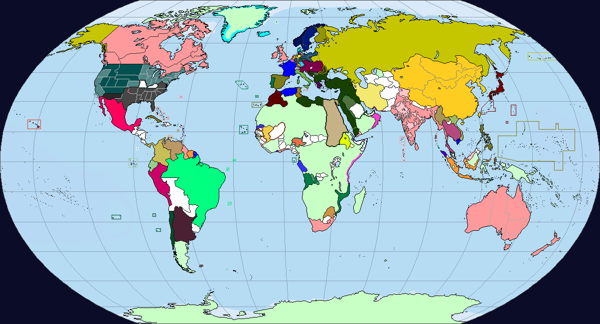
Starting from this 1862 map: (mostly for good basemap, and partially because I'm not sure what the PoD is):
fetch.php


I would find that this might be a reasonable assumption:

Maybe Canadian States.PNG


Red borders are ones that are easily changed; Blue borders should be the absolute minimum.

A. Your Sitka/Yukon State, with borders along the edge of the rockies and mostly concentrated along the coast.

B. Columbia, but only with its 54' 40" borders (minus former Alaskan Panhandle). Vancouver Island is part of the state; there's no reason to separate. The two colonies were separate at one point, so there is potential here.

C. Prairie Province State. Could end up being split in half or, I find more likely, have some of its territory given to Manitoba.

D. Manitoba, without access to the sea. Doesn't seem likely, as the Nelson river zigzags around its border and Churchill would be nearby. I think Manitoba would expand at the expense of C and H, frankly.

E. Upper Canada/Canada West/Ontario. I don't know of any separatist sentiment, and part of the impetus for the Canadians to join the US would be remaining large states with lots of room to grow. If they are worried about the Senate, keeping the maritimes separate solves that.

F. Lower Canada/Canada East/Quebec. Same as above; Don't know of any reason to split them up, other than power struggle between Montreal and Quebec City. Seems more likely that they'd remain united so as to prevent the erosion of their culture (rather than being split up and having half remain French and the other half slowly Anglicizing).

G. Maritimes. Nothing of note, but all 4 would remain separate as a concession to keep them in.

H. North* Territories. This is the absolutely smallest I think they can be, although you might divide it in two if it incorporates more of the border area.

1. Could be a region that goes to Sitka or Columbia (A or B)

2. This would work as a straight lineborder, or some could go to A and some to H (and some to C if the border moves north). I'd argue that, as the majority of the population would be in the former Alaskan Panhandle, with some in Whitehorse, that the majority of the territory in the north should go to H. It'd be easier to make H a state, the larger it is.

3. A small section that would give C a more natural border; it's mostly falling hills and mountains, making a straight line over depressions to get to the next ridge.

4. A lot of land that could go to H or C/D. Due to natural resources, it would likely be later appended to the latter two.

5. The aforementioned region that would give D control over the mouth of the Nelson River and Churchill.

6. Potential Borders allowing E an outlet to the Hudson. Having some minimal amount of territory seems likely, rather than it continuously being locked up. One follows the 90 Degree West, while the other two just mark the line from the westernmost border of E, and one border heading from the northernmost point of E.

7. F would likely want most of this territory for their own, and would likely be part of the concession to bring the Canadiens onto the Us side; they would likely be larger than every other former Canadian province, and would have a domineering position over the Hudson bay.

8. Labrador would be disputed between Newfoundland and Quebec (F). As Labrador's borders were ill definied, it is likely that Quebec would likely maintain at least a portion of Labrador, if not being granted the whole thing. If Labrador does remain a separate (if reduced) polity, then it will likely be appended to Newfoundland as per OTL; not enough population to remain independent.

Anywho: that gives you 10 states by 1900, with the potential for 2 more in there. One other border I didn't cover (as it was getting cluttered) would be a potential border between C and another Prairie Province state along the Peace River (or the former Rupert's Land boundary, but watershed borders are... difficult to delineate). Edmonton would be along that, so you could see a bit of a Kansas City situation developing along the river. That would make C quite a bit smaller, and would require giving that new state the majority of the territory within 4 to maintain viability. That, and such a border might interfere with Manitoba's own borders. Still, there's quite a lot you can do.
 
Top