Bit of an unwieldy title, but I hope it gets the point across.
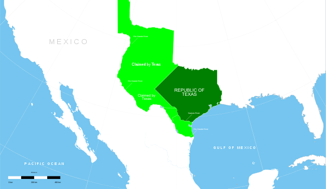
Light Green was everything the Republic (and for a bit the state) of Texas claimed. The Dark Green was what it actually controlled and populated. The Light Green territories were cut back to the modern borders as part of the Compromise of 1850.
How would American history change if the Texas border was scaled back to the dark green section? What states would be formed out of the remaining land ceded to the Government? How would this impact the Civil War and Texas's relationship with the Federal Government?

 I can only imagine what such a map would look like, or the Alternate Names of all the mini Texases.
 .png")